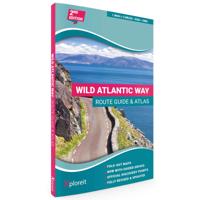
Wegenatlas The Wild Atlantic Way Ierland | Xploreit Maps

0
Yvonne Gordon provides an essential guide to Ireland's epic coastal driving route - the Wild Atlantic Way. In this newly revised and updated edition she divides the route into 16 easy-to-follow scenic drives from Kinsale, in south Cork, all the way to the little village of Muff in the far north of the island. Each drive can be comfortably complete...

Verkopers met dit product

Verkoper
Bezorging
Prijs
DeZwerver.nl logo
DeZwerver.nl
2,95
24,95

Anderen bekeken ook

Wegenatlas The Wild Atlantic Way Ierland | Xploreit Maps
Yvonne Gordon provides an essential guide to Ireland's epic coastal driving route - the Wild Atlantic Way. In this newly revised and updated edition she divides the route into 16 easy-to-follow scenic drives from Kinsale, in south Cork, all the way to the little village of Muff in the far north of the island. Each drive can be comfortably completed in one day and includes an overview map with photographs to illustrate the text. Information is provided on mileage, directions, official discovery points and numerous additional attractions, including the many towns and villages dotted along the way. The generous fold-out maps can be used to follow the guided route or to design custom itineraries. 31 handy fold-out maps. 16 easy-to-follow drives. Official Discovery Points highlighted. Additional recommendations and tips. Route planning maps for the national road network. Distance charts for towns and villages. Yvonne Gordon is an award-winning travel writer who writes about Ireland for pub…
24,95
Wegenkaart - landkaart - Fietskaart Donegal | Xploreit Maps
Zeer goed leesbare deelkaart van Ierland. Alle wegen, alle dorpen en steden en veel topografische details staan er op: daardoor zowel als wegenkaart ook als fietskaart goed te gebruiken. Naast de algemene kaartdetails zijn ook de bezienswaardigheden en historische monumenten goed ingetekend en makkelijk te vinden. Campings en jeugdherbergen maken het compleet.  This convenient and informative paper travel map is specifically designed for visitors to Donegal – the northernmost county in Ireland. With a heady mix of peninsulas, promontories and sandy beaches, Donegal’s  long, indented coastline includes some of the most spectacular scenery in the country. Further inland, the attractions are just as enticing and include Glenveagh National Park – an all-time favourite destination. This new map covers all of County Donegal and highlights local walking trails, cycle routes and scenic drives. The road network shown includes local roads and driving distances are indicated on the main routes. …
21,95
Wegenkaart - landkaart - Fietskaart Clare (Ierland) | Xploreit Maps
Mooie geplastificeerde en scheurvaste kaart van de County Clare met index. This Xploreit map is an essential companion for your next trip to County Clare. Whatever your location in the county, a quick scan of the map will reveal all the local attractions including the best drives, cycle routes and walks in the area.  It is fully revised and now includes the Clare section of the long-distance Euro Velo Atlantic Cycle Route. From Loop Head, with its famous lighthouse, you can follow West Clare’s wild and rugged coast as it rises to the spectacular Cliffs of Moher and meets The Burren, the unique limestone pavement of the northern uplands. East Clare has numerous walking and sightseeing opportunities also, with Lough Derg and Slieve Bernagh as highlights. Convenient and informative, this touring map will help you discover ancient megalithic tombs, imposing castles, sparkling lakes, golden beaches and the many charming towns and villages dotted around ‘The Banner County’. Topography is sh…
23,50
Wegenkaart - landkaart - Fietskaart Kerry (Ierland) | Xploreit Maps
Een nieuwe editie van de populaire Xploreit-kaart van County Kerry   Of u nu uw dagelijkse activiteiten wilt plannen of gewoon een snelle scan van uw huidige locatie nodig hebt, deze kaart is een uitstekende metgezel voor uw avonturen in County Kerry. Deze handige en informatieve tourkaart heeft al vele jaren duizenden bezoekers en inwoners naar de beste autoritten, fietsroutes, wandelingen en bezienswaardigheden in Kerry, 'The Kingdom', geleid. Deze opwindende nieuwe editie is volledig herzien en bijgewerkt. Het Kerry-gedeelte van de nieuwe langeafstands Euro Velo Atlantic Cycle Route is opgenomen, samen met de nieuwe groene routes, waaronder Listowel naar Abbeyfeale en Tralee naar Fenit. Topografie wordt weergegeven door hoogtekleuren met contouren op 30 m en er worden talrijke geografische kenmerken geïdentificeerd. Het wegennet omvat lokale wegen en paden met gemarkeerde schilderachtige wegen, waaronder het Kerry-gedeelte van de Wild Atlantic Way en relevante Discovery Points. Elk…
23,95
Wegenkaart - landkaart - Fietskaart Cork (Ierland) | Xploreit Maps
Mooie geplastificeerde en scheurvaste kaart met index The Xploreit Map of County Cork includes all of Cork along with parts of counties Kerry, Limerick, Tipperary and Waterford. Cork's rich heritage of megalithic monuments, medieval churches and castles can instantly be identified. Noted sites such as Blarney Castle, St. Finbarr's Oratory at Gougane Barra and McCarthy's Bar in Castletownbere are featured in red text. Whether you want to explore Youghal's town walls in the east, savour the views from the footbridge at Mizen Head in the south-west or or imagine times past as you stroll around Mitchelstown's King's Square and Kingston College in the north it's easy to find your chosen destination. Showing a large array of golf courses, angling spots, sandy beaches for swimming and surfing, equestrian facilities, boating facilities, this map is an indispensable tool for visitors. Several scenic drives, cycle routes and waymarked walks are shown. The scale of the Cork map is 1:100,000. Wal…
23,95
Wegenkaart - landkaart - Fietskaart Mayo en Sligo (Ierland) | Xploreit Maps
Mooie geplastificeerde en scheurvaste kaart van Mayo en Sligo met index. Mayo’s wealth of unspoiled, natural beauty is a fitting compliment to Sligo’s magnificent scenery providing a wonderfully varied landscape to be enjoyed by visitors. This map shows where all the famous landmarks and hidden gems are to be found when touring the area. A comprehensive compilation of waymarked trails with local walking loops , cycle routes, scenic drives, beaches, medieval buildings, megalithic sites, historic houses and numerous other points of interest are illustrated. Discover the haunts of W.B. Yeats like Lissadell, Drumcliff and Lough Gill along with dramatic vistas such as Croagh Patrick and the Doolough Valley using this easy to read sheet. Parts of Counties Galway, Roscommon, Leitrim and Donegal are also included.   The scale of the Mayo & Sligo map is 1:100,000.   Walking Routes The following long distance waymarked ways in Mayo and Sligo are included: The Western Way The Great Western Gre…
23,95
Wegenatlas Big Atlas Britain & Ireland 2025 | A3-Formaat | Ringband | Philip's Maps
Goede gedetailleerde wegenatlas van Groot-Brittannië, schaal 1:200.000 met een overzichtskaart van Ierland, schaal 1:1.000.000. Groot formaat, A3, en in ringband. 'Good balance between detail and clarity with excellent town maps' What Car? PHILIP'S is No. 1 in the UK for clear maps. The latest 2025 Philip's Big Road Atlas of Britain and Ireland, in a supersize large format, has fully updated mapping from the Philip's digital database alongside all the detail and information needed for successful travel.   * Top driving tips for safety and skill including how to parallel park * The best scenic routes, natural features and landscape highlighted for enhanced travelling * Practical 'more to view per page' A3 size * Main scale of maps: 3 miles to 1 inch = 1:200,000 for ease of use * Route-planning section for the easiest navigation * Special wide-vehicle access indicators for rural areas * 64 fully indexed and detailed town and city plans * City approach maps with named roads fo…
22,50
Fietsgids The Wild Atlantic Way and Western Ireland - Ierland | Cicerone
Uitstekende fietsgids van Cicerone over de westkust van Ierland. De routes zijn goed beschreven, met veel praktische informatie. Kaartmateriaal is redelijk, om echt op te fietsen wat summier.  Boasting deserted beaches, towering sea-cliffs and tiny harbours - not to mention rich cultural and historical interest - the west of Ireland has much to entice the visitor, and with many miles of quiet roads, it's a cyclist's paradise. The Wild Atlantic Way is a driving route along Ireland's Atlantic seaboard, covering over 2,350km of coastline and showcasing the region's breathtaking landscapes. This guide adapts the route for cyclists - and throws in a couple of other highlights (such as the Aran Islands and Killarney) for good measure. Since relatively few people are likely to have seven weeks to spare for a full Wild Atlantic Way tour, the book presents six self-contained cycle tours, each offering 7-10 days of riding. For the full Wild Atlantic Way experience, these distinct routes can be…
20,95
Wegenatlas Philip's Handy Atlas Britain: | Ringband | A5-Formaat | Philip's Maps
The perfect atlas for planning a trip anywhere in the UK and Ireland"The essential handy road atlas for planning a trip in Britain and Ireland. Keep it in the glove box or your travel bag for quick and easy reference. This gem of a glove-box sized atlas has all the core information you need for driving around the British Isles.   It includes all the motorways, primary roads and A Roads and they are clearly shown - ideal for route planning. There is a separate 4-page road map of Ireland for easy use. Alongside that, this handy atlas includes a key map, a distance table and useful counties map.   All the towns and villages listed within are indexed and all the information comes in a handy glove-box size format with practical, lie-flat spiral binding. With the scale at a user-friendly 8 miles to 1 inch / 1:500,000 (Ireland 19 miles to 1 inch /1:1,200,000) and fully up-to-date using Philip's clear mapping, you will never be at a loss to establish the best route. Keep in the car or sling i…
11,95
Wegenatlas Great British Road Trip Atlas : Easy to Read Edition | Philip's Maps
Looking for inspiration to hit the open road? Fancy exploring the best routes Britain and Ireland has to offer? This user-friendly atlas is designed to make your road trips both effortless and exhilarating. Why not embark on an unforgettable adventure with Philip's Great Road Trip Atlas and satisfy your inner explorer? Or perhaps you fancy a delightful meander through valleys and dales, or skirting snow-capped mountains and ending up cruising along the coast? Wherever you want to travel, we have the inspirational mapping, route planning tools and essential information that you need to set off on the open road. * Featuring specially easy-to-read maps and clear directions * Navigating through scenic routes and bustling cities has never been easier * Discover charming roadside attractions and picturesque villages alongside dramatic scenery and wildly thrilling drives. * From the North Coast 500 in the Highlands to the Atlantic Highway in Devon and Cornwall, or the Wild Atlantic Way in I…
12,95

Klanten-reviews van Wegenatlas The Wild Atlantic Way Ierland | Xploreit Maps

Er zijn nog geen beoordelingen voor dit productBen jij de eerste die een review plaatst?

Meer over Wegenatlas The Wild Atlantic Way Ierland | Xploreit Maps

Productomschrijving

Yvonne Gordon provides an essential guide to Ireland's epic coastal driving route - the Wild Atlantic Way. In this newly revised and updated edition she divides the route into 16 easy-to-follow scenic drives from Kinsale, in south Cork, all the way to the little village of Muff in the far north of the island. Each drive can be comfortably completed in one day and includes an overview map with photographs to illustrate the text. Information is provided on mileage, directions, official discovery points and numerous additional attractions, including the many towns and villages dotted along the way. The generous fold-out maps can be used to follow the guided route or to design custom itineraries. 31 handy fold-out maps. 16 easy-to-follow drives. Official Discovery Points highlighted. Additional recommendations and tips. Route planning maps for the national road network. Distance charts for towns and villages. Yvonne Gordon is an award-winning travel writer who writes about Ireland for publications around the globe including the Irish Independent, The Guardian, Lonely Planet, The Washington Post, National Geographic Travel, BBC Travel and Hemispheres magazine. She is the author of Frommer’s Ireland, co-author of Back Roads Ireland and Lonely Planet Experience Ireland and her awards include Irish Travel Writer of the Year. Based in Dublin, she explores the Wild Atlantic Way regularly, finding something new and fascinating on each journey.

Productinformatie

    Verken gerelateerde categorieën

    Webshop.nl maakt gebruik van cookies. Ga je verder op onze website, ga dan akkoord met het plaatsen van cookies en de verwerking van deze data door ons en vermelde partners.