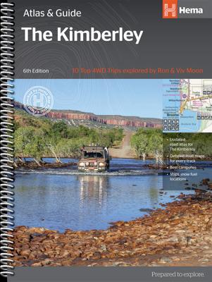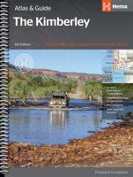
Wegenatlas The Kimberley Atlas & Guide | Hema Maps

0
A4 formaat, spiraal gebonden, verschillende schalen This guide is jam-packed with information on what to do and see in the Kimberley. Travel writer Denis O'Byrne gives information on the Kimberley's amazing 'must see' landmarks as well as expert favourites that often go unseen. Hema's guide helps you make the most of your visit to the remarkable c...

Verkopers met dit product

Verkoper
Bezorging
Prijs
DeZwerver.nl logo
DeZwerver.nl
2,95
47,50

Anderen bekeken ook

Wegenatlas Victoria High Country Atlas & Guide | Hema Maps
The definitive guidebook for discovering the Victorian High Country, featuring the Top 30 4WD Trips written by Ron and Viv Moon, in combination with topographic atlas mapping for the region.   40 atlas pages at a scale of 1:150 000 Top 30 4WD Trips Best campsites Adventure activities Trip planning tips This brand new edition of Hema’s best-selling outdoor guidebook for discovering the Victorian High Country now features 40 atlas pages at a large scale of 1:150 000 in a stunning new cartographic style. The guide now features the Top 30 4WD Trips for the High Country, which has been written by off-road legends Ron and Viv Moon. Also included is an introduction to the region, as well as information sections on planning the trip and what to see and do. There are detailed touring sections on the distinct regions of the High Country, including the Great Alpine Road, Alpine National Park as well as Snowy River and Baw Baw national parks. The Top 30 4WD Trips are broken into their respe…
46,95
Wegenkaart - landkaart Iconic Map The Kimberley - Gibb River road | Hema Maps
Detailkaart van een deel van Australië. Zeer goed leesbaar, met naast de topografische details veel symbolen waarmee allerhande toeristische zaken worden aangeduid als campsites, nationale parken, attracties, wandelmogelijkheden etc. A regional map of the Kimberley that features the iconic Gibb River Road. On the reverse are inset maps for Purnululu National Park, the Dampier Peninsula and the Parry Creek area. Detailed trip coverage and drive detail for the Gibb River Road is featured as well, with inset mapping covering the journey and corresponding text to guide explorers.   This edition of Hema’s best-selling Kimberley map features Hema's iconic mapping and detailed points of interest. It combines Hema’s entire database of remote roads and 4WD tracks with touring points of interest and topographic information.   Also included are national park information and relevant contact details for pre-trip planning and use on the road or track.   Key Features Waterproof paper Detailed 4WD…
17,50
Reisgids Fodor's the Complete Guide to the National Parks of the USA | Fodor's Travel
Whether you want to hike through the jaw-dropping scenery of Acadia, see rare wildlife and natural wonders in Yellowstone, or go river-rafting in the Grand Canyon, the local Fodor's travel experts in all the National Parks are here to help! Fodor's Complete Guide to the National Parks of the USA is packed with maps, carefully curated recommendations, and everything else you need to simplify your trip-planning process and make the most of your time. This brand new title has been designed with an easy-to-read layout, fresh information, and beautiful color photos. Fodor's Complete Guide to the National Parks of the USA travel guide includes: AN ILLUSTRATED ULTIMATE EXPERIENCES GUIDE to the top things to see and do MULTIPLE ITINERARIES to effectively organize your days and maximize your time MORE THAN 70 DETAILED MAPS to help you navigate confidently COLOR PHOTOS throughout to spark your wanderlust! HONEST RECOMMENDATIONS FROM LOCALS on the best sights, restaurants, hotels, activiti…
26,95
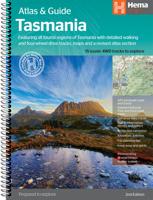
Wegenatlas Tasmania atlas & guide - Tasmanië | Hema Maps
The definitive guidebook for discovering Tasmania, featuring the Top 15 4WD Trips of the State and 5 of the best walking tracks.   This first edition Tasmania Atlas & Guide contains 40 atlas pages at a large scale of 1:150 000 in a stunning cartographic style. The guide features the Top 15 4WD Trips for Tassie, which has been field checked by Hema's Map Patrol. Also included is an introduction to the region, as well as information sections on planning the trip and what to see and do. There are detailed touring sections on the distinct regions of Tasmania. The Top 15 4WD Trips are broken into their respective localities, with each trip containing comprehensive trip information including gradings, distances, relevant travel information and drive coverage from start to finish.   Key Features 40 atlas pages at a scale of 1:150 000 Top 15 4WD Trips Top 5 Walking tracks Best campsites Adventure activities Trip planning tips
45,95
Wegenatlas Cape York Atlas & Guide | Hema Maps
A4 formaat, verschillende schalen / spiraal uitvoering With detailed coverage of The Tip, the coast from Cairns to Cooktown, Rinyirru (Lakefield) National Park, the Peninsula Developmental Road, Old Telegraph Track, Torres Strait and the Savannah Way, it ensures you won’t miss the ‘must-see’ attractions, but it also describes some of the lesser known areas favoured by the experts. Whether you just want to make it to The Tip or are looking for a serious 4WD adventure, this informative book is an indispensable companion.   The book features 15 4WD trips, explored and revised by travel journalist Ian Glover, with photography by Matt Williams. Each trip has a detailed map, plus all the information you need to plan the trip including trip grading, longest distance without fuel, permits and contact details.   This brand new edition of Hema’s best-selling outdoor guidebook for discovering Cape York now features 22 atlas pages in a stunning new cartographic style and also incorporates c…
45,95
Reisgids The Rough Guide to Albania: Travel Guide with EBook | Rough Guides
Ideal for independent travellers, this guidebook to the Albania, written by destination experts, combines must-see sights with hidden gems and offers essential tips for both planning and on-the-ground adventures. It's sustainably printed to ensure environmental responsibility. Inside this Albania travel book, you'll find: Regional deep dive - coverage of key regions, offering a rich selection of places and experiences, and honest reviews of each one Itinerary samples - designed for various durations and interests Practical information - tips on how to get there and get around, use public transport, beat the crowds, save time and money, travel responsibly and more Expert recommendations - insider advice on where to eat, drink, and stay, alongside tips for nightlife and outdoor activities Seasonal tips - when to go to the Albania, climate details, and festival highlights to plan your perfect trip Must-See pick - a curated selection of not-to-miss sights as chosen by our autho…
23,95
Wandelgids Walking in the Thames Valley | Cicerone
Walking in the Thames Valley offers 25 challenging circular walks around the River Thames and River Kennet in the south of England, taking in the Southern Chilterns, the Berkshire and North Hampshire Downs, Southern Oxfordshire and the eastern edge of Wiltshire. All routes are within easy reach of Reading, Newbury, Abingdon and London. While some walks visit Iron Age hill forts, others pass more modern features such as Wilton Windmill and the Kennet and Avon Canal. Some follow sections of the Ridgeway, while others meander along the banks of the Thames. What they all have in common is that they take the keen rambler to some of the best parts of the Thames Valley – a patchwork of open chalk grassland, broadleaved woodland and farmland and home to two Areas of Outstanding Natural Beauty. • walks from 10 to 18 miles, including one 2-day route • shorter, less strenuous alternatives for many of the walks • detailed route descriptions with information on local points of interest, OS mapping…
18,50
Wegenatlas Local Explorer Street Atlas Nottinghamshire | Philip's Maps
Philip's created this new series for walkers, cyclists and local explorers at a scale that provides greener options to uncover all the nature and hidden gems in your local area. From Beeston to Tickwell, we cover Nottinghamshire in enticing detail.   Who hasn't explored and enjoyed their surrounding area in recent years and come to appreciate what is on our respective doorsteps? Philip's have created this new series for walkers, cyclists and local explorers at a scale that provides greener options to uncover all the nature and hidden gems in your local area.   Includes all the 18,000 streets in BEESTON, MANSFIELD, NOTTINGHAM, SUTTON IN ASHFIELD, WEST BRIDGFORD, WORKSOP, Balderton, Bawtry, Bingham, Blidworth, Bottesford, Calverton, Clifton, Cotgrave, East Leake, Eastwood, Edwinstowe, Gainsborough, Harworth, Hucknall, Kegworth, Keyworth, Kimberley, Kirkby in Ashfield, Long Eaton, Mansfield Woodhouse, Market Warsop, Newark-on-Trent, Ollerton, Pinxton, Radcliffe on Trent, Rainworth, Raven…
23,95
Wegenatlas Local Explorer Street Atlas Oxfordshire | Philip's Maps
Who hasn't explored and enjoyed their surrounding area in recent years and come to appreciate what is on our respective doorsteps? Philip's have created this new series for walkers, cyclists and local explorers at a scale that provides greener options to uncover all the nature and hidden gems in your local area.   Includes all the streets in ABINGDON-ON-THAMES, BANBURY, BICESTER, DIDCOT, HENLEY-ON-THAMES, KIDLINGTON, OXFORD, THAME, WITNEY, Adderbury, Benson, Burford, Carterton, Caversham, Chalgrove, Charlbury, Chinnor, Chipping Norton, Cholsey, Cowley, Cumnor, Eynsham, Faringdon, Goring, Grove, Headington, Highworth, Kennington, Lechlade-on-Thames, Middleton Cheney, Pangbourne, Sonning Common, Stokenchurch, Wallingford, Wantage, Wargrave, Watlington, Wheatley, Woodstock, Wootton.   The detailed scale allows explorers, walkers and cyclists to avoid main roads and select pathways, bridleways and lanes for optimum enjoyment. Whether it's meandering through the local parks or historic hou…
23,95
Reisgids New Orleans | Rough Guides
Zeer goede reisgids voor zowel de georganiseerde maar vooral voor de zelfstandige reiziger. Boordevol informatie over reizen, slapen, eten, maar ook musea en cultuur. Voor Wereldsteden en Europese landen meestal completer en beter dan de Lonely Planet ! This practical travel guide to New Orleans features detailed factual travel tips and points-of-interest structured lists of all iconic must-see sights as well as some off-the-beaten-track treasures. Our itinerary suggestions and expert author picks of things to see and do will make it a perfect companion both, ahead of your trip and on the ground. This New Orleans guide book is packed full of details on how to get there and around, pre-departure information and top time-saving tips, including a visual list of things not to miss.   Our colour-coded maps make New Orleans easier to navigate while you're there. This guide book to New Orleans has been fully updated post-COVID-19 and it comes with a free eBook. The Rough Guide to New Orleans…
20,95

Klanten-reviews van Wegenatlas The Kimberley Atlas & Guide | Hema Maps

Er zijn nog geen beoordelingen voor dit productBen jij de eerste die een review plaatst?

Meer over Wegenatlas The Kimberley Atlas & Guide | Hema Maps

Productomschrijving

A4 formaat, spiraal gebonden, verschillende schalen

This guide is jam-packed with information on what to do and see in the Kimberley. Travel writer Denis O'Byrne gives information on the Kimberley's amazing 'must see' landmarks as well as expert favourites that often go unseen.

Hema's guide helps you make the most of your visit to the remarkable corner of Australia. With detailed coverage of the Gibb River Road, Broome, Kununurra, Purnululu, (The Bungle Bungles) and many other famous destinations, it ensures you won't miss the 'must-see' attractions, but it also describes some of the lesser known areas favoured by the experts.    Features:   New larger A4 format - easy-to-read Town and locatlities GPS index When to go and how to prepare Handy atlas for navigation, plus detailed maps of the Gibb River Road, Great Northern Highway, Broome and Kununurra regions, and national parks Where to go for the best outdoor experiences Where to stay, from luxurious resorts to the best bush camping spots Extensive listing of rental agencies and tour operators - fully organised excursions, Aboriginal culture tours, DIY adventures, scenic flights and more Background reading on the region's unique geographical featues, flora and fauna.   Whether you're here for a relaxing holiday or a serious 4WD adventure, this informative book with its easy-to-follow maps is an indispensable companion.

Verken gerelateerde categorieën

Webshop.nl maakt gebruik van cookies. Ga je verder op onze website, ga dan akkoord met het plaatsen van cookies en de verwerking van deze data door ons en vermelde partners.