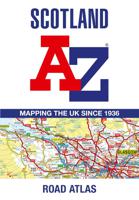
Wegenatlas Scotland - Schotland | A-Z Map Company

0
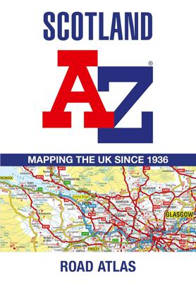
Handzame gedetailleerde wegenatlas van Schotland. Navigate your way around Scotland with this detailed, full-colour and easy-to-use A-Z Road Atlas. From the border to the north coast, the mainland pages scale is 3.5 miles to 1 inch and the Western Isles, Shetland Islands and Orkney Islands scale is 4.5 miles to 1 inch.   Covering the entire co...

Verkopers met dit product

Verkoper
Bezorging
Prijs
DeZwerver.nl logo
DeZwerver.nl
2,95
13,50

Anderen bekeken ook

Wegenkaart - landkaart Visitors map Scotland - Schotland | A-Z Map Company
xplore the whole of Scotland from Dumfries and Galloway in the South to the Orkney Islands in the North. With detailed road mapping and illustrated town plans of major cities, this feature rich, helpful tourist guide is ideal for touring around Scotland. Published at a clear 8.7 miles to 1 inch scale (5.51 cm to 1 km), this handy map is a detailed and informative exploration of what Scotland has to offer.   Highlights include: 8 inset street maps to major cities and popular destinations, including: Edinburgh, Glasgow, Stirling, and Cairngorms National Park, with detailed descriptions and places of interestLocations of visitor centres and tourist information sitesUseful key to map symbols making it a clear and easy readMore than 700 places of interest The perfect map for exploring Scotland whether you are a tourist or a local.
11,50
Wegenkaart - landkaart Touring Map of Scotland - Schotland | Collins
Best-selling map of Scotland. More than 1,000 places of tourist interest plotted and named on the map. The features have been plotted onto an up-to-date and attractive Collins map of Scotland.   A clear, easy to follow road map with colour classified roads. Ideal for tourists with hundreds of distinctive tourist symbols and tourist information centres all shown.   This map includes: • The whole of Scotland on a double sided sheet at 5 miles to 1 inch • Over 25 categories of tourist information shown on the map including youth hostels, picnic sites and ferries as well as the more obvious tourist sites such as castles, wildlife parks and museums • Detailed town centre maps of Edinburgh, Glasgow, Aberdeen, Dundee, Inverness and Perth • New places of interest including Japanese Garden (near Dollar), Macallan Distillery Centre, Moat Brae (Dumfries) and Scottish Submarine Centre (Helensburgh) • Road updates include the new Dalry bypass, Maybole bypass under construction, A9 dualling section…
9,95
Nieuw
Reisgids Scotland - Schotland | Rough Guides
Zeer goede reisgids voor zowel de georganiseerde maar vooral voor de zelfstandige reiziger. Boordevol informatie over reizen, slapen, eten, maar ook musea en cultuur. Voor Europese landen - zeker de Engelse deelgebieden - meestal completer en beter dan de Lonely Planet ! Ideal for independent travellers, this guidebook to Scotland, written by destination experts, combines must-see sights with hidden gems and offers essential tips for both planning and on-the-ground adventures. It's sustainably printed to ensure environmental responsibility.   Inside this Scotland travel book, you'll find:   - Regional deep dive - coverage of key regions, offering a rich selection of places and experiences, and honest reviews of each one - Itinerary samples - designed for various durations and interests - Practical information - tips on how to get there and get around, use public transport, beat the crowds, save time and money, travel responsibly and more - Expert recommendations - insider advi…
23,50
Nieuw
Reisgids Experience Scotland - Schotland | Lonely Planet
De nieuwste reisgidsen-serie van Lonely Planet: een luxe uitgave met als titel 'Experience... ' waarin aandacht voor de belangrijkste niet te missen hoogtepunten van het land. Ook hier wordt het kort en bondig geschreven met veel praktische informatie erbj als eten-drinken en vervoer. De lijst met accommodaties - zoals bij de gewone Planets - hebben ze weggelaten. Wel weer met veel plattegronden en kaartjes, rijkelijk geillustreerd met mooie foto's.   This latest edition of Lonely Planet's Experience Scotland travel guide reveals exciting new ways to explore this iconic country with all the tools you need to create your own unique trip. Discover amazing local experiences from flocking to Oban, the 'Seafood Capital of Scotland', for sustainable shell-fish platters; to hitting the road to find hidden beaches on the crowd-free Cowal Peninsula; and star gazing amid the epic beauty of Galloway Forest Park. Build a one-of-a-kind trip with Lonely Planet's Experience Scotland travel guide:Ou…
26,50
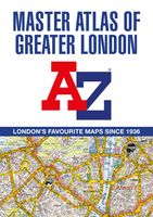
Wegenatlas A -Z Master Atlas of Greater London | A-Z Map Company
De ultieme stratengids van Londen en directe omgeving. Super gedetailleerd en alle straten staan er op, met een enorm register bovendien. The ultimate street atlas to navigate your way around London. A comprehensive paperback street atlas of London encompassing an area of 1450 square miles with coloured street mapping, and including more than 90,000 streets and other addresses. The coverage extends beyond the Greater London and M25 area to: Hemel Hempstead, St.   Albans, Potters Bar, Waltham Cross, Epping, Brentwood, Thurrock, Stanford-le-Hope, Gravesend, Wrotham, Sevenoaks, Westerham, Oxted, Redhill, Reigate, Leatherhead, Great Bookham, Woking, Egham, Windsor, Slough, Chalfont St. Peter, Chorleywood, Bovingdon There are eighteen pages of large scale (9" to 1 mile) street mapping of central London which gives additional clarity and detail, this mapping extends to: Regent's Park, St. Pancras International Station, Old Street, Tower Bridge, Bricklayer's Arms Junction, Vauxhall Bridge, S…
29,95
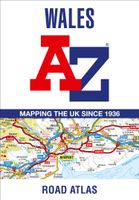
Wegenatlas Wales road atlas | A-Z Map Company
Handige wegenatlas op A5 formaat, makkelijk te gebruiken met grote letters en heel goed leesbaar. De schaal is behoorlijk gedetaileerd en zeker ook voor fietsers goed te gebruiken. Met veel aanduidingen van toeristisch interessante plekken. Full-colour road atlas of Wales, with extended coverage into England and including all the major routes into the country. The detailed road mapping also includes Liverpool, Warrington, Nantwich, Shrewsbury, Hereford, Bristol and Severn River Crossings.   Published at a clear 2.5 miles to 1 inch the following features are shown on the road mapping:   Motorways open with full junction detail, motorways under construction and proposed, motorway service areas, primary routes and destinations, A and B roads, selected minor roads, gradients 1:5 and steeper, tolls, mileages, national and county boundaries, spot heights and hill shading Selected places of interest, tourist information centres and golf courses National Park boundaries for Snowdonia, …
11,95
Wegenatlas - Stadsplattegrond London Street Atlas - Londen | A-Z Map Company
Handzame, maar behoorlijk dikke stadsatlas van Londen. Gebonden uitgave, maar toch redelijk makkelijk open ter klappen. Met register achterin. Zeer uitgebried met alle staten en steegjes. Centrumgedeelte met meer details (1:11.000)  dan de kaarten buiten het centrum (1:22.000) First published in 1936, this iconic atlas is a trusted means of finding your way around the capital city.   The main mapping extends beyond Central London from Heathrow Airport to Chingford at a scale of 2.88 inches to 1 mile (4.55 cm to 1 km), featuring postcode districts, one-way streets, the Congestion Charging Zone and Low Emission Zone.   The large-scale street map of Central London – at a scale of 5.75 inches to 1 mile – cover Regent’s Park and Shoreditch, Chelsea and Vauxhall, Hyde Park and Bermondsey.   A comprehensive index lists streets, selected flats, walkways and places of interest, place, area and junction names. Additional healthcare (hospitals, walk-in centres and hospices) and transport …
13,50
Nieuw
Fietsgids Cycling in the Hebrides - Schotland | Cicerone
Prachtige fietsgids, zeer inspirerend , van een bijzonder fietsgebied. goede routesuggesties, Veel informatie, met hoogteprofielen en praktische zaken. The 37 day routes and 22 link routes brought together in this guide offer cyclists of all abilities the opportunity to island-hop by bike across the Hebrides, visiting over 20 islands in six sections: Clyde and Kintyre; Colonsay, Islay and Jura; Mull, Coll and Tiree; Skye and Raasay; Barra and the Uists; and Harris and Lewis. From Skye's majestic Cuillin mountains to the palm trees of Bute and the white sands of Tiree and Harris, there is nowhere better to indulge your sense of adventure and experience the thrill of travelling under your own steam in the fresh air. The Hebrides from Islay in the south up to Lewis in the north are all included, along with Arran and its neighbouring islands in the Firth of Clyde, and this comprehensive guide contains all the information you need - from ferry schedules to refreshment stops and bike repair…
22,50
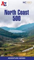
Wegenatlas Adventure Atlas North Coast 500 | A-Z Map Company
The A-Z Adventure Series of maps is the perfect companion for walkers, off-road cyclists, and anyone wishing to explore the great outdoors.   The scenic North Coast 500 is one of the most popular routes in Scotland and journeying along it makes for an incredible adventure. The 516 mile (830 km) route passes through picturesque landscapes and abundant wildlife, linking a wide range of tourist destinations in the Highlands.   This A-Z North Coast 500 Adventure Atlas features more than 90 pages of continuous 1:50 000 mapping, providing detailed coverage of the entire route. A route planner showing distances between places and the amenities available is also included, along with the locations of:   Campsites (seasonal opening) Information Centres Hotels/B&Bs Youth Hostels Pubs, Restaurants and Cafes Shops Petrol Stations Now with NEW electric charge point data from Zapmap! Other walks available in the A-Z Adventure series include: Cotswold Way, Peddars Way and Norfolk Coast Path, Coast to…
13,95
Reisgids Scotland - Schotland | Insight Guides
Dé gids als het gaat om achtergrondinformatie en prachtige foto’s. Ideaal om je reis goed te plannen. Door het formaat en gewicht niet zo zeer om mee te nemen in een echte rugzak maar in een Samsonite misstaat deze niet! Uitstekend om thuis voor en na de reis uitgebreid te lezen. Kwalitatief van een hoog niveau! Engels. This Insight Guide is a lavishly illustrated inspirational travel guide to Scotland and a beautiful souvenir of your trip. Perfect for travellers looking for a deeper dive into the destination's history and culture, it's ideal to inspire and help you plan your travels. With its great selection of places to see and colourful magazine-style layout, this Scotland guidebook is just the tool you need to accompany you before or during your trip. Whether it's deciding when to go, choosing what to see or creating a travel plan to cover key places like Glen Coe, Stirling Castle, it will answer all the questions you might have along the way. It will also help guide you when you…
23,95

Klanten-reviews van Wegenatlas Scotland - Schotland | A-Z Map Company

Er zijn nog geen beoordelingen voor dit productBen jij de eerste die een review plaatst?

Meer over Wegenatlas Scotland - Schotland | A-Z Map Company

Productomschrijving

Handzame gedetailleerde wegenatlas van Schotland.

Navigate your way around Scotland with this detailed, full-colour and easy-to-use A-Z Road Atlas. From the border to the north coast, the mainland pages scale is 3.5 miles to 1 inch and the Western Isles, Shetland Islands and Orkney Islands scale is 4.5 miles to 1 inch.   Covering the entire country, this road atlas includes the following features: • Motorways with full junction detail, primary routes and destinations, A & B roads, under construction and proposed roads, service areas, tolls, mileages, national, county and unitary authority boundaries • Cairngorms and Loch Lomond & The Trossachs National Park boundaries • Selected places of interest and tourist information centres   20 city and town street maps are included for Aberdeen, Aviemore, Ayr, Dumfries, Dundee, Dunfermline, Edinburgh, Glasgow, Falkirk, Fort William, Hamilton, Inverness, Kilmarnock, Kirkcaldy, Motherwell, Oban, Paisley, Perth, St Andrews and Stirling. Also included is a comprehensive index to cities, towns, villages, hamlets and locations. Also included are 20 city and town plans for:   Aberdeen Aviemore Ayr Dumfries Dundee Dunfermline Edinburgh Glasgow Falkirk Fort William Hamilton Inverness Kilmarnock Kirkcaldy Motherwell Oban Paisley Perth St Andrews Stirling   There is a comprehensive index to cities, towns, villages, hamlets and locations.

Productinformatie

    Verken gerelateerde categorieën

    Webshop.nl maakt gebruik van cookies. Ga je verder op onze website, ga dan akkoord met het plaatsen van cookies en de verwerking van deze data door ons en vermelde partners.