webshop.nl
Categorieën
  Sluiten

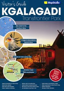
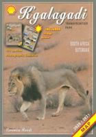
Wegenatlas - Reisgids Visitor's Guide to Kgalagadi Transfrontier Park | MapStudio

The Kgalagadi Transfrontier Park is a fusing of two parks, namely South Africa’s Kalahari Gemsbok National Park and Botswana’s Gemsbok National Park. The vastness of the Kgalagadi makes this one of the select few conservation areas of such magnitude left on the globe.   The park is characterised by high orange-red sand dunes rippling like a burnish...
13,50

Webshops met dit product

Webshop
Bezorging
Prijs

Anderen bekeken ook

Reisgids Isle of Skye Guide Book | Charles Tait
The Isle of Skye is one of the most popular visitor destinations in Scotland and it was voted the fourth best island in the world by National Geographic. Being a relitavely small island, this guidebook has everything you'll need to experience the wonders of Skye. It covers all the main sites of interest, monuments, details of all of the best places to visit, walks and visitor attractions. It also includes a selection of 11 suggested day itineraries.   Charles does an excellent job at leaving nothing untouched when delving into the beauty that Skye has to offer. Some of the different sections covered range from Nature and Enviroment, Birds, Flora, Fauna, History, Archaeology and Culture. All sections are supported with Charles' own photography, with nearly 800 mostly new and unpublished photographs.   Charles Tait guide books   The Charles Tait guides for Scotland are chock full of information, which will both inspire you before your trip and enhance your experience whilst you're there.…
18,95
Reisgids Outer Hebrides Guide Book | Charles Tait
The Outer Hebrides Guide Book provides a thoroughly informative insight into unique life on the Scottish islands. Learn in fine photographic and written detail about the active traditional crafts, ancient archeology, geology and undisturbed nature and wildlife across these stunning islets.   This wonderfully written guide by experienced travel writer and photographer Charles Tait takes you around the main magical islands of the Outer Hebrides off the west coast of Scotland. Take a step back in time and explore the rich cultural, historical and natural delights of Lewis, Harris, The Uists, and Barra.   All the information provided in this guide is complimented by 12 hand-picked itineraries across the main islands of the Outer Hebrides. Each itinerary lists recommended sites, monuments and activities across a designated region or theme and are all accompanyed with Ordnance Survey maps for clarity.   How this guide is laid out   The Charles Tait guides for Scotland are brimming with infor…
19,95
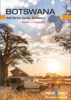
Accommodatiegids - Campergids - Campinggids Botswana Self-Drive Guide | Tracks4Africa
De Self Drive Guide Botswana van Tracks4Africa is een uitgebreide gids met alle informatie voor mensen die zelf met een eigen of gehuurde auto door Botswana willen reizen. De gids bevat informatie over parken en routes, over overnachtingsmogelijkheden en campings, maar ook over de veiligheid, de beste reistijd, de planning, de keuze van welk vervoermiddel en de hulpmiddelen die vereist zijn. Zo vindt u bijvoorbeeld ook informatie over het huren van een 4x4 met tent op het dak en campingspullen, over de techniek van de auto, over voorbereiding, over navigatie, communicatie en vereiste documenten. De gids ziet er aantrekkelijk en overzichtelijk uit en bevat veel kaarten met routes en ook kleurenfoto's. De gids is groot van formaat : A4 !   This guide is specifically aimed at self-drive travellers. If you are a self-drive tourist, there are five things that you need to know when you are on the road:  1. Where to sleep.  2. Where to get fuel.  3. What to see and do.  4. Where to buy suppli…
52,50
Wegenatlas Australië - Great Desert Tracks Atlas & Guide | Hema Maps
Whether you're a desert lover or just looking to tackle some of Australia's favourite 4WD destinations, the Hema Great Desert Tracks Atlas & Guide - Edition 5 is an indispensable companion to this country's arid centre. The complete atlas contains Hema's entire Great Desert Tracks map series. The guide features 25 4WD tracks, each with its own detailed map inset showing the route taken, with GPS location and points of interest featured. All of the tracks are colour-coded to make it simple to find the treks that suit your type of vehicle and handy symbols show towing suitability also! The track descriptions are written by some of Australia's top four-wheel driving enthusiasts and experienced travel writers. Each track's notes contain all the information you need to plan for the trip, including permits and contact details. There's also plenty of essential pre-trip reading on how to prepare for your trek, safety in the outback and driving techniques!   Features Contains Hema's entire G…
55,95
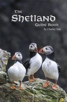
Reisgids Shetland Guide Book | Charles Tait
The Shetland Guide Book offers unrivalled detail on the more than 100 islands that make up the Shetland Isles. The islands have a wealth of archaeological history, from viking farms to bronze age burial mounds, but the natural wonders are just as impressive and this guide will tell you where you can catch a glimpse of everything from puffins to ponies.   Charles Tait Guidebooks   Charles Tait Guidebooks are photographed, researched, designed and written by the author. Being an Orcadian photographer and travel writer, Charles Tait has been publishing guidebooks based on the natural and cultural history of the Highlands and Islands since 1991. The aim is to create authoritative, readable, informative, easily assimilated handbooks to each area. Each book is extensively illustrated with photographs by Charles Tait, as well as Ordnance Survey maps, old photographs and prints. The guides include introductions covering natural history, archaeology, history and the economy. The Gazetteer cover…
19,95
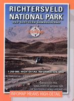
Wegenkaart - landkaart Richtersveld National Park and Northern Namaqualand | Infomap
Wegenkaart met toeristische informatie en geschikt voor gebruik met GPS   The original InfoMap! Now in its 8th edition this map remains as popular as ever. For those who don’t know, the Richtersveld National Park is a 160 000 hectare national park found on the banks of the Orange River in South Africa’s Northern Cape. It is the only mountain desert park in Southern Africa and is one of the few national parks in which you are not confined to your car. Dry, arid with a feeling of isolation, life in the park is influenced by the mist created by the cold Atlantic Ocean. Known to the local Nama people as ‘malmokkie’ it brings moisture to an otherwise parched land. Despite its lack of rainfall the area is rich in flora containing many species, like the Halfmens, which exist nowhere else on earth.   The area has long been a favorite for botanists, photographers, lovers of remote places and 4×4 enthusiasts who flock to this corner of South Africa for its unique character, isolation and feel…
15,95
Wegenkaart - landkaart - Wandelkaart Jasper National Park (Alberta) | Gem Trek Maps
Waterproof and tear-resistant map for Jasper National Park in the Canadian Rockies.   Whether you are a first-time visitor or a long-time local, you’ll find Gem Trek’s Jasper National Park Map to be an invaluable tool. Researched and designed by locals, and printed in Canada, this map features accurate cartography and subtly colored relief that puts the mountainous region in perspective. The map is printed on high-quality synthetic waterproof paper that can be folded and refolded hundreds of times.   The 1:250,000 scale is ideal for discovering the very best of Jasper National Park. Highlights and our recommended hiking trails are marked by numbered stars, then cross-referenced on the reverse side with descriptions. Also included are all mountains and their elevations, along with natural features such as waterfalls, hot springs, and glaciers.   In addition to descriptions for the top highlights and most popular hiking trails, the reverse side has inset maps for the town of Jasper…
16,95
Wegenkaart - landkaart Kgalagadi - Tourist Map of Kgalagadi Transfrontier Park Botswana | Shell
Zeer bijzondere landkaart van het grensgebied van Botswana en Zuid Afrika. Uitermate handig zijn de GPS coordinaten van de meest belangrijke punten als campings of uitzichtpunten. De kaart is gebaseerd op een luchtfoto, waarbij alle details zijn ingetekend. The map: The map consists of a large map of the entire Park on the front of the map. On the back is enlargements of six maps - the South African side, Mabuasehube, Swart Pan area, Gemsbok Wilderness Trail, Mabuasehube Wilderness Trail and of the Kaa Kalahari Concession. Satellite images were used and the roads were tracked by GPS. There are 168 GPS coordinates on this map. Establishment of a Transfrontier Park: On the 7 th of April 1999 Botswana and South Africa signed a bilateral agreement in which they agreed to manage their adjacent national parks, Gemsbok National Park in Botswana and Kalahari Gemsbok National Park in South Africa, as a single ecological unit – the Kgalagadi Transfrontier Park. It is the first formally declared …
17,50
Wandelkaart 901 Banff North National Park | National Geographic
Prachtige geplastificeerde kaart van het bekende nationaal park. Met alle recreatieve voorzieningen als campsites, maar ook met topografische details en wandelroutes ed. Door uitgekiend kleurgebruik zeer prettig in gebruik. Scheur en watervast! The front side of the Banff North map details the south side of the national park, from Siffleur Wilderness Area to the north, to Kootenay National Park to the south. This side also covers survival tips, area trails, entry fees and details both Kootenay and Yoho Nationals Parks. The reverse side of the map details the north side of the park, extending from Siffleur Wilderness area to the south, to White Goat Wilderness to the North. Insets show safe travel in Bear Country, and all the recreation the park has to offer with backpacking, camping, biking, hiking and horseback riding.  National Geographic's Trails Illustrated map of Banff North is a two-sided, waterproof map designed to meet the needs of outdoor enthusiasts with unmatched durability …
17,95
Reisgids Botswana Safari Guide | Bradt Travel Guides
Er bestaat geen uitgebreide Lonely Planet van Botswana. Voor Afrikaanse landen net zo goed, zo niet beter dan de Planet. Beduidend soberder uitgevoerd, maar ook met veel informatie voor backpackers en met veel kaartmateriaal. Een aanrader! This new edition of Bradt's Botswana remains the only full-blown, standalone guide to one of Africa's most popular and rewarding safari destinations. Acclaimed by tour operators and travel writers alike, this is the only guide to focus on the most popular tourist areas of Botswana: the Okavango Delta, Chobe National Park and the Northern Kalahari, and this new edition includes a new full-colour wildlife guide, backed up by detailed flora and fauna information for each safari area.    Fully updated, from top lodges in the Okavango Delta to small guesthouses (including many new to this edition), also included are detailed maps, comprehensive GPS coordinates (invaluable to self-drivers), and coverage of Livingstone and the Victoria Falls, ideal as an ad…
24,95

Klanten-reviews van Wegenatlas - Reisgids Visitor's Guide to Kgalagadi Transfrontier Park | MapStudio

Er zijn nog geen beoordelingen voor dit productBen jij de eerste die een review plaatst?

Meer over Wegenatlas - Reisgids Visitor's Guide to Kgalagadi Transfrontier Park | MapStudio

Productomschrijving

The Kgalagadi Transfrontier Park is a fusing of two parks, namely South Africa’s Kalahari Gemsbok National Park and Botswana’s Gemsbok National Park. The vastness of the Kgalagadi makes this one of the select few conservation areas of such magnitude left on the globe.   The park is characterised by high orange-red sand dunes rippling like a burnished sea. No permanent rivers have forged across this ancient landscape for thousands of years. The courses of two dry river beds, the Auob and Nossob, are testament to this.   This visitor’s guide features an opening checklist and an overview map, as well as a main map giving detailed information on the layouts of the main campsites, handy hints and tips, visitor’s facilities and information, distance chart and travelling times, contact details and booking information, gate times and travel times between the various camps. There is interesting information about waterholes, points of interest and picnic sites. Included are positions of viewpoints, where fuel is available and where the best places are for taking great photographs.   Images and descriptions of mammals, reptiles, birds and flora are detailed at the end.   There is also a great star gazing map of the Southern Skies – the clean air and lack of light and pollution makes it ideal for star gazing.   This is a must have for any traveller who wishes to visit the Kgalagadi Transfrontier Park an amazing and beautiful part of our world.   Content Includes: – Full-colour photographs – Camp, museum and waterhole information in detail – Accommodation options available – Contact details – Climate chart – Overview map of the region – Layout of main camp sites – Over 100 images and descriptions of fauna and flora – Checklist of fauna and flora – Handy hints and tips – Facilities and info – Distance chart and travelling times – Gate times – 4WD specific information – GPS points – Best times to visit – Family friendly rating – Trailer-friendly rating – Sanparks regulations
Webshop.nl maakt gebruik van cookies. Ga je verder op onze website, ga dan akkoord met het plaatsen van cookies en de verwerking van deze data door ons en vermelde partners.