webshop.nl
Categorieën
  Sluiten

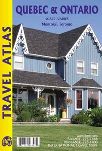
Wegenatlas Quebec & Ontario | ITMB

Wegenatlas van Quebec en Ontario. Natuurkundig kaartbeeld. Met inzetjes van stadsregio's en centrumkaarten van Montreal en Toronto. Uitgebreide index.   We are blessed in North America with a state of peace unattainable in most other parts of the world. We take for granted freedom to travel over vast distances on good roads, have rail services carr...
16,50

Webshops met dit product

Webshop
Bezorging
Prijs

Anderen bekeken ook

Wegenkaart - landkaart Southern Ontario | ITMB
Een degelijke kaart met aanduidingen van o.a. nationale parken, vliegveld, benzinepomp, dirt-roads en kleine plattegrond van hoofdstad. Als overzichtskaart goed te gebruiken. The Canadian province of Ontario is intimidatingly large. It is also mostly tundra with extremely few settlements and few roads; in fact, the geographic centre of Ontario is about 1,500 kms north of the nearest road. The very first map I prepared, at age 10, was of Ontario; and it took me six weeks to trace all the lakes. My point is that the developed portion of the province is a much smaller wedge of fertile ground south of the mineral belt of the Great Canadian Shield. This double-sided map focusses on the area south of Sudbury and North Bay and expands the scale to a much more useful purpose for most users. Imagine Detroit in the southwest corner of the map, with Highway 401 joining it to London and Toronto and a branch motorway cutting across to Buffalo. Add in the Bruce Peninsula and the major routes north t…
13,95
Wegenkaart - landkaart Ontario | ITMB
Een degelijke kaart voor Ontario met aanduidingen van o.a. nationale parken, vliegveld, benzinepomp, dirt-roads en kleine plattegrond van Toronto, Sault Ste. Marie. Als overzichtskaart goed te gebruiken. Ontario and Quebec form the portion of Canada known as Central Canada. Ontario is the industrial heartland of the country, and the southern portion is the most densely-populated and urbanized part of Canada. Toronto is a city of 2.8M people and the heartland of an economic region serving 100,000,000 people in two countries. Southern Ontario is also home for six million residents, some of the most historic sites in the country, and major recreational land masses (Algonquin Park, Bruce Trail, Muskoka/Haliburton). Northern Ontario, on the other side of the map, occupies the bulk of the land area of the province, and is dominated by the Canadian Shield (a pre-Cambrian rock formation that is the oldest land on earth, rich in mineral wealth). The North is dominated by recreational activities…
13,95
Wegenkaart - landkaart - Stadsplattegrond Toronto & Southern Ontario - Ontario zuid | ITMB
Overzichtskaart van het zuiden van Ontario - schaal 1:600.000 - met op de andere kant een grote plattegrond van Toronto op schaal 1:12.000 Legend Includes: Roads by classification, Accomodations, Museum, Churches, Buildings, Points of tourist, Public Interests, Post Offices, Police Stations, Schools, Live Theatres, Cinemas, Ruins, Bus Terminals, Ferry Terminals, Service Areas, Hospitals, Ports, Mines, RCMP, Major Airports, Secondary Airports, Camp Grounds, National Park and Equivalent Reserves, Ski, Picnic Sites, and much more.   Toronto is the largest city in Canada by far. Touristically, its attraction rests with its central core, from High Park in the west to the Don River in the east, and from the park-like islands in Lake Ontario to Bloor Street in the north. In this area, one finds remnants of the oldest portion of ‘muddy York’, the original fort built to deter American raiders (close to the exhibition grounds), Campbell House (at Queen & University), and the first public school…
13,95
Wegenkaart - landkaart Southern Quebec - Zuid Quebec | ITMB
Een degelijke kaart met aanduidingen van o.a. nationale parken, vliegveld, benzinepomp, dirt-roads en kleine plattegrond van hoofdstad. Als overzichtskaart goed te gebruiken. La Belle Province has a lot in common with Ontario. It is a huge political entity, with most of the land mass unusable due to permafrost. Almost all the roads and settlements are in the southern half of the province, so we expanded the scale of our artwork and created a map that will be of greater practical use for visitors than one of the entire province. Even so, the distances are formidable (say it in French; it sounds much more dramatic!) Side one concentrates on the region north of Montreal, and includes the Canadian Shield region of Abitibi. The second side follows the St. Lawrence River eastward to Quebec City, where one can continue eastward on the north shore for hundreds of kilometers or cross over an enormous bridge to the south shore and do essentially the same; ending up in the picturesque Gaspe Penin…
13,95
Wegenkaart - landkaart - Stadsplattegrond Montreal & Southern Quebec | ITMB
Stadsplattegrond van Montreal met register. Op de achterzijde een kaart van het zuiden van Quebec. 1:12,500/1:850,000 on waterproof paper. In this third, updated, edition of Canada's third largest city, we have added a user-friendly bonus. As is common now to most of our city maps, we have included a regional map of the hinterland of the urban area, so buyers won't have to purchase a second map to explore the environs of the city being presented. In the case of Montreal, being in a huge geographic country, this means Southern Quebec which, because of its size, dictates a map of more than one to a million scale. In the European context this would be the equivalent of Paris and all of France as a 'regional' map of the surrounds of Paris - but that's France and this is Canada.   Montreal (or Mont Royale in its original) was a village called Hochelaga when the early French explorers arrived in the early 1600s. They established a trading fort and, generally speaking, maintained good relatio…
13,95
Stadsplattegrond - Wegenkaart - landkaart Quebec City & Gaspe Peninsula | ITMB
Een degelijke kaart aan twee kanten bedrukt. Aan de ene zijde een plattegrond van Quebec stad, schaal 1:10.000. En aan de andere zijde een wegenkaart, schaal 1:750.000, van Gaspe schiereiland met aanduidingen van o.a. nationale parken, vliegveld, benzinepomp, dirt-roads. ITMB is pleased to be introducing yet another brand new title to our line. Quebec City is one of the oldest urban areas in North America, having been continuously occupied since 1608 (unfortunately, the first attempt at settlement, in 1606, failed through poor planning, and all the settlers perished). QC is also the only completely walled city in North America and the city streets within the walls have barely changed in 400 years. The city is also linguistically unique in being almost completely French Canadian in language (Montreal is much more Anglophiled). The city was the capital of French Canada until General Wolfe and the British army arrived in 1759. The British were able to climb the cliffs protecting the city …
13,95
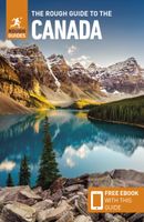
Reisgids Canada | Rough Guides
Zeer goede reisgids voor zowel de georganiseerde maar vooral voor de zelfstandige reiziger. Boordevol informatie over reizen, slapen, eten, maar ook musea en cultuur. Uitputtende bron van informatie, veelal nog completer dan de Lonely Planet. Inleidende informatie over land en cultuur is zeer goed.   Practical travel guide to Canada with a free eBook featuring points-of-interest structured lists of all sights and off-the-beaten-track treasures, with detailed colour-coded maps, practical details about what to see and to do in Canada, how to get there and around, pre-departure information, as well as top time-saving tips, like a visual list of things not to miss in Canada, expert author picks and itineraries to help you plan your trip. The Rough Guide to Canada covers: Toronto, Ontario, Montreal and Southwest Quebec, Quebec City and Northern Quebec, The Maritime Provinces, Newfoundland and Labrador, The Prairie Provinces, The Canadian Rockies, The BC Interior, Vancouver and Vancouver I…
27,95
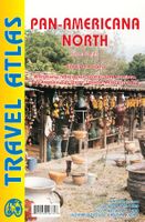
Wegenkaart - landkaart - Wegenatlas Pan-Americana North | ITMB
Wegenatlas - A5 formaat - verschillende schalen - voor de het Noord-Amerikaanse gedeelte van de Pan-Americana ( Pan-American Highway ) van Alaska langs the Pacific kust van British Colombia in Canada, de staten Washington, Oregon en Californie, Mexico, Guatemala tot Panama.   The Pan-American Highway was created by the USA to improve road communications within the Western Hemisphere post-WW2. The highway started at the Mexican border and eventually reached somewhere south of Santiago in Chile. It was a vote-buying gimmick by the Americans to fund allies, but it also created an essential 'spine' road through Central America to the Darien Gap and along the west coast of South America to the then-limits of Chile. Driving the Pan-Am has become a travel experience. More recently, the improvement in more northerly highways, such as the Dalton Highway from Fairbanks to Prudhoe Bay in Alaska, the paving of most of the Stewart Highway through British Columbia, and the tremendous improvement in …
16,50
Wegenkaart - landkaart Western Canada | ITMB
Een degelijke kaart met aanduidingen van o.a. nationale parken, vliegveld, benzinepomp, dirt-roads. Als overzichtskaart goed te gebruiken. This is actually our second attempt at mapping the western portion of Canada; the first covered everything from northwestern Ontario to the Pacific Ocean and, while it was an excellent map, the scale that such a huge area covered necessitated severe problems. In this version, all of British Columbia, Alberta, and the Yukon have been mapped from fresh digital data and presented at 1:1.4T scale. This would have been impossible when we prepared the first map. The Northwest Territories portion had to be compressed in two ways; first, the scale is 1:2M; second, only the portion with roads is shown. This is still an extremely large area. One has to consider the actual size of Canada when designing a map. Most countries in Europe would fit into this area, which only covers 20% of Canada. The Fort McMurray forest fire of a year ago covered an area larger th…
13,95
Waterkaart Halifax & Nova Scotia | ITMB
Halifax & Nova Scotia Travel Reference Map 1:9,000/1:535,000   Halifax was founded by the British navy in 1745 as a base to patrol the North Atlantic and to place pressure on the nearby French possessions of Acadia and Quebec. It has an excellent harbour, and is still the main base for the Canadian naval fleet. The city is also the eastern terminus of the Trans-Canada rail network and a major harbour for shipping goods to Europe. For modern travellers, it is also a major port call for cruise ships and its airport is convenient for flights from Europe. The urban area is actually two separate cities, with Halifax on the western side of the harbour and Dartmouth on the eastern side. Both are shown in excellent detail on this map. The downtown area of Halifax is the most historic part of the city, with the citadel dominating the landscape (well worth a visit!). The second side is a good map of Nova Scotia and most of Prince Edward Island. It isn’t as detailed as our double-sided map of the…
13,95

Klanten-reviews van Wegenatlas Quebec & Ontario | ITMB

Er zijn nog geen beoordelingen voor dit productBen jij de eerste die een review plaatst?

Meer over Wegenatlas Quebec & Ontario | ITMB

Productomschrijving

Wegenatlas van Quebec en Ontario. Natuurkundig kaartbeeld. Met inzetjes van stadsregio's en centrumkaarten van Montreal en Toronto. Uitgebreide index.   We are blessed in North America with a state of peace unattainable in most other parts of the world. We take for granted freedom to travel over vast distances on good roads, have rail services carrying millions of passengers each year, and have reasonably minimal border formalities to undergo at borders. Quebec is one of the great travel destinations for North Americans; so is Ontario. In fact, it is almost inconceivable that one would visit one without seeing the other. Geographically, each province occupies a huge amount of space far larger than any American state, so combining these areas on a folded paper sheet makes no sense. We have combined the two provinces into one travel atlas which, in Canadian terms, would be called central Canada, a term peculiar to Canadians and unmarketable. We present in a compact atlas format the ideal way for visitors to explore two very different but at the same time two very similar societies that have been closely linked for more than 400 years. It includes Niagara Falls, Toronto, the Thousand Islands, Cottage Country, Ottawa, Montreal and the Laurentians, Quebec City and the North Shore, the Eastern Townships and the unsurpassable Gaspe Peninsula. All in one volume!
Webshop.nl maakt gebruik van cookies. Ga je verder op onze website, ga dan akkoord met het plaatsen van cookies en de verwerking van deze data door ons en vermelde partners.