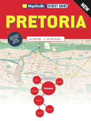
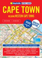
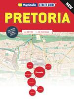
Wegenatlas Pretoria street guide | MapStudio

0

Verkopers met dit product

Verkoper
Bezorging
Prijs
DeZwerver.nl logo
DeZwerver.nl
2,95
30,95

Anderen bekeken ook

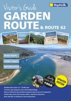
Wegenatlas - Reisgids Garden Route & Route 62 Visitors Guide | MapStudio
Visitor’s Guide to the Garden Route & Route 62 is your GPS Companion   This Visitor’s Guide includes 14 street maps along with the various routes and detailed listing of places of interest and top attractions. All featuring what to see, do and experience in the Garden Route and Route 62.   This new edition of the Visitor’s Guide includes a detailed route planner with all National Parks and Reserves along the Garden Route. Also listed is the top sites to visit around the Garden Route and Route 62, highlighting all major and minor roads, airports and airfields.   Main maps within the Visitor’s Guide : – Robertson – Ashton – Montagu – Barrydale – Ladismith – Mossel Bay – Dana Bay – Oudtshoorn – George – Knysna Lagoon Area – Knysna Central – Humansdorp – Jeffreys Bay
14,50
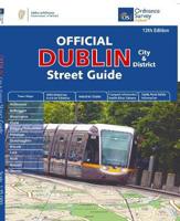
Wegenatlas Dublin official city & district street guide spiral | Ordnance Survey Ireland
Navigate your way around Dublin with confidence with the Official Dublin City & District Street Guide. Find your way around Ireland’s vibrant, historic capital with an enlarged city centre map plus 12 maps of surrounding major towns.   Official Dublin City & District Street Guide features:   - Enlarged city centre map - Maps of Ashbourne, Balbriggan, Blessington, Clane, Delgany/Greystones, Donabate, Dunshaughlin, Kilcock, Lusk, Rush, Rafoath and Skerries - Spiral-bound for ease of laying flat and quick navigation - Schematic maps of all M50 motorway junctions - Up-to-date and indexed information on hospitals, embassies and industrial estates - Garda Road Safety Information - Transport information for bus and rail routes and Dublin Bikes Scheme   Other Ordnance Survey Ireland maps of Dublin include Medieval Dublin, Dublin City Centre Tourist Map and Dublin Commuter Map.
25,95
Wegenatlas Cuba Road Guide | Cuba Incentives
In de wegenkaart is Cuba opgedeeld in 11 uitklapbare kaarten met een schaal van 1:400.000. Met een handzaam formaat van 23 cm hoog en 13 cm breed is de wegenkaart ideaal om mee te nemen en onderweg te gebruiken. Een uitgeklapte kaart heeft het formaat van 23 cm hoog en 61 cm breed. Gedrukt op 170 gram stevig FSC papier. Stadsmappen op straatniveau van de volgende plaatsen: Baracoa - Bayamo - Camagüey - Cienfuegos - Gibara - Guardalavaca - Havana - Holguín - Matanzas - Pinar del Río - Playa Larga - Remedios - Sancti Spíritus - Santa Clara - Santiago de Cuba - Trinidad - Varadero - Viñales
19,95
Wegenatlas Japan Atlas - a Bilingual Guide | Kodansha
This title features: 21 large-scale maps of the regions of Japan, whichnclude all the officially registered cities, towns and villages.   The only atlas of its kind to feature place-names in both English and Japanese, Kodansha's perennial favorite has been newly revised to reflect the many changes that have resulted from the government's policy of consolidating Japanese cities, towns and villages. The volume includes: -- 21 large-scale maps of the regions of Japan, including Greater Tokyo and the Kanto area, the Greater Osaka area, and almost all of the officially registered Japanese municipalities; -- 10 maps of the major metropolitan areas, from Naha in Okinawa to Hiroshima, Kyoto, Nagoya, Tsukuba, Sapporo and many others; -- 7 maps featuring notable tourist and resort areas, including Fuji-Hakone, Nara, Kamakura, Nikko, etc.; -- 9 transportation maps, including road and intercity railway maps, Tokyo and Osaka subway and rail maps, and major domestic airline routes; -- 12 thematic m…
27,95
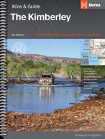
Wegenatlas The Kimberley Atlas & Guide | Hema Maps
A4 formaat, spiraal gebonden, verschillende schalen This guide is jam-packed with information on what to do and see in the Kimberley. Travel writer Denis O'Byrne gives information on the Kimberley's amazing 'must see' landmarks as well as expert favourites that often go unseen. Hema's guide helps you make the most of your visit to the remarkable corner of Australia. With detailed coverage of the Gibb River Road, Broome, Kununurra, Purnululu, (The Bungle Bungles) and many other famous destinations, it ensures you won't miss the 'must-see' attractions, but it also describes some of the lesser known areas favoured by the experts.    Features:   New larger A4 format - easy-to-read Town and locatlities GPS index When to go and how to prepare Handy atlas for navigation, plus detailed maps of the Gibb River Road, Great Northern Highway, Broome and Kununurra regions, and national parks Where to go for the best outdoor experiences Where to stay, from luxurious resorts to the best bush camping …
47,50
Wegenatlas Cape York Atlas & Guide | Hema Maps
A4 formaat, verschillende schalen / spiraal uitvoering With detailed coverage of The Tip, the coast from Cairns to Cooktown, Rinyirru (Lakefield) National Park, the Peninsula Developmental Road, Old Telegraph Track, Torres Strait and the Savannah Way, it ensures you won’t miss the ‘must-see’ attractions, but it also describes some of the lesser known areas favoured by the experts. Whether you just want to make it to The Tip or are looking for a serious 4WD adventure, this informative book is an indispensable companion.   The book features 15 4WD trips, explored and revised by travel journalist Ian Glover, with photography by Matt Williams. Each trip has a detailed map, plus all the information you need to plan the trip including trip grading, longest distance without fuel, permits and contact details.   This brand new edition of Hema’s best-selling outdoor guidebook for discovering Cape York now features 22 atlas pages in a stunning new cartographic style and also incorporates c…
45,95
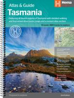
Wegenatlas Tasmania atlas & guide - Tasmanië | Hema Maps
The definitive guidebook for discovering Tasmania, featuring the Top 15 4WD Trips of the State and 5 of the best walking tracks.   This first edition Tasmania Atlas & Guide contains 40 atlas pages at a large scale of 1:150 000 in a stunning cartographic style. The guide features the Top 15 4WD Trips for Tassie, which has been field checked by Hema's Map Patrol. Also included is an introduction to the region, as well as information sections on planning the trip and what to see and do. There are detailed touring sections on the distinct regions of Tasmania. The Top 15 4WD Trips are broken into their respective localities, with each trip containing comprehensive trip information including gradings, distances, relevant travel information and drive coverage from start to finish.   Key Features 40 atlas pages at a scale of 1:150 000 Top 15 4WD Trips Top 5 Walking tracks Best campsites Adventure activities Trip planning tips
45,95
Wegenatlas Victoria High Country Atlas & Guide | Hema Maps
The definitive guidebook for discovering the Victorian High Country, featuring the Top 30 4WD Trips written by Ron and Viv Moon, in combination with topographic atlas mapping for the region.   40 atlas pages at a scale of 1:150 000 Top 30 4WD Trips Best campsites Adventure activities Trip planning tips This brand new edition of Hema’s best-selling outdoor guidebook for discovering the Victorian High Country now features 40 atlas pages at a large scale of 1:150 000 in a stunning new cartographic style. The guide now features the Top 30 4WD Trips for the High Country, which has been written by off-road legends Ron and Viv Moon. Also included is an introduction to the region, as well as information sections on planning the trip and what to see and do. There are detailed touring sections on the distinct regions of the High Country, including the Great Alpine Road, Alpine National Park as well as Snowy River and Baw Baw national parks. The Top 30 4WD Trips are broken into their respe…
46,95

Klanten-reviews van Wegenatlas Pretoria street guide | MapStudio

Er zijn nog geen beoordelingen voor dit productBen jij de eerste die een review plaatst?

Meer over Wegenatlas Pretoria street guide | MapStudio

Verken gerelateerde categorieën

Webshop.nl maakt gebruik van cookies. Ga je verder op onze website, ga dan akkoord met het plaatsen van cookies en de verwerking van deze data door ons en vermelde partners.