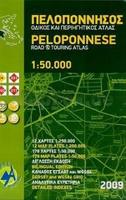
Wegenatlas Peloponnese | Anavasi

0
Paperback, 237-page road atlas of the Peloponnese with detailed contoured mapping at 1;50,000 showing place names in Greek and Roman alphabets and providing a 2km UTM grid for GPS use. The main section of the atlas has 178 pages of detailed maps with contours at 100m intervals, altitude colouring and relief shading to provide a vivid representatio...

Verkopers met dit product

Verkoper
Bezorging
Prijs
DeZwerver.nl logo
DeZwerver.nl
5,95
26,95

Anderen bekeken ook

Wegenkaart - landkaart Kreta | Marco Polo
Goede wegenkaart voorzien van alle noodzakelijke aanduidingen. Daarnaast bijvoorbeeld ook campings, mooie wegen e.d. Crete on a double-sided, indexed map in MairDumont's Marco Polo series, with four street plans, plus special features to make route planning and navigating easier: a fold-out flap in the jacket shows the whole island highlighting popular locations, with the grid reference system in the margins making it easier to find various places on the main map.  Road network shows main and secondary roads with driving distances and highlights scenic routes. Smaller country roads or tracks, presented in white on a background with relief shading, are perhaps less clear to see than on maps with altitude colouring. In addition to the shading, topography is presented by numerous peaks and names of mountain ranges. E4 long-distance hiking route is marked, both the section across the central mountains and the variant along the south coast. Picturesque towns, places of interest and landsca…
14,95
Spoorwegenkaart Railmap Europe - Treinkaart Europa | Kümmerly & Frey
Duidelijke kaart van Europa waarop de verschillende spoorwegen staan ingetekend. Er wordt onderschied gemaakt in de soort treinen, al of niet electrisch, diesel of anders. De kaart is te grof om alle stations te vermelden, het is een ideale kaart om je treinreis te plannen.  Large physical map of Europe with political boundaries, showing the railway network graded into 18 different types of lines. The base map with very fine cartography clearly shows various mountain ranges. Coverage extends to beyond the Urals and the eastern side of the Caspian Sea, large part of the Middle East with most of Iraq and Iran, and the coast of North Africa, and includes railway lines in all these areas.   Country and geographical names are in English and cities in local languages with, where appropriate, English versions. In countries using other alphabets, larger cities are additionally given in Cyrillic, Greek, Arabic, etc.   The railway network distinguishes 18 different types of lines, from new high…
14,95
Wegenatlas IJsland met stadsplattegronden | Ferdakort
Super handige kleine wegenatlas van IJsland (schaal 1:500.000) met vooral een enorme hoeveelheid plattegronden van steden en dorpen, enkele themakaarten en een groot register. De kaarten zijn uitstekend leesbaar en de atlas in in een mooie ringband uitgevoerd.  Road Atlas of Iceland at 1:500,000 from Ferðakort, published in a handy 15x25cm spiral-bound format, with an index of over 3,000 entries, a comprehensive distance table, 46 street plans including Reykjavik and several thematic map sincluding cultural heritage and geology.   The whole of Iceland is covered at 1:500,000 with the road network distinguishing between paved and gravel roads, and showing which small local roads are maintained by the country’s government. Fords, locations of petrol stations, driving distances and car ferry routes are marked. National parks and other protected areas are highlighted and symbols mark locations of various places of interest: different types of tourist accommodations including campsites, re…
30,95
Wegenkaart - landkaart 110 Milos Kimolos | Road Editions
Gedetailleerde wegenkaart met aanduiding van de wandelwegen, lijst van hotels en toeristische informatie. Voor alle doeleinden een zeer geschikte kaart. Though not among the top ten most popular destinations in the Aegean, these are two beautiful islands with a unique character, ideal for quiet family holidays, and nature touring, as well as for the young crowd looking for exciting summer fun. This is the best, most updated and easy to read map available of Milos and Kimolos. As all ROAD maps, it was designed following careful and exhaustive onsite research. We used the most advanced technology to precisely map the entire road networks of these two islands, we measured the distances in kilometers from intersection to intersection with precision instruments, marked all country churches, monasteries, archaeological sites and castles on these islands, as we did the beaches and the roads leading to them, the altitudes of mountain peaks, the footpaths we were able to locate and record, the…
9,95
Reisgids Greece: The Peloponnese | Bradt Travel Guides
 This new edition of Bradt's Greece: The Peloponnese with Athens, Delphi and Kythira remains the only dedicated guidebook to the southern part of the Greek mainland and provides more detailed coverage of the peninsula than any other rival book, making it an indispensable read for travellers to this small but fascinating part of Greece. It also incorporates a focussed mini-guide to the Greek capital of Athens and nearby world famous site of Delphi and is particularly strong on off-the-beaten-track sites, background information, accommodation and other subjects of interest for both independent travellers and those travelling as part of a group.  Originally written by Andrew Bostock, an expert on Greece and former resident of the Peloponnese, this fourth edition has been updated by Bradt's most prolific and experienced guidebook writer Philip Briggs. Selective listings have been refreshed to reflect a growing trend towards eco-conscious boutique hotels. As with previous editions, in-dept…
22,50
Wegenkaart - landkaart 5 (Geografische versie) Tibet - Bhutan - Nepal | Gizi Map
Natuurkundige overzichtskaart Tibet, Bhutan, Nepal met veel plaatsen en wegen, spoorlijnen en rivieren, hoogten, lengte- en breedtegraden - zeer gedetailleerd schaal. Deze kaart is meer gericht op geografische details, minder op het wegennetwerk, daar is van dezelfde uitgever de Roadmpa versie meer geschikt. Tibet in a series of indexed regional maps of China from Gizi Map, in a road edition with relief shading which makes all the place names stand out better against a lighter background. The map provides an alternative to the altitude colouring used in the geographical edition of this title which follows the presentation used for other regions of China. Most place names are also shown in local versions, with the Tibetan language included in the multilingual legend. The maps extend south to include the whole of Nepal and Bhutan. In the remaining part of this series, including the geographical edition of Tibet, bold altitude colouring with spot heights plus names of mountain ranges and…
15,95
Reisgids Greece: The Peloponnese - Griekenland: Peloponnesos | Bradt Travel Guides
Voor vele landen net zo goed, zo niet beter dan de Planet. Beduidend soberder uitgevoerd, maar ook met veel informatie voor backpackers en met veel kaartmateriaal. Een aanrader! Engels. This new, thoroughly updated fifth edition of Bradt's Greece: The Peloponnese with Athens, Delphi and Kythira remains the only dedicated guidebook to the southern part of the Greek mainland. It provides more detailed coverage than any other rival guide, making it indispensable for independent and group travellers visiting a fascinating area slightly smaller than Wales. It also incorporates focussed mini-guides to the Greek capital of Athens and the world-famous site of Delphi.   The Peloponnese contains a huge diversity of cultural landscapes, from sleepy, white-washed villages to Byzantine churches, medieval fortresses and ancient archaeological sites such as Olympia and Mycenae. In addition to a long Mediterranean coast lined with classic white sandy beaches, the peninsula incorporates towering mount…
27,50
Wandelkaart Tour & Trail Zakynthos | Discovery Walking Guides
Goede scheur- en watervaste wandelkaart van Zakynthos. For the best adventures, use the best map. Water-proof, split-proof, tear-proof, adventure-proof. Zakynthos (Zante) Tour & Trail Super-Durable Map is simply the toughest, most accurate, easy to read, easy to use map of the island you can buy at any price.   Super-Durable Maps come with a 2 year adventurous use `Wear and Tear' guarantee. A large 840mm by 694mm double sided map sheet has Zakynthos (Zante) at 1:35,000 scale with the North-West of the island on the cover side and the South-East on the reverse. There is a very generous overlap between the two sides so the only time you need to turn the map over is if you are driving from Cape Skinari (NW) to Cape Gerakas (SE) at the opposite end of the island.   Our special concertina map fold makes our map easy to use and easy to refold to its 235mm by 120mm pocket size. You can also download the digital Custom Map edition of our Zakynthos Tour & Trail Map for use with Garmin gps unit…
15,95
Wandelkaart 36 Mount Othris | Road Editions
Mt Othris at 1:50,000 in a series of contoured maps from Road Editions covering popular hiking areas of Greece. All the maps have altitude coloring and spot heights - contour interval varies, as indicated in the descriptions of individual titles. Local footpaths are marked and, for road users the maps show picturesque routes, intermediate driving distances on minor roads, and locations of petrol stations and tyre repairs workshops. Boundaries of national parks and administrative regions are marked, and symbols show campsites, hotels and mountain refuges, and various landmarks and places of interest, e.g. archaeological sites, churches, etc. All place names are in both Greek and Latin alphabet. All the titles have latitude and longitude margin ticks, many also show GPS waypoints. Some maps come with a booklet or notes on the reverse side giving further information about the area and/or descriptions of hiking routes. Map legends include English. In this title: the Othris region in cen…
9,95
Wandelkaart 37 Mount Agrafa | Road Editions
Mt Agrafa at 1:50,000 in a series of contoured maps from Road Editions covering popular hiking areas of Greece. All the maps have altitude coloring and spot heights - contour interval varies, as indicated in the descriptions of individual titles. Local footpaths are marked and, for road users the maps show picturesque routes, intermediate driving distances on minor roads, and locations of petrol stations and tyre repairs workshops. Boundaries of national parks and administrative regions are marked, and symbols show campsites, hotels and mountain refuges, and various landmarks and places of interest, e.g. archaeological sites, churches, etc. All place names are in both Greek and Latin alphabet. All the titles have latitude and longitude margin ticks, many also show GPS waypoints. Some maps come with a booklet or notes on the reverse side giving further information about the area and/or descriptions of hiking routes. Map legends include English. In this title: the Agrafa region, on th…
9,95

Klanten-reviews van Wegenatlas Peloponnese | Anavasi

Er zijn nog geen beoordelingen voor dit productBen jij de eerste die een review plaatst?

Meer over Wegenatlas Peloponnese | Anavasi

Productomschrijving

Paperback, 237-page road atlas of the Peloponnese with detailed contoured mapping at 1;50,000 showing place names in Greek and Roman alphabets and providing a 2km UTM grid for GPS use.

The main section of the atlas has 178 pages of detailed maps with contours at 100m intervals, altitude colouring and relief shading to provide a vivid representation of the terrain. Nearly all names: town and villages, geographical features, etc., are given in both Greek and Roman alphabets, with just minor local churches shown in Greek only. Names of most archeological sites and many other places of interest are given in Greek and in English.

Road classification has 10 different grades, from toll motorways to minor dirt roads in poor condition and 4WD tracks. Intermediate driving distances are shown on main and secondary roads. The maps also indicate locations of petrol stations (with names of oil companies) and tire repairs facilities.

Local footpaths are also marked, with the E4 trans-European long-distance trail and routes 031, 032 and 033 highlighted. A wide range of symbols mark locations of various places of interest including accommodation (hotels, campsites, summer camps, mountain refuges), archaeological sites, churches and monasteries, beaches, caves, viewpoints, etc.

The maps have a 2km UTM grid and 1’ latitude/longitude ticks. Map legend includes English. Two indexes, one for each alphabet, include separate sections listing archaeological sites and religious monuments.

The atlas also has a 12 page section showing the Peloponnese at 1:250,000 for more general route planning. Also included are two tables giving driving distance and driving times between over 60 location.

Productinformatie

    Verken gerelateerde categorieën

    Webshop.nl maakt gebruik van cookies. Ga je verder op onze website, ga dan akkoord met het plaatsen van cookies en de verwerking van deze data door ons en vermelde partners.