Wegenatlas Lietuvos Autokeliu Atlasas - Litouwen | Jana Seta

0
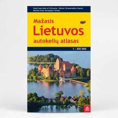
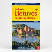
Lithuania Road Atlas from the Riga based Jana Seta, in handy glovebox paperback format with street plans of 19 towns, including an enlargement for city centre of Vilnius, The whole country is covered at 1:200,000, showing detailed classification of road network with petrol stations, and railway lines with stops. Boundaries of national parks and ot...

Verkopers met dit product

Verkoper
Bezorging
Prijs
DeZwerver.nl logo
DeZwerver.nl
2,95
24,50

Anderen bekeken ook

Wegenatlas Lietuvos Autokeliu Atlasas - Litouwen | Jana Seta
Lithuania Road Atlas from the Riga based Jana Seta, in handy glovebox paperback format with street plans of 19 towns, including an enlargement for city centre of Vilnius, The whole country is covered at 1:200,000, showing detailed classification of road network with petrol stations, and railway lines with stops. Boundaries of national parks and other protected areas are marked and a range of symbols indicate tourist accommodations, campsites, various places of interest, etc. Picturesque towns and villages are highlighted. Colouring and graphics show forested areas and swamps and the atlas also shows the country’s administrative divisions. Latitude lines are at intervals of 5’ intervals and longitude at 10’. The atlas has an extensive index of localities.   The atlas also includes street plans of 19 towns at 1:20,000 or 1:25,000, annotated with places of interest and various facilities. For Vilnius the atlas has a plan of its central districts, plus a road map of the surrounding area h…
24,50
Wegenatlas Letland west - Kurzeme | Jana Seta
Bijzonder gedetailleerde wegenatlas van een deel van Letland. Uitvoering in ringband en op geplastificeerd papier. Inclusief stadplattegronden van Aizpute, Kandava, Kuldiga, Liepaja, Saldus, Talsi, Tukums en Ventspils. Jana Seta’s adventure atlases in this series have topography shown by contour lines at 10m intervals, with colouring and/or graphics for orchards, forests, swamps, etc; boundaries of national parks and other protected area are clearly marked. The mapping provides a very detail presentation of the road network, from main roads to “difficult to travel” unsurfaced local roads. Locations of petrol stations are marked and driving distances are shown on many local routes. The atlases also show cycling routes. Railway lines are shown with stations. Interesting locations are highlighted and symbols indicate campsites and other tourist accommodation, museums, etc. In each title a selection of best sights is cross-referenced to their descriptions (in Latvian only). Latitude and l…
37,50
Wegenatlas Letland oost - Latgale | Jana Seta
Bijzonder gedetailleerde wegenatlas van een deel van Letland. Uitvoering in ringband en op geplastificeerd papier. Inclusief stadplattegronden van Balvi, Daugavpils, Kraslava, Livani, Ludza, Preili en Rezekne. Jana Seta’s adventure atlases in this series have topography shown by contour lines at 10m intervals, with colouring and/or graphics for orchards, forests, swamps, etc; boundaries of national parks and other protected area are clearly marked. The mapping provides a very detail presentation of the road network, from main roads to “difficult to travel” unsurfaced local roads. Locations of petrol stations are marked and driving distances are shown on many local routes. The atlases also show cycling routes. Railway lines are shown with stations. Interesting locations are highlighted and symbols indicate campsites and other tourist accommodation, museums, etc. In each title a selection of best sights is cross-referenced to their descriptions (in Latvian only). Latitude and longitude …
37,50
Wegenatlas Letland noord - Vidzeme | Jana Seta
Bijzonder gedetailleerde wegenatlas van een deel van Letland. Uitvoering in ringband en op geplastificeerd papier. Inclusief stadplattegronden van Aluksne, Cesis, Gulbene, Limbai, Madona, Ogre, Sigulda, Valka, en Valmiera.   Jana Seta’s adventure atlases in this series have topography shown by contour lines at 10m intervals, with colouring and/or graphics for orchards, forests, swamps, etc; boundaries of national parks and other protected area are clearly marked. The mapping provides a very detail presentation of the road network, from main roads to “difficult to travel” unsurfaced local roads. Locations of petrol stations are marked and driving distances are shown on many local routes. The atlases also show cycling routes. Railway lines are shown with stations. Interesting locations are highlighted and symbols indicate campsites and other tourist accommodation, museums, etc. In each title a selection of best sights is cross-referenced to their descriptions (in Latvian only). Latitude…
37,50
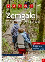
Wegenatlas Letland zuid Zemgale - Vidusdaugava | Jana Seta
Bijzonder gedetailleerde wegenatlas van een deel van Letland. Uitvoering in ringband en op geplastificeerd papier. Inclusief stadplattegronden van Aizkraukle, Auce, Bauska, Dobele. Iecava, Jekabplis, Jeglava, Lielvarde, Plavinas en Tukums. Jana Seta’s adventure atlases in this series have topography shown by contour lines at 10m intervals, with colouring and/or graphics for orchards, forests, swamps, etc; boundaries of national parks and other protected area are clearly marked. The mapping provides a very detail presentation of the road network, from main roads to “difficult to travel” unsurfaced local roads. Locations of petrol stations are marked and driving distances are shown on many local routes. The atlases also show cycling routes. Railway lines are shown with stations. Interesting locations are highlighted and symbols indicate campsites and other tourist accommodation, museums, etc. In each title a selection of best sights is cross-referenced to their descriptions (in Latvian …
37,50
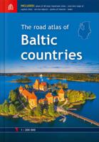
Wegenatlas The Road atlas of Baltic countries - Baltische Staten | Jana Seta
Mooie wegenatlas op schaal 1:200.000 van de Baltische landen op A-4 formaat in gebonden hardcover versie. Edition 2018 Latvia, Estonia and Lithuania road maps in scale 1:200'000 Atlas base map is supplemented with plans of the 48 largest cities in scale 1:20'000 Tallinn, Riga and Vilnius vicinity maps in scale 1:85'000 Information about points of interest and tourism services Index of place names Size 21,5 x 30,6 cm 254 pages Hardback
51,50
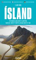
Wegenatlas IJsland met stadsplattegronden | Ferdakort
Super handige kleine wegenatlas van IJsland (schaal 1:500.000) met vooral een enorme hoeveelheid plattegronden van steden en dorpen, enkele themakaarten en een groot register. De kaarten zijn uitstekend leesbaar en de atlas in in een mooie ringband uitgevoerd.  Road Atlas of Iceland at 1:500,000 from Ferðakort, published in a handy 15x25cm spiral-bound format, with an index of over 3,000 entries, a comprehensive distance table, 46 street plans including Reykjavik and several thematic map sincluding cultural heritage and geology.   The whole of Iceland is covered at 1:500,000 with the road network distinguishing between paved and gravel roads, and showing which small local roads are maintained by the country’s government. Fords, locations of petrol stations, driving distances and car ferry routes are marked. National parks and other protected areas are highlighted and symbols mark locations of various places of interest: different types of tourist accommodations including campsites, re…
30,95
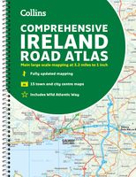
Wegenatlas Ireland Comprehensive Road Atlas - Ierland | Collins
Duidelijke en gedetailleerde atlas voor Ierland in A4-formaat met ringband.   Clear, detailed road atlas of Ireland in a handy A4 spiral-bound format. This comprehensive, general purpose road atlas of the whole of Ireland is ideal for both business and pleasure use. The atlas contains a range of mapping scales: • 9 miles to 1 inch route planning map • Main maps at 3.2 miles to 1 inch, which are ideal for navigation. • A wide selection of detailed town centre street plans.   This edition boasts road mapping packed with detail showing colour classified road network, toll roads, land heights, the location of safety cameras, Blue Flag and Green Coast beaches, tourist information centres and a wide range of tourist attractions. There is also comprehensive guide information for visitors to Belfast, Cork, Dublin and Limerick. The locations of Speed Enforcement Zones, which highlight roads that have a high risk of accidents as identified by the Garda and the National Roads Authority, are incl…
14,95
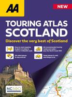
Wegenatlas Touring Atlas Scotland 2026 | Ringband | A4-Formaat | AA Publishing
Updated and new for 2025 the AA Touring Atlas Scotland, is your trusted travel companion for discovering the very best of Scotland. Expertly designed for travellers, this easy-to-read, 176-page atlas combines premium quality with unbeatable value.   Main Features: Easy-to-read mapping and super-detailed plans of major, towns and cities Official North Coast 500 route and information AA-rated places to stay and eat and AA-recommended touring routes and walks Large-scale district maps of Edinburgh and Glasgow with extra detail Great places to visit and useful locations including golf courses, distilleries, and scenic landscapes User-friendly spiral bound with a durable cover The atlas makes exploring Scotland easy with road mapping consisting of mainland Scotland at giant 2.3 miles to 1 inch scale, and Scottish islands at a minimum of 7.6 miles to 1 inch. Featuring scores of wonderful places to visit as well as AA-recommended tours and the iconic North Coast 500 route this practic…
15,50
Wegenatlas Scotland - Schotland | A-Z Map Company
Handzame gedetailleerde wegenatlas van Schotland. Navigate your way around Scotland with this detailed, full-colour and easy-to-use A-Z Road Atlas. From the border to the north coast, the mainland pages scale is 3.5 miles to 1 inch and the Western Isles, Shetland Islands and Orkney Islands scale is 4.5 miles to 1 inch.   Covering the entire country, this road atlas includes the following features: • Motorways with full junction detail, primary routes and destinations, A & B roads, under construction and proposed roads, service areas, tolls, mileages, national, county and unitary authority boundaries • Cairngorms and Loch Lomond & The Trossachs National Park boundaries • Selected places of interest and tourist information centres   20 city and town street maps are included for Aberdeen, Aviemore, Ayr, Dumfries, Dundee, Dunfermline, Edinburgh, Glasgow, Falkirk, Fort William, Hamilton, Inverness, Kilmarnock, Kirkcaldy, Motherwell, Oban, Paisley, Perth, St Andrews and Stirling. A…
13,50

Klanten-reviews van Wegenatlas Lietuvos Autokeliu Atlasas - Litouwen | Jana Seta

Er zijn nog geen beoordelingen voor dit productBen jij de eerste die een review plaatst?

Meer over Wegenatlas Lietuvos Autokeliu Atlasas - Litouwen | Jana Seta

Productomschrijving

Lithuania Road Atlas from the Riga based Jana Seta, in handy glovebox paperback format with street plans of 19 towns, including an enlargement for city centre of Vilnius, The whole country is covered at 1:200,000, showing detailed classification of road network with petrol stations, and railway lines with stops. Boundaries of national parks and other protected areas are marked and a range of symbols indicate tourist accommodations, campsites, various places of interest, etc. Picturesque towns and villages are highlighted. Colouring and graphics show forested areas and swamps and the atlas also shows the country’s administrative divisions. Latitude lines are at intervals of 5’ intervals and longitude at 10’. The atlas has an extensive index of localities.   The atlas also includes street plans of 19 towns at 1:20,000 or 1:25,000, annotated with places of interest and various facilities. For Vilnius the atlas has a plan of its central districts, plus a road map of the surrounding area highlighting main traffic routes to the centre. Also included is road a map of the eastern Baltic Sea region, physical, administrative and route planning maps of Lithuania, general information for drivers and a distance table.   *Map legend, conveniently placed on a flap of the cover, includes English.*   * The same atlas is also available in a larger, A4 format with street plans of 57 towns.

Productinformatie

    Verken gerelateerde categorieën

    Webshop.nl maakt gebruik van cookies. Ga je verder op onze website, ga dan akkoord met het plaatsen van cookies en de verwerking van deze data door ons en vermelde partners.