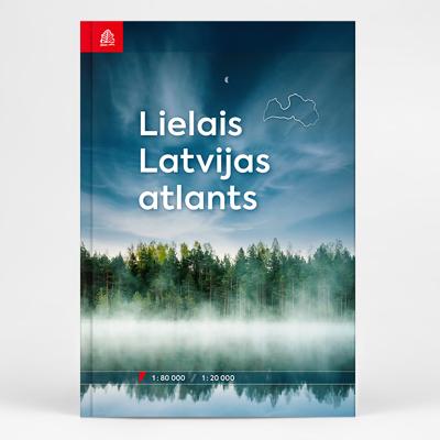
Wegenatlas Lielais Latvijas atlants - Letland | Jana Seta

0

Verkopers met dit product

Verkoper
Bezorging
Prijs
DeZwerver.nl logo
DeZwerver.nl
2,95
82,95

Anderen bekeken ook

Wegenatlas Letland west - Kurzeme | Jana Seta
Bijzonder gedetailleerde wegenatlas van een deel van Letland. Uitvoering in ringband en op geplastificeerd papier. Inclusief stadplattegronden van Aizpute, Kandava, Kuldiga, Liepaja, Saldus, Talsi, Tukums en Ventspils. Jana Seta’s adventure atlases in this series have topography shown by contour lines at 10m intervals, with colouring and/or graphics for orchards, forests, swamps, etc; boundaries of national parks and other protected area are clearly marked. The mapping provides a very detail presentation of the road network, from main roads to “difficult to travel” unsurfaced local roads. Locations of petrol stations are marked and driving distances are shown on many local routes. The atlases also show cycling routes. Railway lines are shown with stations. Interesting locations are highlighted and symbols indicate campsites and other tourist accommodation, museums, etc. In each title a selection of best sights is cross-referenced to their descriptions (in Latvian only). Latitude and l…
37,50
Wegenatlas Letland oost - Latgale | Jana Seta
Bijzonder gedetailleerde wegenatlas van een deel van Letland. Uitvoering in ringband en op geplastificeerd papier. Inclusief stadplattegronden van Balvi, Daugavpils, Kraslava, Livani, Ludza, Preili en Rezekne. Jana Seta’s adventure atlases in this series have topography shown by contour lines at 10m intervals, with colouring and/or graphics for orchards, forests, swamps, etc; boundaries of national parks and other protected area are clearly marked. The mapping provides a very detail presentation of the road network, from main roads to “difficult to travel” unsurfaced local roads. Locations of petrol stations are marked and driving distances are shown on many local routes. The atlases also show cycling routes. Railway lines are shown with stations. Interesting locations are highlighted and symbols indicate campsites and other tourist accommodation, museums, etc. In each title a selection of best sights is cross-referenced to their descriptions (in Latvian only). Latitude and longitude …
37,50
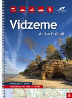
Wegenatlas Letland noord - Vidzeme | Jana Seta
Bijzonder gedetailleerde wegenatlas van een deel van Letland. Uitvoering in ringband en op geplastificeerd papier. Inclusief stadplattegronden van Aluksne, Cesis, Gulbene, Limbaži, Madona, Ogre, Sigulda, Valka, en Valmiera.   Jana Seta’s adventure atlases in this series have topography shown by contour lines at 10m intervals, with colouring and/or graphics for orchards, forests, swamps, etc; boundaries of national parks and other protected area are clearly marked. The mapping provides a very detail presentation of the road network, from main roads to “difficult to travel” unsurfaced local roads. Locations of petrol stations are marked and driving distances are shown on many local routes. The atlases also show cycling routes. Railway lines are shown with stations. Interesting locations are highlighted and symbols indicate campsites and other tourist accommodation, museums, etc. In each title a selection of best sights is cross-referenced to their descriptions (in Latvian only). Latitud…
37,50
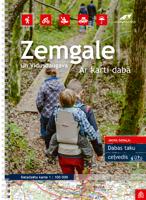
Wegenatlas Letland zuid Zemgale - Vidusdaugava | Jana Seta
Bijzonder gedetailleerde wegenatlas van een deel van Letland. Uitvoering in ringband en op geplastificeerd papier. Inclusief stadplattegronden van Aizkraukle, Auce, Bauska, Dobele. Iecava, Jekabplis, Jeglava, Lielvarde, Plavinas en Tukums. Jana Seta’s adventure atlases in this series have topography shown by contour lines at 10m intervals, with colouring and/or graphics for orchards, forests, swamps, etc; boundaries of national parks and other protected area are clearly marked. The mapping provides a very detail presentation of the road network, from main roads to “difficult to travel” unsurfaced local roads. Locations of petrol stations are marked and driving distances are shown on many local routes. The atlases also show cycling routes. Railway lines are shown with stations. Interesting locations are highlighted and symbols indicate campsites and other tourist accommodation, museums, etc. In each title a selection of best sights is cross-referenced to their descriptions (in Latvian …
37,50
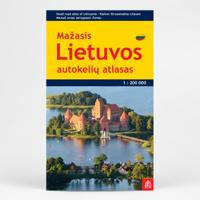
Wegenatlas Lietuvos Autokeliu Atlasas - Litouwen | Jana Seta
Lithuania Road Atlas from the Riga based Jana Seta, in handy glovebox paperback format with street plans of 19 towns, including an enlargement for city centre of Vilnius, The whole country is covered at 1:200,000, showing detailed classification of road network with petrol stations, and railway lines with stops. Boundaries of national parks and other protected areas are marked and a range of symbols indicate tourist accommodations, campsites, various places of interest, etc. Picturesque towns and villages are highlighted. Colouring and graphics show forested areas and swamps and the atlas also shows the country’s administrative divisions. Latitude lines are at intervals of 5’ intervals and longitude at 10’. The atlas has an extensive index of localities.   The atlas also includes street plans of 19 towns at 1:20,000 or 1:25,000, annotated with places of interest and various facilities. For Vilnius the atlas has a plan of its central districts, plus a road map of the surrounding area h…
24,50
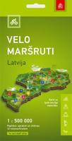
Fietskaart Velo Marsruti Latvija - Fietskaart Letland | Jana Seta
De kaart is uitgegeven op een zeer duurzaam Tyvek® synthetisch vezelmateriaal dat waterbestendig is en scheurvast. waardoor de levensduur van het kaartgebruik wordt gegarandeerd.   De kaart nodigt u uit om Letland  op het meest milieuvriendelijke vervoermiddel te leren kennen - fietsen Om de meest geschikte route voor u te vinden, bekijkt u de informatie over elke route: routelengte, dekking en startpuntcoördinaten. Rekening houdend met de route, het natuurlijke landschap en de culturele en historische waarden, de kwaliteit en toegankelijkheid van de infrastructuur, hebben de auteurs gekozen voor de 12 interessantste fietsroutes   De informatie wordt aangevuld met een gedetailleerde kaart van elke route
19,95
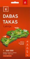
Wandelkaart Dabas- Takas, Natuurwandelingen in Letland | Jana Seta
De kaart is uitgegeven op een zeer duurzaam Tyvek® synthetisch vezelmateriaal dat waterbestendig is en scheurvast, waardoor de levensduur van het kaartgebruik wordt gegarandeerd.   Oo de kaart worden de mooiste wandelplekken weergegeven met uitzichtstorens. Het blijft een globale kaart die echter wel een heel goed overzicht geeft van waar het mooi is om te wandelen. Bepaalde wandelingen (24 atuk ) worden aan de achterzijde nader uitgewerrkt, helaas in het Lets.    De paden op de kaart geven karakteristieke informatie: lengte, moeilijkheidsgraad, dekking en startcoördinaten (voor kijkmasten alleen coördinaten)  
19,95

Klanten-reviews van Wegenatlas Lielais Latvijas atlants - Letland | Jana Seta

Er zijn nog geen beoordelingen voor dit productBen jij de eerste die een review plaatst?

Meer over Wegenatlas Lielais Latvijas atlants - Letland | Jana Seta

Productinformatie

    Verken gerelateerde categorieën

    Webshop.nl maakt gebruik van cookies. Ga je verder op onze website, ga dan akkoord met het plaatsen van cookies en de verwerking van deze data door ons en vermelde partners.