webshop.nl
Categorieën
  Sluiten

Meer Collins

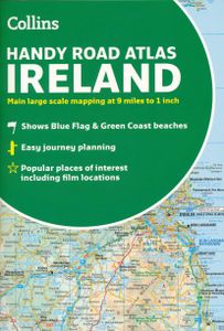
Wegenatlas Handy Road Atlas Ireland - Ierland | Collins

0
Handzame wegenatlas op A5 formaat van Ierland. Vrij grove schaal maar heel handig door formaat en goed kaartbeeld.  Met enkele stadsplattegronden en een paar pagina's met hoogtepunten van het land.  Explore Ireland with this handy format route-planning atlas in full colour, complete with information on places of tourist interest. There are also ful...

Webshops met dit product

Webshop
Bezorging
Prijs

Anderen bekeken ook

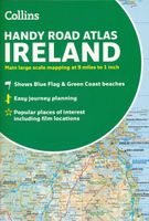
Wegenatlas Handy Road Atlas Ireland - Ierland | Collins
Handzame wegenatlas op A5 formaat van Ierland. Vrij grove schaal maar heel handig door formaat en goed kaartbeeld.  Met enkele stadsplattegronden en een paar pagina's met hoogtepunten van het land.  Explore Ireland with this handy format route-planning atlas in full colour, complete with information on places of tourist interest. There are also fully indexed town centre plans of Belfast, Cork, Dublin, Galway, Limerick and Londonderry. Now with places of interest marked including famous film locations. This atlas, at A5 size, contains mapping of the whole of Ireland at 9 miles to 1 inch (1:570,240). The mapping is beautifully designed with colour classified roads and subtle layered height tinting. The atlas is ideal for residents, visitors and tourists alike. Key features of the atlas include:* All Ireland route planning maps* Town centre plans* Places of interest including TV and film locations such as Game of Thrones, Star Wars and Harry Potter* Blue Flag and Green Coast beaches map* …
8,95
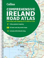
Wegenatlas Ireland Comprehensive Road Atlas - Ierland | Collins
Duidelijke en gedetailleerde atlas voor Ierland in A4-formaat met ringband.   Clear, detailed road atlas of Ireland in a handy A4 spiral-bound format. This comprehensive, general purpose road atlas of the whole of Ireland is ideal for both business and pleasure use. The atlas contains a range of mapping scales: • 9 miles to 1 inch route planning map • Main maps at 3.2 miles to 1 inch, which are ideal for navigation. • A wide selection of detailed town centre street plans.   This edition boasts road mapping packed with detail showing colour classified road network, toll roads, land heights, the location of safety cameras, Blue Flag and Green Coast beaches, tourist information centres and a wide range of tourist attractions. There is also comprehensive guide information for visitors to Belfast, Cork, Dublin and Limerick. The locations of Speed Enforcement Zones, which highlight roads that have a high risk of accidents as identified by the Garda and the National Roads Authority, are inclu…
14,95
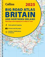
Wegenatlas Big Road Atlas Britain and Northern Ireland 2025 | A3 | Rin
Grote wegenatlas, a3-formaat in ringband. The ultimate 3.2 miles to 1 inch scale large-format, spiral-bound road atlas of Britain, featuring Collins’ popular and well established road mapping, and designed for exceptional clarity and ease of use.   The atlas has a wide range of urban area maps at even larger scale and 64 detailed town centre street plans.   This fully updated road atlas covers the whole of Britain with each scale of mapping colour-coded for ease of use. The smallest scale maps are great for long distance route planning and the street plans help you locate your final destination.   Main features:   Easy to use, clear road maps at a scale of 3.2 miles to 1 inch of England, Wales and Southern Scotland. Northern Scotland is shown at 5 miles to 1 inch Route planning section including maps at a scale of 15.8 miles to 1 inch, motorway services information and a handy distance calculator 22 urban area approach maps at 1 mile to 1 inch which clearly show the best rou…
20,95
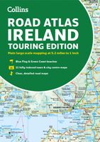
Wegenatlas Road Atlas Ireland | Collins
Explore Ireland with this accurate and fully updated road atlas. This road atlas is at A4 size, covering the whole of Ireland and features clear and detailed Collins colour mapping at a scale of 5.2 miles to 1 inch. Perfect for both residents and visitorstouring Ireland.   This revised edition includes: Places of tourist interestContact information for Tourist Information Centres with grid references to the mappingFully indexed street maps of 11 cities and towns - Dublin, Belfast, Cork, Limerick, Waterford,Londonderry (Derry), Galway, Bangor, Dun Laoghaire, Drogheda and KillarneyBlue Flag & Green Coast beachesFerry and airport information; Distance chart; Distances marked on the roads in miles and kilometresRoute planning map of the whole of Ireland at 15.8 miles to 1 inchAdministrative map of Irish counties and districts.
9,95
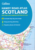
Wegenatlas Handy Road Atlas Scotland - Schotland | Collins
Handzame A% wegenatlas van Schotland met register en stadsplattegronden. Discover new places with handy road atlases from Collins. Your ideal companion for navigating around Scotland. It has extremely clear, route planning maps of Scotland, detailed city plans of the major cities and towns and fits neatly into your glovebox, briefcase or bag.   Main featuresClear, attractive route planning maps of the whole of Scotland supported by comprehensive, fully indexed city centre street maps of Aberdeen, Dundee, Edinburgh, Glasgow, Inverness and Perth. Scale of main maps: 1:625,000 (9.9 miles to 1 inch). Also includes* Places of tourist interest are highlighted* Attractive layer colouring showing land height* Road network fully classified and colour coded* Detailed street mapping of Edinburgh, including the Royal Mile with all its attractions clearly marked, Leith and Holyrood Park* Detailed street mapping of Glasgow, including the West End, city centre and M74 extension* Detailed street mappi…
9,95
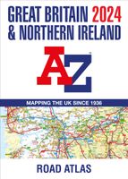
Wegenatlas Great Britain and Northern Ireland Road Atlas 2024 | A-Z Ma
A full-colour, paperback road atlas of Great Britain, now fully revised and updated. Clear detailed road mapping at a scale of 3.5 miles to 1 inch. Presented in a large, easy to read A3 format. This essential road atlas includes the following; 11 pages of main route mapping covering Greater London, Birmingham and Manchester Mileage chart with average journey times Information on motorway junctions with limited interchanges 70 city and town centre street plans 16 port and airport plans Channel Tunnel terminus maps Map reference information also in French and German Also included is a full index to cities, towns, villages, hamlets, major destinations and selected places of interest with postcodes for sat-nav use. Instantly recognisable and easy to use, the road mapping has been specifically tailored for the smaller scale featuring: clear standard road classification colours for easy identification, motorway junction symbols, under construction and proposed roads, primary route des…
18,95

Klanten-reviews van Wegenatlas Handy Road Atlas Ireland - Ierland | Collins

Er zijn nog geen beoordelingen voor dit productBen jij de eerste die een review plaatst?

Meer over Wegenatlas Handy Road Atlas Ireland - Ierland | Collins

Productomschrijving

Handzame wegenatlas op A5 formaat van Ierland. Vrij grove schaal maar heel handig door formaat en goed kaartbeeld.  Met enkele stadsplattegronden en een paar pagina's met hoogtepunten van het land.  Explore Ireland with this handy format route-planning atlas in full colour, complete with information on places of tourist interest. There are also fully indexed town centre plans of Belfast, Cork, Dublin, Galway, Limerick and Londonderry. Now with places of interest marked including famous film locations. This atlas, at A5 size, contains mapping of the whole of Ireland at 9 miles to 1 inch (1:570,240). The mapping is beautifully designed with colour classified roads and subtle layered height tinting. The atlas is ideal for residents, visitors and tourists alike. Key features of the atlas include:* All Ireland route planning maps* Town centre plans* Places of interest including TV and film locations such as Game of Thrones, Star Wars and Harry Potter* Blue Flag and Green Coast beaches map* List of tourist information centres* Full index to place names and places of interest* Information on airports, ferries and radio stations* Mileage chart

Productspecificaties

Artikelnummer(s)
Brand
Collins
Webshop.nl maakt gebruik van cookies. Ga je verder op onze website, ga dan akkoord met het plaatsen van cookies en de verwerking van deze data door ons en vermelde partners.