webshop.nl

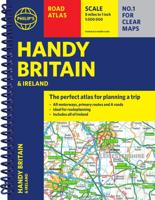
Wegenatlas Handy Road Atlas Britain A5-Formaat | Philip's Maps

0
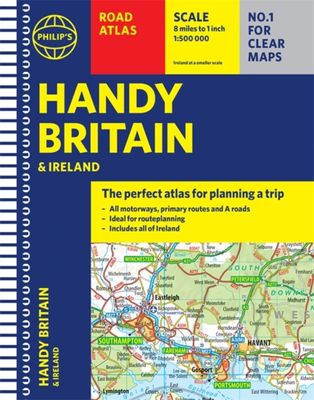
"The perfect atlas for planning a trip anywhere in the UK and Ireland"The essential handy road atlas for planning a trip in Britain and Ireland. Keep it in the glove box or your travel bag for quick and easy reference. This gem of a glove-box sized atlas has all the core information you need for driving around the British Isles.   It includes all ...

Webshops met dit product

Webshop
Bezorging
Prijs
DeZwerver.nl logo
DeZwerver.nl
niet bekend
9,95

Anderen bekeken ook

Wegenatlas Big Atlas Britain & Ireland 2024 A3-Formaat | Philip's Maps
Goede gedetailleerde wegenatlas van Groot-Brittannië, schaal 1:200.000 met een overzichtskaart van Ierland, schaal 1:1.000.000. Groot formaat, A3, en in ringband. 'Good balance between detail and clarity with excellent town maps' What Car? PHILIP'S is No. 1 in the UK for clear maps. The latest 2025 Philip's Big Road Atlas of Britain and Ireland, in a supersize large format, has fully updated mapping from the Philip's digital database alongside all the detail and information needed for successful travel.   * Top driving tips for safety and skill including how to parallel park * The best scenic routes, natural features and landscape highlighted for enhanced travelling * Practical 'more to view per page' A3 size * Main scale of maps: 3 miles to 1 inch = 1:200,000 for ease of use * Route-planning section for the easiest navigation * Special wide-vehicle access indicators for rural areas * 64 fully indexed and detailed town and city plans * City approach maps with named roads fo…
23,50
Wegenatlas Road Atlas Britain and Ireland 2024 | Philip's Maps
Let op! Ierland en een gedeelte van Schotland hebben een andere schaal dan de rest van de atlas.   PHILIP'S - Market leaders and No. 1 in the UK for clear maps'Good balance between detail and clarity with excellent town maps' What Car? * Super-clear mapping at a scale of 3 miles to 1 inch = 1:200,000* Includes the latest highway code requirements* Completely updated and revised for 2024* New map showing Smart Motorways- Practical spiral bound, lie-flat format- 160 pages of fully updated super-clear road maps - 10 pages of detailed route-planning maps - plan your route in advance - 88 indexed town-centre maps - 14 pages of city approach maps with named arterial roads - 2 page road map of Ireland- Map of scenic Britain and a map highlighting railways, airports and ferry ports Philip's 2024 Road Atlas Britain and Ireland is the top-of-the-range spiral road atlas featuring the latest maps from the Philip's digital database. Voted Britain's clearest and most detailed in an independent cons…
23,95
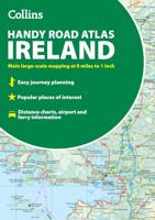
Wegenatlas 2025 Collins Handy Road Atlas Britain and Ireland | Collins
Handzame A5 wegenatlas van Engeland, Wales, Schotland en Ierland met register en stadsplattegronden This easy-to-use, handy A5 sized road atlas with popular lie-flat spiral binding features extremely clear route planning maps of Britain and Ireland and fits neatly into your glove box or bag. The maps of Britain are at 10 miles to 1 inch (1:625,000) and the whole of Ireland is covered at 15.8 miles to 1 inch (1:1,000,000). There are also a selection of more detailed urban area maps at 4.5 miles to 1 inch (1:285,000) to aid route planning in these busy areas.   Main features: Road maps that focus on the main roads, motorways and settlementsMore detailed maps of London, Manchester, Merseyside and West MidlandsPark & Ride locations (for bus and rail)Handy distance calculator chart highlighting distances between the major towns
9,95
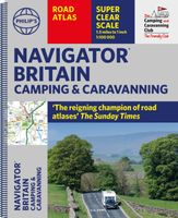
Wegenatlas Navigator Camping and Caravanning - Atlas of Britain | Philip's Maps
THE MUST-HAVE ATLAS OF BRITAIN FOR CAMPING, CARAVANNING AND MOTORHOMES'A map that beats all others' - The Daily Telegraph'Scale, accuracy and clarity are without parallel' - Driving Magazine'No. 1 in the UK for clear maps' - Independent research surveyThe lure of the open road and British countryside has never waned and the appeal of independent exploration has surely grown in recent years. However, the adventurous need practical information about what lies ahead - from bridge heights, widths and weights to places to stop and enjoy.   Philip's Navigator Camping and Caravanning Atlas of Britain is the No. 1 Choice of Road Atlas for the independent travelling motorist and camper van owner. * Scale: 1.5 miles to 1 inch = 1:100,000 (Northern Scotland: 3 miles to 1 inch = 1:200,000)* Over 1,880 approved campsites located, plus essential advice from The Camping and Caravanning Club* Includes essential information for caravanning motorists: 6000 bridge height limits, 1500 bridge weight limit…
37,50
Wegenatlas Ireland Comprehensive Road Atlas - Ierland | Collins
Duidelijke en gedetailleerde atlas voor Ierland in A4-formaat met ringband.   Clear, detailed road atlas of Ireland in a handy A4 spiral-bound format. This comprehensive, general purpose road atlas of the whole of Ireland is ideal for both business and pleasure use. The atlas contains a range of mapping scales: • 9 miles to 1 inch route planning map • Main maps at 3.2 miles to 1 inch, which are ideal for navigation. • A wide selection of detailed town centre street plans.   This edition boasts road mapping packed with detail showing colour classified road network, toll roads, land heights, the location of safety cameras, Blue Flag and Green Coast beaches, tourist information centres and a wide range of tourist attractions. There is also comprehensive guide information for visitors to Belfast, Cork, Dublin and Limerick. The locations of Speed Enforcement Zones, which highlight roads that have a high risk of accidents as identified by the Garda and the National Roads Authority, are incl…
14,95
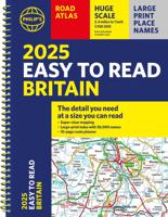
Wegenatlas Philip's Easy to Read Road Atlas of Britain 2025 | A4-Formaat | Ringband | Philip's Maps
"The detail you need at a size you can read". The latest 2025 Philip's Easy to Read Road Atlas of Britain from the best-selling Road Atlas range has over 350 pages packed with exceptionally clear mapping and everything you need for exploring Britain. Practical A4-size with lie-flat spiral binding, it will enhance any journey.   · Clear maps packed with extra details for a better journey · Huge 1:150,000 scale (approx 2.4 miles to 1 inch) · Large print place names · Large print index · Super-clear 10-page route planner to create the best journeys · Thousands of attractions clearly mapped, including castles, theme parks, gardens, zoos and more. · Lie-flat spiral binding for easy use and planning   At last, a road atlas that everyone can read easily, in or out of the car, no matter what the conditions. With up-to-date mapping technology, your travels have never been easier to plan. This edition contains a wealth of useful information, including tourist attractions, to ensure the best pos…
27,50
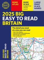
Wegenatlas Philip's Easy to Read Road Atlas of Britain 2025 | A3-Formaat | Paperback | Philip's Maps
With the detail you need at a size you can read, the latest edition of 2025 Philip's Big Easy to Read Road Atlas of Britain is super-clear, super-sized and bang up-to-date in a large paperback format.   · Huge 1:150,000 scale (approx 2.4 miles to 1 inch) · Large super-sized pages (A3) · Large print place names, and large scale maps · 88 detailed town plans for easy navigation · Clear road colours, which are easier to read in the dark · Thousands of attractions clearly mapped · Special route planner section for arranging the best trips · Large print approach maps for all major cities · Durable paperback format   At last, a road atlas that everyone can read easily in or out of the car, no matter what the conditions. Restricted motorway information, a distance chart, and clearly labelled places of interest are just some of the features within this bestselling road atlas of Britain. Whether it's getting dark, or you just can't find your glasses, 2025 Philip's Big Easy to Read Road Atlas o…
23,95
Wegenatlas Road Atlas Ireland | Collins
Explore Ireland with this accurate and fully updated road atlas. This road atlas is at A4 size, covering the whole of Ireland and features clear and detailed Collins colour mapping at a scale of 5.2 miles to 1 inch. Perfect for both residents and visitorstouring Ireland.   This revised edition includes: Places of tourist interestContact information for Tourist Information Centres with grid references to the mappingFully indexed street maps of 11 cities and towns - Dublin, Belfast, Cork, Limerick, Waterford,Londonderry (Derry), Galway, Bangor, Dun Laoghaire, Drogheda and KillarneyBlue Flag & Green Coast beachesFerry and airport information; Distance chart; Distances marked on the roads in miles and kilometresRoute planning map of the whole of Ireland at 15.8 miles to 1 inchAdministrative map of Irish counties and districts.
9,95
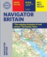
Wegenatlas Navigator Britain - Engeland en Schotland 1:100.000 | Philip's Maps
Bijzonder gedetaileerde wegenatlas van Engeland en Schotland op schaal 1:100.000 (met het noorden van Schotland 1:200.000). Alle wegen, bezienswaardigheden,  National Trails, campings ... noem maar op en je vindt het in deze atlas. Voorzien van een stevige ringband, iets groter dan A4. Philip's Navigator are Britain's bestselling detailed road atlases - exceptional for their scale and clarity. 'A map that beats all others' The Daily Telegraph 'Scale, accuracy and clarity are without parallel' Driving Magazine 'No.1 in the UK for clear maps' Independent research survey - Scale: 1.5 miles to 1 inch = 1:100,000 (Northern Scotland: 3 miles to 1 inch = 1:200,000) - Super-detailed 6-page route-planning section. - Every street in Britain is marked on the maps. - Over 3000 roads clearly named. - 100 indexed town-centre maps plus approaches maps to 12 major urban areas. - Exceptional road detail, from motorways to country lanes, with every junction, roundabout and slip-road shown. - Thousand…
37,95
Wegenatlas Easy to Read Road Atlas Britain 2025 | Philip's Maps
"The detail you need at a size you can read". The latest 2025 Philip's Easy to Read Road Atlas of Britain from the best-selling Road Atlas range has over 350 pages packed with exceptionally clear mapping and everything you need for exploring Britain. Now available as a practical paperback, it will enhance any trip.   · Clear maps packed with extra details for a better journey · Huge 1:150,000 scale (approx 2.4 miles to 1 inch) · Large print place names · Large print index · Super-clear 10-page route planner to create the best journeys · Thousands of attractions clearly mapped, including castles, theme parks, gardens, zoos and more. · London's expanded ULEZ clearly shown on approach mapping   At last, a road atlas that everyone can read easily, in or out of the car, no matter what the conditions. With up-to-date mapping technology, your travels have never been easier to plan. This edition contains a wealth of useful information, including tourist attractions, to ensure the best possibl…
22,50

Klanten-reviews van Wegenatlas Handy Road Atlas Britain A5-Formaat | Philip's Maps

Er zijn nog geen beoordelingen voor dit productBen jij de eerste die een review plaatst?

Meer over Wegenatlas Handy Road Atlas Britain A5-Formaat | Philip's Maps

Productomschrijving

"The perfect atlas for planning a trip anywhere in the UK and Ireland"The essential handy road atlas for planning a trip in Britain and Ireland. Keep it in the glove box or your travel bag for quick and easy reference. This gem of a glove-box sized atlas has all the core information you need for driving around the British Isles.   It includes all the motorways, primary roads and A Roads and they are clearly shown - ideal for route planning. There is a separate 4-page road map of Ireland for easy use. Alongside that, this handy atlas includes a key map, a distance table and useful counties map.   All the towns and villages listed within are indexed and all the information comes in a handy glove-box size format with practical, lie-flat spiral binding. With the scale at a user-friendly 8 miles to 1 inch / 1:500,000 (Ireland 19 miles to 1 inch /1:1,200,000) and fully up-to-date using Philip's clear mapping, you will never be at a loss to establish the best route. Keep in the car or sling in your bag before travelling, the Philip's Handy Road Atlas of Britain is also great value at only GBP5.99.

Verken gerelateerde categorieën

Webshop.nl maakt gebruik van cookies. Ga je verder op onze website, ga dan akkoord met het plaatsen van cookies en de verwerking van deze data door ons en vermelde partners.