Wegenatlas Great Britain and Ireland 2025 - Groot Brittannie en Ierland | Michelin

0
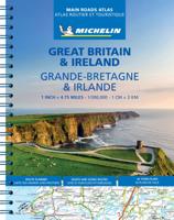
Zoals je mag verwachten van Michelin ook voor Engeland, Schotland en Ierland weer een handige atlas in ringband op A4 formaat. De kaarten zijn goed leesbaar, altijd een pluspunt bij Michelin! Full of practical features, the Michelin Great Britain & Ireland 2025 - Main Roads Atlas (A4-Spiral) is the perfect companion for your everyday journey and h...

Verkopers met dit product

Verkoper
Bezorging
Prijs
DeZwerver.nl logo
DeZwerver.nl
2,95
21,95

Anderen bekeken ook

Wegenkaart - landkaart 798 Great Britain & Ireland | Michelin
Scheur- en watervast!   Zoals je van Michelin mag verwachten is deze kaart zeer overzichtelijk en heeft een duidelijk helder kaartbeeld. De kaart geeft uitgebreid toeristische informatie weer. Met register, afstanden en reistijden.   Wegen worden naar verschillende klasse ingedeeld en - mooi van Michelin - de interessante mooie routes worden gemarkeerd met een groene streep.  Hindernissen voor automobilsiten met caravans zijn gemarkeerd: steile hellingen, bergpassen of een anderzins moeilijke route. Bezienswaardigheden als een kasteel, religieus gebouw, ruine of grot is door een symbool goed te vinden.   MICHELIN National Map Great Britain & Ireland High Resistance will give you an overall picture of your journey thanks to its clear and accurate mapping scale 1/1,000,000. Our map will help you easily plan your safe and enjoyable journey in thanks to a comprehensive key, a complete name index as well a clever distance & time chart. Michelin's driving information will help you navigate …
12,95
Wegenatlas Easy to Read Road Atlas Britain 2025 | Philip's Maps
"The detail you need at a size you can read". The latest 2025 Philip's Easy to Read Road Atlas of Britain from the best-selling Road Atlas range has over 350 pages packed with exceptionally clear mapping and everything you need for exploring Britain. Now available as a practical paperback, it will enhance any trip.   · Clear maps packed with extra details for a better journey · Huge 1:150,000 scale (approx 2.4 miles to 1 inch) · Large print place names · Large print index · Super-clear 10-page route planner to create the best journeys · Thousands of attractions clearly mapped, including castles, theme parks, gardens, zoos and more. · London's expanded ULEZ clearly shown on approach mapping   At last, a road atlas that everyone can read easily, in or out of the car, no matter what the conditions. With up-to-date mapping technology, your travels have never been easier to plan. This edition contains a wealth of useful information, including tourist attractions, to ensure the best possibl…
22,50
Wegenatlas Philip's Easy to Read Road Atlas of Britain 2025 | A4-Formaat | Ringband | Philip's Maps
"The detail you need at a size you can read". The latest 2025 Philip's Easy to Read Road Atlas of Britain from the best-selling Road Atlas range has over 350 pages packed with exceptionally clear mapping and everything you need for exploring Britain. Practical A4-size with lie-flat spiral binding, it will enhance any journey.   · Clear maps packed with extra details for a better journey · Huge 1:150,000 scale (approx 2.4 miles to 1 inch) · Large print place names · Large print index · Super-clear 10-page route planner to create the best journeys · Thousands of attractions clearly mapped, including castles, theme parks, gardens, zoos and more. · Lie-flat spiral binding for easy use and planning   At last, a road atlas that everyone can read easily, in or out of the car, no matter what the conditions. With up-to-date mapping technology, your travels have never been easier to plan. This edition contains a wealth of useful information, including tourist attractions, to ensure the best pos…
27,50
Wegenatlas Road Atlas 2025 USA - Canada - Mexico - Verenigde Staten groot formaat | Michelin
De beroemde wegenatlas van Rand McNally nu als Michelin atlas op groot formaat, bijna dubbel A4. Elke staat een eigen, of soms zelfs twee pagina's. Uitgebreid register. Zoals de Amerikanen zelf zeggen: America's number 1 Road Atlas! Canada en Mexico staan er zeer beperkt in. Highlighting 51 road trips and scenic drives the Michelin's updated Large Format North America Road Atlas 2025 helps you enjoy the planning and the journey. Large-format maps and larger lettering for towns and sites (compared to the midsize atlas) make for easier reading while the tiled format flows maps from page to page—the ideal complement to GPS and online directions. Four jam-packed pages highlight selected US and Canadian national parks, with points of interest, hikes and drives.   Covers US, Canada & Mexico. Large grid map to quickly locate atlas pages. Easy-read text and mapping. Map pages are 36% larger than midsize atlas. Inspired ideas for outdoor fun and road trip adventures in the US and Canada…
19,95
Wegenatlas Road Atlas Britain and Ireland 2025 | Ringband | A4-Formaat | Philip's Maps
Let op! Ierland en een gedeelte van Schotland hebben een andere schaal dan de rest van de atlas.   'Good balance between detail and clarity with excellent town maps' What Car?PHILIP'S - Market leader and No. 1 in the UK for clear maps 2025 Philip's Road Atlas of Britain and Ireland is a top-of-the-range, A4-sized, spiral-bound atlas, featuring fully updated maps from the Philip's digital database. Voted Britain's clearest and most detailed in an independent consumer survey, the mapping is super-clear.   * 160 pages of fully updated super-clear road maps * Top tips for better and safer driving and the easiest way to parallel park * Detailed route-planning maps, to help plan your route in advance * 88 fully indexed and detailed town-centre maps throughout the British Isles * Major city approach maps with named arterial roads including the expanded London ULEZ * Clear road map showing all of Ireland * Mapping at a scale of 3 miles to 1 inch = 1:200,000 for easy use * Handy lie-f…
23,95
Wegenatlas Touring Atlas Scotland 2026 | Ringband | A4-Formaat | AA Publishing
Updated and new for 2025 the AA Touring Atlas Scotland, is your trusted travel companion for discovering the very best of Scotland. Expertly designed for travellers, this easy-to-read, 176-page atlas combines premium quality with unbeatable value.   Main Features: Easy-to-read mapping and super-detailed plans of major, towns and cities Official North Coast 500 route and information AA-rated places to stay and eat and AA-recommended touring routes and walks Large-scale district maps of Edinburgh and Glasgow with extra detail Great places to visit and useful locations including golf courses, distilleries, and scenic landscapes User-friendly spiral bound with a durable cover The atlas makes exploring Scotland easy with road mapping consisting of mainland Scotland at giant 2.3 miles to 1 inch scale, and Scottish islands at a minimum of 7.6 miles to 1 inch. Featuring scores of wonderful places to visit as well as AA-recommended tours and the iconic North Coast 500 route this practic…
15,50
Reisgids Green Britain & Northern Ireland | Rough Guides
Een kleinere versie van de grotere versies van de Rough Guides. Als altijd weer vol met goede informatie over cultuur en praktische zaken. Achterin kleine plattegronden.   Practical travel guide to Green Britain & Northern Ireland with a free eBook featuring points-of-interest structured lists of all sights and off-the-beaten-track treasures, with detailed colour-coded maps, practical details about what to see and to do in Green Britain & Northern Ireland. The Rough Guide to Green Britain & Northern Ireland also includes details on how to get there and around, pre-departure information, as well as top time-saving tips, like a visual list of things not to miss in Green Britain & Northern Ireland, expert author picks and itineraries to help you plan your trip. This guide book has been fully updated post-COVID-19.     The Rough Guide to Green Britain & Northern Ireland covers: London & the Southeast, the Southwest, Central England, Northern England, Wales, Scotland and Northern Irela…
13,95
Wegenatlas Great Britain and Northern Ireland Road Atlas 2025 | A3-Formaat | A-Z Map Company
A full-colour, paperback road atlas of Great Britain, now fully revised and updated. Clear detailed road mapping at a scale of 3.5 miles to 1 inch. Presented in a large, easy to read A3 format. This essential road atlas includes the following; 11 pages of main route mapping covering Greater London, Birmingham and Manchester Mileage chart with average journey times Information on motorway junctions with limited interchanges 70 city and town centre street plans 16 port and airport plans Channel Tunnel terminus maps Map reference information also in French and German Also included is a full index to cities, towns, villages, hamlets, major destinations and selected places of interest with postcodes for sat-nav use. Instantly recognisable and easy to use, the road mapping has been specifically tailored for the smaller scale featuring: clear standard road classification colours for easy identification, motorway junction symbols, under construction and proposed roads, primary route de…
18,95
Wegenkaart - landkaart 801 Malta | Michelin
Edition updated in 2025), Malta is an archipelago in the central Mediterranean between Sicily and the North African coast. It's a nation known for historic sites related to a succession of rulers including the Romans, Moors, Knights of Saint John, French and British. It has numerous fortresses, megalithic temples and the al Saflieni Hypogeum, a subterranean complex of halls and burial chambers dating to circa 4000 B.C. MICHELIN National Map Malta will give you an overall picture of your journey thanks to its clear and accurate mapping scale 1:50,000. Our map will help you easily plan your safe and enjoyable journey in Malta thanks to a comprehensive key, a complete name index as well a clever time & distance chart. Includes a City map of Valletta. Our National Map Series will help you easily plan your safe and enjoyable journey thanks to a comprehensive key, a complete name index as well a clever time & distance chart. Michelin's driving information will help you navigate safely in al…
11,95
Wandelgids Great Britain & Ireland | Vertebrate Publishing
Big Trails: Great Britain & Ireland is an inspirational guide to the most iconic, spectacular and popular long-distance trails in England, Scotland, Wales, Northern Ireland, Ireland and the Isle of Man.   The twenty-five featured routes will take you across the best of the British Isles. From the South Downs Way in South-East England and across Wales' mountains in the Cambrian Way, the book delves into the heart of Scotland on the West Highland Way, along the Causeway Coast Way on Northern Ireland’s coast, and into southern Ireland on the Beara Way.   The book is designed to inspire big adventures. Rather than being carried along the route, this guide provides everything you need to plan and explore further, including a general overview of the trails, specific technical information, overview mapping, key information and stunning photography. As well as this, each route specifies approximate timings devised using the Jones–Ross formula, which allows for custom itineraries to be generat…
27,95

Klanten-reviews van Wegenatlas Great Britain and Ireland 2025 - Groot Brittannie en Ierland | Michelin

Er zijn nog geen beoordelingen voor dit productBen jij de eerste die een review plaatst?

Meer over Wegenatlas Great Britain and Ireland 2025 - Groot Brittannie en Ierland | Michelin

Productomschrijving

Zoals je mag verwachten van Michelin ook voor Engeland, Schotland en Ierland weer een handige atlas in ringband op A4 formaat. De kaarten zijn goed leesbaar, altijd een pluspunt bij Michelin!

Full of practical features, the Michelin Great Britain & Ireland 2025 - Main Roads Atlas (A4-Spiral) is the perfect companion for your everyday journey and holiday planning. Updated every year, it gives you clear and accurate information for a safe and enjoyable journey thanks to a detailed mapping scale of 1/300 000. The route planner as well as the time and distance charts will help you plan and optimise your journey.


Michelin's safety alerts warn you about dangerous driving areas, such as steep hills, level crossing as well as risk zone subject to tighter speed check. The Great Britain & Ireland 2025 - Main Roads Atlas (A4-Spiral) also shows tourist sights, leisure facilities, as well as scenic routes so that you can make the most of your journey.

The Michelin Great Britain & Ireland 2025 - Main Roads Atlas (A4-Spiral) features:

  • Detailed mapping with a scale 1/300 000 (4.75 miles to 1 inch)
  • Mileage chart and journey times to help you plan your journey
  • Key to Map Pages to quickly access your region of interest
  • Practical street plan section for an easy navigation in urban areas: 52 town plans embedded in the mapping of their surrounding area.
  • Easier navigation thanks to the location map featured on top of each page.
  • An extensive place name index to easily identify the destination of your choice
  • Comprehensive and detailed key to symbols used
  • Fuel station and service areas
  • Tourist information with place of interest and leisure facilities, as well as scenic routes, cross-referenced with the famous Michelin Green Guides, with towns underlined in green

Verken gerelateerde categorieën

Webshop.nl maakt gebruik van cookies. Ga je verder op onze website, ga dan akkoord met het plaatsen van cookies en de verwerking van deze data door ons en vermelde partners.