webshop.nl
Categorieën
  Sluiten

Meer Michelin
Meer Michelin in Literatuur boeken

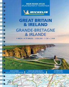
Wegenatlas Great Britain and Ireland 2024 - Main Roads Atlas (A4-Spira

0
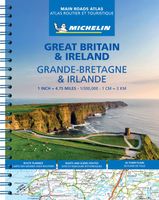
Full of practical features, the Michelin Great Britain & Ireland 2024 - Main Roads Atlas (A4-Spiral) is the perfect companion for your everyday journey and holiday planning. Updated every year, it gives you clear and accurate information for a safe and enjoyable journey thanks to a detailed mapping scale of 1/300 000. The route planner as well as t...

Webshops met dit product

Webshop
Bezorging
Prijs

Anderen bekeken ook

Wegenatlas Great Britain and Ireland 2024 - Main Roads Atlas (A4-Spira
Full of practical features, the Michelin Great Britain & Ireland 2024 - Main Roads Atlas (A4-Spiral) is the perfect companion for your everyday journey and holiday planning. Updated every year, it gives you clear and accurate information for a safe and enjoyable journey thanks to a detailed mapping scale of 1/300 000. The route planner as well as the time and distance charts will help you plan and optimise your journey. Michelin's safety alerts warn you about dangerous driving areas, such as steep hills, level crossing as well as risk zone subject to tighter speed check. The Great Britain & Ireland 2024 - Main Roads Atlas (A4-Spiral) also shows tourist sights, leisure facilities, as well as scenic routes so that you can make the most of your journey. The Michelin Great Britain & Ireland 2024 - Main Roads Atlas (A4-Spiral) features: Detailed mapping with a scale 1/300 000 (4.75 miles to 1 inch) Mileage chart and journey times to help you plan your journey Key to Map Pages to quickl…
19,95
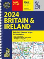
Wegenatlas Road Atlas Britain and Ireland 2024 | Philip's Maps
PHILIP'S - Market leaders and No. 1 in the UK for clear maps'Good balance between detail and clarity with excellent town maps' What Car? * Super-clear mapping at a scale of 3 miles to 1 inch = 1:200,000* Includes the latest highway code requirements* Completely updated and revised for 2024* New map showing Smart Motorways- Practical spiral bound, lie-flat format- 160 pages of fully updated super-clear road maps - 10 pages of detailed route-planning maps - plan your route in advance - 88 indexed town-centre maps - 14 pages of city approach maps with named arterial roads - 2 page road map of Ireland- Map of scenic Britain and a map highlighting railways, airports and ferry ports Philip's 2024 Road Atlas Britain and Ireland is the top-of-the-range spiral road atlas featuring the latest maps from the Philip's digital database. Voted Britain's clearest and most detailed in an independent consumer survey, the mapping is super-clear.   Philip's 2024 Road Atlas Britain and Ireland contains 160…
23,95
Wegenatlas Road Atlas Britain and Ireland 2024 | Philip's Maps
Let op! Ierland en een gedeelte van Schotland hebben een andere schaal dan de rest van de atlas.   PHILIP'S - Market leaders and No. 1 in the UK for clear maps'Good balance between detail and clarity with excellent town maps' What Car? * Super-clear mapping at a scale of 3 miles to 1 inch = 1:200,000* Includes the latest highway code requirements* Completely updated and revised for 2024* New map showing Smart Motorways- Practical spiral bound, lie-flat format- 160 pages of fully updated super-clear road maps - 10 pages of detailed route-planning maps - plan your route in advance - 88 indexed town-centre maps - 14 pages of city approach maps with named arterial roads - 2 page road map of Ireland- Map of scenic Britain and a map highlighting railways, airports and ferry ports Philip's 2024 Road Atlas Britain and Ireland is the top-of-the-range spiral road atlas featuring the latest maps from the Philip's digital database. Voted Britain's clearest and most detailed in an independent consu…
23,95
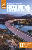
Reisgids Green Britain & Northern Ireland | Rough Guides
Een kleinere versie van de grotere versies van de Rough Guides. Als altijd weer vol met goede informatie over cultuur en praktische zaken. Achterin kleine plattegronden.   Practical travel guide to Green Britain & Northern Ireland with a free eBook featuring points-of-interest structured lists of all sights and off-the-beaten-track treasures, with detailed colour-coded maps, practical details about what to see and to do in Green Britain & Northern Ireland. The Rough Guide to Green Britain & Northern Ireland also includes details on how to get there and around, pre-departure information, as well as top time-saving tips, like a visual list of things not to miss in Green Britain & Northern Ireland, expert author picks and itineraries to help you plan your trip. This guide book has been fully updated post-COVID-19.     The Rough Guide to Green Britain & Northern Ireland covers: London & the Southeast, the Southwest, Central England, Northern England, Wales, Scotland and Northern Irelan…
13,95
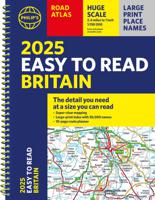
Wegenatlas Philip's Easy to Read Road Atlas of Britain 2025 | A4-Form
"The detail you need at a size you can read". The latest 2025 Philip's Easy to Read Road Atlas of Britain from the best-selling Road Atlas range has over 350 pages packed with exceptionally clear mapping and everything you need for exploring Britain. Practical A4-size with lie-flat spiral binding, it will enhance any journey.   · Clear maps packed with extra details for a better journey · Huge 1:150,000 scale (approx 2.4 miles to 1 inch) · Large print place names · Large print index · Super-clear 10-page route planner to create the best journeys · Thousands of attractions clearly mapped, including castles, theme parks, gardens, zoos and more. · Lie-flat spiral binding for easy use and planning   At last, a road atlas that everyone can read easily, in or out of the car, no matter what the conditions. With up-to-date mapping technology, your travels have never been easier to plan. This edition contains a wealth of useful information, including tourist attractions, to ensure the best poss…
27,50
Wandelgids Great Britain & Ireland | Vertebrate Publishing
Big Trails: Great Britain & Ireland is an inspirational guide to the most iconic, spectacular and popular long-distance trails in England, Scotland, Wales, Northern Ireland, Ireland and the Isle of Man.   The twenty-five featured routes will take you across the best of the British Isles. From the South Downs Way in South-East England and across Wales' mountains in the Cambrian Way, the book delves into the heart of Scotland on the West Highland Way, along the Causeway Coast Way on Northern Ireland’s coast, and into southern Ireland on the Beara Way.   The book is designed to inspire big adventures. Rather than being carried along the route, this guide provides everything you need to plan and explore further, including a general overview of the trails, specific technical information, overview mapping, key information and stunning photography. As well as this, each route specifies approximate timings devised using the Jones–Ross formula, which allows for custom itineraries to be generate…
27,95
Wegenatlas Routier et Touristique France - Frankrijk 2024 | A4-Formaat
Geplastificeerde waterafstotende en scheurvaste wegenatlas van Frankrijk 1:250.000 Michelin A4 Formaat, Spiraal rug. Met uitgebreid register.   Michelin's France 100% laminated A4 atlas offers, in addition of Michelin's clear and accurate mapping, an enhanced view of your journey thanks to its scale 1/250,000. Convenient and easy to use thanks to its spiral bound cover, this atlas comes with extra-resistant laminated pages on which you can trace and erase your journey. The route planner as well as the time distance charts will help you plan and optimise journey. Michelin's new safety alerts warn you about dangerous driving areas and zones subjet to tighter speed checks. Michelin's laminated France atlas also includes information on tourist sights, leisure facilities and scenic routes, as well as service areas to add pleasure and comfort to your journey. Michelin's France laminated tourist and motorist atlas features: * Scale 1/250,000: for an enhanced view of your journey * Extra resis…
26,95

Klanten-reviews van Wegenatlas Great Britain and Ireland 2024 - Main Roads Atlas (A4-Spira

Er zijn nog geen beoordelingen voor dit productBen jij de eerste die een review plaatst?

Meer over Wegenatlas Great Britain and Ireland 2024 - Main Roads Atlas (A4-Spira

Productomschrijving

Full of practical features, the Michelin Great Britain & Ireland 2024 - Main Roads Atlas (A4-Spiral) is the perfect companion for your everyday journey and holiday planning. Updated every year, it gives you clear and accurate information for a safe and enjoyable journey thanks to a detailed mapping scale of 1/300 000. The route planner as well as the time and distance charts will help you plan and optimise your journey. Michelin's safety alerts warn you about dangerous driving areas, such as steep hills, level crossing as well as risk zone subject to tighter speed check. The Great Britain & Ireland 2024 - Main Roads Atlas (A4-Spiral) also shows tourist sights, leisure facilities, as well as scenic routes so that you can make the most of your journey. The Michelin Great Britain & Ireland 2024 - Main Roads Atlas (A4-Spiral) features: Detailed mapping with a scale 1/300 000 (4.75 miles to 1 inch) Mileage chart and journey times to help you plan your journey Key to Map Pages to quickly access your region of interest Practical street plan section for an easy navigation in urban areas: 52 town plans embedded in the mapping of their surrounding area. Easier navigation thanks to the location map featured on top of each page. An extensive place name index to easily identify the destination of your choice Comprehensive and detailed key to symbols used Fuel station and service areas Tourist information with place of interest and leisure facilities, as well as scenic routes, cross-referenced with the famous Michelin Green Guides, with towns underlined in green

Productspecificaties

Artikelnummer(s)
Brand
Michelin

Verken gerelateerde categorieën

Webshop.nl maakt gebruik van cookies. Ga je verder op onze website, ga dan akkoord met het plaatsen van cookies en de verwerking van deze data door ons en vermelde partners.