Wegenatlas Glovebox Atlas Scotland - Schotland | AA Publishing

0
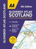
This handy road atlas fits the glovebox of your car, perfect for quick referencing on the move. Including information on route planning, car ferry routes and operators, restricted motorway junctions, county map, and a mileage chart, this is the perfect glovebox companion for traveling through Scotland. New features on the mapping include award win...

Verkopers met dit product

Webshop
Bezorging
Prijs
DeZwerver.nl logo
DeZwerver.nl
niet bekend
9,95

Anderen bekeken ook

Wegenatlas AA Glovebox Atlas Britain | AA Publishing
This handy atlas fits in the glovebox of your car, perfect for quick referencing on the move. The clear mapping includes a range of essential motoring and useful touring information so you can find your way and discover places to visit whilst on your travels. Including information such as road tolls, service areas, road distances, national parks, places to visit and viewpoints this is the perfect glovebox companion for travelling through Britain and Ireland.
8,50
Wegenkaart - landkaart 9 Road Map Britain Scotland - Schotland | AA Publishing
Goede dubbelzijdige wegenkaart van Schotland met plaatsnamen index. Britain’s clearest mapping from the experts at the AA, in a handy foldable map. Fully updated, this map of Scotland combines clear design and an easy-to-read scale with more road detail to ensure that you never lose your way. The map includes information on toll points, service areas, road numbers, motorways, dual carriageways and wide and narrow local roads. National Parks, and places of interest are also highlighted. Caravan and camping sites pinpointed on the mapping. City and town plans Easy-to-read place index name. Part of a range of 9 regional sheet maps plus 1 map covering the whole of Britain. Map Series - 1 West Country & Wales. 2 Central Southern England. 3 South East England. 4 East Anglia. 5 Midlands & Central England. 6 Wales. 7 Northern England. 8 North England & Scottish Borders. 9 Scotland. 10 Britain.  
10,95
Wegenatlas Japan Traveler's Atlas | Tuttle Publishing
Finding your way around the various regions of Japan is a breeze with this handy Tuttle Japan Traveler's Atlas. Designed for the adventurous traveler and containing all the maps you'll need on your explorations, this atlas includes many views that are not available anywhere else.   The atlas is conveniently divided into the major regions of Japan: Tokyo Mt. Fuji & Around Tokyo Central Honshu Kyoto Kansai Hiroshima & Western Honshu Northern Honshu Hokkaido Shikoku Kyushu Okinawa & the Southwest Islands   Each of the 148 maps in this atlas is presented in a logical, easy-to-follow manner, with emphasis on the most frequently-visited areas. All cities, towns, villages, places of interest including nature reserves are indexed for quick reference.   Comprehensive: detailed insets are given for all the major cities, travel destinations and business hubs in Japan. Informative: Precise locations are indicated for all popular sights, hotels, restaurants, temples, shopping malls an…
19,95
Nieuw
Wegenkaart - landkaart Scotland - Schotland | ITMB
Anyone who has been in this business for a few years remembers Ordnance Survey and their brilliantly detailed artwork. They should also remember that OS guarded this artwork religiously. That all changed when the then head of government in the UK, one soon-forgotten Gordon Brown, decreed that commercial OS artwork had to be discontinued and artwork had to be made more freely available to users. I expected an outpouring of new artwork by private UK firms. It did not happen; in fact, the range of travel maps decreased dramatically. However, OS artwork is still an excellent source of mapping artwork. This is a wonderful double-sided, detailed map of Scotland. It is both extremely detailed and accurate. We have added symbols for parks, historic sites, battlefields, country hotels, and anything else that we think would interest visitors. In order to portray Scotland to best scale advantage, the only inset included with this map are those of outlying islands, such as the Shetlands. ITMB als…
13,95
Wegenatlas Scotland - Schotland | A-Z Map Company
Handzame gedetailleerde wegenatlas van Schotland. Navigate your way around Scotland with this detailed, full-colour and easy-to-use A-Z Road Atlas. From the border to the north coast, the mainland pages scale is 3.5 miles to 1 inch and the Western Isles, Shetland Islands and Orkney Islands scale is 4.5 miles to 1 inch.   Covering the entire country, this road atlas includes the following features: • Motorways with full junction detail, primary routes and destinations, A & B roads, under construction and proposed roads, service areas, tolls, mileages, national, county and unitary authority boundaries • Cairngorms and Loch Lomond & The Trossachs National Park boundaries • Selected places of interest and tourist information centres   20 city and town street maps are included for Aberdeen, Aviemore, Ayr, Dumfries, Dundee, Dunfermline, Edinburgh, Glasgow, Falkirk, Fort William, Hamilton, Inverness, Kilmarnock, Kirkcaldy, Motherwell, Oban, Paisley, Perth, St Andrews and Stirling. A…
13,50
Reisgids Scotland - Schotland | Insight Guides
Dé gids als het gaat om achtergrondinformatie en prachtige foto’s. Ideaal om je reis goed te plannen. Door het formaat en gewicht niet zo zeer om mee te nemen in een echte rugzak maar in een Samsonite misstaat deze niet! Uitstekend om thuis voor en na de reis uitgebreid te lezen. Kwalitatief van een hoog niveau! Engels. This Insight Guide is a lavishly illustrated inspirational travel guide to Scotland and a beautiful souvenir of your trip. Perfect for travellers looking for a deeper dive into the destination's history and culture, it's ideal to inspire and help you plan your travels. With its great selection of places to see and colourful magazine-style layout, this Scotland guidebook is just the tool you need to accompany you before or during your trip. Whether it's deciding when to go, choosing what to see or creating a travel plan to cover key places like Glen Coe, Stirling Castle, it will answer all the questions you might have along the way. It will also help guide you when you…
23,95
Wegenatlas Road Atlas Ireland | Collins
Explore Ireland with this accurate and fully updated road atlas. This road atlas is at A4 size, covering the whole of Ireland and features clear and detailed Collins colour mapping at a scale of 5.2 miles to 1 inch. Perfect for both residents and visitorstouring Ireland.   This revised edition includes: Places of tourist interestContact information for Tourist Information Centres with grid references to the mappingFully indexed street maps of 11 cities and towns - Dublin, Belfast, Cork, Limerick, Waterford,Londonderry (Derry), Galway, Bangor, Dun Laoghaire, Drogheda and KillarneyBlue Flag & Green Coast beachesFerry and airport information; Distance chart; Distances marked on the roads in miles and kilometresRoute planning map of the whole of Ireland at 15.8 miles to 1 inchAdministrative map of Irish counties and districts.
9,95
Reisgids Experience Scotland - Schotland | Lonely Planet
De nieuwste reisgidsen-serie van Lonely Planet: een luxe uitgave met als titel 'Experience... ' waarin aandacht voor de belangrijkste niet te missen hoogtepunten van het land. Ook hier wordt het kort en bondig geschreven met veel praktische informatie erbj als eten-drinken en vervoer. De lijst met accommodaties - zoals bij de gewone Planets - hebben ze weggelaten. Wel weer met veel plattegronden en kaartjes, rijkelijk geillustreerd met mooie foto's.   This latest edition of Lonely Planet's Experience Scotland travel guide reveals exciting new ways to explore this iconic country with all the tools you need to create your own unique trip. Discover amazing local experiences from flocking to Oban, the 'Seafood Capital of Scotland', for sustainable shell-fish platters; to hitting the road to find hidden beaches on the crowd-free Cowal Peninsula; and star gazing amid the epic beauty of Galloway Forest Park. Build a one-of-a-kind trip with Lonely Planet's Experience Scotland travel guide:Ou…
26,50
Wegenatlas Navigator Camping and Caravanning - Atlas of Britain | Philip's Maps
THE MUST-HAVE ATLAS OF BRITAIN FOR CAMPING, CARAVANNING AND MOTORHOMES'A map that beats all others' - The Daily Telegraph'Scale, accuracy and clarity are without parallel' - Driving Magazine'No. 1 in the UK for clear maps' - Independent research surveyThe lure of the open road and British countryside has never waned and the appeal of independent exploration has surely grown in recent years. However, the adventurous need practical information about what lies ahead - from bridge heights, widths and weights to places to stop and enjoy.   Philip's Navigator Camping and Caravanning Atlas of Britain is the No. 1 Choice of Road Atlas for the independent travelling motorist and camper van owner. * Scale: 1.5 miles to 1 inch = 1:100,000 (Northern Scotland: 3 miles to 1 inch = 1:200,000)* Over 1,880 approved campsites located, plus essential advice from The Camping and Caravanning Club* Includes essential information for caravanning motorists: 6000 bridge height limits, 1500 bridge weight limit…
37,50
Wegenatlas Road Atlas 2025 USA - Canada - Mexico - Verenigde Staten groot formaat | Michelin
De beroemde wegenatlas van Rand McNally nu als Michelin atlas op groot formaat, bijna dubbel A4. Elke staat een eigen, of soms zelfs twee pagina's. Uitgebreid register. Zoals de Amerikanen zelf zeggen: America's number 1 Road Atlas! Canada en Mexico staan er zeer beperkt in. Highlighting 51 road trips and scenic drives the Michelin's updated Large Format North America Road Atlas 2025 helps you enjoy the planning and the journey. Large-format maps and larger lettering for towns and sites (compared to the midsize atlas) make for easier reading while the tiled format flows maps from page to page—the ideal complement to GPS and online directions. Four jam-packed pages highlight selected US and Canadian national parks, with points of interest, hikes and drives.   Covers US, Canada & Mexico. Large grid map to quickly locate atlas pages. Easy-read text and mapping. Map pages are 36% larger than midsize atlas. Inspired ideas for outdoor fun and road trip adventures in the US and Canada…
19,95

Klanten-reviews van Wegenatlas Glovebox Atlas Scotland - Schotland | AA Publishing

Er zijn nog geen beoordelingen voor dit productBen jij de eerste die een review plaatst?

Meer over Wegenatlas Glovebox Atlas Scotland - Schotland | AA Publishing

Productomschrijving

This handy road atlas fits the glovebox of your car, perfect for quick referencing on the move. Including information on route planning, car ferry routes and operators, restricted motorway junctions, county map, and a mileage chart, this is the perfect glovebox companion for traveling through Scotland. New features on the mapping include award winning beaches, soccer stadiums, lighthouses, and waterfalls.

The 4th edition of this AA glovebox atlas for Scotland has been fully revised and updated for November 2017. This handy, flexibound A5 road atlas is designed specifically for the motorist in Scotland. There is a distance and journey time chart between 40 destinations. The atlas legend is in English, French, Spanish, Italian, German and Dutch.

1:250 000 (1 inch=4 miles, 1cm=2.5km) Symbols indicating: places of interest, motorways, dual carriageways, toll areas, prohibited roads, rail lines, road numbers and boundaries Multilingual key to the symbols Distance matrix which shows distances and driving times between major cities Alphabetical index by town name including page numbers and grid references Overview map of Scotland with page reference numbers so you can find the region you want to travel to quickly and easily

Verken gerelateerde categorieën

Webshop.nl maakt gebruik van cookies. Ga je verder op onze website, ga dan akkoord met het plaatsen van cookies en de verwerking van deze data door ons en vermelde partners.