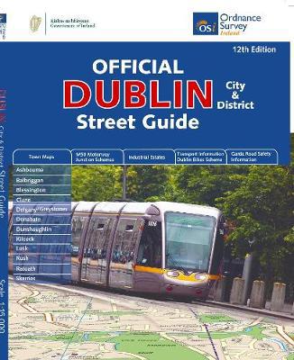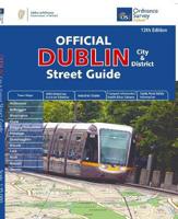
Wegenatlas Dublin official city & district street guide spiral | Ordnance Survey Ireland

0
Navigate your way around Dublin with confidence with the Official Dublin City & District Street Guide. Find your way around Ireland’s vibrant, historic capital with an enlarged city centre map plus 12 maps of surrounding major towns.   Official Dublin City & District Street Guide features:   - Enlarged city centre map - Maps of Ashbourne, Balbrigg...

Verkopers met dit product

Verkoper
Bezorging
Prijs
DeZwerver.nl logo
DeZwerver.nl
2,95
25,95

Anderen bekeken ook

Reisgids Mini Rough Guide Dublin | Rough Guides
Een kleinere versie in zakformaat van de grotere versies van de Rough Guides. Als altijd weer vol met goede informatie over cultuur en praktische zaken. Achterin kleine plattegronden. This mini pocket Dublin travel guidebook is perfect for travellers looking for essential information about Dublin. It provides details on key places and main attractions, along with a selection of itineraries, recommendations for restaurants and top tips on how to make the most of your trip. It's sustainably printed to ensure environmental responsibility. In this Dublin guidebook, you will find: Curated recommendations of places – expert picks of main attractions, child-friendly activities and relaxing spots, plus where to take the best photos What's new, when to go and sustainable travel – all-new features direct you to what you need to know Things not to miss in Dublin – O'Connell Street, Kilmainham Gaol, The Guinness Storehouse Tour, Custom House, Trinity College, Phoneix Park, National Gallery, Te…
12,50
Stadsplattegrond City map Dublin | Lonely Planet
Durable and waterproof, with a handy slipcase and an easy-fold format, Lonely Planet's Dublin City Map is your conveniently sized passport to travelling with ease. With this easy-to-use, full-colour navigation tool in your back pocket, you can truly get to the heart of Dublin, so begin your journey now!         Durable and waterproof   Easy-fold format and convenient size   Handy slipcase   Full colour and easy to use   Extensive street and site index   Images and information about top city attractions   Handy transport maps   Walking tour routes   Practical travel tips and directory   Itinerary suggestions   Covers City Centre, Merrion Square, Temple Bar, Kilmainham, the Liberties, North of the Liffey, Phoenix Park, Docklands   Looking for more extensive coverage? Check out Lonely Planet's Dublin, our most comprehensive guidebook to the city, covering the top sights and most authentic offbeat experiences. Or check out Lonely Planet's Pocket Dublin, a handy-sized guide focused on the …
9,95
Wegenatlas Ireland Comprehensive Road Atlas - Ierland | Collins
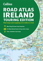
Duidelijke en gedetailleerde atlas voor Ierland in A4-formaat met ringband.   Clear, detailed road atlas of Ireland in a handy A4 spiral-bound format. This comprehensive, general purpose road atlas of the whole of Ireland is ideal for both business and pleasure use. The atlas contains a range of mapping scales: • 9 miles to 1 inch route planning map • Main maps at 3.2 miles to 1 inch, which are ideal for navigation. • A wide selection of detailed town centre street plans.   This edition boasts road mapping packed with detail showing colour classified road network, toll roads, land heights, the location of safety cameras, Blue Flag and Green Coast beaches, tourist information centres and a wide range of tourist attractions. There is also comprehensive guide information for visitors to Belfast, Cork, Dublin and Limerick. The locations of Speed Enforcement Zones, which highlight roads that have a high risk of accidents as identified by the Garda and the National Roads Authority, are incl…
14,95
Stadsplattegrond City map New York | Lonely Planet
De stadsplattegronden van Lonely Planet zijn uitgevoerd op scheur- en watervast papier, zijn lichtgewicht en kennen een handig formaat. Het centrum van de stad is in heldere kleuren in beeld gebracht met straatnamen, bezienswaardigheden en symbolen voor openbaar vervoer. Op de achterzijde staat informatie over de toeristische hoogtepunten en in de meeste gevallen een schematische plattegrond van het openbaar vervoer. Met een register. Durable and waterproof, with a handy slipcase and an easy-fold format, Lonely Planet's New York City Map is your conveniently sized passport to traveling with ease. Get more from your map and your trip with images and information about top city attractions, walking tour routes, transport maps, itinerary suggestions, an extensive street and site index, and practical travel tips and directory. With this easy-to-use, full-color navigation tool in your back pocket, you can truly get to the heart of New York, so begin your journey now! Durable and waterproof…
9,95
Reisgids Pocket Dublin | Lonely Planet
Pocket reisgidsen van Lonely Planet zijn een kleinere versie dan de 'echte' Planets. Vaak echter van bijzondere bestemmingen binnen een bepaald land waardoor er meer aandacht is en uitgebreidere tips zijn voor die bepaalde streek i.v.m. de grote Planets. Handzaam formaat, makkelijk in de binnenzak! Tcoh ook deze vol met praktische informatie. Lonely Planet's Pocket Dublin is your guide to the city's best experiences and local life - neighbourhood by neighbourhood. Step back in time at Kilmainham Gaol, admire art at the Hugh Lane Gallery, and sample a pint at the Guinness Storehouse; all with your trusted travel companion. Uncover the best of Dublin and make the most of your trip!   Inside Lonely Planet's Pocket Dublin:   Full-colour maps and travel photography throughout   Highlights and itineraries help you tailor a trip to your personal needs and interests   Insider tips to save time and money and get around like a local, avoiding crowds and trouble spots   Essential info…
13,50
Reisgids Rough Guide Pocket Peak District (Travel Guide with Free EBook) | Rough Guides
Image for Pocket Rough Guide British Breaks Peak District (Travel Guide with Free eBook) Click to enlarge Pocket Rough Guide British Breaks Peak District (Travel Guide with Free eBook) by Rough Guides (Author)   Series:Pocket Rough Guides British Breaks Format:Paperback / softback 152 pages Publisher:APA Publications Imprint:APA Publications ISBN:9781839057885 Published:15 Oct 2022 Classifications:England, Travel & holiday guides Readership:General (US: Trade) Weight:202g Dimensions:100 x 190 x 11 (mm) Pub. Country:United Kingdom Country of Origin:GB Tariff Codes:49019900 For sale in: All countries Description Discover the best of The Peak District with this compact, practical, entertaining Pocket Rough Guide with a free eBook. This slim, trim treasure trove of trustworthy travel information is ideal for travellers on short trips, and covers all the key sights such as Buxton, Castleton and Bakewell, restaurants, shops, cafes and bars, plus inspired ideas for day-trips, with honest ind…
12,50
Reisgids City Guide Vienna - Wenen | Lonely Planet
De perfecte reisgids voor zowel de georganiseerde als de zelfstandige reiziger. Naast een algemene inleiding van de stad vol met praktische informatie over hoe je er het beste kunt reizen: slapen, eten, vervoer, excursies ... alles kun je er in vinden. Engelstalig. Lonely Planet Baroque streetscapes and imperial palaces set the stage for artistic and musical masterpieces, alongside vibrant epicurean and design scenes. Lonely Planet is your passport to Vienna, with amazing travel experiences and the best planning advice.   Experience the grandeur of the Habsburgs at Schloss Schönbrunn, feast on art at Kunsthistorisches Museum Vienna, or stroll through the imposing Hofburg Palace complex; all with your trusted travel companion. Get to the heart of Vienna and begin your journey now!   Inside Lonely Planet’s Vienna Travel Guide:   Full-colour maps and images throughout Highlights and itineraries help you tailor your trip to your personal needs and interests Insider tips to save t…
20,95
Wandelgids Lake District National Park | Ordnance Survey
Explore the spectacular scenery of the Lake District without scaling the high fells on these accessible walks that everybody can enjoy, covering the whole of the National Park. Wander the tranquil shores of Lakeland and drink in dazzling views on a day out for the whole family.   Lake District Short Walks Made Easy include:   - Make a leisurely circuit of beautiful Buttermere and the woodlands and meadows surrounding it, with a backdrop of rugged high fells - Follow a stretch of the Ullswater Way beside one of Lakeland’s most spectacular bodies of water (with optional detour to stunning Aira Force waterfall) – and catch one of the iconic ‘Steamers’ back - Walk in William Wordsworth’s footsteps from Grasmere village through oak woodlands and around the shores of Grasmere, visiting the poet’s grave en route - Start at imposing Wray Castle, glimpse Belham Tarn and enjoy stunning views of Windermere, England’s largest natural lake - Stroll along a stretch of the England Coast Path to the …
10,95
Wegenatlas Handy Road Atlas Ireland - Ierland | Collins
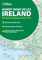
Handzame wegenatlas op A5 formaat van Ierland. Vrij grove schaal maar heel handig door formaat en goed kaartbeeld.  Met enkele stadsplattegronden en een paar pagina's met hoogtepunten van het land.  Explore Ireland with this handy format route-planning atlas in full colour, complete with information on places of tourist interest. There are also fully indexed town centre plans of Belfast, Cork, Dublin, Galway, Limerick and Londonderry. Now with places of interest marked including famous film locations. This atlas, at A5 size, contains mapping of the whole of Ireland at 9 miles to 1 inch (1:570,240). The mapping is beautifully designed with colour classified roads and subtle layered height tinting. The atlas is ideal for residents, visitors and tourists alike. Key features of the atlas include:* All Ireland route planning maps* Town centre plans* Places of interest including TV and film locations such as Game of Thrones, Star Wars and Harry Potter* Blue Flag and Green Coast beaches map*…
9,95
Wegenkaart - landkaart Mexico Central & Mexico City | ITMB
Goede wegenkaart met duidelijk kleurgebruik. Het betreft een deel van Mexico met op de achterkant een stadsplattegrond van het centrale deel van Mexico City. MC is the largest city in the Western Hemisphere, with a population of 28,000,000 (or twice as big as New York City!). It would be impractical to portray the entire urban area on one map and have it make sense, so we show the portion of greatest interest to visitors, from the Chapultepec Zoological Park in the west to the incredibly busy Tapo Bus Terminal in the east, and from the railway station in the north to the southern east-west motorway just south of the main hospital complex. Much of MC’s touristic interest is concentrated in the Zona Rosa, Reforma, and Zocalo segments of the city centre, and these are shown in detail, noting hotels, major restaurants, shopping areas, and points of interest.   The map also includes inset maps of the San Angel area just north of the university, an inset map of the greater Mexico City Feder…
13,95

Klanten-reviews van Wegenatlas Dublin official city & district street guide spiral | Ordnance Survey Ireland

Er zijn nog geen beoordelingen voor dit productBen jij de eerste die een review plaatst?

Meer over Wegenatlas Dublin official city & district street guide spiral | Ordnance Survey Ireland

Productomschrijving

Navigate your way around Dublin with confidence with the Official Dublin City & District Street Guide. Find your way around Ireland’s vibrant, historic capital with an enlarged city centre map plus 12 maps of surrounding major towns.   Official Dublin City & District Street Guide features:   - Enlarged city centre map - Maps of Ashbourne, Balbriggan, Blessington, Clane, Delgany/Greystones, Donabate, Dunshaughlin, Kilcock, Lusk, Rush, Rafoath and Skerries - Spiral-bound for ease of laying flat and quick navigation - Schematic maps of all M50 motorway junctions - Up-to-date and indexed information on hospitals, embassies and industrial estates - Garda Road Safety Information - Transport information for bus and rail routes and Dublin Bikes Scheme   Other Ordnance Survey Ireland maps of Dublin include Medieval Dublin, Dublin City Centre Tourist Map and Dublin Commuter Map.

Verken gerelateerde categorieën

Webshop.nl maakt gebruik van cookies. Ga je verder op onze website, ga dan akkoord met het plaatsen van cookies en de verwerking van deze data door ons en vermelde partners.