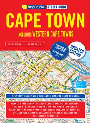
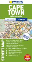
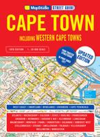
Wegenatlas Capetown Western Cape Cape Peninsula | MapStudio

0

Verkopers met dit product

Verkoper
Bezorging
Prijs
DeZwerver.nl logo
DeZwerver.nl
niet bekend
2,95
29,95

Anderen bekeken ook

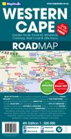
Wegenkaart - landkaart 10 Western Cape Road Map | MapStudio
Road map of the Western Cape Province with an enlargement for the Cape Peninsula and 27 street plans of the central areas in main towns. The map is annotated numerous places of interest, vineyards, etc. GPS coordinates are provides for main road junctions. This new edition Western Cape Road Map covers the whole of the Western Cape. It features easy-to-read full colour maps with GPS co-ordinates. The map provides tourist-friendly text, highlights places of interest and lists accommodation information. This map is perfect for scenic drives and includes information boxes on activities of interest.   Coverage includes the Garden Route & Route 62, South Western Cape, Winelands and Overberg, West Coast Flower Region and Little Karoo. The map features small detailed street plans of Cape Town CBD, Montagu, Barrydale, Ladismith, Oudtshoorn, Mossel Bay, Knysna, Plettenberg Bay, Humansdorp, George, Stellenbosch, Franschhoek, Paarl, Wellington, Hermanus, Swellendam, Robertson, Ceres, Tulbagh, Lan…
16,95
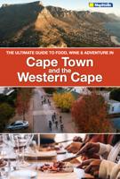
Reisgids Ultimate Guide to food, wine & adventure - Cape Town and the Western Cape | MapStudio
Welcome to the Western Cape. Cape Town is a bustling melting pot of cultures, tastes and experiences for young and old. You will find state-of-the-art shopping malls, open-air markets, delis and more.   A world of natural beauty lies beyond the boundaries of the city in the greater Western Cape regions: the Cape West Coast, the Cape Karoo, Garden Route and Klein Karoo, Cape Winelands and the Cape Overberg.   Each region is worth exploring and has its own unique charm. You will uncover and discover diverse culinary delights, award-winning wine estates, nature in full bloom, wide-open spaces and deserts, azure water and white sandy beaches, and world-class experiences that will make your journey truly unforgettable.   The people of the Western Cape - the locals make our destination beautiful and they are ready and waiting to share their stories with you.   The Ultimate Guide to Cape Town and the Western Cape is a complete guide with up-t0-date maps to guide you through your stay in the …
24,95
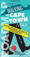
Stadsplattegrond Walking Cape Town | MapStudio
Zeer gedetailleerde plattegrond van het centrum van Kaapstad. Ideaal om de stad te voet te ontdekken. Met veel bezienswaardigheden weergegeven in verschillende categorieën, met elk hun eigen kleur , zoals musea, parken, hotels en winkels.   This newly released super-detailed map, Walking Cape Town Road Map, is ideal for walking tours of the city and for anyone wanting to get to know the Mother City.   Content of Walking Cape Town Road Map includes:   • All points of interest are listed and colour-coded by category for ease-of-use, • Museums, urban parks, arts & crafts, theatres, concert halls, shopping centres/malls, cinemas, • Hotels, hostels, embassies/consulates, hospitals/clinics, police stations, important tourist attractions eg. Bo-Kaap houses, Noon Gun, • Historical monuments & statues, • Interesting facts, • Ideal for exploring the city on foot or by public transport
13,95
Wandelkaart Dingle Peninsula | Harvey Maps
The whole of the Dingle Peninsula on one lightweight, waterproof map at the popular 1:30,000 scale.   Includes Mount Brandon and the entire Brandon Group of mountains in the west of the Peninsula.   To the east, the Slieve Mish mountains are also shown.   The map also shows the Dingle Way - a 179km long distance walking route around the edge of the Peninsula that starts and finishes in Tralee. The route is highlighted in red.   The Blasket Islands are also shown at 1:50,000 scale. Popular for day trips, these uninhabited islands are the most westerly point of Europe.   Placenames in English and Gaeilge / Gaelic.   Archaeological sites and walls and fences in farmland are clearly marked.
25,50
Stadsplattegrond Streetmap Cape Town - Kaapstad | MapStudio
Uitgebreide stadsplattegrond van Kaapstad en directe omgeving.    The Cape Town & Peninsula Street Map is the ideal travel companion to find your way around Cape Town.   Coverage includes:   North : Milnerton West : Hout Bay East : Jakes Gerwel (Vanguard Drive) South : Muizenberg   Great content which includes a detailed map of Cape Town CBD and Waterfront insert map.   The main map is in detailed 1: 25 000 street level scale, which depicts parks and reserves, golf courses, sports fields and stadiums, intersections, route numbers and interchange names. The map also includes places of interest, historical sites and hotels, suburb names and boundaries, schools and sporting venues, industrial areas, wine estates and heritage sites as well as bird sanctuaries and post offices and libaries.  
16,95

Klanten-reviews van Wegenatlas Capetown Western Cape Cape Peninsula | MapStudio

Er zijn nog geen beoordelingen voor dit productBen jij de eerste die een review plaatst?

Meer over Wegenatlas Capetown Western Cape Cape Peninsula | MapStudio

Productinformatie

    Verken gerelateerde categorieën

    Webshop.nl maakt gebruik van cookies. Ga je verder op onze website, ga dan akkoord met het plaatsen van cookies en de verwerking van deze data door ons en vermelde partners.