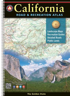
Wegenatlas California Road & Recreation Atlas | A3 Formaat | Ringband | Benchmark Maps

0
"California is rich in geographical diversity and natural beauty, from its verdant mountains and vast deserts to its seemingly endless Pacific coastline. Get to know the best of California with this recently updated and improved atlas. Now freeway exit numbers are shown and the Landscape Maps™ are clearer and brighter. The comprehensive Recreation...

Verkopers met dit product

Verkoper
Bezorging
Prijs
DeZwerver.nl logo
DeZwerver.nl
niet bekend
39,95

Anderen bekeken ook

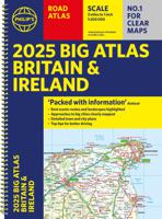
Wegenatlas Big Atlas Britain & Ireland 2025 | A3-Formaat | Ringband | Philip's Maps
Goede gedetailleerde wegenatlas van Groot-Brittannië, schaal 1:200.000 met een overzichtskaart van Ierland, schaal 1:1.000.000. Groot formaat, A3, en in ringband. 'Good balance between detail and clarity with excellent town maps' What Car? PHILIP'S is No. 1 in the UK for clear maps. The latest 2025 Philip's Big Road Atlas of Britain and Ireland, in a supersize large format, has fully updated mapping from the Philip's digital database alongside all the detail and information needed for successful travel.   * Top driving tips for safety and skill including how to parallel park * The best scenic routes, natural features and landscape highlighted for enhanced travelling * Practical 'more to view per page' A3 size * Main scale of maps: 3 miles to 1 inch = 1:200,000 for ease of use * Route-planning section for the easiest navigation * Special wide-vehicle access indicators for rural areas * 64 fully indexed and detailed town and city plans * City approach maps with named roads fo…
22,50
Wegenatlas Road Atlas USA Canada Mexico 2025 | A4-Formaat | Ringband | Michelin
De beroemde wegenatlas van Rand McNally nu als Michelin atlas. Super handige atlas van Michelin in A4 formaat met stevige ringband. Let op: Canada en Mexico staan er zeer beperkt in. For inspiring road trips and scenic drives, Michelin's updated, spiral-bound North America Road Atlas 2024 suggests 52 routes. The tiled atlas, with its clear, accurate mapping, complements online navigation while its big picture and road details aid in advance planning and en route decisions. For outdoor fun and adventure, look for inspiration among the highlights from national and provincial parks, including the parks' GPS coordinates.   Rely with confidence on Michelin's deluxe atlas to get you there. Covers USA, Canada and Mexico. Scale 1:625,000 - 1:9,018,000.   Spiral bound for lay-flat convenience. More than 240 large-scale city maps for navigating in and around urban areas. Bonus Northeast Corridor maps provide extra detail between Boston and Washington DC for easier driving.   Six-page tra…
21,95
Campinggids - Campergids Northern California Camping | Moon Travel Guides
De Amerikaanse uitgever Moon is een vergelijkbare gids met uitgever Lonely Planet > veel praktische informatie met veel diepgang! Het feit dat het een Amerikaanse uitgever is, maken deze gidsen zeer aantrekkelijk voor de staten en nabije landen afzonderlijk. De Lonely Planet haalt dat nivo niet! Whether you're camping among towering redwoods, along rugged coastline, or in the High Sierra, you'll always find your perfect campsite with Moon Northern California Camping. *A Campsite for Everyone: Pick the right tent or motorhome site with options ranging from secluded Sierra hike-ins to convenient roadside stopovers, including dog-friendly, family-friendly, and wheelchair accessible options, and strategic lists of the best campgrounds for hiking, swimming, and more*Ratings and Essentials: All campgrounds are rated on a scenic scale and marked with amenities like restrooms, trailhead access, picnic areas, laundry, piped water, showers, and playgrounds*Recreation Highlights: Discover nearby…
22,50
Reisgids Road Trip USA Route 66 | Moon Travel Guides
Moon Route 66 Road Trip reveals the ins and outs of this iconic highway, from sweeping prairies and retro roadside pit-stops to the stunning vistas of the Southwest. Inside you'll find:* Maps and Driving Tools: 38 easy-to-use maps detail the existing roads that comprise the original Route 66, along with site-to-site mileage, driving times, detailed directions for the entire route, and full-color photos throughout* Eat, Sleep, Stop and Explore: With lists of the best hikes, bites, roadside curiosities, and more, you can admire extraordinary landscapes like Acoma Pueblo or Joshua Tree National Park, explore big cities like Los Angeles and Chicago, or wander abandoned ghost towns. Immerse yourself in classic Americana with outsider art and kitsch masterpieces, find the most Instagram-worthy retro motels, and sample the breadth of regional cuisine, from deep dish pizza to carne asada* Flexible Itineraries: Moon Route 66 Road Trip covers Illinois, Missouri, Kansas, Oklahoma, Texas, New Mex…
23,95
Nieuw
Wegenatlas Touring Atlas Scotland 2026 | Ringband | A4-Formaat | AA Publishing
Updated and new for 2025 the AA Touring Atlas Scotland, is your trusted travel companion for discovering the very best of Scotland. Expertly designed for travellers, this easy-to-read, 176-page atlas combines premium quality with unbeatable value.   Main Features: Easy-to-read mapping and super-detailed plans of major, towns and cities Official North Coast 500 route and information AA-rated places to stay and eat and AA-recommended touring routes and walks Large-scale district maps of Edinburgh and Glasgow with extra detail Great places to visit and useful locations including golf courses, distilleries, and scenic landscapes User-friendly spiral bound with a durable cover The atlas makes exploring Scotland easy with road mapping consisting of mainland Scotland at giant 2.3 miles to 1 inch scale, and Scottish islands at a minimum of 7.6 miles to 1 inch. Featuring scores of wonderful places to visit as well as AA-recommended tours and the iconic North Coast 500 route this practic…
15,50
Wegenatlas Philip's Easy to Read Road Atlas of Britain 2025 | A3-Formaat | Paperback | Philip's Maps
With the detail you need at a size you can read, the latest edition of 2025 Philip's Big Easy to Read Road Atlas of Britain is super-clear, super-sized and bang up-to-date in a large paperback format.   · Huge 1:150,000 scale (approx 2.4 miles to 1 inch) · Large super-sized pages (A3) · Large print place names, and large scale maps · 88 detailed town plans for easy navigation · Clear road colours, which are easier to read in the dark · Thousands of attractions clearly mapped · Special route planner section for arranging the best trips · Large print approach maps for all major cities · Durable paperback format   At last, a road atlas that everyone can read easily in or out of the car, no matter what the conditions. Restricted motorway information, a distance chart, and clearly labelled places of interest are just some of the features within this bestselling road atlas of Britain. Whether it's getting dark, or you just can't find your glasses, 2025 Philip's Big Easy to Read Road Atlas o…
23,95
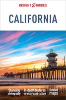
Reisgids California | Insight Guides
De Insight Guide is niet alleen een reisgids het is tevens een leuk boek om in weg te dromen en is ook voor thuisblijvers interessante lectuur, geschreven door een team van auteurs, van wie de meesten zelf woonachtig zijn in het land waarover de gids handelt. Uitvoerige geschiedschrijving en hedendaagse journalistiek, geillustreerd met sublieme foto's, informatie over vervoer, accommodatie, restaurants, reisbenodigdheden, toeristische tips, uitgaan, sport, nuttige adressen en talloze andere wetenswaardigheden. De Insight Guide is hierdoor niet alleen een bron van informatie en inspiratie, maar ook een bijzonder praktische reisgids. Fully revised and updated, this book includes a section detailing California's history, five features covering the state's life and culture, ranging from Californian cuisine to its ever-present car culture, a region by region visitor's guide to the sights, and a comprehensive Travel Tips section packed with essential contact addresses and numbers. This titl…
24,95
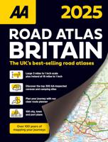
Wegenatlas Road Atlas Britain 2025 - A4 | AA Publishing
Wegenatlas, met spiraal,  van Groot-Brittannie, Engeland, Wales en Schotland, met toeristische informatie This top-selling road atlas showcases Britain’s clearest mapping from the experts at the AA at a large 3.2 miles to 1 inch scale. Each page has been titled with its geographical location so you can turn to the page you need more easily. Wide and narrow minor roads, National Trust, English and World Heritage sites and hard-to-find places are shown. There are 112 city, town, port and airport plans, full colour country, unitary and administrative area map and a comprehensive 31,500 entry index with airports, top tourist sites and motorway services listed. Plus, scenic routes, over 1,800 golf courses and the top 300 AA-Inspected caravan and camping sites symbolised on the mapping. Motorway maps, ferry planning information and 5 district maps provide the essential motoring content for travelling the country. 10 pages of central London street mapping with index. District maps of Birm…
24,95
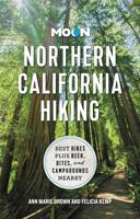
Wandelgids Northern California Hiking - Californie | Moon Travel Guides
Een mooie gids met een grote verzameling aan wandeltochten in het noordelijk deel van Californië, de zuidelijke grens van deze gids wordt bepaald door Monterey - San Jaoquin Valley - Sequoia and Kings Canyon. Goed beschreven wandeltochten (dagtochten) door vaste auteur Tom Stienstra, kaartmateriaal is summier, de rest is uitstekend!  Pack a lunch, lace up your boots, and head out to discover the rugged coastline, towering redwoods and best hiking trails in NorCal with Moon Northern California Hiking. Inside you'll find: Diverse Hiking Options: Whether you plan to take leisurely seaside walks or challenging journeys around the Sierras, enjoy outdoor getaways ranging from easy day hikes to multi-day backpacking trips Find Your Hike: Looking for something specific? Choose from strategic lists of the best hikes for breathtaking waterfalls, spring wildflowers, or hiking with your dog, plus a breakdown of the best hikes by season The Top Outdoor Experiences: Wander the terraces of the E…
31,95
Nieuw
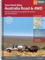
Wegenatlas Australia Road & 4WD Easy Read Atlas | A3 | Ringband | Hema Maps
Deze gloednieuwe editie van Hema's best verkopende wegenatlas van Australië telt nu 188 pagina's en is opgemaakt met een prachtige cartografie in een nieuwe stijl. Elke atlas in de reeks bevat nu ook kaarten voor 4WD en touring bestemmingen zoals Cape York, Fraser Island, Top End, Kimberley, Pilbara, Central Australia, High Country Victoria en de Flinders Ranges. Extra kaarten geven de drukke kuststroken in meer detail weer. De atlas is nog steeds de ultieme bron van informatie om Australië te verkennen, met de omvangrijke kartering van Hema en veel relevante tourinformatie. Op de kaarten worden campings, overnachtingsplaatsen, stopplaatsen, benzinestations, erkende informatiediensten en interessante bezienswaardigheden weergegeven met icoontjes. Een handig raster om afstanden af te lezen, een gids van de nationale parken, een lijst van de erkende informatiediensten en een volledig plaatsnamenregister zijn inbegrepen en helpen bij de planning en tijdens de reis. Featuring trusted He…
48,95

Klanten-reviews van Wegenatlas California Road & Recreation Atlas | A3 Formaat | Ringband | Benchmark Maps

Er zijn nog geen beoordelingen voor dit productBen jij de eerste die een review plaatst?

Meer over Wegenatlas California Road & Recreation Atlas | A3 Formaat | Ringband | Benchmark Maps

Productomschrijving

"California is rich in geographical diversity and natural beauty, from its verdant mountains and vast deserts to its seemingly endless Pacific coastline. Get to know the best of California with this recently updated and improved atlas. Now freeway exit numbers are shown and the Landscape Maps™ are clearer and brighter. The comprehensive Recreation Guide and accompanying California Road Map are the perfect resources to plan your Golden State adventure.   Landscape Maps 1:300,000. Recreation Maps 1:863,000. Metro Maps 1:158:000

Verken gerelateerde categorieën

Webshop.nl maakt gebruik van cookies. Ga je verder op onze website, ga dan akkoord met het plaatsen van cookies en de verwerking van deze data door ons en vermelde partners.