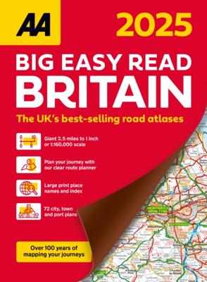
Wegenatlas Big Easy Read Britain 2026 | A3 | Ringband | AA Publishing

0
This A3 format atlas provides giant scale mapping and type throughout making it very easy to use. It is available in two binding styles; paperback and spiral bound. Each page has been titled with its geographical location so you can turn to the page you need more easily.   Wide minor roads (more than and less than 4m wide), National Trust, English...

Verkopers met dit product

Verkoper
Bezorging
Prijs
DeZwerver.nl logo
DeZwerver.nl
5,95
23,95

Anderen bekeken ook

Wegenatlas Big Road Atlas Britain 2025 - A3 | Ringband | AA Publishing
This best-selling A3 format atlas is available in two binding styles; paperback and spiral bound. Up-to-date mapping from the experts at the AA this atlas has large 3 miles to 1 inch scale including Ireland at 16 miles to 1 inch. Each page has been titled with its geographical location so you can turn to the page you need more easily. Wide minor roads (more than and less than 4m wide), National Trust, English and World Heritage sites, crematorium locations and other hard-to-find places are indicated on the mapping. 4 page clear route planner map. There are 68 city, town and port plans including central London and a list of tourist sites with satnav friendly post codes. Top 300 AA-Inspected caravan and camping sites listed and marked on map, over 1,800 golf courses, plus scenic routes and over 240 service areas.  
21,95
Wegenatlas Big Road Atlas Britain 20256 - A3 | Paperback | AA Publishing
This A3 format atlas is available in two binding styles; softback and spiral bound. Each page has been titled with its  geographical location so you can turn to the page you need more easliy. Wide minor roads (more than and less than  4m wide), National Trust, English and World Heritage sites, crematorium locations and other hard-to-find places are indicated on the mapping.   There are 68 city, town and port plans including central London and a list of tourist sites  with satnav friendly post codes. Plus scenic routes, caravan and camping sites and over 240 service areas.  
20,95
Wegenatlas Big Atlas Britain & Ireland 2025 | A3-Formaat | Ringband | Philip's Maps
Goede gedetailleerde wegenatlas van Groot-Brittannië, schaal 1:200.000 met een overzichtskaart van Ierland, schaal 1:1.000.000. Groot formaat, A3, en in ringband. 'Good balance between detail and clarity with excellent town maps' What Car? PHILIP'S is No. 1 in the UK for clear maps. The latest 2025 Philip's Big Road Atlas of Britain and Ireland, in a supersize large format, has fully updated mapping from the Philip's digital database alongside all the detail and information needed for successful travel.   * Top driving tips for safety and skill including how to parallel park * The best scenic routes, natural features and landscape highlighted for enhanced travelling * Practical 'more to view per page' A3 size * Main scale of maps: 3 miles to 1 inch = 1:200,000 for ease of use * Route-planning section for the easiest navigation * Special wide-vehicle access indicators for rural areas * 64 fully indexed and detailed town and city plans * City approach maps with named roads fo…
22,50
Wegenatlas Touring Atlas Scotland 2026 | Ringband | A4-Formaat | AA Publishing
Updated and new for 2025 the AA Touring Atlas Scotland, is your trusted travel companion for discovering the very best of Scotland. Expertly designed for travellers, this easy-to-read, 176-page atlas combines premium quality with unbeatable value.   Main Features: Easy-to-read mapping and super-detailed plans of major, towns and cities Official North Coast 500 route and information AA-rated places to stay and eat and AA-recommended touring routes and walks Large-scale district maps of Edinburgh and Glasgow with extra detail Great places to visit and useful locations including golf courses, distilleries, and scenic landscapes User-friendly spiral bound with a durable cover The atlas makes exploring Scotland easy with road mapping consisting of mainland Scotland at giant 2.3 miles to 1 inch scale, and Scottish islands at a minimum of 7.6 miles to 1 inch. Featuring scores of wonderful places to visit as well as AA-recommended tours and the iconic North Coast 500 route this practic…
15,50
Wegenkaart - landkaart 10 Road Map Britain Britain - Groot Brittannië | AA Publishing
Goede dubbelzijdige overzichtskaart met plaatsnamenregister  van heel Engeland met Schotland erbij. Britain’s clearest mapping from the experts at the AA, in a handy foldable map. Fully updated, this map of Britain combines clear design and an easy-to-read scale with more road detail to ensure that you never lose your way. The map includes information on toll points, service areas, road numbers, motorways, dual carriageways and wide and narrow local roads. National Parks, and places of interest are also highlighted. Caravan and camping sites pinpointed on the mapping. City and town plans Easy-to-read place index name. Part of a range of 9 regional sheet maps plus 1 map covering the whole of Britain. Map Series - 1 West Country & Wales. 2 Central Southern England. 3 South East England. 4 East Anglia. 5 Midlands & Central England. 6 Wales. 7 Northern England. 8 North England & Scottish Borders. 9 Scotland. 10 Britain.    
10,95
Wegenkaart - landkaart 6 Road Map Britain Wales | AA Publishing
Goede dubbelzijdige wegenkaart met plaatsnamenindex van Wales Britain’s clearest mapping from the experts at the AA, in a handy foldable map. Fully updated, this map of Wales combines clear design and an easy-to-read scale with more road detail to ensure that you never lose your way. This map of Wales includes information on toll points, service areas, road numbers, motorways, dual carriageways and wide and narrow local roads. National Parks, and places of interest are also highlighted. Caravan and camping sites pinpointed on the mapping. City and town plans Easy-to-read place index name. Part of a range of 9 regional sheet maps plus 1 map covering the whole of Britain. Map Series - 1 West Country & Wales. 2 Central Southern England. 3 South East England. 4 East Anglia. 5 Midlands & Central England. 6 Wales. 7 Northern England. 8 North England & Scottish Borders. 9 Scotland. 10 Britain.  
10,95
Wegenkaart - landkaart 4 Road Map Britain East Anglia | AA Publishing
Goede dubbelzijdige wegenkaart met  plaatsnamenindex van East Anglia. Grof geschetst is het een rechthoek tussen Lincoln, Norwich, Ipswich en Luton Britain’s clearest mapping from the experts at the AA, in a handy foldable map. Fully updated, this map of East Anglia combines clear design and an easy-to-read scale with more road detail to ensure that you never lose your way. The map includes information on toll points, service areas, road numbers, motorways, dual carriageways and wide and narrow local roads. National Parks, and places of interest are also highlighted. Caravan and camping sites pinpointed on the mapping. City and town plans Easy-to-read place index name. Part of a range of 9 regional sheet maps plus 1 map covering the whole of Britain. Map Series - 1 West Country & Wales. 2 Central Southern England. 3 South East England. 4 East Anglia. 5 Midlands & Central England. 6 Wales. 7 Northern England. 8 North England & Scottish Borders. 9 Scotland. 10 Britain.  
10,95
Wegenkaart - landkaart 7 Road Map Britain Northern England | AA Publishing
Goede dubbelzijdige wegenkaart met plaatsnamenindex van noord Engeland. Grof geschetst is het een rechthoek tussen Penrith, Hartlepool, Lincoln en Chester. Britain’s clearest mapping from the experts at the AA, in a handy foldable map. Fully updated, this map of Northern England combines clear design and an easy-to-read scale with more road detail to ensure that you never lose your way. The map includes information on toll points, service areas, road numbers, motorways, dual carriageways and wide and narrow local roads. National Parks, and places of interest are also highlighted. Caravan and camping sites pinpointed on the mapping. City and town plans Easy-to-read place index name. Part of a range of 9 regional sheet maps plus 1 map covering the whole of Britain. Map Series - 1 West Country & Wales. 2 Central Southern England. 3 South East England. 4 East Anglia. 5 Midlands & Central England. 6 Wales. 7 Northern England. 8 North England & Scottish Borders. 9 Scotland. 10 Britain.  
10,95
Wegenkaart - landkaart 9 Road Map Britain Scotland - Schotland | AA Publishing
Goede dubbelzijdige wegenkaart van Schotland met plaatsnamen index. Britain’s clearest mapping from the experts at the AA, in a handy foldable map. Fully updated, this map of Scotland combines clear design and an easy-to-read scale with more road detail to ensure that you never lose your way. The map includes information on toll points, service areas, road numbers, motorways, dual carriageways and wide and narrow local roads. National Parks, and places of interest are also highlighted. Caravan and camping sites pinpointed on the mapping. City and town plans Easy-to-read place index name. Part of a range of 9 regional sheet maps plus 1 map covering the whole of Britain. Map Series - 1 West Country & Wales. 2 Central Southern England. 3 South East England. 4 East Anglia. 5 Midlands & Central England. 6 Wales. 7 Northern England. 8 North England & Scottish Borders. 9 Scotland. 10 Britain.  
10,95
Wegenatlas Peloponnese | Anavasi
Paperback, 237-page road atlas of the Peloponnese with detailed contoured mapping at 1;50,000 showing place names in Greek and Roman alphabets and providing a 2km UTM grid for GPS use. The main section of the atlas has 178 pages of detailed maps with contours at 100m intervals, altitude colouring and relief shading to provide a vivid representation of the terrain. Nearly all names: town and villages, geographical features, etc., are given in both Greek and Roman alphabets, with just minor local churches shown in Greek only. Names of most archeological sites and many other places of interest are given in Greek and in English. Road classification has 10 different grades, from toll motorways to minor dirt roads in poor condition and 4WD tracks. Intermediate driving distances are shown on main and secondary roads. The maps also indicate locations of petrol stations (with names of oil companies) and tire repairs facilities. Local footpaths are also marked, with the E4 trans-European long-d…
26,95

Klanten-reviews van Wegenatlas Big Easy Read Britain 2026 | A3 | Ringband | AA Publishing

Er zijn nog geen beoordelingen voor dit productBen jij de eerste die een review plaatst?

Meer over Wegenatlas Big Easy Read Britain 2026 | A3 | Ringband | AA Publishing

Productomschrijving

This A3 format atlas provides giant scale mapping and type throughout making it very easy to use. It is available in two binding styles; paperback and spiral bound. Each page has been titled with its geographical location so you can turn to the page you need more easily.   Wide minor roads (more than and less than 4m wide), National Trust, English and World Heritage sites, crematorium locations and other hard-to-find places are indicated on the mapping. There are 72 city, town and port plans including a central district map of London and a full-colour admin map showing all the latest unitary authority areas. Plus, scenic routes and tourist sites with satnav friendly post codes.

Productinformatie

    Verken gerelateerde categorieën

    Webshop.nl maakt gebruik van cookies. Ga je verder op onze website, ga dan akkoord met het plaatsen van cookies en de verwerking van deze data door ons en vermelde partners.