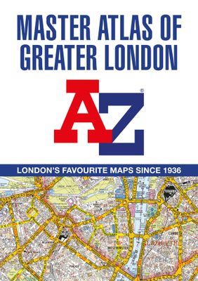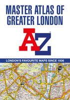
Wegenatlas A -Z Master Atlas of Greater London | A-Z Map Company

0
De ultieme stratengids van Londen en directe omgeving. Super gedetailleerd en alle straten staan er op, met een enorm register bovendien. The ultimate street atlas to navigate your way around London. A comprehensive paperback street atlas of London encompassing an area of 1450 square miles with coloured street mapping, and including more than 90,0...

Verkopers met dit product

Webshop
Bezorging
Prijs
DeZwerver.nl logo
DeZwerver.nl
niet bekend
29,95

Anderen bekeken ook

Wegenatlas - Stadsplattegrond London Street Atlas - Londen | A-Z Map Company
Handzame, maar behoorlijk dikke stadsatlas van Londen. Gebonden uitgave, maar toch redelijk makkelijk open ter klappen. Met register achterin. Zeer uitgebried met alle staten en steegjes. Centrumgedeelte met meer details (1:11.000)  dan de kaarten buiten het centrum (1:22.000) First published in 1936, this iconic atlas is a trusted means of finding your way around the capital city.   The main mapping extends beyond Central London from Heathrow Airport to Chingford at a scale of 2.88 inches to 1 mile (4.55 cm to 1 km), featuring postcode districts, one-way streets, the Congestion Charging Zone and Low Emission Zone.   The large-scale street map of Central London – at a scale of 5.75 inches to 1 mile – cover Regent’s Park and Shoreditch, Chelsea and Vauxhall, Hyde Park and Bermondsey.   A comprehensive index lists streets, selected flats, walkways and places of interest, place, area and junction names. Additional healthcare (hospitals, walk-in centres and hospices) and transport …
13,50
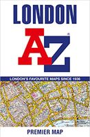
Stadsplattegrond Premier Map London | A-Z Map Company
Grote kaart van Londen, ongeveer 10 kilometer rond Charing Cross - centrum Londen. Uitgebreide kaart met alle straatnamen.  Gedetailleerde stadsplattegrond Londen schaal 1:21.000 met los straatnamenregister. Gebied omvat ca. 10 km rondom Charing Cross, Londen centrum tot aan Acton, Charlton, East Ham, Hendon, Kew Sydenham, Walthamstow, Wembley, Wimbledon   Navigate your way around London with this detailed, easy-to-use, and up-to-date A-Z Premier Map. A full-colour, single sided, fold-out street map, covering a six-mile radius from Charing Cross in Central London. Extending to Muswell Hill to the north, London City Airport to the east, Crystal Palace to the south, and Wembley to the west.   Attached to the cover is a booklet containing a comprehensive index of more than 40,000 streets, along with selected flats, walkways, places of interest, fire stations, hospitals and hospices within this region. Also included on the map are postcode districts, one-way streets, the congestion zon…
14,95
Wegenatlas - Stadsplattegrond Bristol and Bath Streetatlas | A-Z Map Company
Navigate your way around Bristol and Bath with this detailed and easy-to-use A-Z Street Atlas. Printed in full-colour, paperback format, this atlas contains 104 pages of continuous street mapping. More than 12,800 streets indexed. Large scale 6.25 inches to 1 mile map. Areas covered include: Avonmouth, Bradley Stoke, Filton, Keynsham, Kingswood, Mangotsfield, Portishead, Yate, Frampton Cotterell, Chipping Sodbury, Oldland, Swainswick, Batheaston, University of Bath, Combe Down, Bath Spa University, Saltford, Whitchurch, Bedminster, Long Ashton, Easton-in-Gordano, Cribbs Causeway. Also included are large scale city centre maps of both Bristol and Bath and a postcode map of the atlas area. Postcode districts, one-way streets and safety camera locations with their maximum speed are featured on the street mapping. A comprehensive index lists streets, selected flats, walkways and places of interest, place, area and station names. Additional healthcare (hospitals, walk-in centres and hospi…
20,95
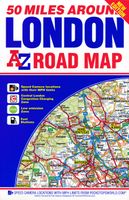
Wegenkaart - landkaart 50 Miles Around London Road Map | A-Z Map Company
This A-Z 50 Miles around London map is a full colour, single sided, fold-out road map featuring continuous mapping extending from Rugby and Bury St. Edmunds to the south coast and from Oxford and Winchester to Margate and Felixstowe in the east.   Published at a clear 3.5 miles to 1 inch the following features are shown on the road mapping:   Motorways open with full junction detail, motorways under construction and proposed, service areas, primary routes and destinations, A & B roads, selected minor roads, gradients 1:5 and steeper, tolls, mileages, county boundaries, spot heights and hill shading Selected safety camera locations with maximum speed limits Selected fuel stations A wide range of ancillary and tourist information South Downs National Park boundary An index to cities, towns, villages, hamlets and locations is adjacent to the map.   Two overview maps are printed on the inside of the cover:   The London Congestion Charging Zone The Greater London Low Emission Zone
9,95
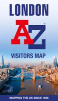
Wegenkaart - landkaart Visitors map London | A-Z Map Company
Clear and easy-to-read map of central London and surrounding area. Contains detailed mapping, presented in a handy compact format. This attractive map, ideal for both tourists and residents, and fully updated, has an extensive area of coverage and displays a wealth of detail.   Fully classified roads Congestion and ULEZ charging zones Postal districts and boundaries clearly depicted Full indexes to street names (on back of map), place names and places of interest Fully updated London underground map conveniently located on the back cover Extends from Hampstead in the north to Clapham in the south and from Hammersmith in the west to Greenwich in the east.   The perfect map for exploring London whether you are a tourist or a local.   Scale: 1:17,500 (3.6 inches to 1 mile)
12,50
Wegenatlas Wales road atlas | A-Z Map Company
Handige wegenatlas op A5 formaat, makkelijk te gebruiken met grote letters en heel goed leesbaar. De schaal is behoorlijk gedetaileerd en zeker ook voor fietsers goed te gebruiken. Met veel aanduidingen van toeristisch interessante plekken. Full-colour road atlas of Wales, with extended coverage into England and including all the major routes into the country. The detailed road mapping also includes Liverpool, Warrington, Nantwich, Shrewsbury, Hereford, Bristol and Severn River Crossings.   Published at a clear 2.5 miles to 1 inch the following features are shown on the road mapping:   Motorways open with full junction detail, motorways under construction and proposed, motorway service areas, primary routes and destinations, A and B roads, selected minor roads, gradients 1:5 and steeper, tolls, mileages, national and county boundaries, spot heights and hill shading Selected places of interest, tourist information centres and golf courses National Park boundaries for Snowdonia, …
11,95
Wegenatlas Road Atlas Britain 2025 - A4 | AA Publishing
Wegenatlas, met spiraal,  van Groot-Brittannie, Engeland, Wales en Schotland, met toeristische informatie This top-selling road atlas showcases Britain’s clearest mapping from the experts at the AA at a large 3.2 miles to 1 inch scale. Each page has been titled with its geographical location so you can turn to the page you need more easily. Wide and narrow minor roads, National Trust, English and World Heritage sites and hard-to-find places are shown. There are 112 city, town, port and airport plans, full colour country, unitary and administrative area map and a comprehensive 31,500 entry index with airports, top tourist sites and motorway services listed. Plus, scenic routes, over 1,800 golf courses and the top 300 AA-Inspected caravan and camping sites symbolised on the mapping. Motorway maps, ferry planning information and 5 district maps provide the essential motoring content for travelling the country. 10 pages of central London street mapping with index. District maps of Birm…
24,95
Stadsplattegrond Pocket Street Map Bath | A-Z Map Company
This up-to-date detailed A-Z street map includes more than 1,700 streets in and around Bath. This street map includes the following: Postcode districts, one-way streets and car parks Tourist attractions and places of interest marked On the reverse side of the map there is a handy index to streets, places of interest, place and area names, park and ride sites, national rail stations, hospitals and hospicesIdeal companion to a sat-nav - it enables route planning and route sense-checking Extensive mapping covers an area from Charlcombe in the north to Combe Down in the south, and from Bathampton Down in the east to Whiteway in the west. With clear mapping at a scale of 5.5 inches to 1 mile, this is the perfect reference map for finding your way around Bath.
7,95
Stadsplattegrond Streetwise London | Michelin
Handige stadsplattegrond van Londen in de vorm van een uitklapkaart, die aan twee zijden bedrukt is. Prettig leesbaar, helder kaartbeeld, met een register en een kleine kaart van het openbaar vervoer. Deze kaart is geplastificeerd. REVISED 2023Streetwise London Map is a laminated city center map of London, England. The accordion-fold pocket size travel map includes a London Underground map with tube lines & stations. Cover includes:Main London City Map 1:20,000London Underground Map - London Tube MapDimensions: 4" x 8.5" folded, 8.5" x unfoldedLondon is one of the most popular, populated and accessible cites on earth.   People love London. And why not? Londoners are charming and helpful, and their city operates on such a high dosage of civility that it could be considered an art form. London is an urban oasis where you can search out cutting edge design, cuisine, fashion, chic neighborhoods, or traditional culture.   When visiting London, be prepared to walk. Whether its basic window …
9,95
Stadsplattegrond Pocket Street Map Liverpool | A-Z Map Company
Navigate your way around Liverpool with detailed street maps from A-Z This fully updated, folded map covers all of Central London, including: Regent's Park, King's Cross, The Barbican, Spitalfields, Tower Bridge, The South Bank, Waterloo Station, Westminster, South Kensington, Paddington Station and Lord's Cricket Ground.   The large scale 1 mile to 5.5 inch (1 km to 8.68 cm) street map includes the following:   • Places of interest   • One-way streets and car parks   • Index to streets, places of interest, place and area names, park and ride sites, national rail stations, hospitals and hospices   • Separate lists of streets, places of interest, cinemas, theatres and stations (which include London Underground, National Rail and Docklands Light Railway stations)   • A central London Underground Map is printed on the back cover.   The perfect reference map for finding your way around Central London.
7,95

Klanten-reviews van Wegenatlas A -Z Master Atlas of Greater London | A-Z Map Company

Er zijn nog geen beoordelingen voor dit productBen jij de eerste die een review plaatst?

Meer over Wegenatlas A -Z Master Atlas of Greater London | A-Z Map Company

Productomschrijving

De ultieme stratengids van Londen en directe omgeving. Super gedetailleerd en alle straten staan er op, met een enorm register bovendien.

The ultimate street atlas to navigate your way around London. A comprehensive paperback street atlas of London encompassing an area of 1450 square miles with coloured street mapping, and including more than 90,000 streets and other addresses. The coverage extends beyond the Greater London and M25 area to: Hemel Hempstead, St.   Albans, Potters Bar, Waltham Cross, Epping, Brentwood, Thurrock, Stanford-le-Hope, Gravesend, Wrotham, Sevenoaks, Westerham, Oxted, Redhill, Reigate, Leatherhead, Great Bookham, Woking, Egham, Windsor, Slough, Chalfont St. Peter, Chorleywood, Bovingdon There are eighteen pages of large scale (9" to 1 mile) street mapping of central London which gives additional clarity and detail, this mapping extends to: Regent's Park, St. Pancras International Station, Old Street, Tower Bridge, Bricklayer's Arms Junction, Vauxhall Bridge, South Kensington, Paddington Station and Lord's Cricket Ground.   Postcode districts and one-way streets are included on the street mapping. Other features include:* The Congestion Charging Zone (CCZ) boundary which is shown on both scales of mapping and an overview map of the zone is also included. * The Greater London Low Emission Zone boundary is shown on the street mapping and an overview map of the zone is also included.   * The Ultra Low Emission Zone (ULEZ) boundary* There are eight pages of road mapping at 3 miles to 1 inch that cover much of the Home Counties area. * The London Underground map. * The London Rail Connections map.   * West End Cinema and Theatre maps. The index section of the atlas lists streets, selected flats, walkways and places of interest, junction, place and area names; hospitals, hospices and NHS Walk-in Centres. Also included are National Rail stations, Croydon Tramlink stops, Docklands Light Railway stations, London Underground stations and River Boat stops covered by this atlas.


Verken gerelateerde categorieën

Webshop.nl maakt gebruik van cookies. Ga je verder op onze website, ga dan akkoord met het plaatsen van cookies en de verwerking van deze data door ons en vermelde partners.