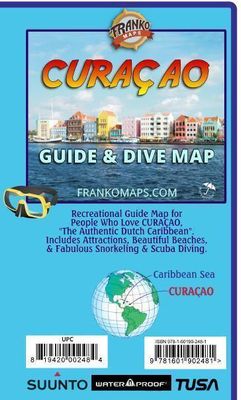
Waterkaart Curaçao Guide & Dive Map | Franko Maps

0
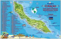
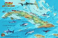
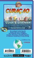
Your guide to outdoor activities in the Authentic Dutch Caribbean!   Side 1 covers the entire island with locations and descriptions of all the dive and snorkeling spots. Lots of additional guidebook-type information on other activities. Illustrations of Curacao's coral reef creatures.   Side 2 has extreme detail of the Willemstad Area with insets...

Verkopers met dit product

Verkoper
Bezorging
Prijs
DeZwerver.nl logo
DeZwerver.nl
niet bekend
10,95

Anderen bekeken ook

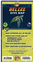
Waterkaart Belize Dive Map | Franko Maps
This is a map and a guidebook for divers and snorkelers rolled into one! Side One is a map of the entire Belize coastline, cayes, reefs, islands and atolls. Dive and snorkeling sites are shown along with natural features, parks and more. Nearly 100 fish and other reef creatures are beautifully illustrated. Side Two offers more detailed mapping of Ambergris Caye, Placencia Reefs and The Atolls of Belize (Turneffe Atoll, Lighthouse Reef and Glovers Reef) with detailed dive site descriptions. 18.5" x 26", folded to 4" x 9". Printed on waterproof, tear-resistant StonePaper.
10,95
Nieuw
Wegenkaart - landkaart Curacao | Kasprowski Maps
Bijzonder gedetailleerde kaart (1:55000) van alleen het eiland Curacao. Zowel de wegen als ook de wandelpaden staan er op vermeld. Stranden, interessante plekken en bovendien de meeste duikplakken staan met diepte helder weergegeven op de kaart. Met stadsplattegrond van Willemstad. The most up-to-date and only complete road map of Curaçao (Scale 1 : 55 000), as well as the entire Willemstad urban area on the reverse, spanning from the international airport to Spanse (Scale 1 : 18 500). Insets of the Willemstad center (Scale 1 : 8 000), Grote Berg (Scale 1 : 6 000), Tera Kora (Scale 1 : 6 000), Barber (Scale 1 : 6 000), and the island Klein Curaçao (Scale 1 : 55 000) are also included. All maps and insets come with thorough street indexes.   The map shows all the island's known roads and streets with their names, displays its many diving sites, and indicates an extensive set of biking routes and hiking trails..   The double-sided map is sold folded, measuring 4 7/8" x 8 7/8" ( 12.5 cm …
18,50
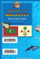
Waterkaart Republic of Maldives Map & Dive Guide | Franko Maps
De Malediven zijn een top internationale bestemming voor duiken. Kant één is een gedetailleerde kaart van de Republiek Malediven. Atollen en belangrijke plaatsen zijn aangegeven. Duiklocaties zijn gemarkeerd. Kant twee biedt uitvergrotingen van Malé, Addu City en Fuvahmulah. De kaart is versierd met prachtige illustraties van vissen en andere koraalrifwezens. Papier, 12" x 18" (ongeveer 30,5 cm x 45,7 cm), gevouwen tot een handig formaat van 4" x 6" (ongeveer 10,2 cm x 15,2 cm). Maldives is a top international destination for diving. Side one is a detailed map of Republic of Maldives. Atolls and major places are named. Dive sites located. Side two offers blow-ups of Mal√©, Addu City and Fuvahmulah. The map is decorated with beautiful illustrations of fish and other coral reef creatures. Paper, 12" x 18", folded to a handy 4" x 6".
10,95
Wegenkaart - landkaart Explorer Map North Queensland | Hema Maps
Detailkaart van een deel van Australië. Zeer goed leesbaar, met naast de topografische details veel symbolen waarmee allerhande toeristische zaken worden aangeduid als campsites, nationale parken, attracties, wandelmogelijkheden etc. Covering Australia's beautiful North Queensland. There is alot of town map insets, tourist information, and photographs on the reverse side Touring map of the northern half of Queensland, with enlargements of popular areas, street plans, lists of facilities, etc. The main map extends south to well beyond the Flinders Highway between Townsville and Mount Isa, including Mackay on the coast. The map shows the road network, including minor roads and unsurfaced tracks, plus railways and local airfields/aerodromes. Designated Tourist Routes are highlighted and symbols mark places of interest (many annotated with brief description), historical sites, tourist resorts, youth hostels, etc. Topography is indicated by names of mountain ranges and peaks, as well as by…
17,50
Reisgids Mini Rough Guide Antigua & Barbuda | Rough Guides
Een kleinere versie in zakformaat van de grotere versies van de Rough Guides. Als altijd weer vol met goede informatie over cultuur en praktische zaken. Achterin kleine plattegronden. This pocket-sized guide is a convenient, quick-reference companion to discovering what to do, what to see and how to get around Antigua & Barbuda. It covers top attractions like the Cathedral of St John the Divine, Radcliffe Quay and Nelson's Dockyard, as well as hidden gems, including a trip to Betty's Hope, Antigua's first sugar plantation and a valuable heritage site, a relaxing day at Half Moon Bay, considered to be one of the best in the world, and a boat ride to Great Bird Island, where birdwatching, picnics on the pristine beach and snorkeling in crystal clear waters is par for the course. This will save you time, and enhance your exploration of this fascinating islands. This title has been fully updated post-COVID-19.   This Mini Rough Guide to Antigua & Barbuda covers: St John's; The north coast…
12,50
Nieuw
Wandelkaart - Topografische kaart 318 Mount Rogers High Country - Grayson Highlands State Park | National Geographic
Prachtige geplastificeerde kaart van het bekende nationaal park. Met alle recreatieve voorzieningen als campsites, maar ook met topografische details en wandelroutes ed. Door uitgekiend kleurgebruik zeer prettig in gebruik. Scheur en watervast!   National Geographic's Trails Illustrated map of Mount Rogers High Country and Grayson Highlands State Park, Southwest Virginia, is a two-sided, waterproof, topographic trail map designed to meet the needs of outdoor enthusiasts with unmatched durability and detail. This map was created in cooperation with local land management agencies and is loaded with valuable recreation information for exploring the area's large rock formations, spruce-fir forests, and the highest peak in Virginia. Trails and major roads, including the Appalachian Trail, the Virginia Creeper Trail, and the Virginia Highland Horse Trail, are clearly distinguished. Places of interest include areas for camping, picnicking, fishing, hiking, mountain biking, horseback riding, …
17,95
Nieuw
Wegenkaart - landkaart Bonaire | Kasprowski Maps
Bijzonder gedetailleerde kaart (1:40000) van alleen het eiland Bonaire. Zowel de wegen als ook de wandelpaden staan er op vermeld. Stranden, interessante plekken en bovendien de meeste duikplakken staan met diepte helder weergegeven op de kaart. Met stadsplattegrond van Kralendijk. The most up-to-date and only complete road map of Bonaire ( Scale 1 : 28 000 ), as well as the Kralendijk urban area, spanning from Santa Barbara Crowns, through the airport, to Punt Vierkant (Scale 1 : 15 000). An inset of Rincon (Scale 1 : 12 000) is also included. All maps and insets come with thorough street indexes.   All of the official diving sites around Bonaire and Klein Bonaire are displayed, most of them with their GPS locations, as recorded by STINAPA, the island's official conservation foundation.   The map shows all the island's known roads and streets with their names, as well as an extensive set of biking routes and kayaking trails.   The map is sold folded, measuring 5 1/4" x 9 5/8" ( 13.5 …
18,50
Reisgids U.S. & British Virgin Islands - Maagden eilanden | Fodor's Travel
Whether you want to sail in Tortola, snorkel at Trunk Bay Beach, or explore the Baths in Virgin Gorda, the local Fodor's travel experts in the Virgin Islands are here to help! Fodor's U.S. & British Virgin Islands guidebook is packed with maps, carefully curated recommendations, and everything else you need to simplify your trip-planning process and make the most of your time. This new edition has been fully-redesigned with an easy-to-read layout, fresh information, and beautiful color photos.   Fodor's U.S. & British Virgin Islands travel guide includes:AN ILLUSTRATED ULTIMATE EXPERIENCES GUIDE to the top things to see and doMULTIPLE ITINERARIES to effectively organize your days and maximize your time15 DETAILED MAPS to help you navigate confidentlyCOLOR PHOTOS throughout to spark your wanderlust!HONEST RECOMMENDATIONS FROM LOCALS on the best sights, restaurants, hotels, shopping, activities, and morePHOTO-FILLED "BEST OF" FEATURES on "The U.S. & British Virgin Islands' Best Beaches,…
20,95
Wegenkaart - landkaart Jasper National Park (Alberta) | Gem Trek Maps
Waterproof and tear-resistant map for Jasper National Park in the Canadian Rockies.   Whether you are a first-time visitor or a long-time local, you’ll find Gem Trek’s Jasper National Park Map to be an invaluable tool. Researched and designed by locals, and printed in Canada, this map features accurate cartography and subtly colored relief that puts the mountainous region in perspective. The map is printed on high-quality synthetic waterproof paper that can be folded and refolded hundreds of times.   The 1:250,000 scale is ideal for discovering the very best of Jasper National Park. Highlights and our recommended hiking trails are marked by numbered stars, then cross-referenced on the reverse side with descriptions. Also included are all mountains and their elevations, along with natural features such as waterfalls, hot springs, and glaciers.   In addition to descriptions for the top highlights and most popular hiking trails, the reverse side has inset maps for the town of Jasp…
16,95

Klanten-reviews van Waterkaart Curaçao Guide & Dive Map | Franko Maps

Er zijn nog geen beoordelingen voor dit productBen jij de eerste die een review plaatst?

Meer over Waterkaart Curaçao Guide & Dive Map | Franko Maps

Productomschrijving

Your guide to outdoor activities in the Authentic Dutch Caribbean!   Side 1 covers the entire island with locations and descriptions of all the dive and snorkeling spots. Lots of additional guidebook-type information on other activities. Illustrations of Curacao's coral reef creatures.   Side 2 has extreme detail of the Willemstad Area with insets of Otrobanda and Punda.   18.5" x 26", folded to 4" x 9". Printed on waterproof, tear-resistant material.
Webshop.nl maakt gebruik van cookies. Ga je verder op onze website, ga dan akkoord met het plaatsen van cookies en de verwerking van deze data door ons en vermelde partners.