webshop.nl
Categorieën
  Sluiten

Meer ITMB
Meer ITMB in Literatuur boeken

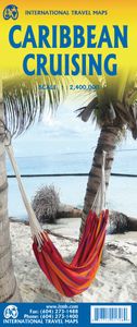
Waterkaart Caribbean Cruising | ITMB

0
The Caribbean Sea is one of the most popular cruising destinations in the world. This colourful double-sided map starts just north of Orlando/Tampa in order to show the northernmost Bahamian islands and south as far as the Panama Canal at Colon and the coast of Venezuela. The map shows good detail for each island and the legal boundaries of each is...

Webshops met dit product

Webshop
Bezorging
Prijs

Anderen bekeken ook

Waterkaart Caribbean Cruising | ITMB
The Caribbean Sea is one of the most popular cruising destinations in the world. This colourful double-sided map starts just north of Orlando/Tampa in order to show the northernmost Bahamian islands and south as far as the Panama Canal at Colon and the coast of Venezuela. The map shows good detail for each island and the legal boundaries of each island nation. Side 1 concentrates on the western Caribbean, essentially the Bahamas, Cuba, Jamaica, and the Cayman Islands. Here’s a fun fact most of you won’t know: tiny Navassa Island between Haiti and Jamaica is claimed by both the USA and Haiti! Side 2 concentrates on the eastern islands of the Caribbean, such as Hispaniola (Haiti and the Dominican Republic), Puerto Rico and the US and British Virgin Islands, Turks & Caicos, and the Lesser Antilles chain of island countries, such as Antigua, Guadeloupe, Barbados, and Trinidad/Tobago, among others. Coverage then extends westward along the Venezuelan coastline to include the Dutch possession…
14,95
Wegenkaart - landkaart South Pacific Cruising & Samoa | ITMB
Een overzichtskaart van de zuidelijke Stille Oceaan met de cruise routes tussen de verschillende eilanden aangegeven. Op de achterzijde een overzichtskaart van Samoa This is a new venture for ITMB. Cruising is a rapidly-growing segment of the travel industry, experiencing double-digit growth rates annually. Obviously, this is a thriving market. In conjunction with several cruise ship lines, we have prepared a map of the South Pacific Ocean, which extends southwards from Hawai'i to the southern tip of New Zealand and eastwards from central Australia/Papua New Guinea to the Pitcairn Islands. Thus, it does not include the popular South East Asia and China coast routes. We think this has to change at a time when 25,000,000 people are travelling by cruise ships. At the same time, we must keep coverage area relevant for those end users of the artwork. Even at 1:12M, most of the area covered is water, with island countries such as Fiji, Tonga, Kiribati, Tahiti, and the Cook Islands being visi…
13,95
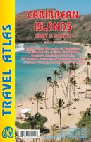
Wegenatlas Travel Atlas Caribbean Island East Half | ITMB
The Caribbean is difficult to map as an entity. It consists of vast amounts of water with dozens of micro-level islands. Last year, ITMB introduced the islands of the Western Caribbean (essentially, Cuba, Hispaniola, Jamaica, Puerto Rico, and the Bahamas). Now we are completing the area with the release of this book atlas, covering the eastern and southern island countries. Traditionally, these were called the Leeward and Windward Islands, but we feel that the term Eastern Caribbean is more commonly used by cruise ships and we made up the name South to include Trinidad/Tobago and the Dutch colonies of Aruba, Bonaire, and Curacao. The list of islands included in this atlas is lengthy and includes Barbados, Grenada,Guadeloupe/Martinique, St. Kitts/Nevis, St. Lucia, St. Vincent, and both sets of Virgin Islands, in detail. Like its counterpart, this atlas would be an excellent travel companion for anyone cruising the Caribbean (on a huge liner or in a yacht). It has 160 pages of maps and i…
16,50
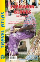
Wegenatlas Travel Atlas Caribbean Island West Half | ITMB
Wegenatlas voor de westelijke Caraïbische eilanden - verschillende schalen : Bahamas, Turks- en Caicoseilanden, Cuba, Kaaimaneilanden, Jamaica, Dominikaanse Republiek, Puerto Rico. Met inzetjes van Freeport, Nassau, Havana, Varadero, Georgetown, Kingston, Port-au-Prince, Santo Domingo, San Juan   The Caribbean is a particularly difficult part of the world to map effectively. It is a combination of larger islands in the west and a string of small islands in the east. Some can be shown as separate maps, but others are too small (or too lacking in market appeal) to be mapped adequately as folded paper maps. This atlas covers the Bahamas and the Turks and Caicos Islands in the north with Cuba, the Cayman Islands, Jamaica, the Dominican Republic, and Puerto Rico in scales ranging from 1:18,000 for Puerto Rico to 1:600,000 for Cuba The atlas is the same size as all ITM atlases (8''x5'' or 21x13.5cm) and has a straight spine edge with title for displaying spine outwards on store shelves, if d…
16,50
Wegenkaart - landkaart US Virgin Islands & Puerto Rico | ITMB
Puerto Rico: schaal 1:190.000 US Virgin Islands: schaal 1:50.000   We are really pleased with this new edition of Puerto Rico. We spent part of August, 2020, touring the island and geo-referencing its many highways. The island is bigger and more densely road-networked than we thought, so we'll have to complete the job on our next visit, but the roads are now much more precisely shown accurately than was possible before satellite imagery. The map looks great on an Ipad screen as well. The map also shows updated inset maps of San Juan, Ponce, Mayaguez, Aguadilla, and Arecibo. Puerto Rico is part of the United States, so has all the benefits, but is internally self-governing. With this edition we are including a map of the other US colonial territory, the US Virgin Islands. The Danish West Indies was purchased from Denmark in 1917 and is an integral part of the USA, with all its benefits, but is, like Puerto Rico, neither fish nor fowl. It is internally self-governing and a great retireme…
13,95
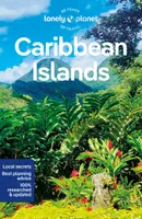
Reisgids Caribbean Islands | Lonely Planet
De perfecte reisgids voor zowel de georganiseerde als de zelfstandige reiziger. Naast een algemene inleiding van het land / streek vol met praktische informatie over hoe je er het beste kunt reizen: slapen, eten, vervoer, excursies ... alles kun je er in vinden. Lonely Planet’s Caribbean Islands is our most comprehensive guide that extensively covers all the country has to offer, with recommendations for both popular and lesser-known experiences. Set sail from Tortola, snorkel in Aruba's clear waters, and feel the music in Cuba; all with your trusted travel companion.   Inside Lonely Planet’s Caribbean Islands Travel Guide:     Lonely Planet’s Top Picks - a visually inspiring collection of the destination’s best experiences and where to have them    Itineraries help you build the ultimate trip based on your personal needs and interests Local insights give you a richer, more rewarding travel experience - whether it’s history, people, music, landscapes, wildlife, politics   Ea…
23,95
Wegenatlas Travel Atlas Caribbean Island West Half | ITMB
Wegenatlas voor de westelijke Caraïbische eilanden - verschillende schalen : Bahamas, Turks- en Caicoseilanden, Cuba, Kaaimaneilanden, Jamaica, Dominikaanse Republiek, Puerto Rico. Met inzetjes van Freeport, Nassau, Havana, Varadero, Georgetown, Kingston, Port-au-Prince, Santo Domingo, San Juan   The Caribbean is a particularly difficult part of the world to map effectively. It is a combination of larger islands in the west and a string of small islands in the east. Some can be shown as separate maps, but others are too small (or too lacking in market appeal) to be mapped adequately as folded paper maps. This atlas covers the Bahamas and the Turks and Caicos Islands in the north with Cuba, the Cayman Islands, Jamaica, the Dominican Republic, and Puerto Rico in scales ranging from 1:18,000 for Puerto Rico to 1:600,000 for Cuba The atlas is the same size as all ITM atlases (8''x5'' or 21x13.5cm) and has a straight spine edge with title for displaying spine outwards on store shelves, if d…
16,50
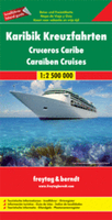
Wegenkaart - landkaart Caribbean Cruises - Cruises in Caraibisch Gebie
Karibik Kreuzfahrten - Antigua - Barbados - Dominikanische Republik - Grenada - Guadeloupe - Haiti - Jamaika - Kuba - Martinique -Nevis - Panamakanal - Puerto Rico - St. Kitts - St. Lucia - St. Vincent Zeer handige kaart voor iedereen die meerdere eilanden via een cruise gaat doet in dit gebied. Voor en achterzijde vol met kaartmateriaal en feiten per eiland. Explore the Caribbean Islands with this Freytag & Berndt map. The best way to plan your trip, prepare your itinerary, and to travel independently in this country. As with all Freytag & Berndt maps the cartography is clear and detailed with the topography shown by relief shading with plenty of spot heights.   One side features a map of the Carribean with information insets on countries bordering the Carribean, for example Cuba, Jamacia, Florida, Haiti. The flipside includes detailed information about the islands found in the Carribean.    Freytag & Berndt maps make good use of an icon system. Icons show tourist information such as:…
14,95

Klanten-reviews van Waterkaart Caribbean Cruising | ITMB

Er zijn nog geen beoordelingen voor dit productBen jij de eerste die een review plaatst?

Meer over Waterkaart Caribbean Cruising | ITMB

Productomschrijving

The Caribbean Sea is one of the most popular cruising destinations in the world. This colourful double-sided map starts just north of Orlando/Tampa in order to show the northernmost Bahamian islands and south as far as the Panama Canal at Colon and the coast of Venezuela. The map shows good detail for each island and the legal boundaries of each island nation. Side 1 concentrates on the western Caribbean, essentially the Bahamas, Cuba, Jamaica, and the Cayman Islands. Here’s a fun fact most of you won’t know: tiny Navassa Island between Haiti and Jamaica is claimed by both the USA and Haiti! Side 2 concentrates on the eastern islands of the Caribbean, such as Hispaniola (Haiti and the Dominican Republic), Puerto Rico and the US and British Virgin Islands, Turks & Caicos, and the Lesser Antilles chain of island countries, such as Antigua, Guadeloupe, Barbados, and Trinidad/Tobago, among others. Coverage then extends westward along the Venezuelan coastline to include the Dutch possessions of Aruba, Bonaire, and Curacao. Interestingly, there is a small island called Isla Mona west of Puerto Rico on the map that I have never heard of. There are also two Bonaire islands. This is a very interesting map! The most popular cruise line routes are shown; most start either from Puerto Rico or from southern Florida. The map also includes a Top Attractions list, and dozens of local points of interest related to each island.

Productspecificaties

Artikelnummer(s)
Brand
ITMB

Verken gerelateerde categorieën

Webshop.nl maakt gebruik van cookies. Ga je verder op onze website, ga dan akkoord met het plaatsen van cookies en de verwerking van deze data door ons en vermelde partners.