Waterkaart Belize Dive Map | Franko Maps

0
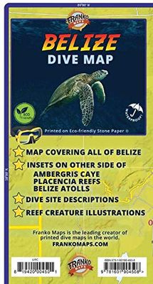
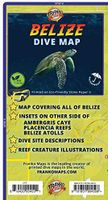
This is a map and a guidebook for divers and snorkelers rolled into one! Side One is a map of the entire Belize coastline, cayes, reefs, islands and atolls. Dive and snorkeling sites are shown along with natural features, parks and more. Nearly 100 fish and other reef creatures are beautifully illustrated. Side Two offers more detailed mapping of ...

Verkopers met dit product

Verkoper
Bezorging
Prijs
DeZwerver.nl logo
DeZwerver.nl
niet bekend
10,95

Anderen bekeken ook

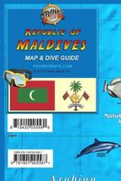
Waterkaart Republic of Maldives Map & Dive Guide | Franko Maps
De Malediven zijn een top internationale bestemming voor duiken. Kant één is een gedetailleerde kaart van de Republiek Malediven. Atollen en belangrijke plaatsen zijn aangegeven. Duiklocaties zijn gemarkeerd. Kant twee biedt uitvergrotingen van Malé, Addu City en Fuvahmulah. De kaart is versierd met prachtige illustraties van vissen en andere koraalrifwezens. Papier, 12" x 18" (ongeveer 30,5 cm x 45,7 cm), gevouwen tot een handig formaat van 4" x 6" (ongeveer 10,2 cm x 15,2 cm). Maldives is a top international destination for diving. Side one is a detailed map of Republic of Maldives. Atolls and major places are named. Dive sites located. Side two offers blow-ups of Mal√©, Addu City and Fuvahmulah. The map is decorated with beautiful illustrations of fish and other coral reef creatures. Paper, 12" x 18", folded to a handy 4" x 6".
10,95
Nieuw
Wegenkaart - landkaart 3106 Adventure Map Belize | National Geographic
Wegenkaart van Belize met vermelding van veel bezienswaardigheden, nationale parken en attrakties. Watervast en scheurvast. Juist door deze vermeldingen onderscheidt de kaart zich van andere wegenkaarten. National Geographics Belize Adventure Map details the countrys numerous protected areas including its National Parks, preserves, wildlife sanctuaries, archeological reserves, marine reserves, spawning grounds and private reserves. UNESCO World Heritage sites and the locations of archeological ruins are highlighted, along with the locations of popular places for diving, surfing, fishing, and more. A detailed road network, plus inset maps of Belize City and San Pedro, including the location of key infrastructure and pointsof-interest, make the Belize AdventureMap ideal for touring both urban and remote destinations. The reverse of the Belize AdventureMap contains detailed interpretive information to Belize's Blue Hole, the ruins of Tikal in Guatemala, The Barrier Reef System, plus info…
17,50
Duikgids Curacao | Yellow Pear Press
The Definitive Guide to Scuba Diving and Snorkeling in Curaçao #1 New Release in Scuba Travel Guides and in Aruba & Netherlands Antilles Travel   From the authors of the Reef Smart Guides series comes Reef Smart Guides Curaçao, a unique and essential scuba, snorkel, and surf travel guide for the island of Curaçao─one of the top shore diving and snorkeling islands in the Caribbean.   A great travel gift. The ultimate guide for visitors and locals looking to explore the underwater world in Curaçao. This guidebook provides detailed descriptions and imagery of the island’s best dive and snorkel sites, including shipwrecks and coral reefs. The guide also details popular beaches, surfing and kiteboarding sites and gives recommendations for dive operators to use and restaurants to visit.   Detailed descriptions and 3D maps. With the help of Reef Smart’s unique 3D-mapping technology, learn all you need to know about the region’s top dive and snorkel sites, including the world famous Superior …
42,50
Nieuw
Wegenkaart - landkaart Belize | Borch
Mooie, geplastificeerde kaart van Belize. Deze kaart biedt een goed overzicht van het land met detailkaarten.   Our soft-laminated folded map of Belize in the 5th edition shows: Belize 1:500 000, Belize City 1:13 000, San Ignacio & Santa Elena 1:25 000, Yucatan Peninsula 1: 2 750 000, Ambergris Caye & Caye Caulker 1:250 000, the Maya sites Altun Ha 1:3 000, Cahal Pech 1:2 500, Caracol 1:7 000, Cerros 1:4 000, El Pilar 1:8 000, Lamanai 1:9 000, Lubaantun 1:5 000, Nim Li Punit 1: 7 000, Xunantunich 1:7 000 and Belize administrative. Borch Maps are easy to fold, durable and water-repellent with a wipeable surface. Borch Maps show hotels, museums, monuments, markets, public transport, top sights and points of interest, useful statistics, conversion charts for temperatures, weights and measurements, climate charts showing temperatures, sunshine hours, precipitation and humidity, overview maps, and much more...   Known as British Honduras until about 1973, Belize is today no longer a Bri…
11,50
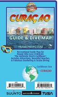
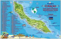
Waterkaart Curaçao Guide & Dive Map | Franko Maps
Your guide to outdoor activities in the Authentic Dutch Caribbean!   Side 1 covers the entire island with locations and descriptions of all the dive and snorkeling spots. Lots of additional guidebook-type information on other activities. Illustrations of Curacao's coral reef creatures.   Side 2 has extreme detail of the Willemstad Area with insets of Otrobanda and Punda.   18.5" x 26", folded to 4" x 9". Printed on waterproof, tear-resistant material.
10,95
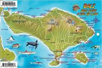
Waterkaart Fish Card Bali Dive Guide & Fish ID Card / Indonesian Coral Reef Creatures | Franko Maps
Handige kleine geplastificeerde kaart met een overzicht van de meest voorkomende vissen die je onder water kunt tegenkomen. Makkelijk met een koord aan je pols te doen!  Perfect for divers, snorkelers and adventurers! Side One is a mini-map of Bali with major dive located. Side Two is a reef creatures identification guide with nearly 100 species illustrated and named. This convenient, waterproof reference is made of rigid, laminated plastic with hole for lanyard. Ca. 20 x 10 cm
7,50
Waterkaart Fish Card Curaçao Dive Sites & Fish ID Card / Coral Reef Creatures | Franko Maps
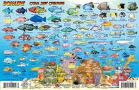
Handige kleine geplastificeerde kaart met een overzicht van de meest voorkomende vissen die je onder water kunt tegenkomen. Makkelijk met een koord aan je pols te doen!   Side One is a mini-map of Curacao.. More than 80 dive and snorkeling sites are located and named.   Side Two is a fish and reef creature identification guide with 100+ species beautifully illustrated.   This convenient, waterproof reference is laminated with hole for lanyard, ca. 20 x 10 cm.
7,50
Nieuw
Wegenkaart - landkaart 3502 Adventure Map Australia East - Australië Oost | National Geographic
Wegenkaart van Australië Oost met vermelding van veel bezienswaardigheden, nationale parken en attrakties. Watervast en scheurvast. Juist door deze vermeldingen onderscheidt de kaart zich van andere wegenkaarten. National Geographic's Australia East AdventureMapis designed to meet the unique needs of adventure travelers with its durability and detailed, accurate information. The map includes the locations of thousands of cities and towns with a user-friendly index, plus a clearly marked road network complete with distances and designations for major highways, main roads, plus tracks and trails for those seeking to explore more remote regions.    The Australia East AdventureMap differs from a traditional road map because it includes hundreds of points of interest that highlight diverse and unique destinations within the country. National parks, World Heritage sites, caves, archeological sites, aboriginal settlements and protected lands are included, making it an invaluable resource to …
17,50

Klanten-reviews van Waterkaart Belize Dive Map | Franko Maps

Er zijn nog geen beoordelingen voor dit productBen jij de eerste die een review plaatst?

Meer over Waterkaart Belize Dive Map | Franko Maps

Productomschrijving

This is a map and a guidebook for divers and snorkelers rolled into one! Side One is a map of the entire Belize coastline, cayes, reefs, islands and atolls. Dive and snorkeling sites are shown along with natural features, parks and more. Nearly 100 fish and other reef creatures are beautifully illustrated. Side Two offers more detailed mapping of Ambergris Caye, Placencia Reefs and The Atolls of Belize (Turneffe Atoll, Lighthouse Reef and Glovers Reef) with detailed dive site descriptions. 18.5" x 26", folded to 4" x 9". Printed on waterproof, tear-resistant StonePaper.

Webshop.nl maakt gebruik van cookies. Ga je verder op onze website, ga dan akkoord met het plaatsen van cookies en de verwerking van deze data door ons en vermelde partners.