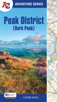
Wateratlas Adventure Atlas Peak District (Dark Peak) | A-Z Map Company

0
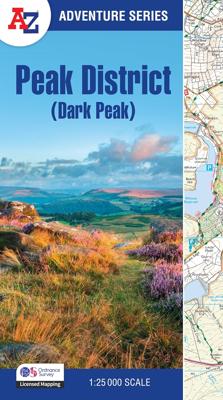
The A-Z Adventure Series uses Ordnance Survey mapping and is the perfect companion for walkers, off-road cyclists, and anyone wishing to explore the great outdoors. This A-Z Adventure Atlas of the Peak District (Dark Peak) features 50 pages of continuous Ordnance Survey mapping covering: Peak District National Park (northern part) Kinder Scout ...

Verkopers met dit product

Verkoper
Bezorging
Prijs
DeZwerver.nl logo
DeZwerver.nl
2,95
17,95

Anderen bekeken ook

Wateratlas Adventure Atlas Peak District (Dark Peak) | A-Z Map Company
The A-Z Adventure Series uses Ordnance Survey mapping and is the perfect companion for walkers, off-road cyclists, and anyone wishing to explore the great outdoors. This A-Z Adventure Atlas of the Peak District (Dark Peak) features 50 pages of continuous Ordnance Survey mapping covering: Peak District National Park (northern part) Kinder Scout Hope Valley Hathersage Castleton Snake Pass Derwent Valley This National Trail Map features detailed mapping at a scale of 1:25 000, providing complete coverage of the Peak District (Dark Peak). Additional features include: Information Centres Hotels/B&Bs Youth Hostels Campsites (seasonal opening) Public Houses Shops Restaurants Cafes (seasonal opening) Petrol Stations Other books available in the A-Z Adventure series include: Pembrokeshire Coast Path, Peddars Way and Norfolk Coast Path, South Downs Way, Cotswold Way, South West Coast Path and The North Coast 500.
17,95
Wandelatlas Adventure Atlas Cotswold Way | A-Z Map Company
The A-Z Adventure Series uses Ordnance Survey mapping and is the perfect companion for walkers, off-road cyclists, and anyone wishing to explore the great outdoors. The Cotswold Way is a 102 mile (164 km) National Trail running along the Cotswold Hills. Starting in the historic City of Bath and finishing in Chipping Campden, the clearly marked route passes through numerous places of interest and an abundance of wildlife. This official National Trail Map features detailed Ordnance Survey mapping at a scale of 1:25 000, providing complete coverage of the Cotswold Way. There is also a route planner included to show distances between places and the amenities available making it easy to plan your adventure. Additional features include: Information Centres Hotels/B&Bs Youth Hostels Campsites (seasonal opening) Public Houses Restaurants Shops Cafes (seasonal opening) Petrol Stations Other books available in the A-Z Adventure series include: Peak District (Dark Peak), Peddars Way and…
17,95
Wandelatlas Adventure Atlas Peddars Way and Norfolk Coast Path | A-Z Map Company
The A-Z Adventure Series uses Ordnance Survey mapping and is the perfect companion for walkers, off-road cyclists, and anyone wishing to explore the great outdoors. Together, Peddars Way and the Norfolk Coast Path form a 93 mile (150km) National Trail across west Norfolk and along its northern coast. The route is clearly shown on the map and passes through a rich landscape with fantastic scenery, places of interest, and an abundance of wildlife. This National Trail Map features detailed Ordnance Survey mapping at a scale of 1:25 000, providing complete coverage of Peddars Way and the Norfolk Coast Path. There is also a route planner included to show distances between places and the amenities available making it easy to plan your adventure. Additional features include: Information Centres Hotels/B&Bs Youth Hostels Campsites (seasonal opening) Public Houses Shops Restaurants Cafes (seasonal opening) Petrol Stations Other books available in the A-Z Adventure series include: Peak…
17,95
Wandelatlas 5 Adventure Atlas South West Coast Path - Dorset | A-Z Map Company
AZ heeft de meest gedetailleerde wandelkaarten van delen van het South West Coast Path  gebundeld in een atlasje. Daardoor is het heel handig qua formaat. De kaarten zelf zijn perfect voor het wandelen. Schaal 1:25.000 Plan your next adventure along the Dorset section of the South West Coast Path with trusted mapping from A-Z The perfect companion for those who love the great outdoors, the A-Z Adventure Series features 1:25000 Ordnance Survey mapping in a convenient book, complete with index. The South West Coast Path is a National Trail along the Somerset, Devon, Cornwall and Dorset coasts. This stunning walk from Minehead, Somerset covers 630 miles to South Haven Point in Poole Harbour, passing through two World Heritage Sites (the Jurassic Coast and the Cornwall and West Devon Mining Landscape), Exmoor National Park, Land's End and many areas of outstanding natural beauty.   This A-Z Adventure Atlas of the South West Coast Path: Dorset features 36 pages of continuous Ordnance Su…
17,95
Wandelatlas 3 Adventure Atlas South West Coast Path South Cornwall | A-Z Map Company
AZ heeft de meest gedetailleerde wandelkaarten van delen van het South West Coast Path  gebundeld in een atlasje. Daardoor is het heel handig qua formaat. De kaarten zelf zijn perfect voor het wandelen. Schaal 1:25.000 Plan your next adventure along the South Cornwall section of the South West Coast Path with trusted mapping from A-Z The perfect companion for those who love the great outdoors, the A-Z Adventure Series features 1:25000 Ordnance Survey mapping in a convenient book, complete with index. The South West Coast Path is a National Trail along the Somerset, Devon, Cornwall and Dorset coasts. This stunning walk from Minehead, Somerset covers 630 miles to South Haven Point in Poole Harbour, passing through two World Heritage Sites (the Jurassic Coast and the Cornwall and West Devon Mining Landscape), Exmoor National Park, Land's End and many areas of outstanding natural beauty.   A series of five A-Z Adventure Atlases together cover the South West Coast Path: South West Coast…
17,95
Wandelatlas 4 Adventure Atlas South West Coast Path South Devon | A-Z Map Company
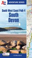
AZ heeft de meest gedetailleerde wandelkaarten van delen van het South West Coast Path  gebundeld in een atlasje. Daardoor is het heel handig qua formaat. De kaarten zelf zijn perfect voor het wandelen. Schaal 1:25.000 Plan your next adventure along the South Devon section of the South West Coast Path with trusted mapping from A-Z The perfect companion for those who love the great outdoors, the A-Z Adventure Series features 1:25000 Ordnance Survey mapping in a convenient book, complete with index. The South West Coast Path is a National Trail along the Somerset, Devon, Cornwall and Dorset coasts. This stunning walk from Minehead, Somerset covers 630 miles to South Haven Point in Poole Harbour, passing through two World Heritage Sites (the Jurassic Coast and the Cornwall and West Devon Mining Landscape), Exmoor National Park, Land's End and many areas of outstanding natural beauty.   This A-Z Adventure Atlas of the South West Coast Path: South Devon features 50 pages of continuous O…
17,95
Wandelatlas 1 Adventure Atlas South West Coast Path North Devon & Somerset | A-Z Map Company
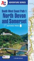
AZ heeft de meest gedetailleerde wandelkaarten van delen van het South West Coast Path  gebundeld in een atlasje. Daardoor is het heel handig qua formaat. De kaarten zelf zijn perfect voor het wandelen. Schaal 1:25.000 Plan your next adventure along the North Devon & Somerset section of the South West Coast Path with trusted mapping from A-Z The perfect companion for those who love the great outdoors, the A-Z Adventure Series features 1:25000 Ordnance Survey mapping in a convenient book, complete with index. The South West Coast Path is a National Trail along the Somerset, Devon, Cornwall and Dorset coasts. This stunning walk from Minehead, Somerset covers 630 miles to South Haven Point in Poole Harbour, passing through two World Heritage Sites (the Jurassic Coast and the Cornwall and West Devon Mining Landscape), Exmoor National Park, Land's End and many areas of outstanding natural beauty.   This guide to the North Devon and Somerset section features 36 pages of continuous Ordnan…
17,95
Fietsgids Cycling in the Peak District | Cicerone
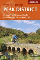
Guide to cycling in and around the Peak District National Park, on road or trail bike. 20 day routes and one multi-day cycle tour of the Peak District. All easily accessible from Sheffield and Manchester with routes starting from charming Derbyshire towns such as Ashbourne, Matlock, Bakewell and Buxton. Includes route profiles and 1:100000 mapping. The scenic Peak District boasts an abundance of country lanes, tracks, towpaths and railway trails that are perfect for two-wheeled exploration. This guidebook presents 20 graded day rides in the national park, along with a challenging 250km route, the five-day 'Tour de Peak District'. With a focus on quiet lanes, gratifying downhills and not overly technical bridleways, tracks and trails, the routes are ideal for gravel/adventure bikes (or hybrid/cross), though most can be easily adapted for road bikes.   Each ride features step-by-step route description accompanied by 1:100,000 mapping. Overview stats are provided to aid route selection, …
18,50
Wandelatlas 2 Adventure Atlas South West Coast Path North Cornwall | A-Z Map Company
AZ heeft de meest gedetailleerde wandelkaarten van delen van het South West Coast Path  gebundeld in een atlasje. Daardoor is het heel handig qua formaat. De kaarten zelf zijn perfect voor het wandelen. Schaal 1:25.000 Plan your next adventure along the North Devon & Somerset section of the South West Coast Path with trusted mapping from A-Z The perfect companion for those who love the great outdoors, the A-Z Adventure Series features 1:25000 Ordnance Survey mapping in a convenient book, complete with index. The South West Coast Path is a National Trail along the Somerset, Devon, Cornwall and Dorset coasts. This stunning walk from Minehead, Somerset covers 630 miles to South Haven Point in Poole Harbour, passing through two World Heritage Sites (the Jurassic Coast and the Cornwall and West Devon Mining Landscape), Exmoor National Park, Land's End and many areas of outstanding natural beauty.   This guide to the North Devon and Somerset section features 36 pages of continuous Ordnan…
17,95
Wegenkaart - landkaart National Park Pocket Map Peak District | Collins
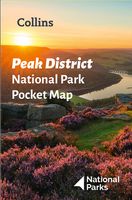
Handige kleine kaart van dit Nationaal Park. De kaart geeft een goed en helder overzicht van het gebied met alle plaatsen, doorgaande wandelpaden (alhoewel grof van schaal), bezienswaardigheden etc. Met een register en aanvullende tekst onder de kaart is het een mooi overzicht wat je waar kunt gaan doen. Handy little full colour map of Peak District National Park. Detailed mapping and visitor information to the National Park along with a selection of photographs. Map at a scale of 1:120 000 (1cm to 1.20km, 1.9 miles to 1 inch).This small map gives a great overview of the Peak District National Park, and is the perfect companion for exploring this beautiful area of England.• Clear, detailed mapping• Key park, tourist and travel information• Ideal for planning visits to the National Park• Index to help locate and plan your trip• Information on the Pennine Way, Stanage-North Lees, caving activities and other places of interest  
7,95

Klanten-reviews van Wateratlas Adventure Atlas Peak District (Dark Peak) | A-Z Map Company

Er zijn nog geen beoordelingen voor dit productBen jij de eerste die een review plaatst?

Meer over Wateratlas Adventure Atlas Peak District (Dark Peak) | A-Z Map Company

Productomschrijving

The A-Z Adventure Series uses Ordnance Survey mapping and is the perfect companion for walkers, off-road cyclists, and anyone wishing to explore the great outdoors.

This A-Z Adventure Atlas of the Peak District (Dark Peak) features 50 pages of continuous Ordnance Survey mapping covering:

  • Peak District National Park (northern part)
  • Kinder Scout
  • Hope Valley
  • Hathersage
  • Castleton
  • Snake Pass
  • Derwent Valley

This National Trail Map features detailed mapping at a scale of 1:25 000, providing complete coverage of the Peak District (Dark Peak). Additional features include:

  • Information Centres
  • Hotels/B&Bs
  • Youth Hostels
  • Campsites (seasonal opening)
  • Public Houses
  • Shops
  • Restaurants
  • Cafes (seasonal opening)
  • Petrol Stations

Other books available in the A-Z Adventure series include: Pembrokeshire Coast Path, Peddars Way and Norfolk Coast Path, South Downs Way, Cotswold Way, South West Coast Path and The North Coast 500.

Productinformatie

    Verken gerelateerde categorieën

    Webshop.nl maakt gebruik van cookies. Ga je verder op onze website, ga dan akkoord met het plaatsen van cookies en de verwerking van deze data door ons en vermelde partners.