webshop.nl
Categorieën
  Sluiten

Meer Prima Games
Meer Prima Games in Hulpprogramma's

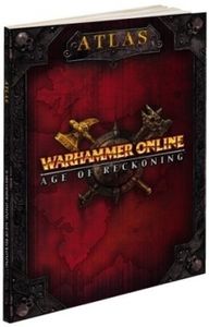
Warhammer Online Atlas

- Exclusive in-game item code for The Adventurer's Handbook!- Detailed maps labeled with points of interest- Realm vs. Realm and Scenario maps with tips on dominating the enemy- Lair and dungeon maps with strategies and boss abilities- Regular updates posted on the Prima Games forums and available for download on all digital versions of the product...
0,99

Webshops met dit product

Webshop
Bezorging
Prijs

Anderen bekeken ook

Wegenatlas Australië - Great Desert Tracks Atlas & Guide | Hema Maps
Whether you're a desert lover or just looking to tackle some of Australia's favourite 4WD destinations, the Hema Great Desert Tracks Atlas & Guide - Edition 5 is an indispensable companion to this country's arid centre. The complete atlas contains Hema's entire Great Desert Tracks map series. The guide features 25 4WD tracks, each with its own detailed map inset showing the route taken, with GPS location and points of interest featured. All of the tracks are colour-coded to make it simple to find the treks that suit your type of vehicle and handy symbols show towing suitability also! The track descriptions are written by some of Australia's top four-wheel driving enthusiasts and experienced travel writers. Each track's notes contain all the information you need to plan for the trip, including permits and contact details. There's also plenty of essential pre-trip reading on how to prepare for your trek, safety in the outback and driving techniques!   Features Contains Hema's entire G…
55,95
Wegenkaart - landkaart - Fietskaart Vanouver Island south - Victoria | ITMB
ITMB wegenkaarten en wandelkaarten kenmerken zich door het kleurgebruik waarbij zo de nadruk wordt gelegd op de natuurkundige aspecten van het land of de streek. Het soort landschap en de hoogte worden hierdoor zeer duidelijk zichtbaar. Natuurlijk vind je ook de 'gewone' zaken als wegennet, spoorwegen, vliegvelden, ferrys, toeristische bezienswaardigheden en nationale parken er op terug.. Vaak - maar niet op alle kaarten - staat op de achterzijde een stadsplattegrond van hoofdstad of belangrijkste stad in de regio.  Voorzijde: Vancouver Island zuidelijk gedeelte met schaal 1:270.000 Achterzijde: stadsplattegrond Victoria met schaal 1:10.000 Victoria is a brand new title for ITMB. The city is the capital of British Columbia (each of Canada’s provinces and territories has its own capital, in addition to Ottawa for the entire country). Located at the southern tip of Vancouver Island, Victoria was established as the colonial capital after the Oregon Treaty of 1846 forced the British to aba…
13,95
Pandoria Merchants
Pandoria Merchants
Overwhelmed by the Goblin hordes, remnants of the Five Realms were forced to flee their prosperous Hiddenlands, eventually establishing their civilizations again in the newly discovered lands of Pandoria. But as they stake their claims and build anew, the old rivalries that were once their downfall resurface. You take on the role of one of these realms, working together with your opponents to develop Pandoria. But all the while, you are also looking to be the dominant realm in the land through gathering resources, building, and learning spells that harness the magic of this mysterious place. Pandoria Merchants transforms the critically-acclaimed board game into a “roll-n-write” game that you can print at home and play anywhere - even online! In the more streamlined “family” version of the game, you gain valuable spells whenever you close out a region, and instead of managing different resources, every region rewards you with victory points. If you are new to the world of Pandoria, then…
49,99
Acer Nitro 5 AN515-57-77K2 Laptop 39,6 cm (15.6") Full HD Intel® Core™ i7 i7-11800H 16 GB DDR4-SDRAM 512 GB SSD NVIDIA GeForce RTX 3070 Wi-Fi 6E (802.11ax) Windows 11 Home Zwart
Go full throttle with an 11th Gen Intel® Core™ i7 processor1, GeForce RTX™ 30 Series GPUs1 and the high-speed FHD / QHD display.Dominating SpecsReign over the game world with the combined power of a 11th Gen Intel® Core™ i7 processor1 and NVIDIA® GeForce RTX™ 30 Series GPUs. Configure your laptop for maximum speed and massive storage with two slots for M.2 PCIe / SATA SSDs1 and up to 32GB of DDR4 3200 RAM.Game Anywhere with Intel®Intel’s latest processors are made to push frames and while making travel easy. Now clocking up to 5.0GHz3 Turbo with up to 4 cores and 8 threads, you get all the performance you need and the freedom to game anywhere.NVIDIA® GeForce RTX™ 30 Series GPUsThese GPUs deliver the ultimate performance for gamers and creators. They’re powered by Ampere—NVIDIA’s 2nd gen RTX architecture—with new Ray Tracing Cores, Tensor Cores, and streaming multiprocessors for a huge leap in performance.3rd Gen Tensor CoresGet up to 2X the throughput with structural sparsity and advan…
1.598,70
Wegenkaart - landkaart 92G Lower Mainland British Columbia - Richmond and New Westminster | ITMB
Goede wegenkaart van British Columbia met topografische uitsnede van Richmond en Westminster. Topographic/Recreation Map 92G&92G2 and G3 - With the 2010 Winter Olympics bearing down on us, this very timely map presents a lovely regional map showing all of the Olympic venues (the Games are being held in Vancouver, Richmond, UBC, Whistler, and the Callaghan Valley – not just in Vancouver). The area of coverage is from Everett (just north of Seattle) in the USA to north of Pemberton, and from Victoria in the west to Chilliwack in the east on the one side, and a detailed 1:50,000 topo map of the Richmond/New Westminster/Surrey/Langley outer urban areas of Metro Vancouver. Both maps are Government of Canada NTS maps, overlaid with touristic and recreational information by ITMB, which holds the copyright on behalf of the Queen (I love being able to say that). The Lower Mainland portion is particularly useful, in that it includes the east coast of Vancouver Island, from Victoria to Nanaimo an…
13,95
Wandelkaart 14 Unterengadin | Kümmerly & Frey
Zeer duidelijke wandelkaart van een deel van Zwitserland. Deze kaart - gemaakt op scheur en watervast papier - is bedoeld voor de gewone en gemiddelde bergwandelaar. Ook voor huttentochten is deze zeker geschikt. Slechts voor de gevorderde wandelaar die glesjers gaat overschrijden zijn de 25.000 topografische kaarten aan te raden. Op deze 1:60.000 kaarten staan de wandelroutes in 3 soorten weergegeven: Wanderweg, Bergweg en Alpine route. De routes staan goed ingetekend en werken prima naast de vele markingen in het veld. Hoogteverschillen, overnachtingsmogelijkheden, bus routes en gps-informatie ontbreken allemaal niet op deze landkaarten.   The maps have contours at 50m or 25m intervals according to the terrain, enhanced by graphic relief and shading. An overprint distinguishes between sign-posted hiking paths, mountain path where proper walking shoes are necessary, and alpine paths requiring special equipment.   Mountain huts are marked, plus various types of accommodation: campsites…
22,50
Wandelkaart 04 Basel - Bazel - Olten - Aarau, Zwitserse Jura | Kümmerly & Frey
Zeer duidelijke wandelkaart van een deel van Zwitserland. Deze kaart - gemaakt op scheur en watervast papier - is bedoeld voor de gewone en gemiddelde bergwandelaar. Ook voor huttentochten is deze zeker geschikt. Slechts voor de gevorderde wandelaar die glesjers gaat overschrijden zijn de 25.000 topografische kaarten aan te raden. Op deze 1:60.000 kaarten staan de wandelroutes in 3 soorten weergegeven: Wanderweg, Bergweg en Alpine route. De routes staan goed ingetekend en werken prima naast de vele markingen in het veld. Hoogteverschillen, overnachtingsmogelijkheden, bus routes en gps-informatie ontbreken allemaal niet op deze landkaarten. The maps have contours at 50m or 25m intervals according to the terrain, enhanced by graphic relief and shading. An overprint distinguishes between sign-posted hiking paths, mountain path where proper walking shoes are necessary, and alpine paths requiring special equipment. Mountain huts are marked, plus various types of accommodation: campsites, yo…
22,50
Wandelkaart 15 Lausanne - Vallée de Joux | Kümmerly & Frey
Zeer duidelijke wandelkaart van een deel van Zwitserland. Deze kaart - gemaakt op scheur en watervast papier - is bedoeld voor de gewone en gemiddelde bergwandelaar. Ook voor huttentochten is deze zeker geschikt. Slechts voor de gevorderde wandelaar die glesjers gaat overschrijden zijn de 25.000 topografische kaarten aan te raden. Op deze 1:60.000 kaarten staan de wandelroutes in 3 soorten weergegeven: Wanderweg, Bergweg en Alpine route. De routes staan goed ingetekend en werken prima naast de vele markingen in het veld. Hoogteverschillen, overnachtingsmogelijkheden, bus routes en gps-informatie ontbreken allemaal niet op deze landkaarten.   The maps have contours at 50m or 25m intervals according to the terrain, enhanced by graphic relief and shading. An overprint distinguishes between sign-posted hiking paths, mountain path where proper walking shoes are necessary, and alpine paths requiring special equipment.   Mountain huts are marked, plus various types of accommodation: campsites…
22,50
Wandelkaart 06 Zürich - Zurich | Kümmerly & Frey
Zeer duidelijke wandelkaart van een deel van Zwitserland. Deze kaart - gemaakt op scheur en watervast papier - is bedoeld voor de gewone en gemiddelde bergwandelaar. Ook voor huttentochten is deze zeker geschikt. Slechts voor de gevorderde wandelaar die glesjers gaat overschrijden zijn de 25.000 topografische kaarten aan te raden. Op deze 1:60.000 kaarten staan de wandelroutes in 3 soorten weergegeven: Wanderweg, Bergweg en Alpine route. De routes staan goed ingetekend en werken prima naast de vele markingen in het veld. Hoogteverschillen, overnachtingsmogelijkheden, bus routes en gps-informatie ontbreken allemaal niet op deze landkaarten.   The maps have contours at 50m or 25m intervals according to the terrain, enhanced by graphic relief and shading. An overprint distinguishes between sign-posted hiking paths, mountain path where proper walking shoes are necessary, and alpine paths requiring special equipment.   Mountain huts are marked, plus various types of accommodation: campsites…
22,50
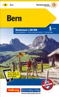
Wandelkaart 09 Bern | Kümmerly & Frey
Zeer duidelijke wandelkaart van een deel van Zwitserland. Deze kaart - gemaakt op scheur en watervast papier - is bedoeld voor de gewone en gemiddelde bergwandelaar. Ook voor huttentochten is deze zeker geschikt. Slechts voor de gevorderde wandelaar die glesjers gaat overschrijden zijn de 25.000 topografische kaarten aan te raden. Op deze 1:60.000 kaarten staan de wandelroutes in 3 soorten weergegeven: Wanderweg, Bergweg en Alpine route. De routes staan goed ingetekend en werken prima naast de vele markingen in het veld. Hoogteverschillen, overnachtingsmogelijkheden, bus routes en gps-informatie ontbreken allemaal niet op deze landkaarten.   The maps have contours at 50m or 25m intervals according to the terrain, enhanced by graphic relief and shading. An overprint distinguishes between sign-posted hiking paths, mountain path where proper walking shoes are necessary, and alpine paths requiring special equipment.   Mountain huts are marked, plus various types of accommodation: campsites…
22,50

Klanten-reviews van Warhammer Online Atlas

Er zijn nog geen beoordelingen voor dit productBen jij de eerste die een review plaatst?

Meer over Warhammer Online Atlas

Productomschrijving

- Exclusive in-game item code for The Adventurer's Handbook!- Detailed maps labeled with points of interest- Realm vs. Realm and Scenario maps with tips on dominating the enemy- Lair and dungeon maps with strategies and boss abilities- Regular updates posted on the Prima Games forums and available for download on all digital versions of the product.Paperback: 192 pagesPublisher: Prima Games (18 Sep 2008)Language: English

Productspecificaties

Artikelnummer(s)
Brand
Prima Games
Webshop.nl maakt gebruik van cookies. Ga je verder op onze website, ga dan akkoord met het plaatsen van cookies en de verwerking van deze data door ons en vermelde partners.