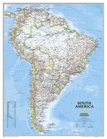
Wandkaart Zuid Amerika, politiek, 91 x 117 cm | National Geographic

0
Staatkundige  kaart van Zuid-Amerika (in kleur). De kaart wordt verzonden in een koker.  This classic map of South America shows political boundaries, place names, airports, major roads and highways, and other geographic features for the entire continent. 36 x 46 inches (approx). Scale size: 1:7,105,000. Founded in 1915 as the Cartographic Group, ...

Verkopers met dit product

Webshop
Bezorging
Prijs
DeZwerver.nl logo
DeZwerver.nl
niet bekend
49,95

Anderen bekeken ook

Wandelgids Wales | Uitgeverij Elmar
De Rother wandelgids Wales beschrijft de 50 mooiste kust- en bergwandelingen in het westen van het Verenigd Koninkrijk - van Pembrokeshire tot Anglesey, van de Ierse Zee tot de grens met Engeland, in de bergachtige regio's, het binnenland en langs de kust.   * Betrouwbare routebeschrijvingen * Gedetailleerde wandelkaarten * Informatieve hoogteprofielen * Downloadbare GPS Tracks   Aanbevolen wandelkaarten bij deze gids:   The Gower + directe omgeving Wandelkaart - Topografische kaart 164 Explorer Gower, Gwyr | Ordnance Survey 1:25.000 Wandelkaart - Topografische kaart 178 Explorer Llanelli, Ammanford, Rhydaman | Ordnance Survey 1:25.000   Pembrokeshire Wandelkaart - Topografische kaart OL35 Explorer Pembrokeshire North - Gogledd Sir Benfro | Ordnance Survey 1:25.000 Wandelkaart - Topografische kaart OL36 Explorer South Pembrokeshire - De Sir Benfro | Ordnance Survey 1:25.000 Wandelkaart - Topografische kaart 198 Explorer Cardigan, New Quay | Ordnance Survey 1:25.000 Wandelkaart - Topog…
19,99
Wandelkaart A06 Siniscola | Abies
Siniscola area at 1:25,000 in a series of contoured maps from Ed. Abies. Overprint highlights campsites and agriturismo accommodation, climbing sites, wild sheep and bird watching sites and archaeological remains. This title has no UTM grid. Main series at 1:60,000 (Nos. 1 to 12) The maps have contours at 100m intervals and colouring for woodlands and maquis shrubland. Local trails are highlighted, with additional overprint for selected hiking, mountain bike and kayaking routes listed on the reverse of the maps with brief notes and grading for the degree of difficulty. All the maps have a UTM grid for GPS users. Very extensive range of symbols highlight numerous places of interest and tourist facilities, including campsites and caravan parks, beaches, sport and recreational sites, archaeological remains and nuraghi, etc. The maps also indicate places where typical local products can be purchased. On the reverse each title has descriptions of its main places of interest, beaches, etc…
12,95
Wandelkaart A15 Sarrabus da Costa Rei a Porto Corallo | Abies
Sarrabus is a territory that is not known by everybody yet. Here lies its charm and this has made possible to keep this environmental area out of big building speculations and also out of history. In fact it preserves little traces of the past, and paradoxically the remains from the prehistoric age are more meaningful than those back to more recent times. We can find traces from the most remote past not far from the State Road SS125, that from Muravera goes to Costa Rei, by visiting the nuraghe Murtas, the nuraghe S’Aqua Secis and the megalithic complexes of Scalas and Cuili Piras. They are about ten menhirs, almost fully intact, arranged in groups and fixed in the ground in the original orthostatic position. They have been put in relation with the position of the sun and the moon, at dawn and at sunset. In fact they were used as a very precise astronomic calendar but also for religious purposes since they represented both the masculine divinity and the fertility according to the wors…
12,95
Wandelkaart - Topografische kaart 147 OS Explorer Map Sevenoaks and Tonbridge | Ordnance Survey
Met zijn 4cm voor 1 km (2 ½ cm voor 1 mijl) schaal, is de OS Explorer kaartenserie de ideale en meest gedetailleerde kaartenreeks voor mensen die graag outdoor-activiteiten zoals fietsen, wandelen, paardrijden, klimmen en watersporten. Deze kaart is nog gedetailleerder dan de 'gewone' Landranger maps. Voor- en achterzijde bedrukt! Zeker op de moors en andere natuurgebieden van onschatbare waarden met echt alle aspecten van het landschap op de kaart ingetekend. Zeer goede detailkaart met topografische ondergrond. Hierop zijn toeristische symbolen van bezienswaardigheden ingetekend, daarnaast staan bijvoorbeeld campings en jeugdherbergen vermeld en - voor wandelaars het belangrijkst - alle right of way paden en Lange afstands Wandelpaden zijn er op te vinden. De ideale kaart voor het wandelen in Engeland, Wales of Schotland.   These highly detailed maps show all the administrative boundaries, settlements as small as isolated farms, the road network down to unfenced roads and country tra…
19,50
Fietskaart 07 De Sterkste van de Regio Veluwe | Buijten & Schipperheijn
De actueelste Nederlandkaart met fietsknooppunten! Een vrijwel onverwoestbare kaart bovendien, met handige informatie over campings, veerdiensten etc. Regio Veluwe. Duidelijk kaartbeeld met royale letter Compleet netwerk van fietspaden en kleine wegen Alle bewegwijzerde fietsknoppunten Landelijke wandelroutes en streekwandelingen Webadressen van alle bed-and-breakfastlocaties en veerdiensten Precieze locaties van monumenten Groot formaat Groot schaal Compact gevouwen Zeer klein opgevouwen formaat van water- en scheurvast papier. Handig voor op de racefiets! An up-to-date cycle map, with wayfinding points clearly marked. This map is virtually indestructible, waterproof and tear-proof. Complete with useful information about camp sites, ferry locations, and long-distance bike routes, this map is a must-have for long and short distance cycling. Its handy pocket size means that it  can fold easily into a handlebar bag. A complete network of bicycle paths and small roads Bicyc…
12,90
Fietskaart 04 De Sterkste van de Regio Drenthe | Buijten & Schipperheijn
De actueelste Nederlandkaart met fietsknooppunten! Een vrijwel onverwoestbare kaart bovendien, met handige informatie over campings, veerdiensten etc. Regio Drenthe. Duidelijk kaartbeeld met royale letter Compleet netwerk van fietspaden en kleine wegen Alle bewegwijzerde fietsknoppunten Landelijke wandelroutes en streekwandelingen Webadressen van alle bed-and-breakfastlocaties en veerdiensten Precieze locaties van monumenten Groot formaat Groot schaal Compact gevouwen   Zeer klein opgevouwen formaat van water- en scheurvast papier. Handig voor op de racefiets!     An up-to-date cycle map, with wayfinding points clearly marked. This map is virtually indestructible, waterproof and tear-proof. Complete with useful information about camp sites, ferry locations, and long-distance bike routes, this map is a must-have for long and short distance cycling. Its handy pocket size means that it  can fold easily into a handlebar bag. A complete network of bicycle paths and small roads …
12,90
Wandelgids Algarve | Rother Bergverlag
Uitstekende wandelgids met een groot aantal dagtochten in dal en hooggebergte. Met praktische informatie en beperkt kaartmateriaal! Wandelingen in verschillende zwaarte weergegeven in rood/blauw/zwart. Aanbevolen wandelkaarten bij deze gids: De west- en zuidwestkust van de Algarve (wandeling 1 t/m 11) + een deel van de Serra de Monchique (wandeling 12 en 13): Wandelkaart Parque Natural do Sudoeste Alentejano e Costa Vicentina | Adventure MAPS Die Algarve ist die Sonnenküste Portugals – mit endlosen Sandstränden, klarem Meer und imposanten Klippenküsten. Doch die südwestlichste Ecke des europäischen Kontinents bietet mehr als nur Badeurlaub. Ein hügelreiches, sich nach Norden immer höher auftürmendes und blumenreiches Hinterland, eine eindrucksvolle Felsenküste im Westen und Südwesten, eine beschauliche Flusstallandschaft (Rio Guadiana) im Osten und die weit gestreckte Lagune zwischen Faro und Tavira (Ria Formosa) an der Südküste sind nur einige Beispiele für die große landschaftliche…
18,50
Wandelkaart - Topografische kaart OL62 OS Explorer Map Coreen Hills & Glenlivet | Ordnance Survey
Met zijn 4cm voor 1 km (2 ½ cm voor 1 mijl) schaal, is de OS Explorer kaartenserie de ideale en meest gedetailleerde kaartenreeks voor mensen die graag outdoor-activiteiten zoals fietsen, wandelen, paardrijden, klimmen en watersporten. Deze kaart is nog gedetailleerder dan de 'gewone' Landranger maps. Voor- en achterzijde bedrukt! Zeker op de moors en andere natuurgebieden van onschatbare waarden met echt alle aspecten van het landschap op de kaart ingetekend. Zeer goede detailkaart met topografische ondergrond. Hierop zijn toeristische symbolen van bezienswaardigheden ingetekend, daarnaast staan bijvoorbeeld campings en jeugdherbergen vermeld en - voor wandelaars het belangrijkst - alle right of way paden en Lange afstands Wandelpaden zijn er op te vinden. De ideale kaart voor het wandelen in Engeland, Wales of Schotland. Map sheet OL 62 covers Correen Hills and Glenlivet. Highlights include Cairngorms National Park, Gordon Way and Badingair Hill. Also includes Water of Bogie, Rhynie…
19,50
Fietskaart 02 De Sterkste van de Regio Friesland | Buijten & Schipperheijn
De actueelste Nederlandkaart met fietsknooppunten! Een vrijwel onverwoestbare kaart bovendien, met handige informatie over campings, veerdiensten etc. Regio Friesland. Duidelijk kaartbeeld met royale letter Compleet netwerk van fietspaden en kleine wegen Alle bewegwijzerde fietsknoppunten Landelijke wandelroutes en streekwandelingen Webadressen van alle bed-and-breakfastlocaties en veerdiensten Precieze locaties van monumenten Groot formaat Groot schaal Compact gevouwen Zeer klein opgevouwen formaat van water- en scheurvast papier. Handig voor op de racefiets! An up-to-date cycle map, with wayfinding points clearly marked. This map is virtually indestructible, waterproof and tear-proof. Complete with useful information about camp sites, ferry locations, and long-distance bike routes, this map is a must-have for long and short distance cycling. Its handy pocket size means that it  can fold easily into a handlebar bag. A complete network of bicycle paths and small roads Bicy…
11,90
Wegenkaart - landkaart 1 Sumatra | Reise Know-How Verlag
Tweetalige kaart (Engels en Duits). Door ingetekende lengte- en breedtegraden is het gebruik van GPS mogelijk. Met hoogtelijnen en uitgebreid wegennetwerk: daarnaast worden ook de afstanden tussen belangrijke plaatsen duidelijk leesbaar weergegeven. Het kleurgebruik is zodanig dat je een goede indruk krijgt van hoogteverschillen en soorten landschap. Natuurlijk staan de toeristische bezienswaardigheden duidelijk vermeld. Gedrukt op water- en scheurvast papier! Polyart is een synthetisch product vrij van giftige stoffen dus duurzaam. Het papier gaat echt lang mee. Topography is indicated by altitude colouring with numerous spot heights and names of mountain ranges and passes. Salt lakes, swamps, seasonal rivers and glacier are also shown. Detailed presentation of the road network includes minor roads and tracks and railways are also shown.   Internal administrative units are presented with their boundaries and names. National parks and other protected areas are highlighted. A wide rang…
17,95

Klanten-reviews van Wandkaart Zuid Amerika, politiek, 91 x 117 cm | National Geographic

Er zijn nog geen beoordelingen voor dit productBen jij de eerste die een review plaatst?

Meer over Wandkaart Zuid Amerika, politiek, 91 x 117 cm | National Geographic

Productomschrijving

Staatkundige  kaart van Zuid-Amerika (in kleur). De kaart wordt verzonden in een koker.

 This classic map of South America shows political boundaries, place names, airports, major roads and highways, and other geographic features for the entire continent. 36 x 46 inches (approx). Scale size: 1:7,105,000.

Founded in 1915 as the Cartographic Group, the first division of the National Geographic Society, National Geographic Maps has been responsible for illustrating the world around us through the art and science of mapmaking.
Today, National Geographic Maps continues this mission by creating the world s best wall maps, recreation maps, atlases, and globes which inspire people to care about and explore their world. All proceeds from the sale of National Geographic maps go to support the Society s non-profit mission to increase global understanding and promote conservation of our planet through exploration, research, and education.

Verken gerelateerde categorieën

Webshop.nl maakt gebruik van cookies. Ga je verder op onze website, ga dan akkoord met het plaatsen van cookies en de verwerking van deze data door ons en vermelde partners.