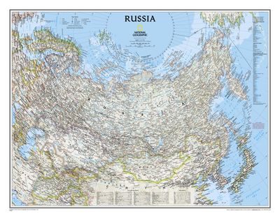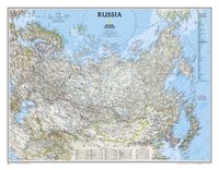
Wandkaart - Wandkaart Russia - Rusland, 77 x 60 cm | National Geographic

0
Decoratieve wandkaart van het land. Naast de mooie kleuren staan er bijzonder veel plaatsen op vermeld. National Geographic's classic wall map of Russia and the independent states of the former Soviet Union shows thousands of place names, roadways, political boundaries, bodies of water, airports, and many other geographic details.  ...

Verkopers met dit product

Verkoper
Bezorging
Prijs
DeZwerver.nl logo
DeZwerver.nl
5,95
31,95

Anderen bekeken ook

Wandkaart 20527 Canada, 97 x 82 cm | National Geographic
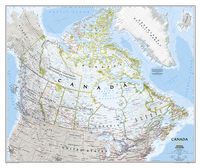
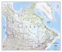
Decoratieve wandkaart van Canada. Naast de mooie kleuren staan er bijzonder veel plaatsen op vermeld. This beautiful wall-map from National Geographic depicts Canada and the areas surrounding the Great Lakes in beautiful and accurate detail. Included in the map are Canadian province and US State boundaries, cities and towns, lakes and waterways, major geographic features, roadways, and other geographic details. Our most detailed wall map of Canada, features the classic National Geographic reference styling. Features thousands of place names, accurate political boundaries, national parks, archeological sites, and major infrastructure networks such as roads, canals, ferry routes, and railroads. Canada s diverse terrain is detailed through accurate shaded relief, coastal bathymetry, and symbolism for water features and other landforms. This wall map depicts Canada and the areas surrounding the Great Lakes. Includes Canadian provinces and US State boundaries.
28,95
Wandkaart Canada, 97 x 82 cm | National Geographic
Decoratieve wandkaart van Canada. Naast de mooie kleuren staan er bijzonder veel plaatsen op vermeld.   This beautiful wall-map from National Geographic depicts Canada and the areas surrounding the Great Lakes in beautiful and accurate detail. Included in the map are Canadian province and US State boundaries, cities and towns, lakes and waterways, major geographic features, roadways, and other geographic details.   Our most detailed wall map of Canada, features the classic National Geographic reference styling. Features thousands of place names, accurate political boundaries, national parks, archeological sites, and major infrastructure networks such as roads, canals, ferry routes, and railroads. Canada s diverse terrain is detailed through accurate shaded relief, coastal bathymetry, and symbolism for water features and other landforms. This wall map depicts Canada and the areas surrounding the Great Lakes. Includes Canadian provinces and US State boundaries.
34,95
Wandkaart New Zealand - Nieuw Zeeland 60 x 77 cm | National Geographic
Mooie heldere wandkaart van Nieuw Zeeland met het Noordereiland en Zuidereiland op dezelfde kant afgebeeld. Veel plaatsnamen, goed kleurgebruik waardoor hoogteverschillen en bijvoorbeeld nationale parken goed zichtbaar zijn.   The reference map of New Zealand uses National Geographic's signature Classic style with blue ocean and stunning shaded relief. The map shows this island nation in great detail, from the subtropical North Island (Te Ika-a-Maui) to the glacial carved valleys of Fiordland on the South Island (Te Waipounamu). The North Island is best known for large volcanic lakes and the cities of Auckland and Wellington. The South Island is famous for the Southern Alps that run along the spine of the island. The highest point in the country is Aoraki (Mount Cook) and is found in the Southern Alps.   The first settlers of New Zealand were the Maori from Polynesia, the names on the map reflect this history with both English and Maori variants. The map also features a transportation…
31,95
Wegenkaart - landkaart Rusland - Russia | Freytag & Berndt
Uitstekende landkaart van Rusland. Met index, toeristische informatie en afstanden in kilometers. Het westen op een schaal van 1 op 2 miljoen en na de Oeral wordt het een grove schaal van 1 op 8 miljoen. Toch een van de betere kaarten van Rusland! Explore Russia and the other members of the Commonwealth of Independent States (C.I.S) with this Freytag & Berndt double-sided road map. The best way to plan your trip, prepare your itinerary, and to travel independently on this region. As with all Freytag & Berndt maps, the cartography is clear and detailed with the topography shown with relief shading with plenty of spot heights.   One side of the map features a 1: 200 000 scale map of Eastern Europe, while the other side features a large scale 1: 8 000 000 map showing the members of the C.I.S. Names of townships in former Soviet countries are listed in both English and the Cyrillic script.   A icon system is used to show tourist information. Icons are displayed for:   Railways and canal s…
14,95
Reisgids Russia - Rusland | Lonely Planet
De perfecte reisgids voor zowel de georganiseerde als de zelfstandige reiziger. Naast een algemene inleiding van het land / streek vol met praktische informatie over hoe je er het beste kunt reizen: slapen, eten, vervoer, excursies ... alles kun je er in vinden. Lonely Planet Russia is your passport to the most relevant, up-to-date advice on what to see and skip, and what hidden discoveries await you. Brush up on your Soviet and imperial history in Moscow and St Petersburg, explore European Russia and its gingerbread cottages and golden domes, or lose yourself in the wilds of Siberia and the east; all with your trusted travel companion. Get to the heart of Russia and begin your journey now!   Inside Lonely Planet’s Russia Travel Guide:   Colour maps and images throughout Highlights and itineraries help you tailor your trip to your personal needs and interests Insider tips to save time and money and get around like a local, avoiding crowds and trouble spots Essential info at your finge…
27,95
Wandkaart Middle East - Midden Oosten 76 x 58 cm | National Geographic
Wandkaart van het Midden Oosten, met o.a. Afghanistan - Pakistan - National Geographic wandkaart geplastificeerd - Afmeting ca 76 x 58 cm  National Geographic Maps' recently updated wall map of the Middle East region, formerly titled Afghanistan/Pakistan and the Middle East. Includes updated place names and the addition of significant locations currently in the news, such as Marjah, Afghanistan. This wall map covers a broad geographic area ranging from northern Africa through the Middle East to the western edge of China and India.   Includes complete coverage of Afghanistan, Pakistan, Tajikistan, Iran, Iraq, Kuwait, Syria, Israel, Jordan, Lebanon, Saudi Arabia, Qatar, Bahrain, United Arab Emirates, Yemen, Oman, Cyprus, and Eritrea.   Also includes parts of India, China, Kyrgyzstan, Uzbekistan, Turkmenistan, Azerbaijan, Armenia, Turkey, Egypt, Sudan, Ethiopia, and Djibouti. Features thousands of place names, accurate political boundaries, archeological sites, and major infrastructure n…
31,95
Wandkaart India, 60 x 77 cm | National Geographic
See India as only National Geographic can depict it. This new reference map is one of the most detailed and comprehensive ever published for India and southern Asia. It includes India, Sri Lanka, Nepal, Bangladesh, Bhutan, Tajikistan, and portions of China, Pakistan, Afghanistan, and Myanmar. The India map is punctuated with thousands of place names, and embellished with shaded relief which highlights the region's dramatic topography in such places as the Tibetan Plateau and the Himalaya.
31,95

Klanten-reviews van Wandkaart - Wandkaart Russia - Rusland, 77 x 60 cm | National Geographic

Er zijn nog geen beoordelingen voor dit productBen jij de eerste die een review plaatst?

Meer over Wandkaart - Wandkaart Russia - Rusland, 77 x 60 cm | National Geographic

Productomschrijving

Decoratieve wandkaart van het land. Naast de mooie kleuren staan er bijzonder veel plaatsen op vermeld.

National Geographic's classic wall map of Russia and the independent states of the former Soviet Union shows thousands of place names, roadways, political boundaries, bodies of water, airports, and many other geographic details.


Productinformatie

    Verken gerelateerde categorieën

    Webshop.nl maakt gebruik van cookies. Ga je verder op onze website, ga dan akkoord met het plaatsen van cookies en de verwerking van deze data door ons en vermelde partners.