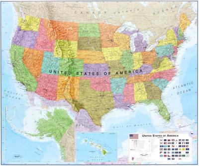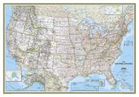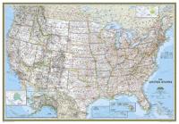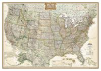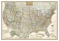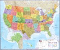
Wandkaart USA - Verenigde Staten Politiek, 120 x 100 cm | Maps International

0
This USA map clearly depicts all the cities, major roads and also shows all the state areas and boundaries....

Verkopers met dit product

Verkoper
Bezorging
Prijs
DeZwerver.nl logo
DeZwerver.nl
5,95
37,95

Anderen bekeken ook

Wandkaart USA - Verenigde Staten, politiek, 110 x 77 cm | National Geographic
  Het klassieke kaartbeeld van National Geographic, de grenzen van de staten van Amerika zijn apart gekleurd. De wandkaart is heel gedetailleerd met veel plaatsen, wegen, rivieren en nationale parken, het reliëf wordt met schaduw aangegeven. Geplastificeerde versie.   The National Geographic Classic United States map uses bright color bands to outline each state. Capitals, major cities, selected towns, bodies of water, highways, and national parks are all shown. Shaded relief, rich in detail, emphasizes the many mountains, valleys, and plateaus of the United States.    Our most popular United States wall map. Features all 50 States with insets for Alaska and Hawaii. All major cities, transportation routes, State boundaries, National Parks, inland waterways, and mountain ranges are clearly displayed and labeled. 
36,95
Wandkaart Canada, 120 x 100 cm | Maps International
Mooi, heldere wandkaart van Canada.   This Canada wall map clearly depicts all the cities, major roads and also shows all the Provinces and Territory boundaries. All major cities and areas are displayed bi-lingually.   This Canada Wall Map features: • Provincial Boundaries • Provincial Capitals • Cities • National and International Airports • Latitude and Longitude Lines • Physical Features and Terrain Shading • Ocean Bathymetry • Highways, Major Roads and Seasonal Roads • Provincial Flags • Provincial and National Parks • Detailed Scale: 1:5,700,000
38,95
Magneetbord - Wandkaart USA - Verenigde Staten, politiek, 110 x 77 cm | National Geographic
Het klassieke kaartbeeld van National Geographic, de grenzen van de staten van Amerika zijn apart gekleurd. De wandkaart is heel gedetailleerd met veel plaatsen, wegen, rivieren en nationale parken, het reliëf wordt met schaduw aangegeven. Geplastificeerde versie.   The National Geographic Classic United States map uses bright color bands to outline each state. Capitals, major cities, selected towns, bodies of water, highways, and national parks are all shown. Shaded relief, rich in detail, emphasizes the many mountains, valleys, and plateaus of the United States.    Our most popular United States wall map. Features all 50 States with insets for Alaska and Hawaii. All major cities, transportation routes, State boundaries, National Parks, inland waterways, and mountain ranges are clearly displayed and labeled.    De kaart wordt in deze versie gelijmd op een plaat, voorzien van een mooie aluminium lijst en een ophangsysteem wordt meegeleverd. Daarnaast krijgt u een bakje bijgeleverd da…
249,-
Wandkaart USA - Verenigde Staten Political, 178 x 124 cm | National Geographic
Het klassieke kaartbeeld van National Geographic, de grenzen van de staten van Amerika zijn apart gekleurd. De wandkaart is heel gedetailleerd met veel plaatsen, wegen, rivieren en nationale parken, het reliëf wordt met schaduw aangegeven. Dit is de grote versie (zie afmetingen)   The National Geographic Classic United States map uses bright color bands to outline each state. Capitals, major cities, selected towns, bodies of water, highways, and national parks are all shown. Shaded relief, rich in detail, emphasizes the many mountains, valleys, and plateaus of the United States.    Our most popular United States wall map. Features all 50 States with insets for Alaska and Hawaii. All major cities, transportation routes, State boundaries, National Parks, inland waterways, and mountain ranges are clearly displayed and labeled. 
68,95
Wandkaart 02003 USA - Verenigde Staten Political, 110 x 77 cm | National Geographic
Het klassieke kaartbeeld van National Geographic, de grenzen van de staten van Amerika zijn apart gekleurd. De wandkaart is heel gedetailleerd met veel plaatsen, wegen, rivieren en nationale parken, het reliëf wordt met schaduw aangegeven. The National Geographic Classic United States map uses bright color bands to outline each state. Capitals, major cities, selected towns, bodies of water, highways, and national parks are all shown. Shaded relief, rich in detail, emphasizes the many mountains, valleys, and plateaus of the United States.    Our most popular United States wall map. Features all 50 States with insets for Alaska and Hawaii. All major cities, transportation routes, State boundaries, National Parks, inland waterways, and mountain ranges are clearly displayed and labeled. 
28,95
Wandkaart 02008 USA - Verenigde Staten Political, 178 x 124 cm | National Geographic
Het klassieke kaartbeeld van National Geographic, de grenzen van de staten van Amerika zijn apart gekleurd. De wandkaart is heel gedetailleerd met veel plaatsen, wegen, rivieren en nationale parken, het reliëf wordt met schaduw aangegeven. Dit is de grote versie (zie afmetingen)   The National Geographic Classic United States map uses bright color bands to outline each state. Capitals, major cities, selected towns, bodies of water, highways, and national parks are all shown. Shaded relief, rich in detail, emphasizes the many mountains, valleys, and plateaus of the United States.    Our most popular United States wall map. Features all 50 States with insets for Alaska and Hawaii. All major cities, transportation routes, State boundaries, National Parks, inland waterways, and mountain ranges are clearly displayed and labeled. 
49,95
Wandkaart 20114 USA - Verenigde Staten politiek, antiek, 108 x 75 cm | National Geographic
Wandkaart van de USA waarbij de kleuren in 'antieke' look zijn weergegeven, de staatgrenzen zeer duidelijk zijn en er veel plaatsen op staan. This Antique-style USA Wall Map by National Geographic Maps combines classic antique-style cartography with fully updated geographical representation. Displaying elegant use of earth-tone color and extensive detail for type placement to aid readability, this USA map is loaded with information. This USA wall map includes: State Boundaries Capitals and Cities National Parks, Monuments and Recreation Areas Airports and Air Force Bases US Interstates and Highways Physical Terrain Shading Latitude and Longitude Graticule Insets of Hawaiian Islands and Alaska Legend and Abbreviation List Includes portions of Canada and Mexico
28,95
Wandkaart USA - Verenigde Staten Antiek, 111 x 77 cm | National Geographic
Wandkaart van de USA waarbij de kleuren in 'antieke' look zijn weergegeven, de staatgrenzen zeer duidelijk zijn en er veel plaatsen op staan.   This Antique-style USA Wall Map by National Geographic Maps combines classic antique-style cartography with fully updated geographical representation. Displaying elegant use of earth-tone color and extensive detail for type placement to aid readability, this USA map is loaded with information.   This USA wall map includes:   State Boundaries Capitals and Cities National Parks, Monuments and Recreation Areas Airports and Air Force Bases US Interstates and Highways Physical Terrain Shading Latitude and Longitude Graticule Insets of Hawaiian Islands and Alaska Legend and Abbreviation List Includes portions of Canada and Mexico
36,95
Wandkaart Azië Politiek, 120 x 100 cm | Maps International
Fraaie politieke kaart van het continent, waarbij vooral de politieke aspecten heel duidelijk te lezen zijn. Alle landen hebben verschillende kleuren, steden en belangrijke verbindingen zijn goed te vinden.   Geplastificeerd, zonder ophangsysteem.   Maps International's political wall map of Asia shows all countries from Turkey in the West to Japan in the East, down to Indonesia in the South of Asia. The largest and most populated continent, Asia has a lot to fit onto a map! Rest assured though, with Maps International's high quality of mapping nothing is missed out!   This political wall map of Asia features countries marked in different colours, with international borders clearly shown. The map's key shows the flags from the countries displayed in this map. This Asia physical wall map also contains city population detail, capital cities and all the major towns and cities in this continent of Asia.
38,95

Klanten-reviews van Wandkaart USA - Verenigde Staten Politiek, 120 x 100 cm | Maps International

Er zijn nog geen beoordelingen voor dit productBen jij de eerste die een review plaatst?

Meer over Wandkaart USA - Verenigde Staten Politiek, 120 x 100 cm | Maps International

Productomschrijving

This USA map clearly depicts all the cities, major roads and also shows all the state areas and boundaries.

Productinformatie

    Verken gerelateerde categorieën

    Webshop.nl maakt gebruik van cookies. Ga je verder op onze website, ga dan akkoord met het plaatsen van cookies en de verwerking van deze data door ons en vermelde partners.