webshop.nl
Categorieën
  Sluiten

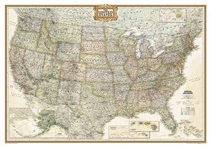
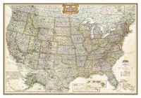
Wandkaart USA - Verenigde Staten Antiek, 111 x 77 cm | National Geographic

Wandkaart van de USA waarbij de kleuren in 'antieke' look zijn weergegeven, de staatgrenzen zeer duidelijk zijn en er veel plaatsen op staan.   This Antique-style USA Wall Map by National Geographic Maps combines classic antique-style cartography with fully updated geographical representation. Displaying elegant use of earth-tone color and extensiv...
36,95

Webshops met dit product

Webshop
Bezorging
Prijs

Anderen bekeken ook

Wandkaart USA - Verenigde Staten politiek, antiek, 108 x 75 cm | National Geographic
Wandkaart van de USA waarbij de kleuren in 'antieke' look zijn weergegeven, de staatgrenzen zeer duidelijk zijn en er veel plaatsen op staan. This Antique-style USA Wall Map by National Geographic Maps combines classic antique-style cartography with fully updated geographical representation. Displaying elegant use of earth-tone color and extensive detail for type placement to aid readability, this USA map is loaded with information. This USA wall map includes: State Boundaries Capitals and Cities National Parks, Monuments and Recreation Areas Airports and Air Force Bases US Interstates and Highways Physical Terrain Shading Latitude and Longitude Graticule Insets of Hawaiian Islands and Alaska Legend and Abbreviation List Includes portions of Canada and Mexico
28,95
Wandkaart USA - Verenigde Staten, politiek, 110 x 77 cm | National Geographic
  Het klassieke kaartbeeld van National Geographic, de grenzen van de staten van Amerika zijn apart gekleurd. De wandkaart is heel gedetailleerd met veel plaatsen, wegen, rivieren en nationale parken, het reliëf wordt met schaduw aangegeven. Geplastificeerde versie.   The National Geographic Classic United States map uses bright color bands to outline each state. Capitals, major cities, selected towns, bodies of water, highways, and national parks are all shown. Shaded relief, rich in detail, emphasizes the many mountains, valleys, and plateaus of the United States.    Our most popular United States wall map. Features all 50 States with insets for Alaska and Hawaii. All major cities, transportation routes, State boundaries, National Parks, inland waterways, and mountain ranges are clearly displayed and labeled. 
36,95
Wandkaart USA - Verenigde Staten Political, 110 x 77 cm | National Geographic
Het klassieke kaartbeeld van National Geographic, de grenzen van de staten van Amerika zijn apart gekleurd. De wandkaart is heel gedetailleerd met veel plaatsen, wegen, rivieren en nationale parken, het reliëf wordt met schaduw aangegeven. The National Geographic Classic United States map uses bright color bands to outline each state. Capitals, major cities, selected towns, bodies of water, highways, and national parks are all shown. Shaded relief, rich in detail, emphasizes the many mountains, valleys, and plateaus of the United States.    Our most popular United States wall map. Features all 50 States with insets for Alaska and Hawaii. All major cities, transportation routes, State boundaries, National Parks, inland waterways, and mountain ranges are clearly displayed and labeled. 
28,95
Magneetbord - Wandkaart USA - Verenigde Staten, politiek, 110 x 77 cm | National Geographic
Het klassieke kaartbeeld van National Geographic, de grenzen van de staten van Amerika zijn apart gekleurd. De wandkaart is heel gedetailleerd met veel plaatsen, wegen, rivieren en nationale parken, het reliëf wordt met schaduw aangegeven. Geplastificeerde versie.   The National Geographic Classic United States map uses bright color bands to outline each state. Capitals, major cities, selected towns, bodies of water, highways, and national parks are all shown. Shaded relief, rich in detail, emphasizes the many mountains, valleys, and plateaus of the United States.    Our most popular United States wall map. Features all 50 States with insets for Alaska and Hawaii. All major cities, transportation routes, State boundaries, National Parks, inland waterways, and mountain ranges are clearly displayed and labeled.    De kaart wordt in deze versie gelijmd op een plaat, voorzien van een mooie aluminium lijst en een ophangsysteem wordt meegeleverd. Daarnaast krijgt u een bakje bijgeleverd dat…
249,-
Wandkaart USA - Verenigde Staten Political, 178 x 124 cm | National Geographic
Het klassieke kaartbeeld van National Geographic, de grenzen van de staten van Amerika zijn apart gekleurd. De wandkaart is heel gedetailleerd met veel plaatsen, wegen, rivieren en nationale parken, het reliëf wordt met schaduw aangegeven. Dit is de grote versie (zie afmetingen)   The National Geographic Classic United States map uses bright color bands to outline each state. Capitals, major cities, selected towns, bodies of water, highways, and national parks are all shown. Shaded relief, rich in detail, emphasizes the many mountains, valleys, and plateaus of the United States.    Our most popular United States wall map. Features all 50 States with insets for Alaska and Hawaii. All major cities, transportation routes, State boundaries, National Parks, inland waterways, and mountain ranges are clearly displayed and labeled. 
68,95
Wandkaart USA - Verenigde Staten Political, 178 x 124 cm | National Geographic
Het klassieke kaartbeeld van National Geographic, de grenzen van de staten van Amerika zijn apart gekleurd. De wandkaart is heel gedetailleerd met veel plaatsen, wegen, rivieren en nationale parken, het reliëf wordt met schaduw aangegeven. Dit is de grote versie (zie afmetingen)   The National Geographic Classic United States map uses bright color bands to outline each state. Capitals, major cities, selected towns, bodies of water, highways, and national parks are all shown. Shaded relief, rich in detail, emphasizes the many mountains, valleys, and plateaus of the United States.    Our most popular United States wall map. Features all 50 States with insets for Alaska and Hawaii. All major cities, transportation routes, State boundaries, National Parks, inland waterways, and mountain ranges are clearly displayed and labeled. 
49,95
Wandkaart Zuidoost Azië, politiek, 96 x 81 cm | National Geographic
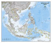
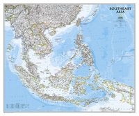
The Southeast Asia Political Map is a detailed reference map containing National Geographic’s clear visual presentation in a bright and appealing color palette. The map contains thousand of place names, accurate political boundaries, and infrastructure, making it the perfect reference for student, home, or business. This detailed wall map of Southeast Asia by National Geographic includes Indonesia, New Guinea, the Phillipines, Malaysia, Thailand, Myanmar, Cambodia and Vietnam. Coverage includes the whole of Indonesia and the Philippines, and extends north to cover China as far as Hangzhou and, in the north-western corner, Bhutan. Details featured on this Southeast Asia Wall Map include:   • Political Boundaries • Major Cities and Capitals • Physical Terrain Shading • Mountain Ranges, Highest Point • Lakes, Rivers and Waterways • Latitude and Longitude Lines • Basic Bathymetry (Ocean Depths) • Major Airports • National Parks
26,95
Wandkaart Zuidoost Azië, politiek, 96 x 81 cm | National Geographic
The Southeast Asia Political Map is a detailed reference map containing National Geographic’s clear visual presentation in a bright and appealing color palette. The map contains thousand of place names, accurate political boundaries, and infrastructure, making it the perfect reference for student, home, or business.   This detailed wall map of Southeast Asia by National Geographic includes Indonesia, New Guinea, the Phillipines, Malaysia, Thailand, Myanmar, Cambodia and Vietnam. Coverage includes the whole of Indonesia and the Philippines, and extends north to cover China as far as Hangzhou and, in the north-western corner, Bhutan.   Details featured on this Southeast Asia Wall Map include:   • Political Boundaries • Major Cities and Capitals • Physical Terrain Shading • Mountain Ranges, Highest Point • Lakes, Rivers and Waterways • Latitude and Longitude Lines • Basic Bathymetry (Ocean Depths) • Major Airports • National Parks
34,95
Wandkaart Caribbean - Caraïben, 91 x 61 cm | National Geographic
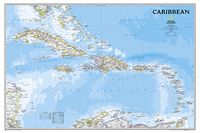
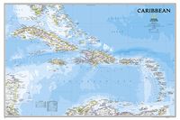
Completely redesigned and updated, National Geographic Maps' Caribbean Classic wall map is one of the most authoritative maps for the islands of the Caribbean Sea. This new edition shows the entire region in exceptional detail, with coverage extending from the tip of Florida to the northern extents of Colombia and Venezuela, east to Barbados, and west to the eastern edge of Honduras, Costa Rica, and Nicaragua. Updated bathymetry reveals the remarkable seafloor variation of the Caribbean including the Puerto Rico Trench, the deepest point in the Atlantic Ocean at 8,605 meters (28,232 feet).   Caribbean Classic is a perfect tool for business or education reference, and a beautiful addition to any décor. Shown on the map are over 1,000 named places including country capitals, primary and secondary towns; political boundaries, important infrastructure, and all key landforms. Useful and informative notes about the region's history and unique geography are spread throughout the map, providin…
28,95
Wandkaart Caribbean - Caraïben, 91 x 61 cm | National Geographic
Completely redesigned and updated, National Geographic Maps' Caribbean Classic wall map is one of the most authoritative maps for the islands of the Caribbean Sea. This new edition shows the entire region in exceptional detail, with coverage extending from the tip of Florida to the northern extents of Colombia and Venezuela, east to Barbados, and west to the eastern edge of Honduras, Costa Rica, and Nicaragua. Updated bathymetry reveals the remarkable seafloor variation of the Caribbean including the Puerto Rico Trench, the deepest point in the Atlantic Ocean at 8,605 meters (28,232 feet).   Caribbean Classic is a perfect tool for business or education reference, and a beautiful addition to any décor. Shown on the map are over 1,000 named places including country capitals, primary and secondary towns; political boundaries, important infrastructure, and all key landforms. Useful and informative notes about the region's history and unique geography are spread throughout the map, providin…
32,95

Klanten-reviews van Wandkaart USA - Verenigde Staten Antiek, 111 x 77 cm | National Geographic

Er zijn nog geen beoordelingen voor dit productBen jij de eerste die een review plaatst?

Meer over Wandkaart USA - Verenigde Staten Antiek, 111 x 77 cm | National Geographic

Productomschrijving

Wandkaart van de USA waarbij de kleuren in 'antieke' look zijn weergegeven, de staatgrenzen zeer duidelijk zijn en er veel plaatsen op staan.   This Antique-style USA Wall Map by National Geographic Maps combines classic antique-style cartography with fully updated geographical representation. Displaying elegant use of earth-tone color and extensive detail for type placement to aid readability, this USA map is loaded with information.   This USA wall map includes:   State Boundaries Capitals and Cities National Parks, Monuments and Recreation Areas Airports and Air Force Bases US Interstates and Highways Physical Terrain Shading Latitude and Longitude Graticule Insets of Hawaiian Islands and Alaska Legend and Abbreviation List Includes portions of Canada and Mexico
Webshop.nl maakt gebruik van cookies. Ga je verder op onze website, ga dan akkoord met het plaatsen van cookies en de verwerking van deze data door ons en vermelde partners.