webshop.nl
Categorieën
  Sluiten

Wandkaart USA Politiek | Michelin

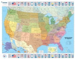
An annually updated political map of the USA. Beautifully coloured and laminated, with statistical information including population, surface area, state capital. Highlights the flags of each state. This laminated map, suitable to use with marker pens, is presented on a scale 1/3,450,000 and measures 100 x 127 cm.   * Flags of each states * State ...
22,95

Webshops met dit product

Webshop
Bezorging
Prijs

Anderen bekeken ook

Wandkaart Europa Europe politiek | Michelin
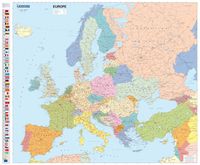
De Michelin kaart van Europa met meer dan 40 Europese landen is actueel, gedetailleerd, nauwkeurig, praktisch en internationaal. Landgrenzen zijn goed leesbaar. De grote wegen staan met afstanden en wegnummer vermeld.   Educational and decorative, this Europe political wall map is ideal for use in both home and office. Updated annually and beautifully coloured, this map highlights flags of each European country and includes information on population, surface area and density. This map also shows main European road networks, cities and capitals. This map is presented on a scale 1/4,300,000 and measures 100 x 122 cm.   MICHELIN Europe political wall map features:   * Flags for each European countries * Stastical information: population, surface area, density * Main road networks * Main cities of Europe and capitals
28,95
Wereldkaart 02 The World - Wereld | Michelin
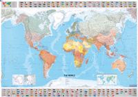
Mooie wereldkaart met duidelijke staatkundige weergave van de bekende kaartenmaker Michelin. Met aan de boven en onderkant de vlaggen van landen. Geplastificeerde versie! Beautifully colored Michelin world map. Highlights the flags of each country and includes population, surface area and density. Scale 1:28,000,000 - 1cm = 285 km . Laminated for durable use. The Michelin political wall map of the world is updated annually to ensure current representation and comprehensive coverage, including physical and climatic features. Detailed and uncluttered, the map reflects Michelin's superior cartographic standard and complements any office, home, or school setting. Statistical information is included in the map boundaries, along with flags of the world.
27,95
Wereldkaart 01 The World - Wereld, 144 x 100 cm | Michelin
Mooie wereldkaart met duidelijke staatkundige weergave van de bekende kaartenmaker Michelin. Met aan de boven en onderkant de vlaggen van landen.   Beautifully colored Michelin world map. Highlights the flags of each country and includes population, surface area and density. Scale 1:28,000,000 - 1cm = 285 km . Laminated for durable use.   The Michelin political wall map of the world is updated annually to ensure current representation and comprehensive coverage, including physical and climatic features. Detailed and uncluttered, the map reflects Michelin's superior cartographic standard and complements any office, home, or school setting. Statistical information is included in the map boundaries, along with flags of the world.     Afmeting 100 cm (h) bij 144 cm (b).
18,95
Wandkaart P Afrika Politiek, 100 x 120 cm | Maps International
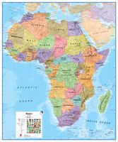
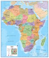
Fraaie politieke kaart van het continent, waarbij vooral de politieke aspecten heel duidelijk te lezen zijn. Alle landen hebben verschillende kleuren, steden en belangrijke verbindingen zijn goed te vinden. Geplastificeerde uitvoering. Geplastificeerd. Maps International's Africa political wall map shows the whole African continent from Morocco in the north, to South Africa and Madagascar in the south.  This political wall map of Africa features countries marked in different colours, with international borders clearly shown. The map's key shows a panel of flags from each of the countries displayed in this African continent map. This political wall map of Africa also contains population detail, capital cities and all the major towns and cities in this continent.  As with most of Maps International's maps, the Africa political wall map, is available either plain or laminated. Ideal size for an office or classroom or for planning a trip around Africa.
38,95
Wandkaart Afrika Politiek, 100 x 120 cm | Maps International
Fraaie politieke kaart van het continent, waarbij vooral de politieke aspecten heel duidelijk te lezen zijn. Alle landen hebben verschillende kleuren, steden en belangrijke verbindingen zijn goed te vinden. Papieren versie, geen ophangsysteem. Maps International's Africa political wall map shows the whole African continent from Morocco in the north, to South Africa and Madagascar in the south.  This political wall map of Africa features countries marked in different colours, with international borders clearly shown. The map's key shows a panel of flags from each of the countries displayed in this African continent map. This political wall map of Africa also contains population detail, capital cities and all the major towns and cities in this continent.  As with most of Maps International's maps, the Africa political wall map, is available either plain or laminated. Ideal size for an office or classroom or for planning a trip around Africa.
27,95
Wandkaart - Magneetbord Afrika Politiek - Africa Political, 120 x 100 cm | Maps International
Fraaie politieke kaart van het continent, waarbij vooral de politieke aspecten heel duidelijk te lezen zijn. Alle landen hebben verschillende kleuren, steden en belangrijke verbindingen zijn goed te vinden.   De kaart wordt in deze versie gelijmd op een plaat, voorzien van een mooie aluminium lijst en een ophangsysteem wordt meegeleverd. Daarnaast krijgt u een bakje bijgeleverd dat u er aan kunt bevestigen voor pennen, stiften of magneetjes.   Maps International's Africa political wall map shows the whole African continent from Morocco in the north, to South Africa and Madagascar in the south.    This political wall map of Africa features countries marked in different colours, with international borders clearly shown. The map's key shows a panel of flags from each of the countries displayed in this African continent map. This political wall map of Africa also contains population detail, capital cities and all the major towns and cities in this continent.    As with most of Maps Interna…
269,-
Wandkaart Middle East - Midden Oosten, 120 x 100 cm | Maps International
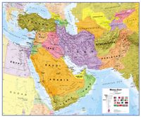
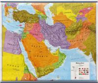
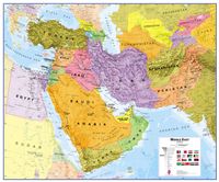
Maps International's Middle East wall map shows the whole of the Middle East area.    Middle East Map Details: This political wall map of the Middle East features countries marked in different colours, with international borders clearly shown. The map's key shows a panel of flags from each of the countries displayed in this Middle East map. This political wall map of Africa also contains population detail, capital cities and all the major towns and cities in this continent.    Middle East Map uses: As with most of our maps, the Middle East political wall map, is available in a range of finishes from paper and laminated finishes to wooden style frames. Ideal size for an office or classroom. 
37,95
Wandkaart Middle East - Midden Oosten, 120 x 100 cm | Maps International
Maps International's Middle East wall map shows the whole of the Middle East area.    Middle East Map Details: This political wall map of the Middle East features countries marked in different colours, with international borders clearly shown. The map's key shows a panel of flags from each of the countries displayed in this Middle East map. This political wall map of Africa also contains population detail, capital cities and all the major towns and cities in this continent.    Middle East Map uses: As with most of our maps, the Middle East political wall map, is available in a range of finishes from paper and laminated finishes to wooden style frames. Ideal size for an office or classroom. 
44,95
Wandkaart Middle East - Midden Oosten, 120 x 100 cm | Maps International
Maps International's Middle East wall map shows the whole of the Middle East area.    Middle East Map Details: This political wall map of the Middle East features countries marked in different colours, with international borders clearly shown. The map's key shows a panel of flags from each of the countries displayed in this Middle East map. This political wall map of Africa also contains population detail, capital cities and all the major towns and cities in this continent.    Middle East Map uses: As with most of our maps, the Middle East political wall map, is available in a range of finishes from paper and laminated finishes to wooden style frames. Ideal size for an office or classroom. 
27,95
Wandkaart - Prikbord Afrika Politiek - Africa Political, 120 x 100 cm | Maps International
Fraaie politieke kaart van het continent, waarbij vooral de politieke aspecten heel duidelijk te lezen zijn. Alle landen hebben verschillende kleuren, steden en belangrijke verbindingen zijn goed te vinden.   De wandkaarten op prikbord worden geleverd met een aluminium lijst en een eenvoudig te monteren ophangsysteem. Zij zijn geschikt voor allerhande markeringsystemen als vlaggetjes en prikkers.   Maps International's Africa political wall map shows the whole African continent from Morocco in the north, to South Africa and Madagascar in the south.    This political wall map of Africa features countries marked in different colours, with international borders clearly shown. The map's key shows a panel of flags from each of the countries displayed in this African continent map. This political wall map of Africa also contains population detail, capital cities and all the major towns and cities in this continent.    As with most of Maps International's maps, the Africa political wall map, …
185,-

Klanten-reviews van Wandkaart USA Politiek | Michelin

Er zijn nog geen beoordelingen voor dit productBen jij de eerste die een review plaatst?

Meer over Wandkaart USA Politiek | Michelin

Productomschrijving

An annually updated political map of the USA. Beautifully coloured and laminated, with statistical information including population, surface area, state capital. Highlights the flags of each state. This laminated map, suitable to use with marker pens, is presented on a scale 1/3,450,000 and measures 100 x 127 cm.   * Flags of each states * State boundaries and each state highlighted in a different colour * Statistical information: population, surface area, state capitals * Fully laminated * Keys in three languages: English, Spanish & French   
Webshop.nl maakt gebruik van cookies. Ga je verder op onze website, ga dan akkoord met het plaatsen van cookies en de verwerking van deze data door ons en vermelde partners.