webshop.nl
Categorieën
  Sluiten

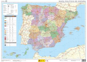
Wandkaart Spanje, 70 x 50 cm | CNIG - Instituto Geográfico Nacional

Administrative provinces of Spain shown in bright colours on a wall map at 1:2,250,000, size 70 x 50cm (27.5" x 20" approx), from IGN/CNIG - the country’s civilian survey organization, plus a panel of regional flags. Each province is presented in a different colour and the map also shows boundaries and names of administrative regions. Town symbols ...
16,95

Webshops met dit product

Webshop
Bezorging
Prijs

Anderen bekeken ook

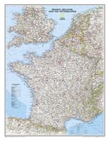
Wandkaart Frankrijk, België en Nederland, 60 x 77 cm | National Geographic
>Our classic wall map of France, Belgium, and the Netherlands shows political boundaries, major highways and roads, cities and towns, and a wealth of other incredibly accurate geographic detail.    France the map shows the division of the country into regions, with a list of their names and regional capitals (curiously, Corsica is not included on the map – what would Napoleon think of that?). The map also provides plenty of names of both geographical features (Pyrenees, Cevennes, etc) and the country’s traditional historical regions (Gascony, Maine, Bourbonais, etc). National parks are highlighted. Within Belgium the map indicates the division into Flanders, Wallonia and the Brussels Region and in the Netherlands boundaries of the country’s administrative provinces are marked. Topography is shown by relief shading and within the Netherlands the areas below the sea level are also indicated. The map shows the network of main road and rail connections, local airports, as well as ferry l…
25,95
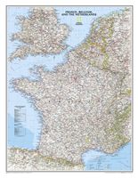
Wandkaart Frankrijk, België en Nederland, 60 x 77 cm | National Geographic
Our classic wall map of France, Belgium, and the Netherlands shows political boundaries, major highways and roads, cities and towns, and a wealth of other incredibly accurate geographic detail.  n France the map shows the division of the country into regions, with a list of their names and regional capitals (curiously, Corsica is not included on the map – what would Napoleon think of that?). The map also provides plenty of names of both geographical features (Pyrenees, Cevennes, etc) and the country’s traditional historical regions (Gascony, Maine, Bourbonais, etc). National parks are highlighted.   Within Belgium the map indicates the division into Flanders, Wallonia and the Brussels Region and in the Netherlands boundaries of the country’s administrative provinces are marked.   Topography is shown by relief shading and within the Netherlands the areas below the sea level are also indicated. The map shows the network of main road and rail connections, local airports, as well as ferry …
31,95
Pelgrimsroute (kaart) - Wandelkaart Camino Frances, wandelen naar Santiago de Compostela | CNIG - Instituto Geográfico Nacional
Kaarten voor de Camino Frances: Set van 10 topografische kaarten en een overzichtskaart om te wandelen door Noord Spanje naar Santiago de Compostella, op de kaarten  toeristische informatie (zoals overnachten, restaurants, bussen, winkels, etc) met symbolen aangegeven. De kaarten zijn met UTM grid en geschikt voor gebruik met GPS. Op de kaarten zijn ook hoogteprofielen te vinden. De pelgrimsroute is in 38 etappes en loopt vanaf de grens, Pyreneeen naar Santiago.   The whole of Way of St James to Santiago de Compostela in a set of 11 maps: 10 double-sided topographic maps at 1:50,000 plus an overview map of northern Spain, published by the Spanish civilian survey organization. Descriptions in 6 languages; English, French, Spanish, German, Italian & Portuguese   Each 1:50,000 map is double-sided and has four 57 x 35cm panels with full topographic mapping of the area through which the route passes. Contours are at 50m intervals, with additional shading and colouring/graphics to show se…
14,95
Wegenkaart - landkaart Mapa Provincial Huelva | CNIG - Instituto Geográfico Nacional
Deze kaart is zuiver gericht op de provincie als in de titel. Gebieden naast de kaart worden zonder kleur weergegeven. Ideale kaart als het gaat om het onderscheid in topografische details als hoogte, nationale parken, vegetatie en plaatsen. Met schaduwrelief wordt hoogte goed zichtbaar. Zeker geschikt voor fietsers, al heb je er soms wel veel nodig. Nadeel is het feit dat deze kaarten niet altijd even goed up-to-date zijn. Het komt soms wel voor dat bepaalde wegen inmiddels veel groter zijn geworden dan ingetekend op de kaart. Maar dan gaat het vooral om de grotere wegen: voor kleinere details is het een prima kaart. One of the titles in a series of contoured road maps from Spain's civilian survey organisation, each covering one administrative province, excellent in presenting the country’s topography and locations of its many national and natural parks. The maps have contours at 100-metre intervals enhanced by relief shading, plus spot heights. Additional colouring is used to indicat…
10,25
Wegenkaart - landkaart Mapa Provincial Caceres | CNIG - Instituto Geográfico Nacional
Deze kaart is zuiver gericht op de provincie als in de titel. Gebieden naast de kaart worden zonder kleur weergegeven. Ideale kaart als het gaat om het onderscheid in topografische details als hoogte, nationale parken, vegetatie en plaatsen. Met schaduwrelief wordt hoogte goed zichtbaar. Zeker geschikt voor fietsers, al heb je er soms wel veel nodig. Nadeel is het feit dat deze kaarten niet altijd even goed up-to-date zijn. Het komt soms wel voor dat bepaalde wegen inmiddels veel groter zijn geworden dan ingetekend op de kaart. Maar dan gaat het vooral om de grotere wegen: voor kleinere details is het een prima kaart. One of the titles in a series of contoured road maps from Spain's civilian survey organisation, each covering one administrative province, excellent in presenting the country’s topography and locations of its many national and natural parks. The maps have contours at 100-metre intervals enhanced by relief shading, plus spot heights. Additional colouring is used to indicat…
9,95
Wegenkaart - landkaart Mapa Provincial Alicante | CNIG - Instituto Geográfico Nacional
Deze kaart is zuiver gericht op de provincie als in de titel. Gebieden naast de kaart worden zonder kleur weergegeven. Ideale kaart als het gaat om het onderscheid in topografische details als hoogte, nationale parken, vegetatie en plaatsen. Met schaduwrelief wordt hoogte goed zichtbaar. Zeker geschikt voor fietsers, al heb je er soms wel veel nodig. Nadeel is het feit dat deze kaarten niet altijd even goed up-to-date zijn. Het komt soms wel voor dat bepaalde wegen inmiddels veel groter zijn geworden dan ingetekend op de kaart. Maar dan gaat het vooral om de grotere wegen: voor kleinere details is het een prima kaart. One of the titles in a series of contoured road maps from Spain's civilian survey organisation, each covering one administrative province, excellent in presenting the country’s topography and locations of its many national and natural parks. The maps have contours at 100-metre intervals enhanced by relief shading, plus spot heights. Additional colouring is used to indicat…
9,95
Wegenkaart - landkaart Mapa Provincial Almeria | CNIG - Instituto Geográfico Nacional
Deze kaart is zuiver gericht op de provincie als in de titel. Gebieden naast de kaart worden zonder kleur weergegeven. Ideale kaart als het gaat om het onderscheid in topografische details als hoogte, nationale parken, vegetatie en plaatsen. Met schaduwrelief wordt hoogte goed zichtbaar. Zeker geschikt voor fietsers, al heb je er soms wel veel nodig. Nadeel is het feit dat deze kaarten niet altijd even goed up-to-date zijn. Het komt soms wel voor dat bepaalde wegen inmiddels veel groter zijn geworden dan ingetekend op de kaart. Maar dan gaat het vooral om de grotere wegen: voor kleinere details is het een prima kaart. One of the titles in a series of contoured road maps from Spain's civilian survey organisation, each covering one administrative province, excellent in presenting the country’s topography and locations of its many national and natural parks. The maps have contours at 100-metre intervals enhanced by relief shading, plus spot heights. Additional colouring is used to indicat…
9,95
Wegenkaart - landkaart Mapa Provincial Avila | CNIG - Instituto Geográfico Nacional
Deze kaart is zuiver gericht op de provincie als in de titel. Gebieden naast de kaart worden zonder kleur weergegeven. Ideale kaart als het gaat om het onderscheid in topografische details als hoogte, nationale parken, vegetatie en plaatsen. Met schaduwrelief wordt hoogte goed zichtbaar. Zeker geschikt voor fietsers, al heb je er soms wel veel nodig. Nadeel is het feit dat deze kaarten niet altijd even goed up-to-date zijn. Het komt soms wel voor dat bepaalde wegen inmiddels veel groter zijn geworden dan ingetekend op de kaart. Maar dan gaat het vooral om de grotere wegen: voor kleinere details is het een prima kaart. One of the titles in a series of contoured road maps from Spain's civilian survey organisation, each covering one administrative province, excellent in presenting the country’s topography and locations of its many national and natural parks. The maps have contours at 100-metre intervals enhanced by relief shading, plus spot heights. Additional colouring is used to indicat…
9,95
Wegenkaart - landkaart Mapa Provincial Burgos | CNIG - Instituto Geográfico Nacional
Deze kaart is zuiver gericht op de provincie als in de titel. Gebieden naast de kaart worden zonder kleur weergegeven. Ideale kaart als het gaat om het onderscheid in topografische details als hoogte, nationale parken, vegetatie en plaatsen. Met schaduwrelief wordt hoogte goed zichtbaar. Zeker geschikt voor fietsers, al heb je er soms wel veel nodig. Nadeel is het feit dat deze kaarten niet altijd even goed up-to-date zijn. Het komt soms wel voor dat bepaalde wegen inmiddels veel groter zijn geworden dan ingetekend op de kaart. Maar dan gaat het vooral om de grotere wegen: voor kleinere details is het een prima kaart. One of the titles in a series of contoured road maps from Spain's civilian survey organisation, each covering one administrative province, excellent in presenting the country’s topography and locations of its many national and natural parks. The maps have contours at 100-metre intervals enhanced by relief shading, plus spot heights. Additional colouring is used to indicat…
9,95
Wegenkaart - landkaart Mapa Provincial Cantabria | CNIG - Instituto Geográfico Nacional
Deze kaart is zuiver gericht op de provincie als in de titel. Gebieden naast de kaart worden zonder kleur weergegeven. Ideale kaart als het gaat om het onderscheid in topografische details als hoogte, nationale parken, vegetatie en plaatsen. Met schaduwrelief wordt hoogte goed zichtbaar. Zeker geschikt voor fietsers, al heb je er soms wel veel nodig. Nadeel is het feit dat deze kaarten niet altijd even goed up-to-date zijn. Het komt soms wel voor dat bepaalde wegen inmiddels veel groter zijn geworden dan ingetekend op de kaart. Maar dan gaat het vooral om de grotere wegen: voor kleinere details is het een prima kaart. One of the titles in a series of contoured road maps from Spain's civilian survey organisation, each covering one administrative province, excellent in presenting the country’s topography and locations of its many national and natural parks. The maps have contours at 100-metre intervals enhanced by relief shading, plus spot heights. Additional colouring is used to indicat…
9,95

Klanten-reviews van Wandkaart Spanje, 70 x 50 cm | CNIG - Instituto Geográfico Nacional

Er zijn nog geen beoordelingen voor dit productBen jij de eerste die een review plaatst?

Meer over Wandkaart Spanje, 70 x 50 cm | CNIG - Instituto Geográfico Nacional

Productomschrijving

Administrative provinces of Spain shown in bright colours on a wall map at 1:2,250,000, size 70 x 50cm (27.5" x 20" approx), from IGN/CNIG - the country’s civilian survey organization, plus a panel of regional flags. Each province is presented in a different colour and the map also shows boundaries and names of administrative regions. Town symbols and names indicate their size and administrative status. The map shows the network of main roads and railways. Latitude and longitude lines are drawn at intervals of 1°. Map legend is in Spanish only.    Next to the map is a panel listing Spain’s autonomous regions, including Ceuta and Melilla, each with its flag, plus a list of its constituent provinces and their capitals. Mapa General de España (Península Ibérica, Baleares, Canarias, Ceuta, Melilla y posesiones españolas en el norte de África) a escala 1:2.000.000, con división autonómica. Proyección Lambert.
Webshop.nl maakt gebruik van cookies. Ga je verder op onze website, ga dan akkoord met het plaatsen van cookies en de verwerking van deze data door ons en vermelde partners.