webshop.nl
Categorieën
  Sluiten

Meer Tracks4Africa
Meer Tracks4Africa in Woontextiel

Wandkaart Southern Africa - Zuid Afrika | 130 x 98 cm | Tracks4Africa

0
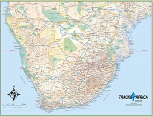
Our SOUTHERN AFRICA WALL MAP is printed at a scale of 1:2.5 million and laminated on both sides. The size of the final map is 1300 X 980 mm.   The map covers South Africa, Lesotho, eSwatini, Zimbabwe, Botswana and Namibia in full.  It also includes the majority of Mozambique up to Nampula.  A small section of southern Angola up to Lubango is includ...

Webshops met dit product

Webshop
Bezorging
Prijs

Anderen bekeken ook

Wandkaart Southern Africa - Zuid Afrika | 130 x 98 cm | Tracks4Africa
Our SOUTHERN AFRICA WALL MAP is printed at a scale of 1:2.5 million and laminated on both sides. The size of the final map is 1300 X 980 mm.   The map covers South Africa, Lesotho, eSwatini, Zimbabwe, Botswana and Namibia in full.  It also includes the majority of Mozambique up to Nampula.  A small section of southern Angola up to Lubango is included and the southern part of Zambia is covered up to Kabwe.  The southern tip of Malawi up to where the lake starts is also included.   Perfect for macro planning of road trips across Southern Africa up to Southern Angola.   Printed in full colour, all major and secondary roads are shown with national parks, towns, country borders, international airports and major tourist attractions are clearly visible. Includes a good number of tracks in remote areas.   Individually packaged in carton tube 1000x75mm with plastic caps on both ends
89,95
Wandkaart Africa - Afrika Zuid | 98 x 130 | Tracks4Africa
Our AFRICA WALL MAP is printed at a scale of 1:4 million and laminated on both sides. The size of the final map is 1300 X 980 mm.   The map includes countries from South Africa in the south to Ethiopia in the north.   Perfect for macro planning of self-drive trips through Southern and Eastern Africa and even to West Africa up to Gabon.   Printed in full colour, all major and secondary roads are shown with national parks and country borders clearly visible.   The Tracks4Africa Wall Map is printed to a scale of 1:4million and provides a surprising amount of detail to the self-drive traveller.  The map is perfect for macro planning of extended road trips across the African continent up to Ethiopia in the east and Gabon in west.  The map indicates major and secondary roads, parks, towns and a good number of tracks in remote areas.  Major tourist attractions are indicated  where space allows for it. International airports and country borders suitable for vehicle crossings are indicated.  …
89,95
Wegenatlas Traveller's Atlas Southern Africa - Zuidelijk Afrika | A3-F
Deze atlas omvat tien landen in zuidelijk Afrika en is speciaal gericht op reizigers die zelf rijden. De betrokken landen zijn: Angola, Botswana, Lesotho, Malawi, Mozambique, Namibië, Zuid-Afrika, Swaziland, Zambia en Zimbabwe.   De Atlas bevat 223 kaartpagina's met hetzelfde vertrouwde kaartdetail waarvoor Tracks4Africa bekend is.   De wegenatlas is afgedrukt in A3 formaat, weegt 2750g, heeft een stevige omslag, spiraal gebonden en de pagina's zijn afgedrukt op dik papier.   Bigger coverage than ever before: 1:4m maps for Southern and Eastern Africa – ideal for macro planning. 1:1m maps for Southern Africa, covering the following countries: Angola, Botswana, eSwatini, Lesotho, Malawi, Mozambique, Namibia, South Africa, Zambia and Zimbabwe. 1:500k maps for South Africa, Malawi, most part of Zambia and the area around Moremi/Chobe in Botswana. Road coverage: This Atlas is designed for overland travel and compiled from the same data used on our famous GPS maps. Use it for trip pl…
79,95
Wegenkaart - landkaart Africa central and south - Afrika zuid en centr
This title is in our series of regional titles for Africa at 1:3,400,000 scale. All of Africa is available as a continental sheet at 1:5M scale and as regional titles at 1:3.8M and 1:3.4M, based on GIS data. This is a milestone for ITMB and the realization of a dream that began in 1993. However, the work is still only in its early stages. This map covers that portion of the continent that old Africa hands always referred to as 'central', meaning the Rhodesias and Nyasaland � now known as Zambia, Malawi, and Zimbabwe.   By its shape, generous portions of the southern portions of DEM Congo, the eastern third of Angola, the northern half of Mozambique, and Botswana's Okavunga Delta are included on the one side. The second side covers South Africa, Lesotho, Swaziland, the rest of Botswana, and southern Namibia in great detail. This is an excellent map for anyone visiting the larger region of the southern third of Africa. As with our other regional titles, this is a work in progress. The ne…
13,95
Wegenkaart - landkaart SC5&SC6 George to Kareedouw | Tracks4Africa
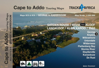
The Cape to Addo map series covers the southern parts of the Western Cape of South Africa in a series of eight highly detailed maps, printed on four sheets of A1 durable paper.   We start in Cape Town in the west and move along the southern coast through the Overberg, Winelands, Garden Route, Klein Karoo R62, Baviaanskloof to eventually arrive in the Addo National Park up to Gqeberha (Port Elizabeth) in the east.   The maps are highly detailed and well researched. Our map scale is 1:200 000 which allows us to show a lot of detail including minor gravel roads, hiking trails, farm boundaries and points of interest which are relevant to self-drive tourists.   The size of the paper is kept small enough to allow this to be the perfect road tripping map. We use Duraflex paper and print two maps per sheet of A1 paper, making this a four-sheet series. Each map sheet is individually packed in a plastic protective sleeve.   The maps are perfect for day drives, overlanding or just doing road trip…
29,95
Wegenkaart - landkaart 3204 Adventure Map South Africa - Zuid Afrika |
Wegenkaart van Zuid Afrika met vermelding van veel bezienswaardigheden, nationale parken en attrakties. Watervast en scheurvast. Juist door deze vermeldingen onderscheidt de kaart zich van andere wegenkaarten. National Geographic’s South Africa Adventure Map is designed to meet the unique needs of adventure travelers—detailed, durable, and accurate. It includes the locations of thousands of major cities and towns with an index for easily locating them, plus a clearly marked road network complete with distances and designations for major highways, limited access highways, and more. Both paved and unpaved roads, tracks, and trails are marked for those adventurers who wish to explore less traveled routes.   What sets National Geographic Adventure Maps apart from traditional road maps are the hundreds of points-of-interest that highlight the diverse, unique, and exotic destinations within South Africa including national parks and reserves, sanctuaries, World Heritage sites, archeological s…
17,50
Wegenkaart - landkaart SC7&SC8 Baviaanskloof to Addo | Tracks4Africa
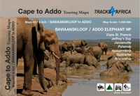
The Cape to Addo map series covers the southern parts of the Western Cape of South Africa in a series of eight highly detailed maps, printed on four sheets of A1 durable paper.   We start in Cape Town in the west and move along the southern coast through the Overberg, Winelands, Garden Route, Klein Karoo R62, Baviaanskloof to eventually arrive in the Addo National Park up to Gqeberha (Port Elizabeth) in the east.   The maps are highly detailed and well researched. Our map scale is 1:200 000 which allows us to show a lot of detail including minor gravel roads, hiking trails, farm boundaries and points of interest which are relevant to self-drive tourists.   The size of the paper is kept small enough to allow this to be the perfect road tripping map. We use Duraflex paper and print two maps per sheet of A1 paper, making this a four-sheet series. Each map sheet is individually packed in a plastic protective sleeve.   The maps are perfect for day drives, overlanding or just doing road trip…
29,95

Klanten-reviews van Wandkaart Southern Africa - Zuid Afrika | 130 x 98 cm | Tracks4Africa

Er zijn nog geen beoordelingen voor dit productBen jij de eerste die een review plaatst?

Meer over Wandkaart Southern Africa - Zuid Afrika | 130 x 98 cm | Tracks4Africa

Productomschrijving

Our SOUTHERN AFRICA WALL MAP is printed at a scale of 1:2.5 million and laminated on both sides. The size of the final map is 1300 X 980 mm.   The map covers South Africa, Lesotho, eSwatini, Zimbabwe, Botswana and Namibia in full.  It also includes the majority of Mozambique up to Nampula.  A small section of southern Angola up to Lubango is included and the southern part of Zambia is covered up to Kabwe.  The southern tip of Malawi up to where the lake starts is also included.   Perfect for macro planning of road trips across Southern Africa up to Southern Angola.   Printed in full colour, all major and secondary roads are shown with national parks, towns, country borders, international airports and major tourist attractions are clearly visible. Includes a good number of tracks in remote areas.   Individually packaged in carton tube 1000x75mm with plastic caps on both ends

Productspecificaties

Artikelnummer(s)
Brand
Tracks4Africa

Verken gerelateerde categorieën

Webshop.nl maakt gebruik van cookies. Ga je verder op onze website, ga dan akkoord met het plaatsen van cookies en de verwerking van deze data door ons en vermelde partners.