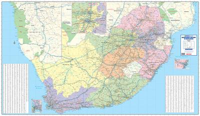
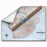
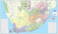
Wandkaart South Africa business map 4-delig | 260 x 152 cm | MapStudio

0

Verkopers met dit product

Verkoper
Bezorging
Prijs
DeZwerver.nl logo
DeZwerver.nl
2,95
111,95

Anderen bekeken ook

Nieuw
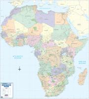
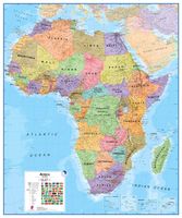
Wandkaart Africa executive Political 2-delig | 176 x 160 cm | MapStudio
Africa Executive Political Wall Map is an easy-to-read comprehensive map of Africa includes the new South Sudan boundary.   Coverage on the Africa Executive Political Wall Map includes capital cities, major towns, towns, major and main routes with route numbers and distances.   Contents of the map of Africa includes national, main and secondary roads in detail, colour-coded countries for convenient overview, rail routes with lines and stations, national parks, reserves, sea routes and distances to major ports, international boundaries, border crossings, airports, airfields, water features (dams, lakes, rivers, deltas), places of interest and historic sites. Coverage shows all countries in Africa including Madagascar.  
78,95
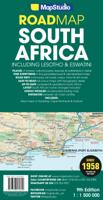
Wegenkaart - landkaart Zuid-Afrika - South Africa, Lesotho & Swaziland | MapStudio
Duidelijke overzichtskaart van Zuid Afrika, Lesotho en Swaziland. Met gedetailleerde kaarten van de regio's Gauteng, Kaapse Schiereiland en Durban. South Africa Lesotho and Swaziland map is a  new edition which includes major and minor routes with route markers, tourist regions and has an index to place names.   Content includes places of interest, mountain passes, topography, national parks & reserves, historic sites, railway lines & stations, route numbers, distance table and the latest toll routes and all route classifications.   Coverage includes a detailed map of South Africa at a scale of 1 : 1 500 000 along with detailed area maps of Gauteng, Durban and Cape Peninsula.
16,95
Wandkaart Africa - Afrika, 97 x 119 cm | Stiefel
Duidelijke, heldere kaart van Afrika. Geplastificeerd met metalen ophangstrips.Beschrijfbaar en afwisbaar. Wandkarte mit Metallbeleistung - beschreib- und abwischbar - extrem reißfest- - Ländergrenzen - alle wichtigen Städte und Hauptstädte - Postleitzahlenbereiche (soweit vorhanden) - Hauptverkehrsnetz, internationale Flughäfen, wichtige Häfen und Bahnlinien - Landschaftsnamen - Gebirge - Höhen- und Gebirgszüge als Relief dargestellt - Beschriftung in englischer Sprache
22,95
Nieuw
Wegenkaart - landkaart 3204 Adventure Map South Africa - Zuid Afrika | National Geographic
Wegenkaart van Zuid Afrika met vermelding van veel bezienswaardigheden, nationale parken en attrakties. Watervast en scheurvast. Juist door deze vermeldingen onderscheidt de kaart zich van andere wegenkaarten. National Geographic’s South Africa Adventure Map is designed to meet the unique needs of adventure travelers—detailed, durable, and accurate. It includes the locations of thousands of major cities and towns with an index for easily locating them, plus a clearly marked road network complete with distances and designations for major highways, limited access highways, and more. Both paved and unpaved roads, tracks, and trails are marked for those adventurers who wish to explore less traveled routes.   What sets National Geographic Adventure Maps apart from traditional road maps are the hundreds of points-of-interest that highlight the diverse, unique, and exotic destinations within South Africa including national parks and reserves, sanctuaries, World Heritage sites, archeological …
17,50
Wandkaart China - political, 95 x 69 cm | Gizi Map
Een wandkaart van China waarop de politieke grenzen en steden tweetalig staan weergeven. Natuurkundige aspecten zijn weggelaten, maar dat komt de politieke en bestuurlijke indeling duidelijk ten goede. Afmetingen: 69cm.x 95cm. (hxb) An administrative wall map of China at 1:6,500,000, size 96 x 68cm (38" x 27" approx), from Gizi Map showing the division of the country into provinces. All place names are given in both Chinese and Latin alphabet. Hong Kong and the Pearl River Delta are presented in a greater detail on an inset.   China’s provinces are shown in bright contrasting colours. Town symbols indicate the size of the population. Main airports and ports are marked, as well as coastal and international shipping routes, Topographic information is limited to the network of rivers. Latitude and longitude lines are at 5° intervals. The map is not indexed. Multilingual map legend includes English. An inset shows Hong Kong and the Pearl River Delta region at 1:1,000,000.
46,95
Wandkaart Nieuw Zeeland, 74 x 93 cm | Gizi Map
Geïndexeerde wegenkaart van Nieuw-Zeeland, ontworpen om een goed overzicht te geven van de topografie van het land. De kaart heeft hoogtekleuren met punthoogtes en namen van verschillende bergketens en geselecteerde bergtoppen. Nationale parken en beschermde gebieden zijn duidelijk aangegeven.   Het wegennet omvat geselecteerde plattelandswegen en toont tussenliggende afstanden op hoofdroutes. Spoorwegen, lokale luchthavens en belangrijkste veerbootverbindingen zijn gemarkeerd en de kaart toont ook lokale interne administratieve divisies met de namen van de regio's.   Symbolen markeren verschillende bezienswaardigheden, zoals stranden, duik- en windsurflocaties, skigebieden, grotten, campings, enz. De kaart heeft een rooster voor lengte- en breedtegraden met intervallen van 1º. De legenda van de kaart is in het Engels. De index staat op de achterkant.   Er zijn ook aparte afstandstabellen opgenomen voor de Noord- en Zuid-eilanden, een kleine administratieve kaart van het land en een k…
46,95
Nieuw
Wandkaart China - geografisch, 120 x 88 cm | Gizi Map
Prachtige wandkaart van China, waarbij zowel de politieke natuurkundige aspecten goed zichtbaar zijn. In rood zijn de belangrijkste toeristische hoogtepunten ingetekend. Kleurgebruik is vrij fel, maar daardoor wordt het geheel bijzonder mooi. De afmetingen zijn 120 x 88 cm. Hooggebergte, woestijnen, laagland en aanduidingen van hoogte vind je op de kaart. Ook een grote hoeveelheid plaatsen en de belangrijkste verbindingsroutes zijn ingetekend.  
49,95

Klanten-reviews van Wandkaart South Africa business map 4-delig | 260 x 152 cm | MapStudio

Er zijn nog geen beoordelingen voor dit productBen jij de eerste die een review plaatst?

Meer over Wandkaart South Africa business map 4-delig | 260 x 152 cm | MapStudio

Verken gerelateerde categorieën

Webshop.nl maakt gebruik van cookies. Ga je verder op onze website, ga dan akkoord met het plaatsen van cookies en de verwerking van deze data door ons en vermelde partners.