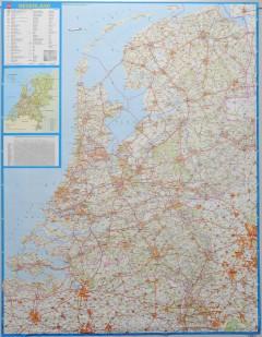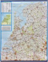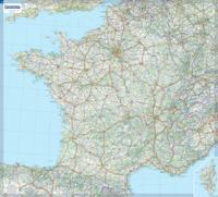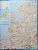
Wandkaart P Nederland Basic, 100 x 130 cm | Falk

0
Wandkaart - Falk Nederland met een  formaat van 130 (h) X 100  (b) cm. Het is een zeer gedetailleerde en duidelijke wandkaart, met veel plaatsen, wegen met wegnummers, afritten. Deze kaarten zijn echt gericht op plaatsen en wegen, natuurgebieden zijn minder duidelijk aangegeven.   Gelamineerd. Wordt geleverd op rol in plastic koker....

Verkopers met dit product

Verkoper
Bezorging
Prijs
DeZwerver.nl logo
DeZwerver.nl
5,95
42,95

Anderen bekeken ook

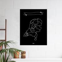
Magneetbord Nederland Basic 100 x 130 cm | Falk
Magneetbord Falk Nederland met een  formaat van 130 (h) X 100  (b) cm. Het is een zeer gedetailleerde en duidelijke wandkaart, met veel plaatsen, wegen met wegnummers, afritten. Deze kaarten zijn echt gericht op plaatsen en wegen, natuurgebieden zijn minder duidelijk aangegeven.   Magneetbord Nederland Hierbij wordt een landkaart op een staalplaat gekleefd, geplastificeerd met een beschrijfbare & drooguitwisbare folie, omkaderd met een stijlvol ALU-profiel en afgewerkt met grijze ronde hoekstukjes. De rugzijde van het paneel wordt voorzien van een gelamineerde polystyreen schuimplaat (kapamount). Pennengoot en standaard-ophangsysteem worden bijgeleverd en zijn, net zoals de verpakking in bubbelfolie, in de prijs begrepen   Bij deze kaart wordt een set magneetjes ( 10 stuks) gratis meegeleverd      
299,-
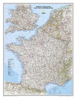
Wandkaart Frankrijk, België en Nederland, 60 x 77 cm | National Geographic
Our classic wall map of France, Belgium, and the Netherlands shows political boundaries, major highways and roads, cities and towns, and a wealth of other incredibly accurate geographic detail.  n France the map shows the division of the country into regions, with a list of their names and regional capitals (curiously, Corsica is not included on the map – what would Napoleon think of that?). The map also provides plenty of names of both geographical features (Pyrenees, Cevennes, etc) and the country’s traditional historical regions (Gascony, Maine, Bourbonais, etc). National parks are highlighted.   Within Belgium the map indicates the division into Flanders, Wallonia and the Brussels Region and in the Netherlands boundaries of the country’s administrative provinces are marked.   Topography is shown by relief shading and within the Netherlands the areas below the sea level are also indicated. The map shows the network of main road and rail connections, local airports, as well as ferry…
31,95
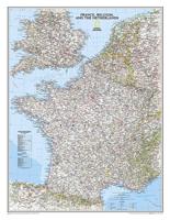
Wandkaart 22074 Frankrijk, België en Nederland, 60 x 77 cm | National Geographic
>Our classic wall map of France, Belgium, and the Netherlands shows political boundaries, major highways and roads, cities and towns, and a wealth of other incredibly accurate geographic detail.    France the map shows the division of the country into regions, with a list of their names and regional capitals (curiously, Corsica is not included on the map – what would Napoleon think of that?). The map also provides plenty of names of both geographical features (Pyrenees, Cevennes, etc) and the country’s traditional historical regions (Gascony, Maine, Bourbonais, etc). National parks are highlighted. Within Belgium the map indicates the division into Flanders, Wallonia and the Brussels Region and in the Netherlands boundaries of the country’s administrative provinces are marked. Topography is shown by relief shading and within the Netherlands the areas below the sea level are also indicated. The map shows the network of main road and rail connections, local airports, as well as ferry …
25,95
Wandkaart USA - Verenigde Staten, politiek, 110 x 77 cm | National Geographic
  Het klassieke kaartbeeld van National Geographic, de grenzen van de staten van Amerika zijn apart gekleurd. De wandkaart is heel gedetailleerd met veel plaatsen, wegen, rivieren en nationale parken, het reliëf wordt met schaduw aangegeven. Geplastificeerde versie.   The National Geographic Classic United States map uses bright color bands to outline each state. Capitals, major cities, selected towns, bodies of water, highways, and national parks are all shown. Shaded relief, rich in detail, emphasizes the many mountains, valleys, and plateaus of the United States.    Our most popular United States wall map. Features all 50 States with insets for Alaska and Hawaii. All major cities, transportation routes, State boundaries, National Parks, inland waterways, and mountain ranges are clearly displayed and labeled. 
36,95

Klanten-reviews van Wandkaart P Nederland Basic, 100 x 130 cm | Falk

Er zijn nog geen beoordelingen voor dit productBen jij de eerste die een review plaatst?

Meer over Wandkaart P Nederland Basic, 100 x 130 cm | Falk

Productomschrijving

Wandkaart - Falk Nederland met een  formaat van 130 (h) X 100  (b) cm. Het is een zeer gedetailleerde en duidelijke wandkaart, met veel plaatsen, wegen met wegnummers, afritten. Deze kaarten zijn echt gericht op plaatsen en wegen, natuurgebieden zijn minder duidelijk aangegeven.   Gelamineerd. Wordt geleverd op rol in plastic koker.

Productinformatie

    Verken gerelateerde categorieën

    Webshop.nl maakt gebruik van cookies. Ga je verder op onze website, ga dan akkoord met het plaatsen van cookies en de verwerking van deze data door ons en vermelde partners.