webshop.nl
Categorieën
  Sluiten

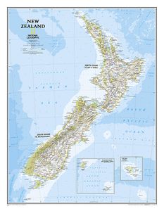
Wandkaart New Zealand - Nieuw Zeeland 60 x 77 cm | National Geographic

Mooie heldere wandkaart van Nieuw Zeeland met het Noordereiland en Zuidereiland op dezelfde kant afgebeeld. Veel plaatsnamen, goed kleurgebruik waardoor hoogteverschillen en bijvoorbeeld nationale parken goed zichtbaar zijn.   The reference map of New Zealand uses National Geographic's signature Classic style with blue ocean and stunning shaded rel...
31,95

Webshops met dit product

Webshop
Bezorging
Prijs

Anderen bekeken ook

Wegenkaart - landkaart 3500 Adventure Map New Zealand - Nieuw Zeeland | National Geographic
Wegenkaart van Nieuw Zeeland met vermelding van veel bezienswaardigheden, nationale parken en attrakties. Watervast en scheurvast. Juist door deze vermeldingen onderscheidt de kaart zich van andere wegenkaarten. National Geographic's New Zealand Adventure Map is designed to meet the unique needs of adventure travelers—detailed, durable, and accurate. The map includes the locations of thousands of major cities and towns with an index for easily locating them, plus a clearly marked road network complete with distances and designations for major highways, toll roads, limited access highways and more.   What sets National Geographic Adventure Maps apart from traditional road maps are the hundreds of points-of-interest that highlight the diverse, unique, and exotic destinations within New Zealand including National Parks and Preserves, World Heritage Sites, Archeological sites, ski areas, beaches, golf courses, camping areas, waterfalls, natural points of interest and important travel aids …
17,50
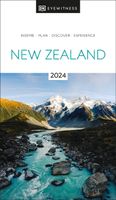
Reisgids New Zealand - Nieuw Zeeland | Eyewitness
Prachtig geillustreerde reisgids met o.a. 3D tekeningen, fraaie kaarten en geweldige foto’s. Daarnaast uitgebreide achtergrondbeschrijvingen. Echt om in de stemming te komen! Groot formaat gids. Engelstalig Whether you're seeking your next adrenaline-fix, the best place to taste traditional Maori cuisine, or the perfect geothermal pool to unwind in, your DK Eyewitness travel guide makes sure you experience all that New Zealand has to offer. An explosion of dramatic scenery, this far-flung Pacific island has it all: mammoth mountains, icy-blue glacial lakes, unspoiled coastlines, idyllic vineyards and cool, cultural cities. From the subtropical kauri forests of the North Island to the remote fjords of the South Island, New Zealand offers countless opportunities for adventure. Our updated guide brings New Zealand to life, transporting you there like no other travel guide does with expert-led insights, trusted travel advice, detailed breakdowns of all the must-see sights, photographs on…
22,50
Wegenkaart - landkaart Nieuw - Zeeland | Borch
Mooie geplasticieerde kaart van Nieuw - Zeeland. Deze kaart biedt een goed overzicht van het land met detailkaarten.   Our soft-laminated map of New Zealand includes: North Island 1:1 300 000, South Island 1:1 300 000, Auckland 1:20 000, Christchurch 1:20 000, Dunedin 1:15 000,  Nelson 1:15 000, Rotorua 1:15 000, Queenstown 1:15 000, Wellington 1:20 000, New Zealand administrative & time zones, interesting statistics, conversion chart for temperatures, weights and measures, climate chart with temperatures, sunshine hours, precipitation and humidity and much more.   "4 million inhabitants and 60 million sheep" does not do justice to the charm and natural diversity of this beautiful country. Lush meadows and fertile soils are only some of the natural resources with which New Zealand is endowed, the real natural wealth of this island state in the middle of the South Pacific lies in its incredibly diverse landscape: snow-covered mountains, dense forests, lush green lowlands, crystal-clear …
11,50
Reisgids Culture Smart! New Zealand - Nieuw Zeeland | Kuperard
De Cultuur Bewust!-gids geeft toeristen en zakenlieden belangrijke informatie met betrekking tot de cultuur van alledag in het land van bestemming. Anders dan in de gebruikelijke reisgidsen wordt de lezer in deze reeks bijgespijkerd op het gebied van omgangsvormen, normen en waarden, hoe zich te gedragen en wat verwacht mag worden op zakelijk en sociaal gebied. Het zijn beknopte zakformaatgidsen met interessante wetenswaardigheden over het dagelijks leven. Een must voor iedereen die naar het buitenland gaat voor vakantie, studie of werk. Culture Smart! New Zealand offers insights into a country that is reflecting on its identity, having shed its colonial past and now moving from a bicultural society (Maori and European) toward a new multiculturalism. Despite the challenges ahead a declining agricultural sector and the consequences for an economy that depends largely on international tradeNew Zealand society is resilient, underpinned by the values of anti-materialism, tolerance, patienc…
15,95
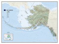
Wandkaart Alaska, 103 x 78 cm | National Geographic
Deze wandkaart van National Geographic is zeer gedetailleerd en bevat alle belangrijke plaatsen. Daarnaast is er ruimte voor de landschappelijke details zoals hoogtelijnen, rivieren, belangrijke wegen en andere items zoals politieke grenzen, luchthavens .    Alaska physical wall map, size 103 x 78cm at 1:3,660,000 from the National Geographic, with colouring to show the topography and plenty of place names. Coverage includes the panhandle and the outermost Aleutian Islands in their proper geographical placing.   Altitude colouring and relief shading shows the topography, with names of mountain ranges, peaks with heights (in feet), etc. Boundaries of national parks and other protected areas are marked. The map shows Alaska’s road network, the railway line from Anchorage to Fairbanks, numerous local airfields with scheduled air or seaplane services, and ferry routes. The map has a very large number of place names: towns and settlements, geographical features including islands, bays, etc.…
36,95
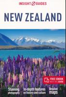
Reisgids New Zealand - Nieuw Zeeland | Insight Guides
Een rijk geillustreerde reisgids met diepgaande teksten: één van de beste reisgidsen die er bestaan. Eerste deel bestaat uit een beschrijving van de unieke aspecten van de regio, daarna een deel echte reisgids en als afsluiting een deel met praktische informatie. De uitstekende informatie wordt vergezeld van prachtige foto's en heldere kaarten. Niet alleen om mee te nemen, maar ook om vooraf en zelfs achteraf weer in de stemming te komen From deciding when to go, to choosing what to see when you arrive, this is all you need to plan your trip and experience the best of New Zealand, with in-depth insider information on must-see, top attractions like Rotorua, Rakiura National Park and Otago, and hiddencultural gems.   · Insight Guide New Zealand is ideal for travellers seeking immersive cultural experiences, from exploring Maori culture, to discovering New Zealand's food and wine · In-depth on history and culture: enjoy special features on wildlife, New Zealand's people and Maori handcraf…
25,95
Wegenkaart - landkaart Planning Map New Zealand - Nieuw Zeeland | Lonely Planet
Durable and waterproof, with a handy slipcase and an easy-fold format, Lonely Planet New Zealand Planning Map is your conveniently-sized passport to traveling with ease. Get more from your map and your trip with images and information about top country attractions, itinerary suggestions, a transport guide, planning information, themed lists and practical travel tips. With this easy-to-use, full colour navigation tool in your back pocket, you can truly get to the heart of New Zealand, so begin your journey now! Durable and waterproof Easy-fold format and convenient size Handy slipcase Full colour and easy-to-use Before-you-go info Beautiful imagery Tailored itineraries Can't-miss regional highlights Detailed town index Transport planner Themed lists Covers Auckland, Bay of Islands, Hauraki Gulf, Waiheke Island, Rotorua, Bay of Plenty, Coromandel Peninsula, Wellington, Abel Tasman National Park, Marlborough Wine Region, Taupo, Tongariro Alpine Crossing, Matamata, Waitomo,…
10,95
Reisgids New Zealand - Nieuw Zeeland | Rough Guides
Zeer goede reisgids voor zowel de georganiseerde maar vooral voor de zelfstandige reiziger. Boordevol informatie over reizen, slapen, eten, maar ook musea en cultuur. Voor veel landen meestal completer en beter dan de Lonely Planet ! This practical travel guide to New Zealand features detailed factual travel tips and points-of-interest structured lists of all iconic must-see sights as well as some off-the-beaten-track treasures. Our itinerary suggestions and expert author picks of things to see and do will make it a perfect companion both, ahead of your trip and on the ground. This New Zealand guide book is packed full of details on how to get there and around, pre-departure information and top time-saving tips, including a visual list of things not to miss. Our colour-coded maps make New Zealand easier to navigate while you're there. This guide book to New Zealand has been fully updated post-COVID-19 and it comes with a free eBook.   The Rough Guide to New Zealand covers: Auckland …
27,95
Wegenkaart - landkaart 790 New Zealand - Nieuw Zeeland | Michelin
Zoals je van Michelin mag verwachten is deze kaart zeer overzichtelijk en heeft een duidelijk helder kaartbeeld. De kaart geeft uitgebreide toeristische informatie weer. De perfecte overzichtskaart!   This New Zealand map from Michelin is part of their red national map series. These are perfect for route planning as well as getting around by car once you're there. They clearly mark out major roads and also show many of the more important minor roads.    The map's simple folding design with durable paper cover, allows it to be read like a book and easily folded back together. Road numbers and intermediate distances are clearly displayed with the more scenic routes highlighted in green.   The map also features:   Political boundaries Regional and National Parks Important sights (points of interest, historic sites, etc.) Driving Times and Distances Road Safety Information A legend in multiple languages (Dutch, English, French, German and Spanish) Michelin New Zealand Map 790 is a new addi…
12,95
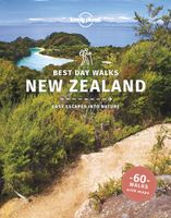
Wandelgids Best Day Walks New Zealand - Nieuw Zeeland | Lonely Planet
Lonely Planet heeft een nieuwe serie uitgebracht: Best Day Walks in verschillende landen. Het zijn de - door Lonely Planet uitgekozen - mooiste wandelingen verspreid over het land. Goed beschreven, met een schetsmatige kaart erbij ... het werkt heel stimulerend met mooie foto's! Lonely Planet's Best Day Walks New Zealand is your passport to 60 easy escapes into nature. Stretch your legs outside the city by picking a hike that works for you, from a few hours to a full day, from easy to hard. Climb ancient volcanoes, view amazing vistas, and scale tall mountains. Get to the heart of New Zealand and begin your journey now!       Inside Lonely Planet's Best Day Walks New Zealand Travel Guide:   Up-to-date information - all businesses were rechecked before publication to ensure they are still open after 2020’s COVID-19 outbreak   Colour maps and images throughout   Special features - on New Zealand's highlights for walkers, kid-friendly walks, accessible trails and what to take   Best for… …
22,50

Klanten-reviews van Wandkaart New Zealand - Nieuw Zeeland 60 x 77 cm | National Geographic

Er zijn nog geen beoordelingen voor dit productBen jij de eerste die een review plaatst?

Meer over Wandkaart New Zealand - Nieuw Zeeland 60 x 77 cm | National Geographic

Productomschrijving

Mooie heldere wandkaart van Nieuw Zeeland met het Noordereiland en Zuidereiland op dezelfde kant afgebeeld. Veel plaatsnamen, goed kleurgebruik waardoor hoogteverschillen en bijvoorbeeld nationale parken goed zichtbaar zijn.   The reference map of New Zealand uses National Geographic's signature Classic style with blue ocean and stunning shaded relief. The map shows this island nation in great detail, from the subtropical North Island (Te Ika-a-Maui) to the glacial carved valleys of Fiordland on the South Island (Te Waipounamu). The North Island is best known for large volcanic lakes and the cities of Auckland and Wellington. The South Island is famous for the Southern Alps that run along the spine of the island. The highest point in the country is Aoraki (Mount Cook) and is found in the Southern Alps.   The first settlers of New Zealand were the Maori from Polynesia, the names on the map reflect this history with both English and Maori variants. The map also features a transportation network including highways, roads, passenger railroads, and major airports. All National Parks are also shown.   The laminated version of the map is encapsulated in heavy-duty 1.6 mil laminate. The laminated map can be framed easily and since there is no need for heavy glass the frame can be much lighter and less expensive.   All proceeds from the purchase of a National Geographic map help support the Society's vital exploration, conservation, scientific research, and education programs.   Map Scale = 1:2,300,000 Sheet Size = 23.5'' x 30.25'' (60 x 77 cm)
Webshop.nl maakt gebruik van cookies. Ga je verder op onze website, ga dan akkoord met het plaatsen van cookies en de verwerking van deze data door ons en vermelde partners.