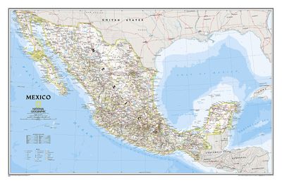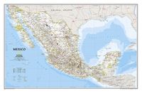
Wandkaart Mexico, 88 x 57 cm | National Geographic

0
Decoratieve wandkaart van Mexico. Naast de mooie kleuren staan er bijzonder veel plaatsen op vermeld. This finely detailed National Geographic political map of Mexico shows country boundaries, cities and towns, airports, major highways and roads, and bodies of water. Shaded relief helps to show the country's terrain more clearly and accurately. Fe...

Verkopers met dit product

Verkoper
Bezorging
Prijs
DeZwerver.nl logo
DeZwerver.nl
5,95
31,95

Anderen bekeken ook

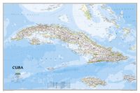
Wandkaart Cuba, 92 x 61 cm | National Geographic
The most accurate and richly detailed reference map available for the iconic Caribbean island nation, our Cuba Classic Map contains National Geographic’s proprietary fonts and world recognized border bands in a bright and appealing color palette with striking blue oceans on a crisp white background.   Cuba’s many offshore islands, reefs, and rivers are noted, as are sites of interest. Ocean bathymetry with depth curves and soundings, peak elevations, and handcrafted shaded relief provide topographical detail. Jamaica, the Cayman Islands, the Florida Keys, and most of the Bahamas and Haiti are shown, presenting Cuba in the context of its important geographical position in the Caribbean.   Cuba contains thousand of place names, accurate political boundaries, and infrastructure making it the perfect reference for student, home, or business.   Additional content unique to this map includes: Sites of interest including national parks and reserves Geographic equivalents provide translatio…
34,95
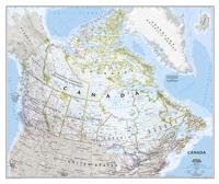
Wandkaart Canada, 97 x 82 cm | National Geographic
Decoratieve wandkaart van Canada. Naast de mooie kleuren staan er bijzonder veel plaatsen op vermeld.   This beautiful wall-map from National Geographic depicts Canada and the areas surrounding the Great Lakes in beautiful and accurate detail. Included in the map are Canadian province and US State boundaries, cities and towns, lakes and waterways, major geographic features, roadways, and other geographic details.   Our most detailed wall map of Canada, features the classic National Geographic reference styling. Features thousands of place names, accurate political boundaries, national parks, archeological sites, and major infrastructure networks such as roads, canals, ferry routes, and railroads. Canada s diverse terrain is detailed through accurate shaded relief, coastal bathymetry, and symbolism for water features and other landforms. This wall map depicts Canada and the areas surrounding the Great Lakes. Includes Canadian provinces and US State boundaries.
34,95
Wandkaart 20527 Canada, 97 x 82 cm | National Geographic
Decoratieve wandkaart van Canada. Naast de mooie kleuren staan er bijzonder veel plaatsen op vermeld. This beautiful wall-map from National Geographic depicts Canada and the areas surrounding the Great Lakes in beautiful and accurate detail. Included in the map are Canadian province and US State boundaries, cities and towns, lakes and waterways, major geographic features, roadways, and other geographic details. Our most detailed wall map of Canada, features the classic National Geographic reference styling. Features thousands of place names, accurate political boundaries, national parks, archeological sites, and major infrastructure networks such as roads, canals, ferry routes, and railroads. Canada s diverse terrain is detailed through accurate shaded relief, coastal bathymetry, and symbolism for water features and other landforms. This wall map depicts Canada and the areas surrounding the Great Lakes. Includes Canadian provinces and US State boundaries.
28,95
Wandkaart Scotland - Schotland, 76 x 91 cm | National Geographic
This new map of Scotland, features our rich, antique-inspired Executive style. This beautiful map includes thousands of place names, accurate political boundaries, national parks, archeological sites, and major infrastructure networks such as roads, canals, ferry routes, and railroads. Scotland’s diverse terrain is detailed through accurate shaded relief, coastal bathymetry, and symbolism for water features and other landforms.
31,95
Wandkaart Canada, antiek, 97 x 82 cm | National Geographic
Our most detailed wall map of Canada, features the classic National Geographic reference styling. Features thousands of place names, accurate political boundaries, national parks, archeological sites, and major infrastructure networks such as roads, canals, ferry routes, and railroads. Canada’s diverse terrain is detailed through accurate shaded relief, coastal bathymetry, and symbolism for water features and other landforms. This wall map depicts Canada and the areas surrounding the Great Lakes. Includes Canadian provinces and US State boundaries.
34,95
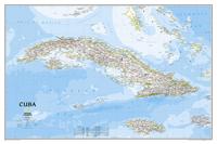
Wandkaart 20614 Cuba, 92 x 61 cm | National Geographic
The most accurate and richly detailed reference map available for the iconic Caribbean island nation, our Cuba Classic Map contains National Geographic’s proprietary fonts and world recognized border bands in a bright and appealing color palette with striking blue oceans on a crisp white background.   Cuba’s many offshore islands, reefs, and rivers are noted, as are sites of interest. Ocean bathymetry with depth curves and soundings, peak elevations, and handcrafted shaded relief provide topographical detail. Jamaica, the Cayman Islands, the Florida Keys, and most of the Bahamas and Haiti are shown, presenting Cuba in the context of its important geographical position in the Caribbean.   Cuba contains thousand of place names, accurate political boundaries, and infrastructure making it the perfect reference for student, home, or business.   Additional content unique to this map includes: Sites of interest including national parks and reserves Geographic equivalents provide translatio…
28,95
Wandkaart Brazil - Brazilië, 104 x 97 cm | National Geographic
National Geographic Wall Maps offer a special glimpse into current and historical events, and they inform about the world and environment. Offered in a variety of styles and formats, these maps are excellent reference tools and a perfect addition to any home, business or school. There are a variety of map options to choose from, including the world, continents, countries and regions, the United States, history, nature and space. This wall map of Brazil contains thousands of place names and accurate political boundaries including Brazil's 26 states. Major and minor cities, superhighways, roads, passenger rail lines, and national parks are clearly depicted. Brazil's diverse terrain is represented through accurate shaded relief and hydrographic symbology. Elevations and depths are in meters.
37,50

Klanten-reviews van Wandkaart Mexico, 88 x 57 cm | National Geographic

Er zijn nog geen beoordelingen voor dit productBen jij de eerste die een review plaatst?

Meer over Wandkaart Mexico, 88 x 57 cm | National Geographic

Productomschrijving

Decoratieve wandkaart van Mexico. Naast de mooie kleuren staan er bijzonder veel plaatsen op vermeld.

This finely detailed National Geographic political map of Mexico shows country boundaries, cities and towns, airports, major highways and roads, and bodies of water. Shaded relief helps to show the country's terrain more clearly and accurately.
Features:

•Shaded relief
•Accurate political markings

Productinformatie

    Verken gerelateerde categorieën

    Webshop.nl maakt gebruik van cookies. Ga je verder op onze website, ga dan akkoord met het plaatsen van cookies en de verwerking van deze data door ons en vermelde partners.