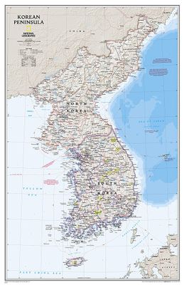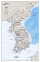
Wandkaart Korean Peninsula Noord- en Zuid Korea, 59 x 91 cm | National Geographic

0
Amid increasingly combative rhetoric from Pyongyang, North Korea, do you know where its underground nuclear test site or missile launch centers are located? Are you aware that the South Korean government has begun a program to move its federal offices and personal from Seoul to a new location? National Geographic's new Korean Peninsula map provide...

Verkopers met dit product

Webshop
Bezorging
Prijs
DeZwerver.nl logo
DeZwerver.nl
niet bekend
31,95

Anderen bekeken ook

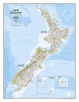
Wandkaart New Zealand - Nieuw Zeeland 60 x 77 cm | National Geographic
Mooie heldere wandkaart van Nieuw Zeeland met het Noordereiland en Zuidereiland op dezelfde kant afgebeeld. Veel plaatsnamen, goed kleurgebruik waardoor hoogteverschillen en bijvoorbeeld nationale parken goed zichtbaar zijn.   The reference map of New Zealand uses National Geographic's signature Classic style with blue ocean and stunning shaded relief. The map shows this island nation in great detail, from the subtropical North Island (Te Ika-a-Maui) to the glacial carved valleys of Fiordland on the South Island (Te Waipounamu). The North Island is best known for large volcanic lakes and the cities of Auckland and Wellington. The South Island is famous for the Southern Alps that run along the spine of the island. The highest point in the country is Aoraki (Mount Cook) and is found in the Southern Alps.   The first settlers of New Zealand were the Maori from Polynesia, the names on the map reflect this history with both English and Maori variants. The map also features a transportation…
31,95
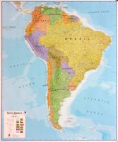
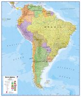
Wandkaart - Magneetbord Zuid Amerika - South America political, 120 x 100 cm | Maps International
Fraaie politieke kaart van het continent, waarbij vooral de politieke aspecten heel duidelijk te lezen zijn. Alle landen hebben verschillende kleuren, steden en belangrijke verbindingen zijn goed te vinden.   De kaart wordt in deze versie gelijmd op een plaat, voorzien van een mooie aluminium lijst en een ophangsysteem wordt meegeleverd. Daarnaast krijgt u een bakje bijgeleverd dat u er aan kunt bevestigen voor pennen, stiften of magneetjes.   Maps International's South America political wall map shows all countries in South America from Venezuela and the Grenadine Islands down to Argentina and the most Southerly points of Chile and the Falkland Islands.    This political wall map of South America features countries marked in different colours, with international borders clearly shown. The map's key shows the flags from the countries displayed in this map. This South American political wall map also contains city population detail, capital cities and all the major towns and cities in …
269,-
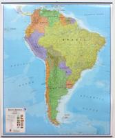
Wandkaart - Prikbord Zuid Amerika - South America political, 120 x 100 cm | Maps International
Fraaie politieke kaart van het continent, waarbij vooral de politieke aspecten heel duidelijk te lezen zijn. Alle landen hebben verschillende kleuren, steden en belangrijke verbindingen zijn goed te vinden.   Maps International's South America political wall map shows all countries in South America from Venezuela and the Grenadine Islands down to Argentina and the most Southerly points of Chile and the Falkland Islands.    This political wall map of South America features countries marked in different colours, with international borders clearly shown. The map's key shows the flags from the countries displayed in this map. This South American political wall map also contains city population detail, capital cities and all the major towns and cities in this continent of South America.    Maps International's North America map is available either plain or laminated. Major motorways and transport lines are shown making it an ideal map for your planning and logistics needs in this South Ame…
185,-
Wandkaart Zuid Amerika, politiek, 91 x 117 cm | National Geographic
Staatkundige  kaart van Zuid-Amerika (in kleur). De kaart wordt verzonden in een koker.  This classic map of South America shows political boundaries, place names, airports, major roads and highways, and other geographic features for the entire continent. 36 x 46 inches (approx). Scale size: 1:7,105,000. Founded in 1915 as the Cartographic Group, the first division of the National Geographic Society, National Geographic Maps has been responsible for illustrating the world around us through the art and science of mapmaking. Today, National Geographic Maps continues this mission by creating the world s best wall maps, recreation maps, atlases, and globes which inspire people to care about and explore their world. All proceeds from the sale of National Geographic maps go to support the Society s non-profit mission to increase global understanding and promote conservation of our planet through exploration, research, and education.
49,95
Wandkaart The Balkans - Balkan landen, 77 x 60 cm | National Geographic
Study the countries of the Balkans with our new map featuring the classic National Geographic reference styling. Features thousands of place names, accurate political boundaries, national parks, and major infrastructure networks such as roads, canals, ferry routes, and railroads. The countries of the Balkans Classic map shows it's diverse terrain as detailed through accurate shaded relief, coastal bathymetry, and symbolism for water features and other landforms. Elevations of major peaks as well as depth soundings are expressed in meters.   Map coverage includes the countries of: Albania, Austria, Bosnia and Herzegovina, Bulgaria, Croatia, Hungary, Kosovo, Macedonia, Moldova, Montenegro, Romania, Slovenia, Vojvodina, as well as the outlying border countries of Greece, Italy, Slovakia, Turkey and Ukraine. Map features also includes listings for the counties of Hungary and Romania along with their respective capitals and the administrative divisions of Bosnia and Herzegovina.
31,95
Reisgids North Korea - Noord Korea | Bradt Travel Guides
Er bestaat geen Lonely Planet van North Korea. Daarom vermelden wij de enige goede gids van North Korea, die van Bradt Guides. Net zo goed, zo niet beter dan de Planet. Beduidend soberder uitgevoerd, maar ook met veel informatie voor backpackers en met veel kaartmateriaal. Een aanrader! This new edition of Bradt's North Korea has been completely written from scratch and remains the only standalone guide to what is often regarded as the world's most secretive state, a place never far from media scrutiny but about which very little is actually known in the wider world. Detailed is everything you need to know for a successful visit, from the practicalities of how to get there and who to go with to cultural sensitivities and etiquette, safety, money and travelling around. Amongst the places covered are the supra-centrally planned showcase capital of Pyongyang; Panmunjom, where North meets South face-to-face inside the 4km-wide DMZ - the dividing line between two nations and one people; Ku…
26,50
Wandkaart Ireland - Ierland, 76 x 91 cm | National Geographic
National Geographic Maps' new Ireland wall map is one of the most authoritative maps yet published of the Emerald Isle. Of the nearly 1,000 place-names shown on this map, all within the Republic of Ireland adhere to that nation's constitution—that the Irish and English language share official status. Thus, Gaelic (Irish) place-names, along with their English variants in parentheses, are shown within Irish-speaking regions while English place-names, along with their Gaelic variants, are shown outside these areas.   Ireland Classic is ideal for those researching their Irish ancestry, a perfect tool for business reference, and a beautiful addition to any décor. It’s one of the largest and most detailed wall maps specifically for Ireland available today. Shown on the map are over 1,000 named places including primary and secondary towns, counties, political boundaries, infrastructure, and selected historical sites for both Ireland and Northern Ireland.   Place-name Details: Per the Republi…
31,95
Wandkaart - Prikbord Australasia - Australië, Nieuw Zeeland en deel Oceanië, 120 x 100 cm | Maps International
Fraaie politieke kaart van het continent, waarbij vooral de politieke aspecten heel duidelijk te lezen zijn. Alle landen hebben verschillende kleuren, steden en belangrijke verbindingen zijn goed te vinden.   De wandkaarten op prikbord worden geleverd met een aluminium lijst en een eenvoudig te monteren ophangsysteem. Zij zijn geschikt voor allerhande markeringsystemen als vlaggetjes en prikkers.   Maps International's Australasia political wall map shows Papua New Guinea in the North of the continent down to Tasmania and New Zealand in the south.   This political wall map of Australasia features countries marked in different colours, with international borders clearly shown. The map's key shows the flags from the countries displayed in this map (Australia, New Zealand and Papua New Guinea). This political wall map of Australasia also contains city population detail, capital cities and all the major towns and cities in this continent.   Maps International's Asia map is available eithe…
185,-
Wandkaart Caribbean - Caraïben, 91 x 61 cm | National Geographic
Completely redesigned and updated, National Geographic Maps' Caribbean Classic wall map is one of the most authoritative maps for the islands of the Caribbean Sea. This new edition shows the entire region in exceptional detail, with coverage extending from the tip of Florida to the northern extents of Colombia and Venezuela, east to Barbados, and west to the eastern edge of Honduras, Costa Rica, and Nicaragua. Updated bathymetry reveals the remarkable seafloor variation of the Caribbean including the Puerto Rico Trench, the deepest point in the Atlantic Ocean at 8,605 meters (28,232 feet).   Caribbean Classic is a perfect tool for business or education reference, and a beautiful addition to any décor. Shown on the map are over 1,000 named places including country capitals, primary and secondary towns; political boundaries, important infrastructure, and all key landforms. Useful and informative notes about the region's history and unique geography are spread throughout the map, providi…
32,95
Wandkaart - Magneetbord Australasia - Australië, Nieuw Zeeland en deel Oceanië, 120 x 100 cm | Maps International
Fraaie politieke kaart van het continent, waarbij vooral de politieke aspecten heel duidelijk te lezen zijn. Alle landen hebben verschillende kleuren, steden en belangrijke verbindingen zijn goed te vinden.   De kaart wordt in deze versie gelijmd op een plaat, voorzien van een mooie aluminium lijst en een ophangsysteem wordt meegeleverd. Daarnaast krijgt u een bakje bijgeleverd dat u er aan kunt bevestigen voor pennen, stiften of magneetjes.   Maps International's Australasia political wall map shows Papua New Guinea in the North of the continent down to Tasmania and New Zealand in the south.   This political wall map of Australasia features countries marked in different colours, with international borders clearly shown. The map's key shows the flags from the countries displayed in this map (Australia, New Zealand and Papua New Guinea). This political wall map of Australasia also contains city population detail, capital cities and all the major towns and cities in this continent.   Ma…
269,-

Klanten-reviews van Wandkaart Korean Peninsula Noord- en Zuid Korea, 59 x 91 cm | National Geographic

Er zijn nog geen beoordelingen voor dit productBen jij de eerste die een review plaatst?

Meer over Wandkaart Korean Peninsula Noord- en Zuid Korea, 59 x 91 cm | National Geographic

Productomschrijving

Amid increasingly combative rhetoric from Pyongyang, North Korea, do you know where its underground nuclear test site or missile launch centers are located? Are you aware that the South Korean government has begun a program to move its federal offices and personal from Seoul to a new location? National Geographic's new Korean Peninsula map provides this and much more information about this conflicted peninsula.   National Geographic Maps' Korean Peninsula wall map is one of the most authoritative maps of the Koreas. The peninsula's rugged terrain is expertly depicted in shaded relief, including the elevation of prominent mountains and ocean depths in meters. This new edition clearly portrays both countries and uses the latest system for transcribing South Korean place-names from the Korean alphabet. In great detail, it delineates the latest administrative divisions of both countries along the historic demarcation line between the two Koreas. The map also portrays the transportation grid of both countries, including South Korea's high-speed passenger railway network.

Verken gerelateerde categorieën

Webshop.nl maakt gebruik van cookies. Ga je verder op onze website, ga dan akkoord met het plaatsen van cookies en de verwerking van deze data door ons en vermelde partners.