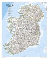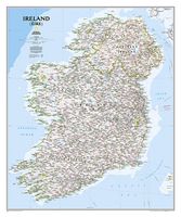
Wandkaart Ireland - Ierland, 76 x 91 cm | National Geographic

0
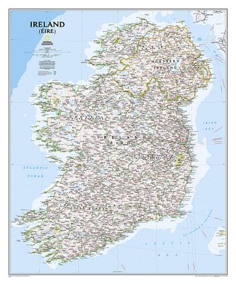
National Geographic Maps' new Ireland wall map is one of the most authoritative maps yet published of the Emerald Isle. Of the nearly 1,000 place-names shown on this map, all within the Republic of Ireland adhere to that nation's constitution—that the Irish and English language share official status. Thus, Gaelic (Irish) place-names, along with th...

Verkopers met dit product

Verkoper
Bezorging
Prijs
DeZwerver.nl logo
DeZwerver.nl
5,95
31,95

Anderen bekeken ook

Wandkaart Ireland - Ierland, 76 x 91 cm | National Geographic
National Geographic Maps' new Ireland wall map is one of the most authoritative maps yet published of the Emerald Isle. Of the nearly 1,000 place-names shown on this map, all within the Republic of Ireland adhere to that nation's constitution—that the Irish and English language share official status. Thus, Gaelic (Irish) place-names, along with their English variants in parentheses, are shown within Irish-speaking regions while English place-names, along with their Gaelic variants, are shown outside these areas.   Ireland Classic is ideal for those researching their Irish ancestry, a perfect tool for business reference, and a beautiful addition to any décor. It’s one of the largest and most detailed wall maps specifically for Ireland available today. Shown on the map are over 1,000 named places including primary and secondary towns, counties, political boundaries, infrastructure, and selected historical sites for both Ireland and Northern Ireland.   Place-name Details: Per the Republi…
31,95
Wandkaart 20427 Ireland - Ierland, 76 x 91 cm | National Geographic
National Geographic Maps' new Ireland wall map is one of the most authoritative maps yet published of the Emerald Isle. Of the nearly 1,000 place-names shown on this map, all within the Republic of Ireland adhere to that nation's constitution—that the Irish and English language share official status. Thus, Gaelic (Irish) place-names, along with their English variants in parentheses, are shown within Irish-speaking regions while English place-names, along with their Gaelic variants, are shown outside these areas.   Ireland Classic is ideal for those researching their Irish ancestry, a perfect tool for business reference, and a beautiful addition to any décor. It’s one of the largest and most detailed wall maps specifically for Ireland available today. Shown on the map are over 1,000 named places including primary and secondary towns, counties, political boundaries, infrastructure, and selected historical sites for both Ireland and Northern Ireland.   Place-name Details: Per the Republi…
25,95
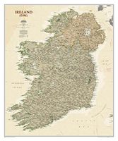
Wandkaart Ierland, antiek, 76 x 92 cm | National Geographic
National Geographic Maps' new Ireland wall map is one of the most authoritative maps yet published of the Emerald Isle. Of the nearly 1,000 place-names shown on this map, all within the Republic of Ireland adhere to that nation's constitution—that the Irish and English language share official status. Thus, Gaelic (Irish) place-names, along with their English variants in parentheses, are shown within Irish-speaking regions while English place-names, along with their Gaelic variants, are shown outside these areas.   Ireland Classic is ideal for those researching their Irish ancestry, a perfect tool for business reference, and a beautiful addition to any décor. It’s one of the largest and most detailed wall maps specifically for Ireland available today. Shown on the map are over 1,000 named places including primary and secondary towns, counties, political boundaries, infrastructure, and selected historical sites for both Ireland and Northern Ireland.   Place-name Details: Per the Republi…
31,95
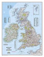
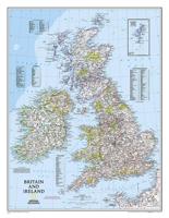
Magneetbord - Wandkaart British Isles - Groot Brittannië en Ierland, 61 x 76 cm | National Geographic
Magneetbord van een wandkaart van Groot Brittannië en Ierland: prachtig kaartbeeld met heel veel details, gemaakt door de gerenommeerde makers van National Geographic. British Isles at 1:1,687,000 on a small wall map, 61 x 76cm (1’11” x 2’5” approx) , from the National Geographic Society showing the constituent parts of the United Kingdom, Irish Republic, Isle of Man and the Channel Islands. Shetland Islands are shown on an inset. The map uses NGS’s classic presentation style of white background plus relief shading to show the topography, with boundaries shown in colour. Within Great Britain, national parks are prominently highlighted. Names of many geographical regions are shown (The Wolds, South Downs, etc.); county boundaries are marked, but county names are indicated only by numbers cross-referenced to lists of counties and unitary authorities in England, with corresponding lists for Scotland, Wales, Northern Ireland and the Irish Republic. Latitude and longitude lines are drawn a…
189,-
Wegenkaart - landkaart Ireland - Ierland | AA Publishing
Folded, double-sided sheet map shows the detailed road network with toll motorways and dual carriageways identified. Includes motorway service areas, AA-inspected campsites, viewpoints and picnic sites. Gaeltacht regions are highlighted with place names in English and Irish. Includes 6 city plans of Dublin, Belfast, Cork, Derry Londonderry, Sligo and Waterford and 5 port plans. A separate map of Ireland features relief shading with key physical landmarks. City, town and port plans. Distance in miles and kilometers.
8,95
Wegenkaart - landkaart 3303 Adventure Map Ireland - Ierland | National Geographic
Wegenkaart van Ierland met vermelding van veel bezienswaardigheden, nationale parken en attrakties. Watervast en scheurvast. Juist door deze vermeldingen onderscheidt de kaart zich van andere wegenkaarten. National Geographic's Ireland Adventure Map is designed to meet the unique needs of adventure travelers—detailed, durable, and accurate. Ireland includes the locations of thousands of major cities and towns with an index for easily locating them, plus a clearly marked road network complete with distances and designations for major highways, limited access highways and more.   What sets National Geographic Adventure Maps apart from traditional road maps are the hundreds of points-of-interest that highlight the diverse, unique, and exotic destinations within Ireland including national parks and preserves, World Heritage sites, castles, archeological sites, monuments, scenic viewpoints, beaches, natural points of interest, and important travel aids like airports, airstrips, rail lines,…
17,50
Reisgids Culture Smart! Ireland- Ierland | Kuperard
De Cultuur Bewust!-gids geeft toeristen en zakenlieden belangrijke informatie met betrekking tot de cultuur van alledag in het land van bestemming. Anders dan in de gebruikelijke reisgidsen wordt de lezer in deze reeks bijgespijkerd op het gebied van omgangsvormen, normen en waarden, hoe zich te gedragen en wat verwacht mag worden op zakelijk en sociaal gebied. Het zijn beknopte zakformaatgidsen met interessante wetenswaardigheden over het dagelijks leven. Een must voor iedereen die naar het buitenland gaat voor vakantie, studie of werk. The island of Ireland is famous for its timeless beauty, the variety of its landscape, its quiet towns and lively cities, the poetic and literary genius of so many of its citizens, its music and folklore, and its colorful and bloody history. What is also true is that the Irish people have in many ways changed in recent years, while retaining the scars and proud memories of their past, and their thriving national culture. Twenty-first century Ireland,…
15,95
Reisgids Ireland - Ierland | Rough Guides
Een zeer uitvoerige reisgids voor zowel de zelfstandige als de georganiseerde reiziger. Veel informatie, zowel praktisch als over allerhande achtergronden van het land; met o.a. aandacht voor geschiedenis, taal, flora & fauna en met veel plattegronden! Voor Europese landen nog iets completer dan de Lonely Planet. Discover Ireland with this comprehensive and entertaining travel guide, packed with practical information and honest recommendations by our independent experts. Whether you plan to drive the scenic Wild Atlantic Way, explorie the delights of Dublin’s architecture and dance along to traditional Irish music in one of the plethora of pubs in the country, Rough Guide Ireland will help you discover the best places to explore, eat, drink, shop and sleep along the way.   Features of this travel guide to Ireland: – Detailed regional coverage: provides practical information for every kind of trip, from off-the-beaten-track adventures to chilled-out breaks in popular tourist areas – Ho…
25,95

Klanten-reviews van Wandkaart Ireland - Ierland, 76 x 91 cm | National Geographic

Er zijn nog geen beoordelingen voor dit productBen jij de eerste die een review plaatst?

Meer over Wandkaart Ireland - Ierland, 76 x 91 cm | National Geographic

Productomschrijving

National Geographic Maps' new Ireland wall map is one of the most authoritative maps yet published of the Emerald Isle. Of the nearly 1,000 place-names shown on this map, all within the Republic of Ireland adhere to that nation's constitution—that the Irish and English language share official status. Thus, Gaelic (Irish) place-names, along with their English variants in parentheses, are shown within Irish-speaking regions while English place-names, along with their Gaelic variants, are shown outside these areas.   Ireland Classic is ideal for those researching their Irish ancestry, a perfect tool for business reference, and a beautiful addition to any décor. It’s one of the largest and most detailed wall maps specifically for Ireland available today. Shown on the map are over 1,000 named places including primary and secondary towns, counties, political boundaries, infrastructure, and selected historical sites for both Ireland and Northern Ireland.   Place-name Details: Per the Republic of Ireland’s constitution, the Irish and English languages share official status. In the Gaeltacht, or predominantly Irish-speaking regions, only Irish place-names have official status and are used on signposts. These districts are found within the counties of Cork, Donegal, Galway, Kerry, Mayo, Meath, and Waterford.   Place-names information for the Republic of Ireland contributed by An Roinn Gnotai Pobail, Comhionannais agus Gaeltachta/ Department of Community, Equality and Gaeltacht Affairs.

Productinformatie

    Verken gerelateerde categorieën

    Webshop.nl maakt gebruik van cookies. Ga je verder op onze website, ga dan akkoord met het plaatsen van cookies en de verwerking van deze data door ons en vermelde partners.