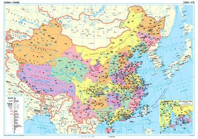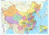
Wandkaart China - political, 95 x 69 cm | Gizi Map

0
Een wandkaart van China waarop de politieke grenzen en steden tweetalig staan weergeven. Natuurkundige aspecten zijn weggelaten, maar dat komt de politieke en bestuurlijke indeling duidelijk ten goede. Afmetingen: 69cm.x 95cm. (hxb) An administrative wall map of China at 1:6,500,000, size 96 x 68cm (38" x 27" approx), from Gizi Map showing the div...

Verkopers met dit product

Verkoper
Bezorging
Prijs
DeZwerver.nl logo
DeZwerver.nl
5,95
46,95

Anderen bekeken ook

Wandkaart China - political, 95 x 69 cm | Gizi Map
Een wandkaart van China waarop de politieke grenzen en steden tweetalig staan weergeven. Natuurkundige aspecten zijn weggelaten, maar dat komt de politieke en bestuurlijke indeling duidelijk ten goede. Afmetingen: 69cm.x 95cm. (hxb) An administrative wall map of China at 1:6,500,000, size 96 x 68cm (38" x 27" approx), from Gizi Map showing the division of the country into provinces. All place names are given in both Chinese and Latin alphabet. Hong Kong and the Pearl River Delta are presented in a greater detail on an inset.   China’s provinces are shown in bright contrasting colours. Town symbols indicate the size of the population. Main airports and ports are marked, as well as coastal and international shipping routes, Topographic information is limited to the network of rivers. Latitude and longitude lines are at 5° intervals. The map is not indexed. Multilingual map legend includes English. An inset shows Hong Kong and the Pearl River Delta region at 1:1,000,000.
46,95
Wegenkaart - landkaart China Administrative Map | Gizi Map
This folded, political map of China shows provinces in different colors. Map features province boundaries, major cities, airports, waterways, ports and the Great Wall. Inset of Pearl River Delta. Legend in 5 languages: English, German, French, Italian, and Chinese. Scale is 1:6.5 million. A basic political map of the country, with colours clearly distinguishing the provinces. Major towns and rivers are identified and the great wall is marked. Symbols depict airports and ports. Manes are written in Roman and Chinese script. An inset shows Hong Kong and the Pearl River Delta region at 1:1,000,000
15,95
Wandkaart China - geografisch, 120 x 88 cm | Gizi Map
Prachtige wandkaart van China, waarbij zowel de politieke natuurkundige aspecten goed zichtbaar zijn. In rood zijn de belangrijkste toeristische hoogtepunten ingetekend. Kleurgebruik is vrij fel, maar daardoor wordt het geheel bijzonder mooi. De afmetingen zijn 120 x 88 cm. Hooggebergte, woestijnen, laagland en aanduidingen van hoogte vind je op de kaart. Ook een grote hoeveelheid plaatsen en de belangrijkste verbindingsroutes zijn ingetekend.  
49,95
Wandkaart Zuid Amerika - South America political, 100 x 120 cm | Maps International
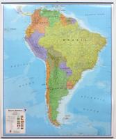
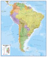
Fraaie politieke kaart van het continent, waarbij vooral de politieke aspecten heel duidelijk te lezen zijn. Alle landen hebben verschillende kleuren, steden en belangrijke verbindingen zijn goed te vinden. Geplastificeerde uitvoering met blauw metalen strips boven en onder de kaart waardoor deze eenvoudig is op te hangen. Maps International's South America political wall map shows all countries in South America from Venezuela and the Grenadine Islands down to Argentina and the most Southerly points of Chile and the Falkland Islands.    This political wall map of South America features countries marked in different colours, with international borders clearly shown. The map's key shows the flags from the countries displayed in this map. This South American political wall map also contains city population detail, capital cities and all the major towns and cities in this continent of South America.    Maps International's North America map is available either plain or laminated. Major mo…
49,95
Wandkaart - Prikbord Zuid Amerika - South America political, 120 x 100 cm | Maps International
Fraaie politieke kaart van het continent, waarbij vooral de politieke aspecten heel duidelijk te lezen zijn. Alle landen hebben verschillende kleuren, steden en belangrijke verbindingen zijn goed te vinden.   Maps International's South America political wall map shows all countries in South America from Venezuela and the Grenadine Islands down to Argentina and the most Southerly points of Chile and the Falkland Islands.    This political wall map of South America features countries marked in different colours, with international borders clearly shown. The map's key shows the flags from the countries displayed in this map. This South American political wall map also contains city population detail, capital cities and all the major towns and cities in this continent of South America.    Maps International's North America map is available either plain or laminated. Major motorways and transport lines are shown making it an ideal map for your planning and logistics needs in this South Ame…
185,-
Wandkaart - Magneetbord Zuid Amerika - South America political, 120 x 100 cm | Maps International
Fraaie politieke kaart van het continent, waarbij vooral de politieke aspecten heel duidelijk te lezen zijn. Alle landen hebben verschillende kleuren, steden en belangrijke verbindingen zijn goed te vinden.   De kaart wordt in deze versie gelijmd op een plaat, voorzien van een mooie aluminium lijst en een ophangsysteem wordt meegeleverd. Daarnaast krijgt u een bakje bijgeleverd dat u er aan kunt bevestigen voor pennen, stiften of magneetjes.   Maps International's South America political wall map shows all countries in South America from Venezuela and the Grenadine Islands down to Argentina and the most Southerly points of Chile and the Falkland Islands.    This political wall map of South America features countries marked in different colours, with international borders clearly shown. The map's key shows the flags from the countries displayed in this map. This South American political wall map also contains city population detail, capital cities and all the major towns and cities in …
269,-
Wandkaart Africa executive Political 2-delig | 176 x 160 cm | MapStudio
Africa Executive Political Wall Map is an easy-to-read comprehensive map of Africa includes the new South Sudan boundary.   Coverage on the Africa Executive Political Wall Map includes capital cities, major towns, towns, major and main routes with route numbers and distances.   Contents of the map of Africa includes national, main and secondary roads in detail, colour-coded countries for convenient overview, rail routes with lines and stations, national parks, reserves, sea routes and distances to major ports, international boundaries, border crossings, airports, airfields, water features (dams, lakes, rivers, deltas), places of interest and historic sites. Coverage shows all countries in Africa including Madagascar.  
78,95
Wandkaart - Magneetbord Afrika Politiek - Africa Political, 120 x 100 cm | Maps International
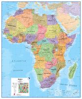
Fraaie politieke kaart van het continent, waarbij vooral de politieke aspecten heel duidelijk te lezen zijn. Alle landen hebben verschillende kleuren, steden en belangrijke verbindingen zijn goed te vinden.   De kaart wordt in deze versie gelijmd op een plaat, voorzien van een mooie aluminium lijst en een ophangsysteem wordt meegeleverd. Daarnaast krijgt u een bakje bijgeleverd dat u er aan kunt bevestigen voor pennen, stiften of magneetjes.   Maps International's Africa political wall map shows the whole African continent from Morocco in the north, to South Africa and Madagascar in the south.    This political wall map of Africa features countries marked in different colours, with international borders clearly shown. The map's key shows a panel of flags from each of the countries displayed in this African continent map. This political wall map of Africa also contains population detail, capital cities and all the major towns and cities in this continent.    As with most of Maps Intern…
269,-
Wandkaart - Prikbord Afrika Politiek - Africa Political, 120 x 100 cm | Maps International
Fraaie politieke kaart van het continent, waarbij vooral de politieke aspecten heel duidelijk te lezen zijn. Alle landen hebben verschillende kleuren, steden en belangrijke verbindingen zijn goed te vinden.   De wandkaarten op prikbord worden geleverd met een aluminium lijst en een eenvoudig te monteren ophangsysteem. Zij zijn geschikt voor allerhande markeringsystemen als vlaggetjes en prikkers.   Maps International's Africa political wall map shows the whole African continent from Morocco in the north, to South Africa and Madagascar in the south.    This political wall map of Africa features countries marked in different colours, with international borders clearly shown. The map's key shows a panel of flags from each of the countries displayed in this African continent map. This political wall map of Africa also contains population detail, capital cities and all the major towns and cities in this continent.    As with most of Maps International's maps, the Africa political wall map,…
185,-

Klanten-reviews van Wandkaart China - political, 95 x 69 cm | Gizi Map

Er zijn nog geen beoordelingen voor dit productBen jij de eerste die een review plaatst?

Meer over Wandkaart China - political, 95 x 69 cm | Gizi Map

Productomschrijving

Een wandkaart van China waarop de politieke grenzen en steden tweetalig staan weergeven. Natuurkundige aspecten zijn weggelaten, maar dat komt de politieke en bestuurlijke indeling duidelijk ten goede.

Afmetingen: 69cm.x 95cm. (hxb)

An administrative wall map of China at 1:6,500,000, size 96 x 68cm (38" x 27" approx), from Gizi Map showing the division of the country into provinces. All place names are given in both Chinese and Latin alphabet. Hong Kong and the Pearl River Delta are presented in a greater detail on an inset.   China’s provinces are shown in bright contrasting colours. Town symbols indicate the size of the population. Main airports and ports are marked, as well as coastal and international shipping routes, Topographic information is limited to the network of rivers. Latitude and longitude lines are at 5° intervals. The map is not indexed. Multilingual map legend includes English. An inset shows Hong Kong and the Pearl River Delta region at 1:1,000,000.

Productinformatie

    Verken gerelateerde categorieën

    Webshop.nl maakt gebruik van cookies. Ga je verder op onze website, ga dan akkoord met het plaatsen van cookies en de verwerking van deze data door ons en vermelde partners.