webshop.nl
Categorieën
  Sluiten

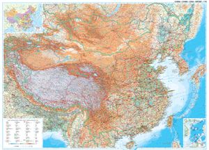
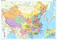
Wandkaart China - geografisch, 120 x 88 cm | Gizi Map

Prachtige wandkaart van China, waarbij zowel de politieke natuurkundige aspecten goed zichtbaar zijn. In rood zijn de belangrijkste toeristische hoogtepunten ingetekend. Kleurgebruik is vrij fel, maar daardoor wordt het geheel bijzonder mooi. De afmetingen zijn 120 x 88 cm. Hooggebergte, woestijnen, laagland en aanduidingen van hoogte vind je op de...
49,95

Webshops met dit product

Webshop
Bezorging
Prijs

Anderen bekeken ook

Wandkaart China - political, 95 x 69 cm | Gizi Map
Een wandkaart van China waarop de politieke grenzen en steden tweetalig staan weergeven. Natuurkundige aspecten zijn weggelaten, maar dat komt de politieke en bestuurlijke indeling duidelijk ten goede. Afmetingen: 69cm.x 95cm. (hxb) An administrative wall map of China at 1:6,500,000, size 96 x 68cm (38" x 27" approx), from Gizi Map showing the division of the country into provinces. All place names are given in both Chinese and Latin alphabet. Hong Kong and the Pearl River Delta are presented in a greater detail on an inset.   China’s provinces are shown in bright contrasting colours. Town symbols indicate the size of the population. Main airports and ports are marked, as well as coastal and international shipping routes, Topographic information is limited to the network of rivers. Latitude and longitude lines are at 5° intervals. The map is not indexed. Multilingual map legend includes English. An inset shows Hong Kong and the Pearl River Delta region at 1:1,000,000.
44,50
Wegenkaart - landkaart Kazakhstan - Kazachstan | Gizi Map
Er zijn 2 GIZI kaarten van Kazachstan: dit is de natuurkundig geografische kaart. Goede wegenkaart - landkaart van Kazachstan. Met stadskaart 1:30.000 van Astana.   Kazachstan op 1: 3.000.000 van Gizi-kaart op een natuurkundige wegenkaart die een uitstekend beeld geeft van de topografie van het land, markeringen voor de routes van de oude zijderoute, olie- of gasbronnen en pijpleidingen, enz., Plus een stratenplan van Ashgabat.   Topografie wordt weergegeven door hoogtekleuren, namen van bergketens, woestijnen, enz., Plus tal van spothoogtes en afbeeldingen die woestijnen, zoutvlaktes en moerassen aangeven. Waterputten en aquaducten, evenals de nationale parken en andere beschermde gebieden van het land zijn ook gemarkeerd. De kaart toont het wegennet, inclusief woestijnsporen, met locaties van grensovergangen en rijafstanden op hoofd- en geselecteerde secundaire routes. Symbolen geven wegen en sporen aan die deel uitmaken van de zijderoute. Spoorlijnen zijn inbegrepen en lokale luchth…
15,95
Wandkaart Zuid Amerika, politiek, 100 x 120 cm, geplastificeerd | Maps International
Fraaie politieke kaart van het continent, waarbij vooral de politieke aspecten heel duidelijk te lezen zijn. Alle landen hebben verschillende kleuren, steden en belangrijke verbindingen zijn goed te vinden. Geplastificeerde versie.   Afwerking: geplastificeerd   De wandkaart wordt afgewerkt met een inkapselingsproces. Inkapseling betekent dat de kaarten met warmte worden geperst tussen twee vellen film van industriële kwaliteit. Houd er rekening mee dat de randen van deze kaart niet zijn geplastificeerd.   Inkapseling geeft de kaart een schrijf- / veegafwerking, wat betekent dat met een droog afveegbare marker elk schrift op de kaart kan worden weggeveegd.   Maps International's South America political wall map shows all countries in South America from Venezuela and the Grenadine Islands down to Argentina and the most Southerly points of Chile and the Falkland Islands.    This political wall map of South America features countries marked in different colours, with international bo…
38,95
Wegenkaart - landkaart Turkmenistan | Gizi Map
Goede wegenkaart - landkaart van Turkmenistan. Met stadskaart 1:35.000 van Ashgabat. Turkmenistan op 1: 1.300.000 van Gizi-kaart op een geïndexeerde kaart met hoogtekleuren en afbeeldingen die een uitstekend beeld geven van de topografie van het land, markeringen voor de routes van de oude zijderoute, olie- of gasbronnen en pijpleidingen, enz., Plus een stratenplan van Ashgabat.   Topografie wordt weergegeven door hoogtekleuren, namen van bergketens, woestijnen, enz., Plus tal van spothoogtes en afbeeldingen die woestijnen, zoutvlaktes en moerassen aangeven. Waterputten en aquaducten, evenals de nationale parken en andere beschermde gebieden van het land zijn ook gemarkeerd. De kaart toont het wegennet, inclusief woestijnsporen, met locaties van grensovergangen en rijafstanden op hoofd- en geselecteerde secundaire routes. Symbolen geven wegen en sporen aan die deel uitmaken van de zijderoute. Spoorlijnen zijn inbegrepen en lokale luchthavens zijn gemarkeerd. Verschillende bezienswaardi…
15,95
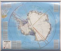
Wandkaart Antarctica - Zuidpool, 120 x 100 cm | Maps International
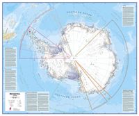
Fraaie kaart van het continent waarbij zowel de natuurkundige als de politieke aspecten zichtbaar zijn. Alle bezettingsstations, berggebieden en landingsplaatsen staan er op. Dit is een geplastificeerde versie met metalen strips boven en onder de kaart waardoor deze eenvoudig is op te hangen. Maps International's collection of continental maps would not be complete without this political Antarctica map.  The Antarctica map includes information from the British Antarctic Survey on scientific research. Information on Antarctica's climate and resources is included and as you would expect with a political map, the territory divisions are shown. Shown also are the major expedition routes, camps and weather stations on Antarctica. Map features hill shading, also contains information on the flora and fauna of Antarctica.   The map provides a great opportunity to learn more about a continent that many of us will never visit. Maps International's Antarctica map is available either plain or lami…
49,95
Wandkaart Antarctica - Zuidpool, 120 x 100 cm | Maps International
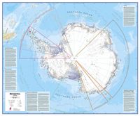
Fraaie kaart van het continent waarbij zowel de natuurkundige als de politieke aspecten zichtbaar zijn. Alle bezettingsstations, berggebieden en landingsplaatsen staan er op. Dit is een geplastificeerde versie. Maps International's collection of continental maps would not be complete without this political Antarctica map.  The Antarctica map includes information from the British Antarctic Survey on scientific research. Information on Antarctica's climate and resources is included and as you would expect with a political map, the territory divisions are shown. Shown also are the major expedition routes, camps and weather stations on Antarctica. Map features hill shading, also contains information on the flora and fauna of Antarctica.   The map provides a great opportunity to learn more about a continent that many of us will never visit. Maps International's Antarctica map is available either plain or laminated making it ideal for classrooms or those with an interest in the South Pole an…
37,95
Wandkaart Antarctica - Zuidpool, 120 x 100 cm | Maps International
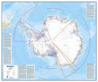
Fraaie kaart van het continent waarbij zowel de natuurkundige als de politieke aspecten zichtbaar zijn. Alle bezettingsstations, berggebieden en landingsplaatsen staan er op. Maps International's collection of continental maps would not be complete without this political Antarctica map.  The Antarctica map includes information from the British Antarctic Survey on scientific research. Information on Antarctica's climate and resources is included and as you would expect with a political map, the territory divisions are shown. Shown also are the major expedition routes, camps and weather stations on Antarctica. Map features hill shading, also contains information on the flora and fauna of Antarctica.   The map provides a great opportunity to learn more about a continent that many of us will never visit. Maps International's Antarctica map is available either plain or laminated making it ideal for classrooms or those with an interest in the South Pole and surrounding areas.
27,95
Wandkaart - Prikbord Antarctica - Zuidpool 120 x 100 cm | Maps International
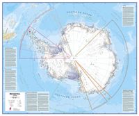
Fraaie kaart van het continent waarbij zowel de natuurkundige als de politieke aspecten zichtbaar zijn. Alle bezettingsstations, berggebieden en landingsplaatsen staan er op.   De wandkaarten op prikbord worden geleverd met een aluminium lijst en een eenvoudig te monteren ophangsysteem. Zij zijn geschikt voor allerhande markeringsystemen als vlaggetjes en prikkers.   Maps International's collection of continental maps would not be complete without this political Antarctica map.    The Antarctica map includes information from the British Antarctic Survey on scientific research. Information on Antarctica's climate and resources is included and as you would expect with a political map, the territory divisions are shown. Shown also are the major expedition routes, camps and weather stations on Antarctica. Map features hill shading, also contains information on the flora and fauna of Antarctica.   The map provides a great opportunity to learn more about a continent that many of us will neve…
185,-
Wandkaart - Magneetbord Antarctica - Zuidpool 120 x 100 cm | Maps International
Fraaie kaart van het continent waarbij zowel de natuurkundige als de politieke aspecten zichtbaar zijn. Alle bezettingsstations, berggebieden en landingsplaatsen staan er op.   De kaart wordt in deze versie gelijmd op een plaat, voorzien van een mooie aluminium lijst en een ophangsysteem wordt meegeleverd. Daarnaast krijgt u een bakje bijgeleverd dat u er aan kunt bevestigen voor pennen, stiften of magneetjes.   Maps International's collection of continental maps would not be complete without this political Antarctica map.    The Antarctica map includes information from the British Antarctic Survey on scientific research. Information on Antarctica's climate and resources is included and as you would expect with a political map, the territory divisions are shown. Shown also are the major expedition routes, camps and weather stations on Antarctica. Map features hill shading, also contains information on the flora and fauna of Antarctica.   The map provides a great opportunity to learn mo…
269,-
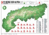
Wandkaart 111 Berge der Alpen | 59.4 x 84.1 cm | Marmota Maps
Mooie gedetailleerde wandkaart met de 111 belangrijkste bergtoppen van de Alpen. Daarnaast zijn 20 bijzondere wandelingen op de kaart ingetekend.   Die Karte bildet die 111 wichtigsten Berge im gesamten Alpenraum ab. 20 besondere Wanderwege in den Alpen vervollständigen die Karte. Zur Auswahl der Wege haben wir uns an Beliebtheit, regionaler Verteilung und der Streckenlänge orientiert, um eine große Bandbreite an Wanderwegen darzustellen. Zu allen 20 Wanderwegen gibt es jeweils ein Diagramm mit höchstem und niedrigstem Punkt der Strecke.   Kartenmaterial Das Grundgerüst unserer Karte besteht aus Höhenlinien im Abstand von 250 Metern. So wirkt die Karte plastisch und gibt die Topographie der Alpen gut wieder. Dazu zeigen wir wesentliche Städte, Flüsse und Alpenpässe, die Grenzen der 8 Alpenländer und Regionen, 111 Alpenberge und 20 besondere Wanderwege.   111 Berge Auf unser Karte zeigen wir die wichtigsten Berge der Alpen.  Die Auswahl dieser Berge ist von der Natur her teilweise su…
29,95

Klanten-reviews van Wandkaart China - geografisch, 120 x 88 cm | Gizi Map

Er zijn nog geen beoordelingen voor dit productBen jij de eerste die een review plaatst?

Meer over Wandkaart China - geografisch, 120 x 88 cm | Gizi Map

Productomschrijving

Prachtige wandkaart van China, waarbij zowel de politieke natuurkundige aspecten goed zichtbaar zijn. In rood zijn de belangrijkste toeristische hoogtepunten ingetekend. Kleurgebruik is vrij fel, maar daardoor wordt het geheel bijzonder mooi. De afmetingen zijn 120 x 88 cm. Hooggebergte, woestijnen, laagland en aanduidingen van hoogte vind je op de kaart. Ook een grote hoeveelheid plaatsen en de belangrijkste verbindingsroutes zijn ingetekend.  
Webshop.nl maakt gebruik van cookies. Ga je verder op onze website, ga dan akkoord met het plaatsen van cookies en de verwerking van deze data door ons en vermelde partners.