Wandkaart 20617 Caribbean - Caraïben, 91 x 61 cm | National Geographic

0
Completely redesigned and updated, National Geographic Maps' Caribbean Classic wall map is one of the most authoritative maps for the islands of the Caribbean Sea. This new edition shows the entire region in exceptional detail, with coverage extending from the tip of Florida to the northern extents of Colombia and Venezuela, east to Barbados, and ...

Verkopers met dit product

Verkoper
Bezorging
Prijs
DeZwerver.nl logo
DeZwerver.nl
5,95
28,95

Anderen bekeken ook

Wandkaart 20617 Caribbean - Caraïben, 91 x 61 cm | National Geographic
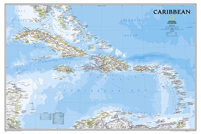
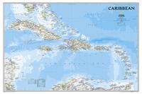
Completely redesigned and updated, National Geographic Maps' Caribbean Classic wall map is one of the most authoritative maps for the islands of the Caribbean Sea. This new edition shows the entire region in exceptional detail, with coverage extending from the tip of Florida to the northern extents of Colombia and Venezuela, east to Barbados, and west to the eastern edge of Honduras, Costa Rica, and Nicaragua. Updated bathymetry reveals the remarkable seafloor variation of the Caribbean including the Puerto Rico Trench, the deepest point in the Atlantic Ocean at 8,605 meters (28,232 feet).   Caribbean Classic is a perfect tool for business or education reference, and a beautiful addition to any décor. Shown on the map are over 1,000 named places including country capitals, primary and secondary towns; political boundaries, important infrastructure, and all key landforms. Useful and informative notes about the region's history and unique geography are spread throughout the map, providi…
28,95
Wandkaart Caribbean - Caraïben, 91 x 61 cm | National Geographic
Completely redesigned and updated, National Geographic Maps' Caribbean Classic wall map is one of the most authoritative maps for the islands of the Caribbean Sea. This new edition shows the entire region in exceptional detail, with coverage extending from the tip of Florida to the northern extents of Colombia and Venezuela, east to Barbados, and west to the eastern edge of Honduras, Costa Rica, and Nicaragua. Updated bathymetry reveals the remarkable seafloor variation of the Caribbean including the Puerto Rico Trench, the deepest point in the Atlantic Ocean at 8,605 meters (28,232 feet).   Caribbean Classic is a perfect tool for business or education reference, and a beautiful addition to any décor. Shown on the map are over 1,000 named places including country capitals, primary and secondary towns; political boundaries, important infrastructure, and all key landforms. Useful and informative notes about the region's history and unique geography are spread throughout the map, providi…
32,95
Wandkaart 20614 Cuba, 92 x 61 cm | National Geographic
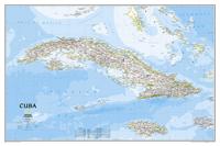
The most accurate and richly detailed reference map available for the iconic Caribbean island nation, our Cuba Classic Map contains National Geographic’s proprietary fonts and world recognized border bands in a bright and appealing color palette with striking blue oceans on a crisp white background.   Cuba’s many offshore islands, reefs, and rivers are noted, as are sites of interest. Ocean bathymetry with depth curves and soundings, peak elevations, and handcrafted shaded relief provide topographical detail. Jamaica, the Cayman Islands, the Florida Keys, and most of the Bahamas and Haiti are shown, presenting Cuba in the context of its important geographical position in the Caribbean.   Cuba contains thousand of place names, accurate political boundaries, and infrastructure making it the perfect reference for student, home, or business.   Additional content unique to this map includes: Sites of interest including national parks and reserves Geographic equivalents provide translatio…
28,95
Wandkaart Cuba, 92 x 61 cm | National Geographic
The most accurate and richly detailed reference map available for the iconic Caribbean island nation, our Cuba Classic Map contains National Geographic’s proprietary fonts and world recognized border bands in a bright and appealing color palette with striking blue oceans on a crisp white background.   Cuba’s many offshore islands, reefs, and rivers are noted, as are sites of interest. Ocean bathymetry with depth curves and soundings, peak elevations, and handcrafted shaded relief provide topographical detail. Jamaica, the Cayman Islands, the Florida Keys, and most of the Bahamas and Haiti are shown, presenting Cuba in the context of its important geographical position in the Caribbean.   Cuba contains thousand of place names, accurate political boundaries, and infrastructure making it the perfect reference for student, home, or business.   Additional content unique to this map includes: Sites of interest including national parks and reserves Geographic equivalents provide translatio…
34,95
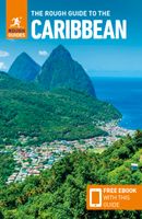
Reisgids The Caribbean | Rough Guides
Zeer goede reisgids voor zowel de georganiseerde maar vooral voor de zelfstandige reiziger. Boordevol informatie over reizen, slapen, eten, maar ook musea en cultuur. Voor veel landen meestal completer en beter dan de Lonely Planet ! This practical travel guide to the Caribbean features detailed factual travel tips and points-of-interest structured lists of all iconic must-see sights as well as some off-the-beaten-track treasures. Our itinerary suggestions and expert author picks of things to see and do will make it a perfect companion both, ahead of your trip and on the ground. This Caribbean guide book is packed full of details on how to get there and around, pre-departure information and top time-saving tips, including a visual list of things not to miss.   Our colour-coded maps make the Caribbean easier to navigate while you're there. This guide book to the Caribbean has been fully updated post-COVID-19 and it comes with a free eBook. The Rough Guide to the Caribbean covers: The B…
27,95
Reisgids Mini Rough Guide Caribbean Ports of Call | Rough Guides
Een kleinere versie in zakformaat van de grotere versies van de Rough Guides. Als altijd weer vol met goede informatie over cultuur en praktische zaken. Achterin kleine plattegronden.   his pocket-sized guide is a convenient, quick-reference companion to discovering the beauty of Caribbean cruising. From the glitzy ships to islands as different as Barbados and St-Barthélemy, this guide aims to cover the popular ports of call, including places not considered part of the region, such as the Bahamas, Mexico and Central America, but which are often found on Caribbean cruise itineraries. This title has been fully updated post-COVID-19.   This Mini Rough Guide to Caribbean Ports of Call covers: Mexico and Central America, the Bahamas, the Western Caribbean, Eastern Caribbean, St-Martin, the Southern Caribbean.   In this travel guide you will find:   RECOMMENDATIONS FOR EVERY TYPE OF TRAVELLER Whether you want to slap on the sun lotion, read a good book and bask in the sun, dive in t…
12,50
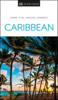
Reisgids Eyewitness Travel Caribbean | Dorling Kindersley
Make your trip to the Caribbean extraordinary   Sailing around the Virgin Islands' sun-soaked shores. Relaxing on pink-sand beaches in the Bahamas. Dancing the night away at Trinidad's colourful carnival. The Caribbean offers enough bucket-list experiences to fill a lifetime. Whatever your dream trip involves, this DK travel guide is the perfect companion.   Our updated guide brings the Caribbean to life, transporting you there like no other travel guide does with expert-led insights, trusted travel advice, detailed breakdowns of all the must-see sights, photographs on practically every page, and our hand-drawn illustrations, which take you inside the region’s buildings and neighbourhoods.   You'll discover: - our pick of the Caribbean's must-sees and top experiences - beautiful photography and detailed illustrations, taking you to the heart of the Caribbean - the best spots to eat, drink, shop and stay - detailed maps and walks which make navigating the region easy - easy-to-follow i…
22,95
Reisgids Caribbean Cruises | Insight Guides
Een rijk geillustreerde reisgids met diepgaande teksten: één van de beste reisgidsen die er bestaan. Eerste deel bestaat uit een beschrijving van de unieke aspecten van de regio, daarna een deel echte reisgids en als afsluiting een deel met praktische informatie. De uitstekende informatie wordt vergezeld van prachtige foto's en heldere kaarten. Niet alleen om mee te nemen, maar ook om vooraf en zelfs achteraf weer in de stemming te komen. Insight Guide Caribbean Cruises is your comprehensive guide book to cruising the Caribbean, with full-color photos throughout combining with the lively narrative. Our inspirational "Best of Caribbean Cruising" section outlines top attractions and activities not to be missed, while features by local writers cover not just the cruising angle but the cultural one too. Get to grips with the world of cruising: from choosing the right cruise for you and planning onboard activities vs shore excursions, to glimpses behind the scenes, cruiseship cuisine and p…
25,95
Waterkaart Caribbean Cruising | ITMB
The Caribbean Sea is one of the most popular cruising destinations in the world. This colourful double-sided map starts just north of Orlando/Tampa in order to show the northernmost Bahamian islands and south as far as the Panama Canal at Colon and the coast of Venezuela. The map shows good detail for each island and the legal boundaries of each island nation. Side 1 concentrates on the western Caribbean, essentially the Bahamas, Cuba, Jamaica, and the Cayman Islands. Here’s a fun fact most of you won’t know: tiny Navassa Island between Haiti and Jamaica is claimed by both the USA and Haiti! Side 2 concentrates on the eastern islands of the Caribbean, such as Hispaniola (Haiti and the Dominican Republic), Puerto Rico and the US and British Virgin Islands, Turks & Caicos, and the Lesser Antilles chain of island countries, such as Antigua, Guadeloupe, Barbados, and Trinidad/Tobago, among others. Coverage then extends westward along the Venezuelan coastline to include the Dutch possessio…
14,95
Reisgids Cruise Ports Caribbean | Lonely Planet
From mountain peaks to shimmering reefs, spicy salsa rhythms to deep rolling reggae, pirate hideouts to sugar-sand beaches, the Caribbean is a dizzyingly diverse region to explore on a cruise ship. Lonely Planet will get you to the heart of Caribbean, with amazing travel experiences and the best planning advice   Lonely Planet’s Cruise Ports Caribbean is your passport to the most relevant, up-to-date advice on what to see and skip, and what hidden discoveries await you. Sip cocktails on the colorful portside of Curacao; sail into the very heart of the West Indies in down-to-earth St Kitts & Nevis; and escape the crowds on stunning St John; all with your trusted travel companion. Discover the best of the Caribbean and begin your journey now!   Inside Lonely Planet’s Cruise Ports Caribbean:   Full-color maps and images throughout Highlights and itineraries help you tailor your trip to your personal needs and interests Insider tips to save time and money and get around like a local, avoi…
20,95

Klanten-reviews van Wandkaart 20617 Caribbean - Caraïben, 91 x 61 cm | National Geographic

Er zijn nog geen beoordelingen voor dit productBen jij de eerste die een review plaatst?

Meer over Wandkaart 20617 Caribbean - Caraïben, 91 x 61 cm | National Geographic

Productomschrijving

Completely redesigned and updated, National Geographic Maps' Caribbean Classic wall map is one of the most authoritative maps for the islands of the Caribbean Sea. This new edition shows the entire region in exceptional detail, with coverage extending from the tip of Florida to the northern extents of Colombia and Venezuela, east to Barbados, and west to the eastern edge of Honduras, Costa Rica, and Nicaragua. Updated bathymetry reveals the remarkable seafloor variation of the Caribbean including the Puerto Rico Trench, the deepest point in the Atlantic Ocean at 8,605 meters (28,232 feet).   Caribbean Classic is a perfect tool for business or education reference, and a beautiful addition to any décor. Shown on the map are over 1,000 named places including country capitals, primary and secondary towns; political boundaries, important infrastructure, and all key landforms. Useful and informative notes about the region's history and unique geography are spread throughout the map, providing the reader further understanding of the Caribbean's unique attributes. This classic-style wall map contains National Geographic's world-recognized proprietary fonts, and bright easy-to-read colors.

Productinformatie

    Verken gerelateerde categorieën

    Webshop.nl maakt gebruik van cookies. Ga je verder op onze website, ga dan akkoord met het plaatsen van cookies en de verwerking van deze data door ons en vermelde partners.