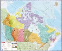
Wandkaart Canada, 120 x 100 cm | Maps International

0
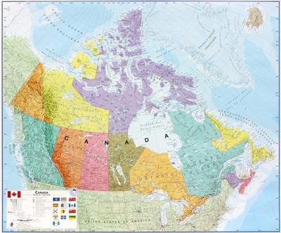
Mooi, heldere wandkaart van Canada.   This Canada wall map clearly depicts all the cities, major roads and also shows all the Provinces and Territory boundaries. All major cities and areas are displayed bi-lingually.   This Canada Wall Map features: • Provincial Boundaries • Provincial Capitals • Cities • National and International Airports • Lati...

Verkopers met dit product

Verkoper
Bezorging
Prijs
DeZwerver.nl logo
DeZwerver.nl
5,95
38,95

Anderen bekeken ook

Wandkaart Canada, 97 x 82 cm | National Geographic
Decoratieve wandkaart van Canada. Naast de mooie kleuren staan er bijzonder veel plaatsen op vermeld.   This beautiful wall-map from National Geographic depicts Canada and the areas surrounding the Great Lakes in beautiful and accurate detail. Included in the map are Canadian province and US State boundaries, cities and towns, lakes and waterways, major geographic features, roadways, and other geographic details.   Our most detailed wall map of Canada, features the classic National Geographic reference styling. Features thousands of place names, accurate political boundaries, national parks, archeological sites, and major infrastructure networks such as roads, canals, ferry routes, and railroads. Canada s diverse terrain is detailed through accurate shaded relief, coastal bathymetry, and symbolism for water features and other landforms. This wall map depicts Canada and the areas surrounding the Great Lakes. Includes Canadian provinces and US State boundaries.
34,95
Nieuw
Wandkaart 20527 Canada, 97 x 82 cm | National Geographic
Decoratieve wandkaart van Canada. Naast de mooie kleuren staan er bijzonder veel plaatsen op vermeld. This beautiful wall-map from National Geographic depicts Canada and the areas surrounding the Great Lakes in beautiful and accurate detail. Included in the map are Canadian province and US State boundaries, cities and towns, lakes and waterways, major geographic features, roadways, and other geographic details. Our most detailed wall map of Canada, features the classic National Geographic reference styling. Features thousands of place names, accurate political boundaries, national parks, archeological sites, and major infrastructure networks such as roads, canals, ferry routes, and railroads. Canada s diverse terrain is detailed through accurate shaded relief, coastal bathymetry, and symbolism for water features and other landforms. This wall map depicts Canada and the areas surrounding the Great Lakes. Includes Canadian provinces and US State boundaries.
28,95
Nieuw
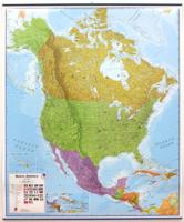
Wandkaart Noord Amerika, politiek, 100 x 120 cm | Maps International
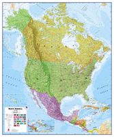
Fraaie politieke kaart van het continent, waarbij vooral de politieke aspecten heel duidelijk te lezen zijn. Alle landen hebben verschillende kleuren, steden en belangrijke verbindingen zijn goed te vinden. Dit is geplastificeerde uitvoering zonder ophangsysteem. Maps International's North America political wall map covers a huge expanse of land from Alaska and Canada through the United States down to Mexico, Central America and the Caribbean. One of the finest maps money can buy!    This political wall map of North America features countries shown in different colours, international boundaries and major transport networks. The wall map also contains a panel of flags relating to the countries shown in this North American continent map. Also shown is city population detail, capital cities and all the major towns and cities in this continent of North America.    Maps International's North America map is available either plain or laminated. Ideal for an office, classroom or when planning…
38,95
Nieuw
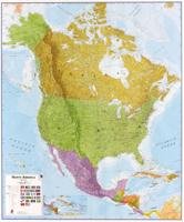
Wandkaart Noord Amerika, politiek, 100 x 120 cm | Maps International
Fraaie politieke kaart van het continent, waarbij vooral de politieke aspecten heel duidelijk te lezen zijn. Alle landen hebben verschillende kleuren, steden en belangrijke verbindingen zijn goed te vinden. Geplastificeerde uitvoering met blauw metalen strips boven en onder de kaart waardoor deze eenvoudig is op te hangen. Maps International's North America political wall map covers a huge expanse of land from Alaska and Canada through the United States down to Mexico, Central America and the Caribbean. One of the finest maps money can buy!  This political wall map of North America features countries shown in different colours, international boundaries and major transport networks. The wall map also contains a panel of flags relating to the countries shown in this North American continent map. Also shown is city population detail, capital cities and all the major towns and cities in this continent of North America.    Maps International's North America map is available either plain or…
49,95
Wandkaart - Magneetbord Noord Amerika - North America Political 120 x 100 cm | Maps International
Fraaie politieke kaart van het continent, waarbij vooral de politieke aspecten heel duidelijk te lezen zijn. Alle landen hebben verschillende kleuren, steden en belangrijke verbindingen zijn goed te vinden. Dit is de papieren uitvoering zonder ophangsysteem.   De kaart wordt in deze versie gelijmd op een plaat, voorzien van een mooie aluminium lijst en een ophangsysteem wordt meegeleverd. Daarnaast krijgt u een bakje bijgeleverd dat u er aan kunt bevestigen voor pennen, stiften of magneetjes.   Maps International's North America political wall map covers a huge expanse of land from Alaska and Canada through the United States down to Mexico, Central America and the Caribbean. One of the finest maps money can buy!    This political wall map of North America features countries shown in different colours, international boundaries and major transport networks. The wall map also contains a panel of flags relating to the countries shown in this North American continent map. Also shown is cit…
269,-
Wandkaart - Prikbord Noord Amerika - North America Political 120 x 100 cm | Maps International
Fraaie politieke kaart van het continent, waarbij vooral de politieke aspecten heel duidelijk te lezen zijn. Alle landen hebben verschillende kleuren, steden en belangrijke verbindingen zijn goed te vinden. Dit is de papieren uitvoering zonder ophangsysteem.   De wandkaarten op prikbord worden geleverd met een aluminium lijst en een eenvoudig te monteren ophangsysteem. Zij zijn geschikt voor allerhande markeringsystemen als vlaggetjes en prikkers.   Maps International's North America political wall map covers a huge expanse of land from Alaska and Canada through the United States down to Mexico, Central America and the Caribbean. One of the finest maps money can buy!    This political wall map of North America features countries shown in different colours, international boundaries and major transport networks. The wall map also contains a panel of flags relating to the countries shown in this North American continent map. Also shown is city population detail, capital cities and all th…
185,-
Nieuw
Wandkaart 20530 Canada, antiek, 97 x 82 cm | National Geographic
Our most detailed wall map of Canada, features the classic National Geographic reference styling. Features thousands of place names, accurate political boundaries, national parks, archeological sites, and major infrastructure networks such as roads, canals, ferry routes, and railroads. Canada’s diverse terrain is detailed through accurate shaded relief, coastal bathymetry, and symbolism for water features and other landforms. This wall map depicts Canada and the areas surrounding the Great Lakes. Includes Canadian provinces and US State boundaries.
28,95
Nieuw
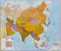
Wandkaart Azië Politiek, 120 x 100 cm | Maps International
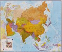
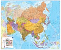
Fraaie politieke kaart van het continent, waarbij vooral de politieke aspecten heel duidelijk te lezen zijn. Alle landen hebben verschillende kleuren, steden en belangrijke verbindingen zijn goed te vinden. Papieren versie, geen ophangsysteem. Maps International's political wall map of Asia shows all countries from Turkey in the West to Japan in the East, down to Indonesia in the South of Asia. The largest and most populated continent, Asia has a lot to fit onto a map! Rest assured though, with Maps International's high quality of mapping nothing is missed out! This political wall map of Asia features countries marked in different colours, with international borders clearly shown. The map's key shows the flags from the countries displayed in this map. This Asia physical wall map also contains city population detail, capital cities and all the major towns and cities in this continent of Asia.
27,95
Wandkaart Canada, antiek, 97 x 82 cm | National Geographic
Our most detailed wall map of Canada, features the classic National Geographic reference styling. Features thousands of place names, accurate political boundaries, national parks, archeological sites, and major infrastructure networks such as roads, canals, ferry routes, and railroads. Canada’s diverse terrain is detailed through accurate shaded relief, coastal bathymetry, and symbolism for water features and other landforms. This wall map depicts Canada and the areas surrounding the Great Lakes. Includes Canadian provinces and US State boundaries.
34,95
Nieuw
Wandkaart Europa - Europe Huge, 170 x 124 cm | Maps International
Fraaie politieke kaart van het continent, waarbij vooral de politieke aspecten heel duidelijk te lezen zijn. Alle landen hebben verschillende kleuren, steden en belangrijke verbindingen zijn goed te vinden. Geplastificeerde uitvoering. Let op: deze heeft geen metalen strips, de kaart is simpelweg te groot daarvoor. Wel is er nog een optie met houten stokken    Maps International’s European political wall map is huge! Our European political wall map is the size of a Smart Car and is the largest single sheet map available to buy.    European Map details: Politically coloured wall map of Europe features countries marked in a different colour, with international boundaries shown. All major towns and cities of Europe are featured within our huge map, and the country's capital cities are clearly marked. The map contains hill and sea shading adding to the vibrant overall effect. The wall map also contains a section showing the different flags of countries in Europe.   Map uses: As with most …
64,95

Klanten-reviews van Wandkaart Canada, 120 x 100 cm | Maps International

Er zijn nog geen beoordelingen voor dit productBen jij de eerste die een review plaatst?

Meer over Wandkaart Canada, 120 x 100 cm | Maps International

Productomschrijving

Mooi, heldere wandkaart van Canada.

  This Canada wall map clearly depicts all the cities, major roads and also shows all the Provinces and Territory boundaries. All major cities and areas are displayed bi-lingually.   This Canada Wall Map features: • Provincial Boundaries • Provincial Capitals • Cities • National and International Airports • Latitude and Longitude Lines • Physical Features and Terrain Shading • Ocean Bathymetry • Highways, Major Roads and Seasonal Roads • Provincial Flags • Provincial and National Parks • Detailed Scale: 1:5,700,000

Verken gerelateerde categorieën

Webshop.nl maakt gebruik van cookies. Ga je verder op onze website, ga dan akkoord met het plaatsen van cookies en de verwerking van deze data door ons en vermelde partners.