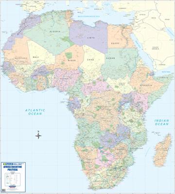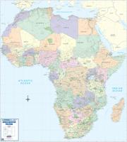
Wandkaart Africa executive Political 2-delig | 176 x 160 cm | MapStudio

0
Africa Executive Political Wall Map is an easy-to-read comprehensive map of Africa includes the new South Sudan boundary.   Coverage on the Africa Executive Political Wall Map includes capital cities, major towns, towns, major and main routes with route numbers and distances.   Contents of the map of Africa includes national, main and secondary ro...

Verkopers met dit product

Verkoper
Bezorging
Prijs
DeZwerver.nl logo
DeZwerver.nl
2,95
78,95

Anderen bekeken ook

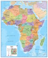
Wandkaart - Magneetbord Afrika Politiek - Africa Political, 120 x 100 cm | Maps International
Fraaie politieke kaart van het continent, waarbij vooral de politieke aspecten heel duidelijk te lezen zijn. Alle landen hebben verschillende kleuren, steden en belangrijke verbindingen zijn goed te vinden.   De kaart wordt in deze versie gelijmd op een plaat, voorzien van een mooie aluminium lijst en een ophangsysteem wordt meegeleverd. Daarnaast krijgt u een bakje bijgeleverd dat u er aan kunt bevestigen voor pennen, stiften of magneetjes.   Maps International's Africa political wall map shows the whole African continent from Morocco in the north, to South Africa and Madagascar in the south.    This political wall map of Africa features countries marked in different colours, with international borders clearly shown. The map's key shows a panel of flags from each of the countries displayed in this African continent map. This political wall map of Africa also contains population detail, capital cities and all the major towns and cities in this continent.    As with most of Maps Intern…
269,-
Wandkaart - Prikbord Afrika Politiek - Africa Political, 120 x 100 cm | Maps International
Fraaie politieke kaart van het continent, waarbij vooral de politieke aspecten heel duidelijk te lezen zijn. Alle landen hebben verschillende kleuren, steden en belangrijke verbindingen zijn goed te vinden.   De wandkaarten op prikbord worden geleverd met een aluminium lijst en een eenvoudig te monteren ophangsysteem. Zij zijn geschikt voor allerhande markeringsystemen als vlaggetjes en prikkers.   Maps International's Africa political wall map shows the whole African continent from Morocco in the north, to South Africa and Madagascar in the south.    This political wall map of Africa features countries marked in different colours, with international borders clearly shown. The map's key shows a panel of flags from each of the countries displayed in this African continent map. This political wall map of Africa also contains population detail, capital cities and all the major towns and cities in this continent.    As with most of Maps International's maps, the Africa political wall map,…
185,-
Wandkaart Middle East - Midden Oosten 76 x 58 cm | National Geographic
Wandkaart van het Midden Oosten, met o.a. Afghanistan - Pakistan - National Geographic wandkaart geplastificeerd - Afmeting ca 76 x 58 cm  National Geographic Maps' recently updated wall map of the Middle East region, formerly titled Afghanistan/Pakistan and the Middle East. Includes updated place names and the addition of significant locations currently in the news, such as Marjah, Afghanistan. This wall map covers a broad geographic area ranging from northern Africa through the Middle East to the western edge of China and India.   Includes complete coverage of Afghanistan, Pakistan, Tajikistan, Iran, Iraq, Kuwait, Syria, Israel, Jordan, Lebanon, Saudi Arabia, Qatar, Bahrain, United Arab Emirates, Yemen, Oman, Cyprus, and Eritrea.   Also includes parts of India, China, Kyrgyzstan, Uzbekistan, Turkmenistan, Azerbaijan, Armenia, Turkey, Egypt, Sudan, Ethiopia, and Djibouti. Features thousands of place names, accurate political boundaries, archeological sites, and major infrastructure n…
31,95
Nieuw
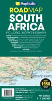
Wegenkaart - landkaart 3204 Adventure Map South Africa - Zuid Afrika | National Geographic
Wegenkaart van Zuid Afrika met vermelding van veel bezienswaardigheden, nationale parken en attrakties. Watervast en scheurvast. Juist door deze vermeldingen onderscheidt de kaart zich van andere wegenkaarten. National Geographic’s South Africa Adventure Map is designed to meet the unique needs of adventure travelers—detailed, durable, and accurate. It includes the locations of thousands of major cities and towns with an index for easily locating them, plus a clearly marked road network complete with distances and designations for major highways, limited access highways, and more. Both paved and unpaved roads, tracks, and trails are marked for those adventurers who wish to explore less traveled routes.   What sets National Geographic Adventure Maps apart from traditional road maps are the hundreds of points-of-interest that highlight the diverse, unique, and exotic destinations within South Africa including national parks and reserves, sanctuaries, World Heritage sites, archeological …
17,50
Wandkaart The Balkans - Balkan landen, 77 x 60 cm | National Geographic
Study the countries of the Balkans with our new map featuring the classic National Geographic reference styling. Features thousands of place names, accurate political boundaries, national parks, and major infrastructure networks such as roads, canals, ferry routes, and railroads. The countries of the Balkans Classic map shows it's diverse terrain as detailed through accurate shaded relief, coastal bathymetry, and symbolism for water features and other landforms. Elevations of major peaks as well as depth soundings are expressed in meters.   Map coverage includes the countries of: Albania, Austria, Bosnia and Herzegovina, Bulgaria, Croatia, Hungary, Kosovo, Macedonia, Moldova, Montenegro, Romania, Slovenia, Vojvodina, as well as the outlying border countries of Greece, Italy, Slovakia, Turkey and Ukraine. Map features also includes listings for the counties of Hungary and Romania along with their respective capitals and the administrative divisions of Bosnia and Herzegovina.
31,95
Nieuw
Wandkaart P Afrika Politiek, 100 x 120 cm | Maps International
Fraaie politieke kaart van het continent, waarbij vooral de politieke aspecten heel duidelijk te lezen zijn. Alle landen hebben verschillende kleuren, steden en belangrijke verbindingen zijn goed te vinden. Geplastificeerde uitvoering. Geplastificeerd. Maps International's Africa political wall map shows the whole African continent from Morocco in the north, to South Africa and Madagascar in the south.  This political wall map of Africa features countries marked in different colours, with international borders clearly shown. The map's key shows a panel of flags from each of the countries displayed in this African continent map. This political wall map of Africa also contains population detail, capital cities and all the major towns and cities in this continent.  As with most of Maps International's maps, the Africa political wall map, is available either plain or laminated. Ideal size for an office or classroom or for planning a trip around Africa.
38,95
Wandkaart 20581 The Balkans - Balkan landen, 77 x 60 cm | National Geographic
Study the countries of the Balkans with our new map featuring the classic National Geographic reference styling. Features thousands of place names, accurate political boundaries, national parks, and major infrastructure networks such as roads, canals, ferry routes, and railroads. The countries of the Balkans Classic map shows it's diverse terrain as detailed through accurate shaded relief, coastal bathymetry, and symbolism for water features and other landforms. Elevations of major peaks as well as depth soundings are expressed in meters.   Map coverage includes the countries of: Albania, Austria, Bosnia and Herzegovina, Bulgaria, Croatia, Hungary, Kosovo, Macedonia, Moldova, Montenegro, Romania, Slovenia, Vojvodina, as well as the outlying border countries of Greece, Italy, Slovakia, Turkey and Ukraine. Map features also includes listings for the counties of Hungary and Romania along with their respective capitals and the administrative divisions of Bosnia and Herzegovina.
21,95
Wandkaart - Prikbord Zuid Amerika - South America political, 120 x 100 cm | Maps International
Fraaie politieke kaart van het continent, waarbij vooral de politieke aspecten heel duidelijk te lezen zijn. Alle landen hebben verschillende kleuren, steden en belangrijke verbindingen zijn goed te vinden.   Maps International's South America political wall map shows all countries in South America from Venezuela and the Grenadine Islands down to Argentina and the most Southerly points of Chile and the Falkland Islands.    This political wall map of South America features countries marked in different colours, with international borders clearly shown. The map's key shows the flags from the countries displayed in this map. This South American political wall map also contains city population detail, capital cities and all the major towns and cities in this continent of South America.    Maps International's North America map is available either plain or laminated. Major motorways and transport lines are shown making it an ideal map for your planning and logistics needs in this South Ame…
185,-
Nieuw
Wandkaart Zuid Amerika - South America political, 100 x 120 cm | Maps International
Fraaie politieke kaart van het continent, waarbij vooral de politieke aspecten heel duidelijk te lezen zijn. Alle landen hebben verschillende kleuren, steden en belangrijke verbindingen zijn goed te vinden. Geplastificeerde uitvoering met blauw metalen strips boven en onder de kaart waardoor deze eenvoudig is op te hangen. Maps International's South America political wall map shows all countries in South America from Venezuela and the Grenadine Islands down to Argentina and the most Southerly points of Chile and the Falkland Islands.    This political wall map of South America features countries marked in different colours, with international borders clearly shown. The map's key shows the flags from the countries displayed in this map. This South American political wall map also contains city population detail, capital cities and all the major towns and cities in this continent of South America.    Maps International's North America map is available either plain or laminated. Major mo…
49,95
Wandkaart - Magneetbord Zuid Amerika - South America political, 120 x 100 cm | Maps International
Fraaie politieke kaart van het continent, waarbij vooral de politieke aspecten heel duidelijk te lezen zijn. Alle landen hebben verschillende kleuren, steden en belangrijke verbindingen zijn goed te vinden.   De kaart wordt in deze versie gelijmd op een plaat, voorzien van een mooie aluminium lijst en een ophangsysteem wordt meegeleverd. Daarnaast krijgt u een bakje bijgeleverd dat u er aan kunt bevestigen voor pennen, stiften of magneetjes.   Maps International's South America political wall map shows all countries in South America from Venezuela and the Grenadine Islands down to Argentina and the most Southerly points of Chile and the Falkland Islands.    This political wall map of South America features countries marked in different colours, with international borders clearly shown. The map's key shows the flags from the countries displayed in this map. This South American political wall map also contains city population detail, capital cities and all the major towns and cities in …
269,-

Klanten-reviews van Wandkaart Africa executive Political 2-delig | 176 x 160 cm | MapStudio

Er zijn nog geen beoordelingen voor dit productBen jij de eerste die een review plaatst?

Meer over Wandkaart Africa executive Political 2-delig | 176 x 160 cm | MapStudio

Productomschrijving

Africa Executive Political Wall Map is an easy-to-read comprehensive map of Africa includes the new South Sudan boundary.   Coverage on the Africa Executive Political Wall Map includes capital cities, major towns, towns, major and main routes with route numbers and distances.   Contents of the map of Africa includes national, main and secondary roads in detail, colour-coded countries for convenient overview, rail routes with lines and stations, national parks, reserves, sea routes and distances to major ports, international boundaries, border crossings, airports, airfields, water features (dams, lakes, rivers, deltas), places of interest and historic sites. Coverage shows all countries in Africa including Madagascar.  

Verken gerelateerde categorieën

Webshop.nl maakt gebruik van cookies. Ga je verder op onze website, ga dan akkoord met het plaatsen van cookies en de verwerking van deze data door ons en vermelde partners.