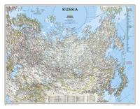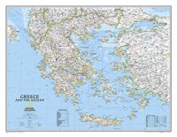
Wandkaart 22111 Greece - Griekenland, 77 x 60 cm | National Geographic

0
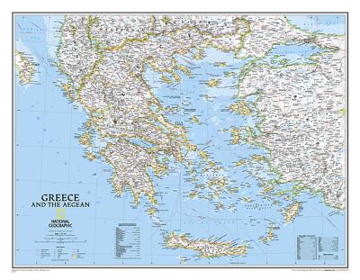
Decoratieve wandkaart van Griekenland. Naast de mooie kleuren staan er bijzonder veel plaatsen op vermeld.   The classic National Geographic wall map of Greece shows this beautiful area in uncompromisingly accurate detail. The map includes political boundaries, cities and towns, bodies of water, major roadways, airports, and many other geographic ...

Verkopers met dit product

Verkoper
Bezorging
Prijs
DeZwerver.nl logo
DeZwerver.nl
5,95
25,95

Anderen bekeken ook

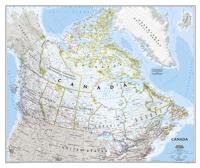
Wandkaart Canada, 97 x 82 cm | National Geographic
Decoratieve wandkaart van Canada. Naast de mooie kleuren staan er bijzonder veel plaatsen op vermeld.   This beautiful wall-map from National Geographic depicts Canada and the areas surrounding the Great Lakes in beautiful and accurate detail. Included in the map are Canadian province and US State boundaries, cities and towns, lakes and waterways, major geographic features, roadways, and other geographic details.   Our most detailed wall map of Canada, features the classic National Geographic reference styling. Features thousands of place names, accurate political boundaries, national parks, archeological sites, and major infrastructure networks such as roads, canals, ferry routes, and railroads. Canada s diverse terrain is detailed through accurate shaded relief, coastal bathymetry, and symbolism for water features and other landforms. This wall map depicts Canada and the areas surrounding the Great Lakes. Includes Canadian provinces and US State boundaries.
34,95
Wandkaart 20527 Canada, 97 x 82 cm | National Geographic
Decoratieve wandkaart van Canada. Naast de mooie kleuren staan er bijzonder veel plaatsen op vermeld. This beautiful wall-map from National Geographic depicts Canada and the areas surrounding the Great Lakes in beautiful and accurate detail. Included in the map are Canadian province and US State boundaries, cities and towns, lakes and waterways, major geographic features, roadways, and other geographic details. Our most detailed wall map of Canada, features the classic National Geographic reference styling. Features thousands of place names, accurate political boundaries, national parks, archeological sites, and major infrastructure networks such as roads, canals, ferry routes, and railroads. Canada s diverse terrain is detailed through accurate shaded relief, coastal bathymetry, and symbolism for water features and other landforms. This wall map depicts Canada and the areas surrounding the Great Lakes. Includes Canadian provinces and US State boundaries.
28,95
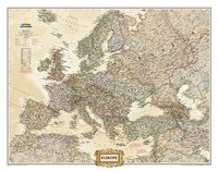
Wandkaart Europa, politiek & antiek, 77 x 60 cm | National Geographic
National Geographic is a renowned authority in cartography. For 120 years the Society's maps have helped spread geographic knowledge around the globe. A vast database allows National Geographic to combine the latest data gained by space-age technology with innovative digital mapping techniques to create state-of-the-art political, physical, and thematic maps. The Society's meticulous research and attention to detail have established a standard of achievement that is unparalleled. The rich tones of the Political Executive map combine the popular antique look with up-to-date information—elegant enough for the board room, study, or office, and contemporary enough to make it an ideal reference.
31,95
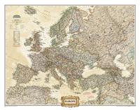
Wandkaart 20323 Europa, politiek & antiek, 77 x 60 cm | National Geographic
National Geographic is a renowned authority in cartography. For 120 years the Society's maps have helped spread geographic knowledge around the globe. A vast database allows National Geographic to combine the latest data gained by space-age technology with innovative digital mapping techniques to create state-of-the-art political, physical, and thematic maps. The Society's meticulous research and attention to detail have established a standard of achievement that is unparalleled. The rich tones of the Political Executive map combine the popular antique look with up-to-date information—elegant enough for the board room, study, or office, and contemporary enough to make it an ideal reference.
21,95
Wegenkaart - landkaart 3316 Adventure Map Greece - Griekenland | National Geographic
Wegenkaart van Griekenland met vermelding van veel bezienswaardigheden, nationale parken en attrakties. Watervast en scheurvast. Juist door deze vermeldingen onderscheidt de kaart zich van andere wegenkaarten. National Geographic's Greece Adventure Map is designed to meet the unique needs of adventure travelers with its durability and accurate information. This folded map provides global travelers with the perfect combination of detail and perspective, highlighting hundreds of points of interest and the diverse and unique destinations within the country.   The front side of the Greece map shows the northern region of the country with Macedonia and Bulgaria to the north, Albania to the west, and Turkey to the east. There are insets detailing the islands of Kerkyra and Zakynthos. The reverse side of the map details the southern portion of Greece showing the islands down to Crete. The map includes the locations of cities and towns with a user-friendly index, plus a clearly marked road ne…
17,50
Wandkaart The Balkans - Balkan landen, 77 x 60 cm | National Geographic
Study the countries of the Balkans with our new map featuring the classic National Geographic reference styling. Features thousands of place names, accurate political boundaries, national parks, and major infrastructure networks such as roads, canals, ferry routes, and railroads. The countries of the Balkans Classic map shows it's diverse terrain as detailed through accurate shaded relief, coastal bathymetry, and symbolism for water features and other landforms. Elevations of major peaks as well as depth soundings are expressed in meters.   Map coverage includes the countries of: Albania, Austria, Bosnia and Herzegovina, Bulgaria, Croatia, Hungary, Kosovo, Macedonia, Moldova, Montenegro, Romania, Slovenia, Vojvodina, as well as the outlying border countries of Greece, Italy, Slovakia, Turkey and Ukraine. Map features also includes listings for the counties of Hungary and Romania along with their respective capitals and the administrative divisions of Bosnia and Herzegovina.
31,95

Klanten-reviews van Wandkaart 22111 Greece - Griekenland, 77 x 60 cm | National Geographic

Er zijn nog geen beoordelingen voor dit productBen jij de eerste die een review plaatst?

Meer over Wandkaart 22111 Greece - Griekenland, 77 x 60 cm | National Geographic

Productomschrijving

Decoratieve wandkaart van Griekenland. Naast de mooie kleuren staan er bijzonder veel plaatsen op vermeld.   The classic National Geographic wall map of Greece shows this beautiful area in uncompromisingly accurate detail. The map includes political boundaries, cities and towns, bodies of water, major roadways, airports, and many other geographic details

Productinformatie

    Verken gerelateerde categorieën

    Webshop.nl maakt gebruik van cookies. Ga je verder op onze website, ga dan akkoord met het plaatsen van cookies en de verwerking van deze data door ons en vermelde partners.