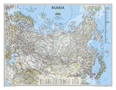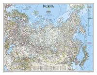
Wandkaart 22091 Russia - Rusland, 77 x 60 cm | National Geographic

0
Our classic wall map of Russia and the independent states of the former Soviet Union shows thousands of place names, roadways, political boundaries, bodies of water, airports, and many other geographic details.   Map is printed on premium quality paper stock, rolled, and packaged in a clear, hard plastic tube....

Verkopers met dit product

Verkoper
Bezorging
Prijs
DeZwerver.nl logo
DeZwerver.nl
5,95
25,95

Anderen bekeken ook

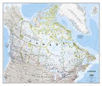
Wandkaart Canada, 97 x 82 cm | National Geographic
Decoratieve wandkaart van Canada. Naast de mooie kleuren staan er bijzonder veel plaatsen op vermeld.   This beautiful wall-map from National Geographic depicts Canada and the areas surrounding the Great Lakes in beautiful and accurate detail. Included in the map are Canadian province and US State boundaries, cities and towns, lakes and waterways, major geographic features, roadways, and other geographic details.   Our most detailed wall map of Canada, features the classic National Geographic reference styling. Features thousands of place names, accurate political boundaries, national parks, archeological sites, and major infrastructure networks such as roads, canals, ferry routes, and railroads. Canada s diverse terrain is detailed through accurate shaded relief, coastal bathymetry, and symbolism for water features and other landforms. This wall map depicts Canada and the areas surrounding the Great Lakes. Includes Canadian provinces and US State boundaries.
34,95
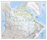
Wandkaart 20527 Canada, 97 x 82 cm | National Geographic
Decoratieve wandkaart van Canada. Naast de mooie kleuren staan er bijzonder veel plaatsen op vermeld. This beautiful wall-map from National Geographic depicts Canada and the areas surrounding the Great Lakes in beautiful and accurate detail. Included in the map are Canadian province and US State boundaries, cities and towns, lakes and waterways, major geographic features, roadways, and other geographic details. Our most detailed wall map of Canada, features the classic National Geographic reference styling. Features thousands of place names, accurate political boundaries, national parks, archeological sites, and major infrastructure networks such as roads, canals, ferry routes, and railroads. Canada s diverse terrain is detailed through accurate shaded relief, coastal bathymetry, and symbolism for water features and other landforms. This wall map depicts Canada and the areas surrounding the Great Lakes. Includes Canadian provinces and US State boundaries.
28,95
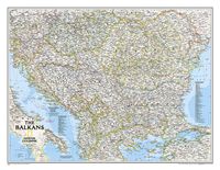
Wandkaart The Balkans - Balkan landen, 77 x 60 cm | National Geographic
Study the countries of the Balkans with our new map featuring the classic National Geographic reference styling. Features thousands of place names, accurate political boundaries, national parks, and major infrastructure networks such as roads, canals, ferry routes, and railroads. The countries of the Balkans Classic map shows it's diverse terrain as detailed through accurate shaded relief, coastal bathymetry, and symbolism for water features and other landforms. Elevations of major peaks as well as depth soundings are expressed in meters.   Map coverage includes the countries of: Albania, Austria, Bosnia and Herzegovina, Bulgaria, Croatia, Hungary, Kosovo, Macedonia, Moldova, Montenegro, Romania, Slovenia, Vojvodina, as well as the outlying border countries of Greece, Italy, Slovakia, Turkey and Ukraine. Map features also includes listings for the counties of Hungary and Romania along with their respective capitals and the administrative divisions of Bosnia and Herzegovina.
31,95
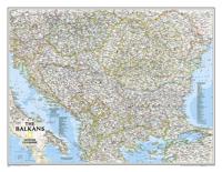
Wandkaart 20581 The Balkans - Balkan landen, 77 x 60 cm | National Geographic
Study the countries of the Balkans with our new map featuring the classic National Geographic reference styling. Features thousands of place names, accurate political boundaries, national parks, and major infrastructure networks such as roads, canals, ferry routes, and railroads. The countries of the Balkans Classic map shows it's diverse terrain as detailed through accurate shaded relief, coastal bathymetry, and symbolism for water features and other landforms. Elevations of major peaks as well as depth soundings are expressed in meters.   Map coverage includes the countries of: Albania, Austria, Bosnia and Herzegovina, Bulgaria, Croatia, Hungary, Kosovo, Macedonia, Moldova, Montenegro, Romania, Slovenia, Vojvodina, as well as the outlying border countries of Greece, Italy, Slovakia, Turkey and Ukraine. Map features also includes listings for the counties of Hungary and Romania along with their respective capitals and the administrative divisions of Bosnia and Herzegovina.
21,95
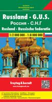
Wegenkaart - landkaart Rusland - Russia | Freytag & Berndt
Uitstekende landkaart van Rusland. Met index, toeristische informatie en afstanden in kilometers. Het westen op een schaal van 1 op 2 miljoen en na de Oeral wordt het een grove schaal van 1 op 8 miljoen. Toch een van de betere kaarten van Rusland! Explore Russia and the other members of the Commonwealth of Independent States (C.I.S) with this Freytag & Berndt double-sided road map. The best way to plan your trip, prepare your itinerary, and to travel independently on this region. As with all Freytag & Berndt maps, the cartography is clear and detailed with the topography shown with relief shading with plenty of spot heights.   One side of the map features a 1: 200 000 scale map of Eastern Europe, while the other side features a large scale 1: 8 000 000 map showing the members of the C.I.S. Names of townships in former Soviet countries are listed in both English and the Cyrillic script.   A icon system is used to show tourist information. Icons are displayed for:   Railways and canal s…
14,95

Klanten-reviews van Wandkaart 22091 Russia - Rusland, 77 x 60 cm | National Geographic

Er zijn nog geen beoordelingen voor dit productBen jij de eerste die een review plaatst?

Meer over Wandkaart 22091 Russia - Rusland, 77 x 60 cm | National Geographic

Productomschrijving

Our classic wall map of Russia and the independent states of the former Soviet Union shows thousands of place names, roadways, political boundaries, bodies of water, airports, and many other geographic details.   Map is printed on premium quality paper stock, rolled, and packaged in a clear, hard plastic tube.

Verken gerelateerde categorieën

Webshop.nl maakt gebruik van cookies. Ga je verder op onze website, ga dan akkoord met het plaatsen van cookies en de verwerking van deze data door ons en vermelde partners.