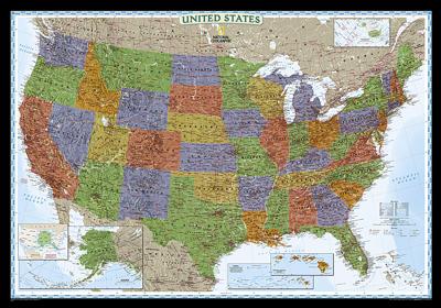
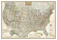
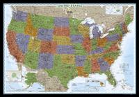
Wandkaart 22081 USA United States - Decorator | 110 x 77 cm | National Geographic

0

Verkopers met dit product

Verkoper
Bezorging
Prijs
DeZwerver.nl logo
DeZwerver.nl
5,95
26,95

Anderen bekeken ook

Wandkaart USA - Verenigde Staten, politiek, 110 x 77 cm | National Geographic
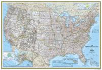
  Het klassieke kaartbeeld van National Geographic, de grenzen van de staten van Amerika zijn apart gekleurd. De wandkaart is heel gedetailleerd met veel plaatsen, wegen, rivieren en nationale parken, het reliëf wordt met schaduw aangegeven. Geplastificeerde versie.   The National Geographic Classic United States map uses bright color bands to outline each state. Capitals, major cities, selected towns, bodies of water, highways, and national parks are all shown. Shaded relief, rich in detail, emphasizes the many mountains, valleys, and plateaus of the United States.    Our most popular United States wall map. Features all 50 States with insets for Alaska and Hawaii. All major cities, transportation routes, State boundaries, National Parks, inland waterways, and mountain ranges are clearly displayed and labeled. 
36,95
Wandkaart 02003 USA - Verenigde Staten Political, 110 x 77 cm | National Geographic
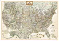
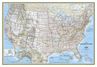
Het klassieke kaartbeeld van National Geographic, de grenzen van de staten van Amerika zijn apart gekleurd. De wandkaart is heel gedetailleerd met veel plaatsen, wegen, rivieren en nationale parken, het reliëf wordt met schaduw aangegeven. The National Geographic Classic United States map uses bright color bands to outline each state. Capitals, major cities, selected towns, bodies of water, highways, and national parks are all shown. Shaded relief, rich in detail, emphasizes the many mountains, valleys, and plateaus of the United States.    Our most popular United States wall map. Features all 50 States with insets for Alaska and Hawaii. All major cities, transportation routes, State boundaries, National Parks, inland waterways, and mountain ranges are clearly displayed and labeled. 
28,95
Magneetbord - Wandkaart USA - Verenigde Staten, politiek, 110 x 77 cm | National Geographic
Het klassieke kaartbeeld van National Geographic, de grenzen van de staten van Amerika zijn apart gekleurd. De wandkaart is heel gedetailleerd met veel plaatsen, wegen, rivieren en nationale parken, het reliëf wordt met schaduw aangegeven. Geplastificeerde versie.   The National Geographic Classic United States map uses bright color bands to outline each state. Capitals, major cities, selected towns, bodies of water, highways, and national parks are all shown. Shaded relief, rich in detail, emphasizes the many mountains, valleys, and plateaus of the United States.    Our most popular United States wall map. Features all 50 States with insets for Alaska and Hawaii. All major cities, transportation routes, State boundaries, National Parks, inland waterways, and mountain ranges are clearly displayed and labeled.    De kaart wordt in deze versie gelijmd op een plaat, voorzien van een mooie aluminium lijst en een ophangsysteem wordt meegeleverd. Daarnaast krijgt u een bakje bijgeleverd da…
249,-
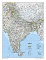
Wandkaart India, 60 x 77 cm | National Geographic
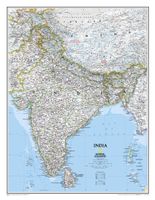
See India as only National Geographic can depict it. This new reference map is one of the most detailed and comprehensive ever published for India and southern Asia. It includes India, Sri Lanka, Nepal, Bangladesh, Bhutan, Tajikistan, and portions of China, Pakistan, Afghanistan, and Myanmar. The India map is punctuated with thousands of place names, and embellished with shaded relief which highlights the region's dramatic topography in such places as the Tibetan Plateau and the Himalaya.
31,95
Wandkaart 20546 India, 60 x 77 cm | National Geographic
See India as only National Geographic can depict it. This new reference map is one of the most detailed and comprehensive ever published for India and southern Asia. It includes India, Sri Lanka, Nepal, Bangladesh, Bhutan, Tajikistan, and portions of China, Pakistan, Afghanistan, and Myanmar. The India map is punctuated with thousands of place names, and embellished with shaded relief which highlights the region's dramatic topography in such places as the Tibetan Plateau and the Himalaya.
25,95

Klanten-reviews van Wandkaart 22081 USA United States - Decorator | 110 x 77 cm | National Geographic

Er zijn nog geen beoordelingen voor dit productBen jij de eerste die een review plaatst?

Meer over Wandkaart 22081 USA United States - Decorator | 110 x 77 cm | National Geographic

Productinformatie

    Verken gerelateerde categorieën

    Webshop.nl maakt gebruik van cookies. Ga je verder op onze website, ga dan akkoord met het plaatsen van cookies en de verwerking van deze data door ons en vermelde partners.