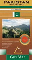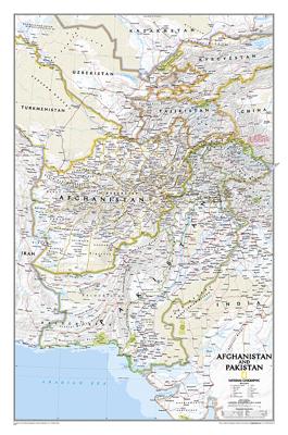

Wandkaart 20436 Afghanistan & Pakistan, 55 x 83 cm | National Geographic

0
This is the latest and most detailed map of the region - a perfect complement for following today's news stories. Afghanistan's 34 administrative provinces and Pakistan's provinces and territorial boundaries are clearly delineated. The region's diverse terrain is expertly depicted in shaded relief and symbology, including the elevation of prominen...

Alle aanbiedingen van dit product

Verkoper
Bezorging
Prijs
DeZwerver.nl logo
DeZwerver.nl
5,95
28,95

Anderen bekeken ook

Wandkaart 20436 Afghanistan & Pakistan, 55 x 83 cm | National Geographic
This is the latest and most detailed map of the region - a perfect complement for following today's news stories. Afghanistan's 34 administrative provinces and Pakistan's provinces and territorial boundaries are clearly delineated. The region's diverse terrain is expertly depicted in shaded relief and symbology, including the elevation of prominent mountains and ocean depths in meters. Superhighways, major roads, canals, railroads, oil infrastructure, and geologic features are detailed.
28,95
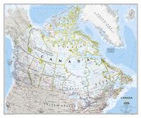
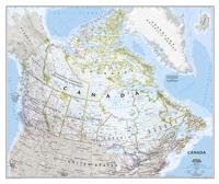
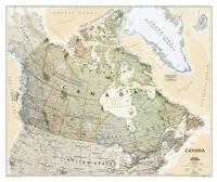
Wandkaart 20527 Canada, 97 x 82 cm | National Geographic
Decoratieve wandkaart van Canada. Naast de mooie kleuren staan er bijzonder veel plaatsen op vermeld. This beautiful wall-map from National Geographic depicts Canada and the areas surrounding the Great Lakes in beautiful and accurate detail. Included in the map are Canadian province and US State boundaries, cities and towns, lakes and waterways, major geographic features, roadways, and other geographic details. Our most detailed wall map of Canada, features the classic National Geographic reference styling. Features thousands of place names, accurate political boundaries, national parks, archeological sites, and major infrastructure networks such as roads, canals, ferry routes, and railroads. Canada s diverse terrain is detailed through accurate shaded relief, coastal bathymetry, and symbolism for water features and other landforms. This wall map depicts Canada and the areas surrounding the Great Lakes. Includes Canadian provinces and US State boundaries.
28,95
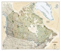
Wandkaart 20530 Canada, antiek, 97 x 82 cm | National Geographic
Our most detailed wall map of Canada, features the classic National Geographic reference styling. Features thousands of place names, accurate political boundaries, national parks, archeological sites, and major infrastructure networks such as roads, canals, ferry routes, and railroads. Canada’s diverse terrain is detailed through accurate shaded relief, coastal bathymetry, and symbolism for water features and other landforms. This wall map depicts Canada and the areas surrounding the Great Lakes. Includes Canadian provinces and US State boundaries.
28,95
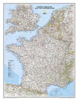
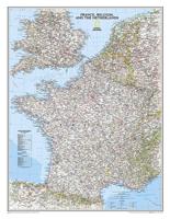
Wandkaart Frankrijk, België en Nederland, 60 x 77 cm | National Geographic
Our classic wall map of France, Belgium, and the Netherlands shows political boundaries, major highways and roads, cities and towns, and a wealth of other incredibly accurate geographic detail.  n France the map shows the division of the country into regions, with a list of their names and regional capitals (curiously, Corsica is not included on the map – what would Napoleon think of that?). The map also provides plenty of names of both geographical features (Pyrenees, Cevennes, etc) and the country’s traditional historical regions (Gascony, Maine, Bourbonais, etc). National parks are highlighted.   Within Belgium the map indicates the division into Flanders, Wallonia and the Brussels Region and in the Netherlands boundaries of the country’s administrative provinces are marked.   Topography is shown by relief shading and within the Netherlands the areas below the sea level are also indicated. The map shows the network of main road and rail connections, local airports, as well as ferry…
31,95
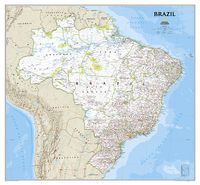
Wandkaart Brazil - Brazilië, 104 x 97 cm | National Geographic
National Geographic Wall Maps offer a special glimpse into current and historical events, and they inform about the world and environment. Offered in a variety of styles and formats, these maps are excellent reference tools and a perfect addition to any home, business or school. There are a variety of map options to choose from, including the world, continents, countries and regions, the United States, history, nature and space. This wall map of Brazil contains thousands of place names and accurate political boundaries including Brazil's 26 states. Major and minor cities, superhighways, roads, passenger rail lines, and national parks are clearly depicted. Brazil's diverse terrain is represented through accurate shaded relief and hydrographic symbology. Elevations and depths are in meters.
37,50
Wandkaart Middle East - Midden Oosten 76 x 58 cm | National Geographic
Wandkaart van het Midden Oosten, met o.a. Afghanistan - Pakistan - National Geographic wandkaart geplastificeerd - Afmeting ca 76 x 58 cm  National Geographic Maps' recently updated wall map of the Middle East region, formerly titled Afghanistan/Pakistan and the Middle East. Includes updated place names and the addition of significant locations currently in the news, such as Marjah, Afghanistan. This wall map covers a broad geographic area ranging from northern Africa through the Middle East to the western edge of China and India.   Includes complete coverage of Afghanistan, Pakistan, Tajikistan, Iran, Iraq, Kuwait, Syria, Israel, Jordan, Lebanon, Saudi Arabia, Qatar, Bahrain, United Arab Emirates, Yemen, Oman, Cyprus, and Eritrea.   Also includes parts of India, China, Kyrgyzstan, Uzbekistan, Turkmenistan, Azerbaijan, Armenia, Turkey, Egypt, Sudan, Ethiopia, and Djibouti. Features thousands of place names, accurate political boundaries, archeological sites, and major infrastructure n…
31,95
Wandkaart 22074 Frankrijk, België en Nederland, 60 x 77 cm | National Geographic
>Our classic wall map of France, Belgium, and the Netherlands shows political boundaries, major highways and roads, cities and towns, and a wealth of other incredibly accurate geographic detail.    France the map shows the division of the country into regions, with a list of their names and regional capitals (curiously, Corsica is not included on the map – what would Napoleon think of that?). The map also provides plenty of names of both geographical features (Pyrenees, Cevennes, etc) and the country’s traditional historical regions (Gascony, Maine, Bourbonais, etc). National parks are highlighted. Within Belgium the map indicates the division into Flanders, Wallonia and the Brussels Region and in the Netherlands boundaries of the country’s administrative provinces are marked. Topography is shown by relief shading and within the Netherlands the areas below the sea level are also indicated. The map shows the network of main road and rail connections, local airports, as well as ferry …
25,95
Wandkaart 20427 Ireland - Ierland, 76 x 91 cm | National Geographic
National Geographic Maps' new Ireland wall map is one of the most authoritative maps yet published of the Emerald Isle. Of the nearly 1,000 place-names shown on this map, all within the Republic of Ireland adhere to that nation's constitution—that the Irish and English language share official status. Thus, Gaelic (Irish) place-names, along with their English variants in parentheses, are shown within Irish-speaking regions while English place-names, along with their Gaelic variants, are shown outside these areas.   Ireland Classic is ideal for those researching their Irish ancestry, a perfect tool for business reference, and a beautiful addition to any décor. It’s one of the largest and most detailed wall maps specifically for Ireland available today. Shown on the map are over 1,000 named places including primary and secondary towns, counties, political boundaries, infrastructure, and selected historical sites for both Ireland and Northern Ireland.   Place-name Details: Per the Republi…
25,95
Wandkaart 20614 Cuba, 92 x 61 cm | National Geographic
The most accurate and richly detailed reference map available for the iconic Caribbean island nation, our Cuba Classic Map contains National Geographic’s proprietary fonts and world recognized border bands in a bright and appealing color palette with striking blue oceans on a crisp white background.   Cuba’s many offshore islands, reefs, and rivers are noted, as are sites of interest. Ocean bathymetry with depth curves and soundings, peak elevations, and handcrafted shaded relief provide topographical detail. Jamaica, the Cayman Islands, the Florida Keys, and most of the Bahamas and Haiti are shown, presenting Cuba in the context of its important geographical position in the Caribbean.   Cuba contains thousand of place names, accurate political boundaries, and infrastructure making it the perfect reference for student, home, or business.   Additional content unique to this map includes: Sites of interest including national parks and reserves Geographic equivalents provide translatio…
28,95
Wandkaart 20546 India, 60 x 77 cm | National Geographic
See India as only National Geographic can depict it. This new reference map is one of the most detailed and comprehensive ever published for India and southern Asia. It includes India, Sri Lanka, Nepal, Bangladesh, Bhutan, Tajikistan, and portions of China, Pakistan, Afghanistan, and Myanmar. The India map is punctuated with thousands of place names, and embellished with shaded relief which highlights the region's dramatic topography in such places as the Tibetan Plateau and the Himalaya.
25,95

Klanten-reviews van Wandkaart 20436 Afghanistan & Pakistan, 55 x 83 cm | National Geographic

Er zijn nog geen beoordelingen voor dit productBen jij de eerste die een review plaatst?

Meer over Wandkaart 20436 Afghanistan & Pakistan, 55 x 83 cm | National Geographic

Productomschrijving

This is the latest and most detailed map of the region - a perfect complement for following today's news stories. Afghanistan's 34 administrative provinces and Pakistan's provinces and territorial boundaries are clearly delineated. The region's diverse terrain is expertly depicted in shaded relief and symbology, including the elevation of prominent mountains and ocean depths in meters. Superhighways, major roads, canals, railroads, oil infrastructure, and geologic features are detailed.

Productinformatie

    Verken gerelateerde categorieën

    Webshop.nl maakt gebruik van cookies. Ga je verder op onze website, ga dan akkoord met het plaatsen van cookies en de verwerking van deze data door ons en vermelde partners.