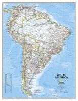
Wandkaart 20074 Zuid Amerika, politiek, 91 x 117 cm | National Geographic

0
Staatkundige  kaart van Zuid-Amerika (in kleur). De kaart wordt verzonden in een koker.   This classic map of South America shows political boundaries, place names, airports, major roads and highways, and other geographic features for the entire continent. 36 x 46 inches (approx). Scale size: 1:7,105,000. Founded in 1915 as the Cartographic Group,...

Verkopers met dit product

Verkoper
Bezorging
Prijs
DeZwerver.nl logo
DeZwerver.nl
5,95
39,95

Anderen bekeken ook

Wandkaart Zuid Amerika, politiek, 91 x 117 cm | National Geographic
Staatkundige  kaart van Zuid-Amerika (in kleur). De kaart wordt verzonden in een koker.  This classic map of South America shows political boundaries, place names, airports, major roads and highways, and other geographic features for the entire continent. 36 x 46 inches (approx). Scale size: 1:7,105,000. Founded in 1915 as the Cartographic Group, the first division of the National Geographic Society, National Geographic Maps has been responsible for illustrating the world around us through the art and science of mapmaking. Today, National Geographic Maps continues this mission by creating the world s best wall maps, recreation maps, atlases, and globes which inspire people to care about and explore their world. All proceeds from the sale of National Geographic maps go to support the Society s non-profit mission to increase global understanding and promote conservation of our planet through exploration, research, and education.
49,95
Wereldkaart 22007 Politiek, 278 x 194 cm | National Geographic
Een bijzonder grote wereldkaart van National Geographic. Deze kaart is politiek van opbouw: alle landen worden met duidelijke grenzen heel goed zichtbaar. Daarnaast staan er veel plaatsen op en worden ook de dieptes van de verschillende oceanen, golfstromen en heersende windrichtingen weergegeven.   Een prachtige kaart aan de muur, aan de zijkanten afgewerkten met een mooie rand en een heldere maar tegelijk ook vrij zachte, niet overheersende kleurstelling. Deze kaart wordt gemaakt in drie delen - te groot om in 1 keer te fabriceren met kans op beschadigingen - die vervolgens zeer nauwkeurig aan elkaar worden geplakt.    De kaart wordt verzonden in een grote stevige kartonnen koker. Bedenk wel dat DHL deze kaart afleverd en dat u zelf moet zorgen dat er op dat adres iemand aanwezig is op moment van levering. Kijk ook de kaart na op eventuele gebreken.   Bedenk dat ophangen van zo'n formaat kaart niet eenvoudig is. Voor het beste resulataat moet de kaart worden verlijmd op een vlakke o…
126,95
Wereldkaart 622085 Politiek & antiek, 117 x 76 cm | National Geographic
Een prachtige, stijlvol gekleurde kaart - bruin met antieke kleurstelling - met een modern kaartbeeld. Alle landen staan er met grenzen en belangrijke steden keurig op, maar de nadruk ligt op de kleurstelling: deze is ‘ouderwets‘ en past goed in een klassiek interieur. Door het kleurgebruik is het reliëf van de bodem van oceanen goed te zien. De kaart is geplastificeerd, daardoor blijven de kleuren langer mooi! Bovendien is het makkelijker op te hangen. Geleverd met wit metalen strips, waarbij een spijker volstaat om de kaart mooi op te hangen. Het is de meest verkochte wereldkaart uit ons assortiment! Maat 117 x 76 cm. Geplastificeerde versie met strips. National Geographic is a renowned authority in cartography. For 120 years the Society's maps have helped spread geographic knowledge around the globe. A vast database allows National Geographic to combine the latest data gained by space-age technology with innovative digital mapping techniques to create state-of-the-art political, ph…
53,95
Wereldkaart 22085 Politiek & antiek, 117 x 76 cm | National Geographic
Een prachtige, stijlvol gekleurde kaart - bruin, antieke kleurstelling - met een modern kaartbeeld. Alle landen staan er met grenzen en belangrijke steden keurig op, maar de nadruk ligt op de kleurstelling: deze is ‘ouderwets‘ en past goed in een klassiek interieur. Door het kleurgebruik is het reliëf van de bodem van oceanen goed te zien. De kaart is geplastificeerd, daardoor blijven de kleuren langer mooi! Bovendien is het makkelijker op te hangen. Het is de meest verkochte wereldkaart uit ons assortiment! Maat 117 x 76 cm. Geplastificeerde versie. National Geographic is a renowned authority in cartography. For 120 years the Society's maps have helped spread geographic knowledge around the globe. A vast database allows National Geographic to combine the latest data gained by space-age technology with innovative digital mapping techniques to create state-of-the-art political, physical, and thematic maps. The Society's meticulous research and attention to detail have established a sta…
36,95
Wereldkaart 22085 Politiek & antiek, 117 x 76 cm | National Geographic
Een prachtige, stijlvol gekleurde kaart - bruin, antieke uitstraling - met een modern kaartbeeld. Alle landen staan er met grenzen en belangrijke steden keurig op, maar de nadruk ligt op de kleurstelling: deze is ‘ouderwets‘ en past goed in een klassiek interieur. Door het kleurgebruik is het reliëf van de bodem van oceanen goed te zien. Het is de meest verkochte wereldkaart uit ons assortiment! National Geographic is a renowned authority in cartography. For 120 years the Society's maps have helped spread geographic knowledge around the globe. A vast database allows National Geographic to combine the latest data gained by space-age technology with innovative digital mapping techniques to create state-of-the-art political, physical, and thematic maps. The Society's meticulous research and attention to detail have established a standard of achievement that is unparalleled. A current political map that features our world in rich, earth-toned colors. Astounding detail and boardroom qualit…
24,95
Wereldkaart 26H Politiek & antiek, 117 x 76 cm | National Geographic
Een prachtige, stijlvol gekleurde kaart  - bruin, antieke kleurstelling - met een modern kaartbeeld. Alle landen staan er met grenzen en belangrijke steden keurig op, maar de nadruk ligt op de kleurstelling: deze is ‘ouderwets‘ en past goed in een klassiek interieur. Door het kleurgebruik is het reliëf van de bodem van oceanen goed te zien. De kaart is geplastificeerd ( de kleuren blijven daardoor langer mooi) en is boven en onder voorzien van blank houten stokken als een ouderwetse schoolkaart. De bovenste stok heeft een linnen touw waar je hem aan kunt ophangen. Maat 116 x 77 cm. Deze kaart wordt verzonden in een brede koker met een lengte van van 120 cm. National Geographic is a renowned authority in cartography. For 120 years the Society's maps have helped spread geographic knowledge around the globe. A vast database allows National Geographic to combine the latest data gained by space-age technology with innovative digital mapping techniques to create state-of-the-art political, …
179,50
Wandkaart Brazil - Brazilië, 104 x 97 cm | National Geographic
National Geographic Wall Maps offer a special glimpse into current and historical events, and they inform about the world and environment. Offered in a variety of styles and formats, these maps are excellent reference tools and a perfect addition to any home, business or school. There are a variety of map options to choose from, including the world, continents, countries and regions, the United States, history, nature and space. This wall map of Brazil contains thousands of place names and accurate political boundaries including Brazil's 26 states. Major and minor cities, superhighways, roads, passenger rail lines, and national parks are clearly depicted. Brazil's diverse terrain is represented through accurate shaded relief and hydrographic symbology. Elevations and depths are in meters.
37,50
Wandelkaart 901 Banff North National Park | National Geographic
Prachtige geplastificeerde kaart van het bekende nationaal park. Met alle recreatieve voorzieningen als campsites, maar ook met topografische details en wandelroutes ed. Door uitgekiend kleurgebruik zeer prettig in gebruik. Scheur en watervast! The front side of the Banff North map details the south side of the national park, from Siffleur Wilderness Area to the north, to Kootenay National Park to the south. This side also covers survival tips, area trails, entry fees and details both Kootenay and Yoho Nationals Parks. The reverse side of the map details the north side of the park, extending from Siffleur Wilderness area to the south, to White Goat Wilderness to the North. Insets show safe travel in Bear Country, and all the recreation the park has to offer with backpacking, camping, biking, hiking and horseback riding.  National Geographic's Trails Illustrated map of Banff North is a two-sided, waterproof map designed to meet the needs of outdoor enthusiasts with unmatched durability…
17,95
Prikbord 26PR Wereldkaart, politiek, 117 x 76 cm | National Geographic
Een prachtige, stijlvol gekleurde kaart - bruin, antieke uitstraling - met een modern kaartbeeld. Alle landen staan er met grenzen en belangrijke steden keurig op, maar de nadruk ligt op de kleurstelling: deze is ‘ouderwets‘ en past goed in een klassiek interieur. Door het kleurgebruik is het reliëf van de bodem van oceanen goed te zien.   Het is de meest verkochte wereldkaart uit ons assortiment!   De wandkaarten op prikbord worden geleverd met een aluminium lijst en een eenvoudig te monteren ophangsysteem. Zij zijn geschikt voor allerhande markeringsystemen als vlaggetjes en prikkers.   Bij dit prikbord wordt gratis een set markeervlaggetjes (20 stuks) bijgeleverd   National Geographic is a renowned authority in cartography. For 120 years the Society's maps have helped spread geographic knowledge around the globe. A vast database allows National Geographic to combine the latest data gained by space-age technology with innovative digital mapping techniques to create state-of-the-art …
200,-
Wandkaart Europa, politiek & antiek, 77 x 60 cm | National Geographic
National Geographic is a renowned authority in cartography. For 120 years the Society's maps have helped spread geographic knowledge around the globe. A vast database allows National Geographic to combine the latest data gained by space-age technology with innovative digital mapping techniques to create state-of-the-art political, physical, and thematic maps. The Society's meticulous research and attention to detail have established a standard of achievement that is unparalleled. The rich tones of the Political Executive map combine the popular antique look with up-to-date information—elegant enough for the board room, study, or office, and contemporary enough to make it an ideal reference.
31,95

Klanten-reviews van Wandkaart 20074 Zuid Amerika, politiek, 91 x 117 cm | National Geographic

Er zijn nog geen beoordelingen voor dit productBen jij de eerste die een review plaatst?

Meer over Wandkaart 20074 Zuid Amerika, politiek, 91 x 117 cm | National Geographic

Productomschrijving

Staatkundige  kaart van Zuid-Amerika (in kleur). De kaart wordt verzonden in een koker.

  This classic map of South America shows political boundaries, place names, airports, major roads and highways, and other geographic features for the entire continent. 36 x 46 inches (approx). Scale size: 1:7,105,000.

Founded in 1915 as the Cartographic Group, the first division of the National Geographic Society, National Geographic Maps has been responsible for illustrating the world around us through the art and science of mapmaking.
Today, National Geographic Maps continues this mission by creating the world s best wall maps, recreation maps, atlases, and globes which inspire people to care about and explore their world. All proceeds from the sale of National Geographic maps go to support the Society s non-profit mission to increase global understanding and promote conservation of our planet through exploration, research, and education.

Productinformatie

    Verken gerelateerde categorieën

    Webshop.nl maakt gebruik van cookies. Ga je verder op onze website, ga dan akkoord met het plaatsen van cookies en de verwerking van deze data door ons en vermelde partners.