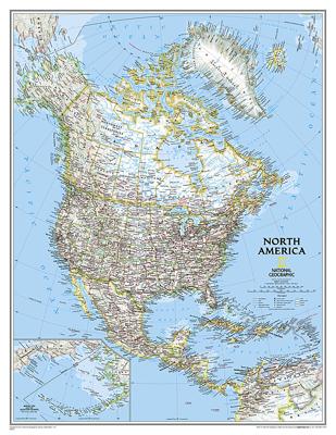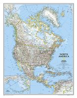
Wandkaart 20035 Noord Amerika, politiek, 91 x 118 cm | National Geographic

0
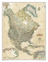
The political map of North America features trademark National Geographic detail and accuracy. The map shows country boundaries, place names, major highways and roads, bodies of water, and more. An inset map shows the Aleutian Islands off the coast of Alaska....

Verkopers met dit product

Verkoper
Bezorging
Prijs
DeZwerver.nl logo
DeZwerver.nl
5,95
34,95

Anderen bekeken ook

Wandkaart 20430 Afrika, politiek & antiek 61 x 78 cm | National Geographic
Mooie wandkaart van Afrika, staatkundig, met rustig kleurgebruik en helder kaartbeeld, Ondanks het wat kleiner formaat staan er toch heel wat topografische details op vermeld.    Kaart is up-to-date, alleen Zuid Sudan wordt niet als een apart land weergegeven.   Our executive-style political map of Africa features country boundaries, place names, bodies of water, airports, major highways and roads, and much more. Astounding detail and boardroom quality make this map excellent for reference in your home or office.   The map presents Africa at 1: 14,244,000 and coverage includes the whole of the Mediterranean Basin, extending north to London. Islands in the Atlantic and the Indian Ocean are included on a separate inset. The base map has relief shading to show the continent’s topography, with additional graphics indicating deserts, swamps, salt flats, etc. The map shows the names of the main geographic features such as mountain ranges, deserts, peaks etc. Heights are given in metres, …
24,95
Wandkaart 20074 Zuid Amerika, politiek, 91 x 117 cm | National Geographic
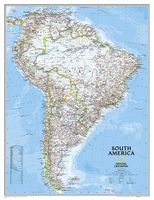
Staatkundige  kaart van Zuid-Amerika (in kleur). De kaart wordt verzonden in een koker.   This classic map of South America shows political boundaries, place names, airports, major roads and highways, and other geographic features for the entire continent. 36 x 46 inches (approx). Scale size: 1:7,105,000. Founded in 1915 as the Cartographic Group, the first division of the National Geographic Society, National Geographic Maps has been responsible for illustrating the world around us through the art and science of mapmaking. Today, National Geographic Maps continues this mission by creating the world s best wall maps, recreation maps, atlases, and globes which inspire people to care about and explore their world. All proceeds from the sale of National Geographic maps go to support the Society s non-profit mission to increase global understanding and promote conservation of our planet through exploration, research, and education.
39,95
Wandkaart Afrika, politiek & antiek, 61 x 78 cm | National Geographic
Mooie wandkaart van Afrika, staatkundig, met rustig kleurgebruik en helder kaartbeeld, Ondanks het wat kleiner formaat staan er toch heel wat topografische details op vermeld.    Kaart is up-to-date, alleen Zuid Sudan wordt niet als een apart land weergegeven.   Our executive-style political map of Africa features country boundaries, place names, bodies of water, airports, major highways and roads, and much more. Astounding detail and boardroom quality make this map excellent for reference in your home or office.   The map presents Africa at 1: 14,244,000 and coverage includes the whole of the Mediterranean Basin, extending north to London. Islands in the Atlantic and the Indian Ocean are included on a separate inset. The base map has relief shading to show the continent’s topography, with additional graphics indicating deserts, swamps, salt flats, etc. The map shows the names of the main geographic features such as mountain ranges, deserts, peaks etc. Heights are given in metres, exc…
31,95
Wandkaart 20587 Alaska, 103 x 78 cm | National Geographic
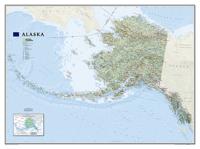
Deze wandkaart van National Geographic is zeer gedetailleerd en bevat alle belangrijke plaatsen. Daarnaast is er ruimte voor de landschappelijke details zoals hoogtelijnen, rivieren, belangrijke wegen en andere items zoals politieke grenzen, luchthavens .    Alaska physical wall map, size 103 x 78cm at 1:3,660,000 from the National Geographic, with colouring to show the topography and plenty of place names. Coverage includes the panhandle and the outermost Aleutian Islands in their proper geographical placing.   Altitude colouring and relief shading shows the topography, with names of mountain ranges, peaks with heights (in feet), etc. Boundaries of national parks and other protected areas are marked. The map shows Alaska’s road network, the railway line from Anchorage to Fairbanks, numerous local airfields with scheduled air or seaplane services, and ferry routes. The map has a very large number of place names: towns and settlements, geographical features including islands, bays, etc…
36,95

Klanten-reviews van Wandkaart 20035 Noord Amerika, politiek, 91 x 118 cm | National Geographic

Er zijn nog geen beoordelingen voor dit productBen jij de eerste die een review plaatst?

Meer over Wandkaart 20035 Noord Amerika, politiek, 91 x 118 cm | National Geographic

Productomschrijving

The political map of North America features trademark National Geographic detail and accuracy. The map shows country boundaries, place names, major highways and roads, bodies of water, and more. An inset map shows the Aleutian Islands off the coast of Alaska.

Verken gerelateerde categorieën

Webshop.nl maakt gebruik van cookies. Ga je verder op onze website, ga dan akkoord met het plaatsen van cookies en de verwerking van deze data door ons en vermelde partners.