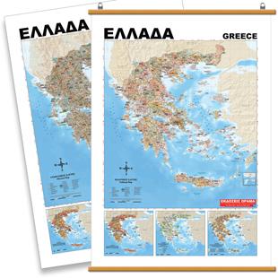
Wandkaart 1301 Griekenland Natuurkundig, 70 x 100 cm | Orama

0
Mooie natuurkundige kaart van Griekenland met namen in het Grieks....

Verkopers met dit product

Verkoper
Bezorging
Prijs
DeZwerver.nl logo
DeZwerver.nl
5,95
18,95

Anderen bekeken ook

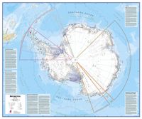
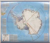
Wandkaart Antarctica - Zuidpool, 120 x 100 cm | Maps International
Fraaie kaart van het continent waarbij zowel de natuurkundige als de politieke aspecten zichtbaar zijn. Alle bezettingsstations, berggebieden en landingsplaatsen staan er op. Dit is een geplastificeerde versie met metalen strips boven en onder de kaart waardoor deze eenvoudig is op te hangen. Maps International's collection of continental maps would not be complete without this political Antarctica map.  The Antarctica map includes information from the British Antarctic Survey on scientific research. Information on Antarctica's climate and resources is included and as you would expect with a political map, the territory divisions are shown. Shown also are the major expedition routes, camps and weather stations on Antarctica. Map features hill shading, also contains information on the flora and fauna of Antarctica.   The map provides a great opportunity to learn more about a continent that many of us will never visit. Maps International's Antarctica map is available either plain or lam…
49,95
Wereldkaart 69H Natuurkundig, 136 x 84 cm | Maps International
Informatieve natuurkundige wereldkaart (Engelstalig). Goede combinatie van de natuurkundige aspecten en de belangrijkste politieke details van landen, steden en verbindingen.   De geplastificeerde kaart wordt geleverd met blank houten stokken aan de boven- en onderzijde, zoals we die uit het klaslokaal nog wel kennen. Aan de bovenstuk zit een linnen koord waarmee de kaart eenvoudig aan een flinke spijker of schroef kan worden opgehangen.   Excellent relief shading presents the mountainous areas in almost 3-D effect. Peak symbols help to identify the highest mountain on each continent or in various countries. 18 different combinations of colouring and graphics show various types of vegetation and terrain: tundra and glaciers or ice caps; coniferous, mixed or rain forests; savannah, grassland or steppe; sand or rocky deserts, lava fields and salt lakes, arable land, etc. Country names and their boundaries are clearly displayed, with town symbols indicating national and, where possible, …
165,-
Wandkaart - Magneetbord Antarctica - Zuidpool 120 x 100 cm | Maps International
Fraaie kaart van het continent waarbij zowel de natuurkundige als de politieke aspecten zichtbaar zijn. Alle bezettingsstations, berggebieden en landingsplaatsen staan er op.   De kaart wordt in deze versie gelijmd op een plaat, voorzien van een mooie aluminium lijst en een ophangsysteem wordt meegeleverd. Daarnaast krijgt u een bakje bijgeleverd dat u er aan kunt bevestigen voor pennen, stiften of magneetjes.   Maps International's collection of continental maps would not be complete without this political Antarctica map.    The Antarctica map includes information from the British Antarctic Survey on scientific research. Information on Antarctica's climate and resources is included and as you would expect with a political map, the territory divisions are shown. Shown also are the major expedition routes, camps and weather stations on Antarctica. Map features hill shading, also contains information on the flora and fauna of Antarctica.   The map provides a great opportunity to learn m…
269,-
Wandkaart Antarctica - Zuidpool, 120 x 100 cm | Maps International
Fraaie kaart van het continent waarbij zowel de natuurkundige als de politieke aspecten zichtbaar zijn. Alle bezettingsstations, berggebieden en landingsplaatsen staan er op. Maps International's collection of continental maps would not be complete without this political Antarctica map.  The Antarctica map includes information from the British Antarctic Survey on scientific research. Information on Antarctica's climate and resources is included and as you would expect with a political map, the territory divisions are shown. Shown also are the major expedition routes, camps and weather stations on Antarctica. Map features hill shading, also contains information on the flora and fauna of Antarctica.   The map provides a great opportunity to learn more about a continent that many of us will never visit. Maps International's Antarctica map is available either plain or laminated making it ideal for classrooms or those with an interest in the South Pole and surrounding areas.
27,95
Wandkaart Antarctica - Zuidpool, 120 x 100 cm | Maps International
Fraaie kaart van het continent waarbij zowel de natuurkundige als de politieke aspecten zichtbaar zijn. Alle bezettingsstations, berggebieden en landingsplaatsen staan er op. Dit is een geplastificeerde versie. Maps International's collection of continental maps would not be complete without this political Antarctica map.  The Antarctica map includes information from the British Antarctic Survey on scientific research. Information on Antarctica's climate and resources is included and as you would expect with a political map, the territory divisions are shown. Shown also are the major expedition routes, camps and weather stations on Antarctica. Map features hill shading, also contains information on the flora and fauna of Antarctica.   The map provides a great opportunity to learn more about a continent that many of us will never visit. Maps International's Antarctica map is available either plain or laminated making it ideal for classrooms or those with an interest in the South Pole a…
37,95
Wereldkaart 22090 Natuurkundig - the world physical, 178 x 122 cm | National Geographic
Bijzonder fraaie natuurkundige kaart van National Geographic waarbij het accent ligt op de fysische aspecten van de aarde met veel details van de oceanen. Een schoonheid aan de muur! Our World Physical - Ocean Floor map highlights the Earth's land and undersea forms with exquisite hand-painted relief. Drawn in the Winkel Tripel projection to minimize distortion of the landforms. Two corner inset maps show the Earth's crust and world climatic zones. Scale: 1:24,031,000. Superb representation of the ocean floor makes this 175.5 x 121.5cm (5ft 9” x 4ft approx.) physical map of the world one of the most interesting titles in the National Geographic Society’s long list of wall maps. Drawn with great skill to achieve a 3-D effect, ocean floor plains, basins, continental shelves, trenches, ridges and fractures are shown with their names, indicating in many places their depth in metres. On land masses relief shading shows the mountain chains, whilst the colouring indicates different types of …
52,95
Wegenkaart - landkaart 54 Centraal Griekenland - Central Greece | Orama
Goede wegenkaart van een deel van Griekenland. Waar beschikbaar worden hotels en campings getoond en met symbolen worden allerhande toeristische symbolen aangeduid als historische plaatsen, kloosters, museas etc.  Tweetalig. Op elke kaart staat van de belangrijkste steden een centrumkaart en er is een behoorlijk uitgebreid register (wel kleine letters!) Kleurgebruik is duidelijk, maar een beetje flets, waardoor hoogteverschillen niet echt goed uitkomen. 
10,25
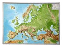
Wandkaart - Reliëfkaart Europa met voelbaar 3D reliëf, 77 x 55 x 2 cm | GeoRelief
De uitgever van de kaart is de bekende Duitse uitgever GeoRelief. Deze topografische kaart van Europa heeft een hoge kwaliteit met prachtige kleuren. De kaart bevat de namen van grote steden, spoorwegen, het wegennet, de namen van bergketens en internationale luchthavens. Gemaakt van een hoge kwaliteit kunststof. Met hoogwaardige licht gestructureerde aluminium lijst van 1,5 cm breed. Our relief map of Europe in the scales 1:8,000,000 or 1:16,000,000 is an impressive, visually attractive and naturally knowledge-imparting enrichment for classrooms or living rooms. From your office, create a geographical reference to current political developments or major social events. Use the card to actively plan your spring awakening excursion to Italy or Mallorca, your annual holiday in Scandinavia, a city trip to Paris or Saint Petersburg or a business trip to London, Frankfurt or Istanbul. Once there, you can also send the “old continent” in postcard format by post to friends, relatives, and oth…
134,95

Klanten-reviews van Wandkaart 1301 Griekenland Natuurkundig, 70 x 100 cm | Orama

Er zijn nog geen beoordelingen voor dit productBen jij de eerste die een review plaatst?

Meer over Wandkaart 1301 Griekenland Natuurkundig, 70 x 100 cm | Orama

Productomschrijving

Mooie natuurkundige kaart van Griekenland met namen in het Grieks.

Productinformatie

    Verken gerelateerde categorieën

    Webshop.nl maakt gebruik van cookies. Ga je verder op onze website, ga dan akkoord met het plaatsen van cookies en de verwerking van deze data door ons en vermelde partners.