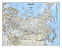
Wandkaart - Wandkaart Russia - Rusland, 77 x 60 cm | National Geographic Decoratieve wandkaart van het land. Naast de mooie kleuren staan er bijzonder veel plaatsen op vermeld. National Geographic's classic wall map of Russia and the independent states of the former Soviet Union shows thousands of place names, roadways, political boundaries, bodies of water, airports, and many other geographic details. 31,95
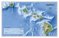
Wandkaart Hawaii, 88 x 58 cm | National Geographic One of our most visually stunning maps, the Hawaii Physical Map shows all eight of the major islands and includes an inset of the entire chain of reefs stretching nearly 3,000 miles across the central Pacific. The map also shows the Hawaiian Ridge shelves underneath the islands, providing a wonderful perspective on how the islands were formed. This version is laminated—featuring a "write and wipe" surface and durable plastic covering.31,95
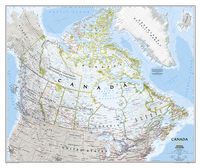
Wandkaart Canada, 97 x 82 cm | National Geographic Decoratieve wandkaart van Canada. Naast de mooie kleuren staan er bijzonder veel plaatsen op vermeld. This beautiful wall-map from National Geographic depicts Canada and the areas surrounding the Great Lakes in beautiful and accurate detail. Included in the map are Canadian province and US State boundaries, cities and towns, lakes and waterways, major geographic features, roadways, and other geographic details. Our most detailed wall map of Canada, features the classic National Geographic reference styling. Features thousands of place names, accurate political boundaries, national parks, archeological sites, and major infrastructure networks such as roads, canals, ferry routes, and railroads. Canada s diverse terrain is detailed through accurate shaded relief, coastal bathymetry, and symbolism for water features and other landforms. This wall map depicts Canada and the areas surrounding the Great Lakes. Includes Canadian provinces and US State boundaries.34,95
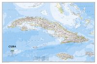
Wandkaart Cuba, 92 x 61 cm | National Geographic The most accurate and richly detailed reference map available for the iconic Caribbean island nation, our Cuba Classic Map contains National Geographic’s proprietary fonts and world recognized border bands in a bright and appealing color palette with striking blue oceans on a crisp white background. Cuba’s many offshore islands, reefs, and rivers are noted, as are sites of interest. Ocean bathymetry with depth curves and soundings, peak elevations, and handcrafted shaded relief provide topographical detail. Jamaica, the Cayman Islands, the Florida Keys, and most of the Bahamas and Haiti are shown, presenting Cuba in the context of its important geographical position in the Caribbean. Cuba contains thousand of place names, accurate political boundaries, and infrastructure making it the perfect reference for student, home, or business. Additional content unique to this map includes: Sites of interest including national parks and reserves Geographic equivalents provide translatio…34,95
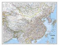
Wandkaart China, 76 x 59 cm | National Geographic Decoratieve wandkaart van China. Naast de mooie kleuren staan er bijzonder veel plaatsen op vermeld. Het gaat soms een beetje ten kosten van de schoonheid van de kaart, maar daardoor wel zeer volledig. This detailed political map of China by National Geographic accurately shows locations of provincial boundaries, cities and towns, major highways and roads, rivers and waterways, and other geographic features. Mongolia is also fully included in the map, as well as portions of many other surrounding countries. 31,95
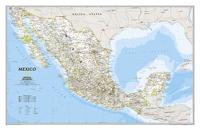
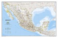
Wandkaart Mexico, 88 x 57 cm | National Geographic Decoratieve wandkaart van Mexico. Naast de mooie kleuren staan er bijzonder veel plaatsen op vermeld. This finely detailed National Geographic political map of Mexico shows country boundaries, cities and towns, airports, major highways and roads, and bodies of water. Shaded relief helps to show the country's terrain more clearly and accurately. Features: •Shaded relief •Accurate political markings31,95
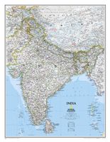
Wandkaart India, 60 x 77 cm | National Geographic See India as only National Geographic can depict it. This new reference map is one of the most detailed and comprehensive ever published for India and southern Asia. It includes India, Sri Lanka, Nepal, Bangladesh, Bhutan, Tajikistan, and portions of China, Pakistan, Afghanistan, and Myanmar. The India map is punctuated with thousands of place names, and embellished with shaded relief which highlights the region's dramatic topography in such places as the Tibetan Plateau and the Himalaya.31,95